Wisconsin - 2004
Updated: 11/09/08
Specific destinations on this page ...
Amnicon Falls Dalles of the St. Croix River Manitou Falls
Shot Tower Stephens Falls Villa Louis Wyalusing State Park
Additional photographs can be viewed at our WI 2004 - Along the way page.
Our route took us through the center of the state to Superior WI in the north and down most of the west shoreline along the Mississippi River.
We found that many of the Wisconsin state parks have natural features within their borders. The annual entry pass for non-residents is $30 (a one-day pass is $10) and camp fees are $12 ($10 Sunday through Thursday and off-season) plus $5 for electricity. The camping areas in the state park are not always big rig friendly due to the terrain. As only about 25% of the sites offer electricity, even in the fall getting electricity was a challenge. However, they are beautiful places to visit and we enjoyed their hospitality.
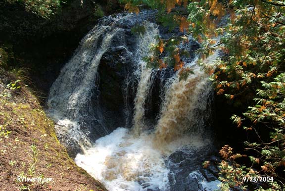
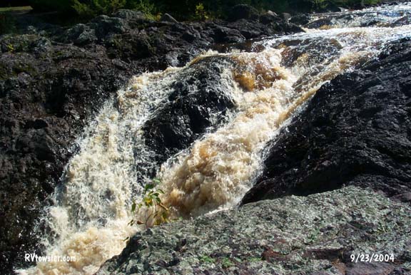
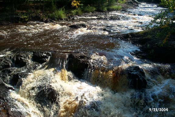
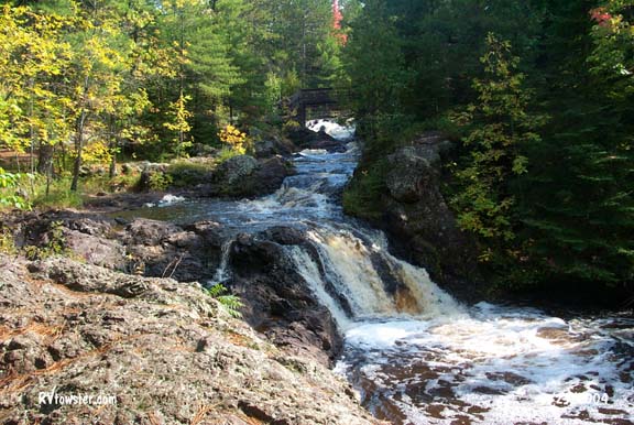
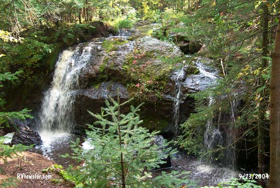
Amnicon Falls
Amnicon Falls State Park - Superior, WI
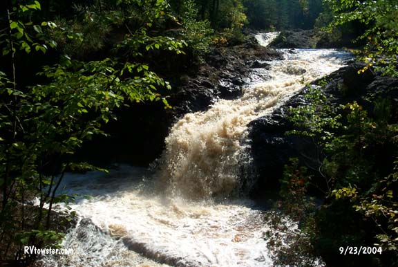
Upper
Falls
Snake Pit Falls
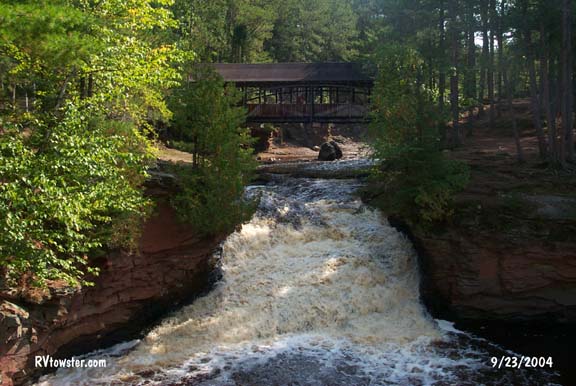
Lower Falls
The walk on an island between the Upper and Snake Pit falls was beautiful . The park's visitor guide gives you a geology lesson.
The final falls is on the other side of the parking lot. Appropriately named because the falls isn't always there, it disappears during periods of low flow.
Now and Then Falls
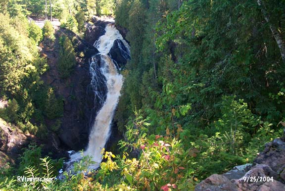
Dalles of the St. Croix River
Interstate Park - St. Croix Falls WI
In Wisconsin's first state park we found beautiful visual examples of the power of water. The Ice Age Interpretive Center includes an informative 20 minute film about the glaciation in Wisconsin. This park is part of the Ice Age National Scientific Reserve and the Ice Age Trail.
We learned that dalles is a gorge carved by glacial meltwater out of ancient bedrock. These canyon walls rise 200' above the river.

Sand, gravel and rock trapped in whirlpools formed by the current of glacial meltwaters drilled deep potholes into solid rock.
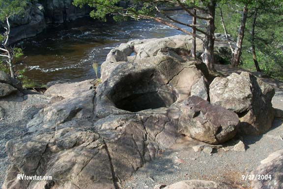
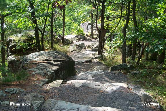
The circular path through the site was a beautiful walk itself.
 The
ranger seemed hesitant about us taking our fifth wheel into the park. We
left it in the parking lot and were glad we did. The roads are very narrow and
the route is steep.
The
ranger seemed hesitant about us taking our fifth wheel into the park. We
left it in the parking lot and were glad we did. The roads are very narrow and
the route is steep.
Manitou Falls
Pattison State Park - Superior WI

Big Manitou
Falls
Little Manitou Falls
The 165' vertical drop of Big Manitou Falls is the highest in Wisconsin and the fourth highest east of the Rock Mountains. Little Manitou Falls, about one mile south, drops 31 feet into Falls Lake.
On the shores of Falls Lake was a picnic area with a sandy beach. The welcome station had a large box with balls of all shapes and sizes available for use in the picnic area.

These are two views of Duluth MN from the top of the hill outside the entrance to the state park. We got our most reliable cellular reception from this spot.
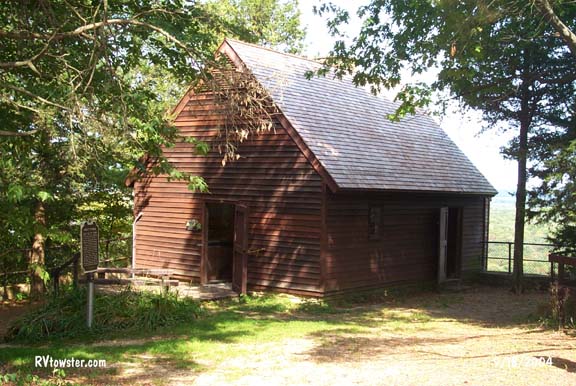
Shot Tower
Tower Hills State Park - Spring Green WI
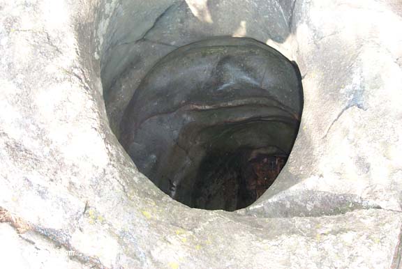
The shot tower was built at this location due to the height of the cliff, the river and the availability of lead from nearby mines. The process was simple. Lead was melted, arsenic was added to make it brittle and help it form into droplets. The melted lead was poured through a ladle with holes in the lid and dropped into a pool of water 180' below. The droplet cooled and became round as they fell.

The lead arrived at the tower in 70# bars called 'pigs'.

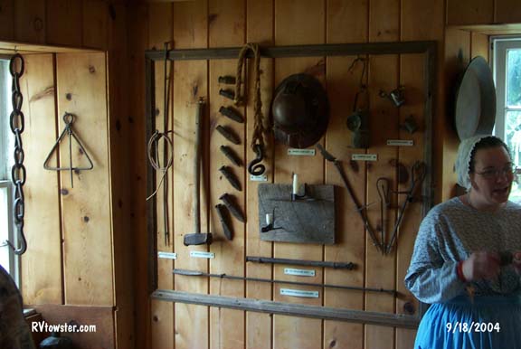
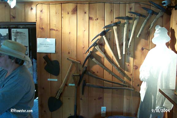
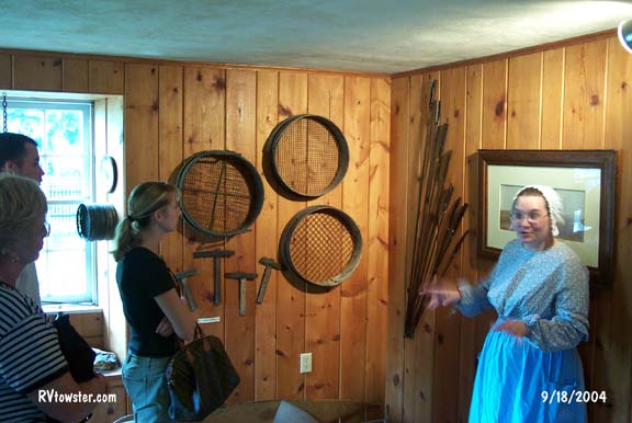
We also visited Mineral Point WI, one of the sources of lead used in the shot tower. On the guided tour of the Pendarvis State Historic Site we learned a lot about lead mining. The fee was $8 per person.
This is a badger hole. Covered with branches it was living quarters for miners.
Miner descended into the mine in buckets. They and the lead come up the same way.
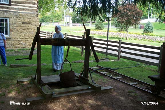
Once the rock containing lead was brought up to the surface, the boys broke it up and sorted it. The women and girls were not allowed near the mining area. Yes, there were many lead related health problems.
Most of the tools used were hand tools.
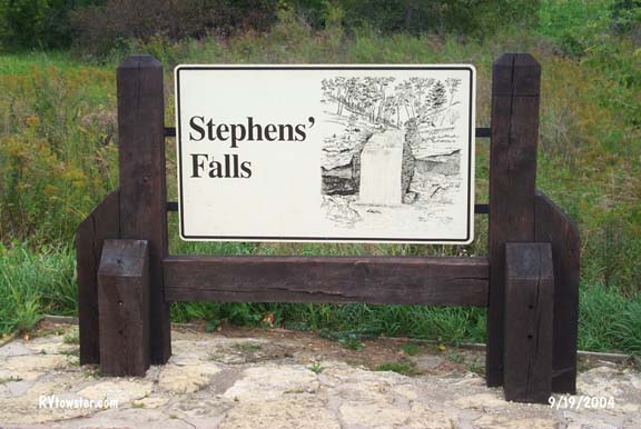
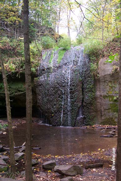
Stephens Falls
Governor Dodge State Park - Dodgeville WI
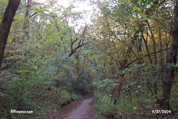
This is a large state park. It was our first experience with the Wisconsin park system.
The sign appeared to direct us to a larger falls. When we got there the water flow was very low. Fortunately, it was a short and easy walk.
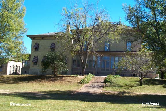
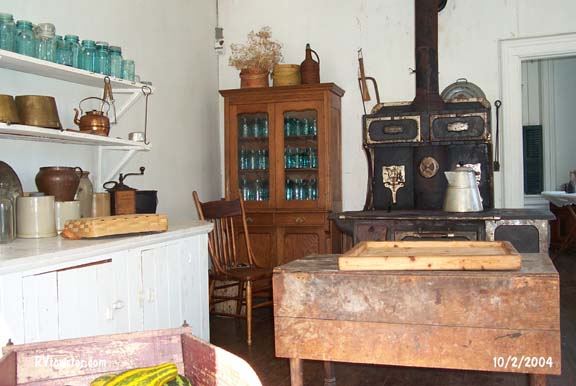
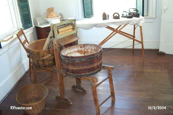
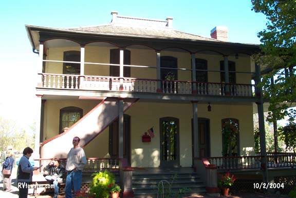
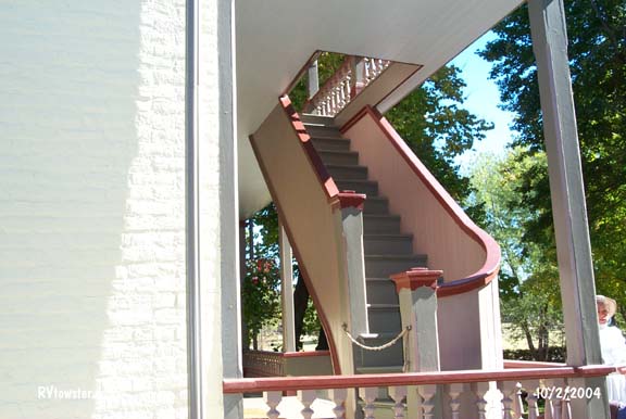
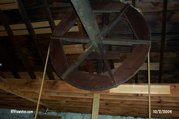
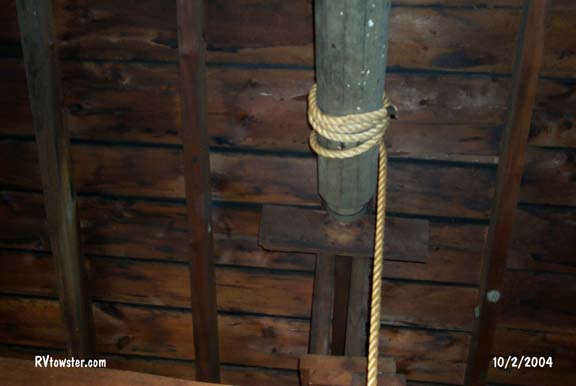
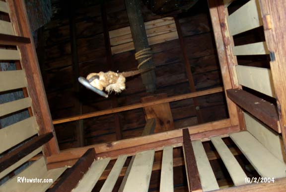
Villa Louis
Prairie du Chien WI
It is the estate of The Dousman Family. The family made their fortune in the fur trade.
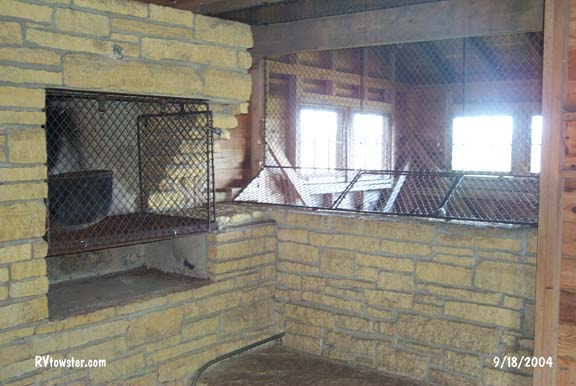
The guides discussion about the ice house reminded us of our trip on the northern shore of Lake Superior. That was our first experience of ice being stored in saw dust.
The ice was stored in saw dust and straw in the basement until needed and then move behind the ice cabinet. The interior walls and shelves of the ice cabinet are marble to hold the cold.

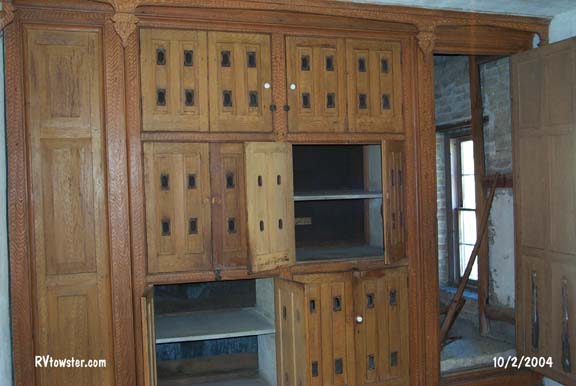

Their Preserve House was set up as a summer kitchen and laundry display.
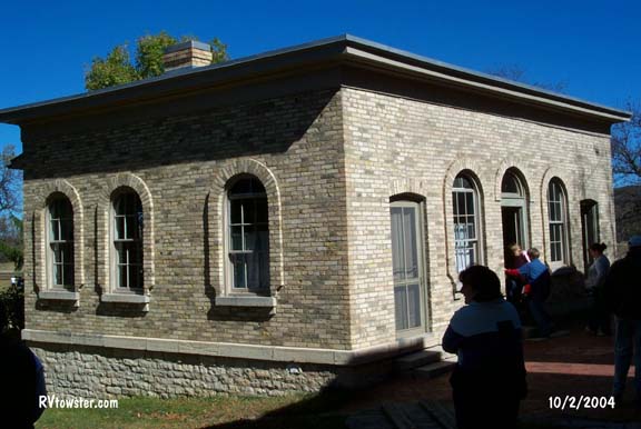
The demands of business and managing the estate required an office building.
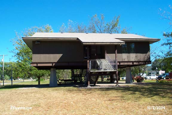
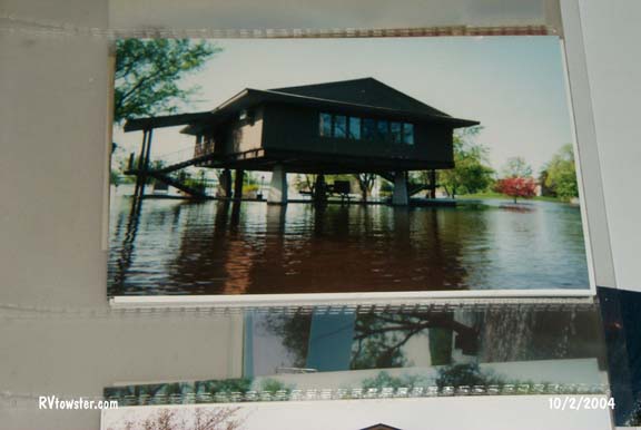
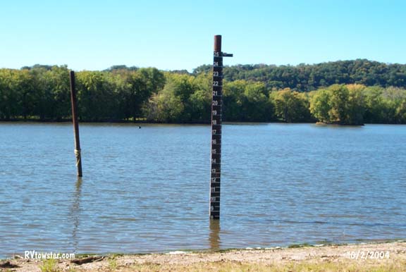 The
hazard of living along a river such as the Mississippi was clear at the villa.
Markers like these are common along the river. When Fred asked why the Visitor
Center was not handicap accessible, the women showed us a photograph from April,
2001.
The
hazard of living along a river such as the Mississippi was clear at the villa.
Markers like these are common along the river. When Fred asked why the Visitor
Center was not handicap accessible, the women showed us a photograph from April,
2001.
Water level 8.5
feet.
Water level 23 feet 8inches.
The Fur Trade Museum on the grounds while interesting offered little new information.
The main furs were beaver, mink and muskrat.
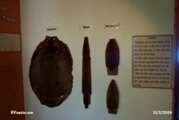

The rope and wheel system used to move the 90# bundles of furs to the second floor storage area was interesting. Pulling a rope loop raised or lowered the hook.
If not in the area for the scenic views from the Wyalusing State Park or other locations, we would not suggest a trip to the area just for the villa tour and small museum on the grounds. The one-hour guided tour was $8.50 per person. A little less if you are over 65.
Willow Falls
Willow River State Park - Hudson WI
The falls are very nice. A lot of water flows and it is noisy. They provide a nice sitting, viewing area.

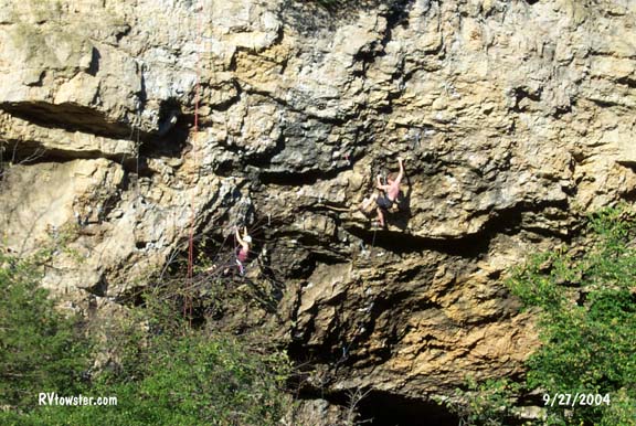 While
we were there we were entertained by climbers. We counted six climbers in the
group.
While
we were there we were entertained by climbers. We counted six climbers in the
group.
 If
you look hard you can see two of three girls walking behind the falls.
If
you look hard you can see two of three girls walking behind the falls.
 This
photograph does not show how steep the walk down to the falls is. Our feet were
all the way to the front of our shoes by the time were at the falls. All the way
down we were thinking about the 'climb' back up the hill.
This
photograph does not show how steep the walk down to the falls is. Our feet were
all the way to the front of our shoes by the time were at the falls. All the way
down we were thinking about the 'climb' back up the hill.
Little Falls Lake is also
in the state park.
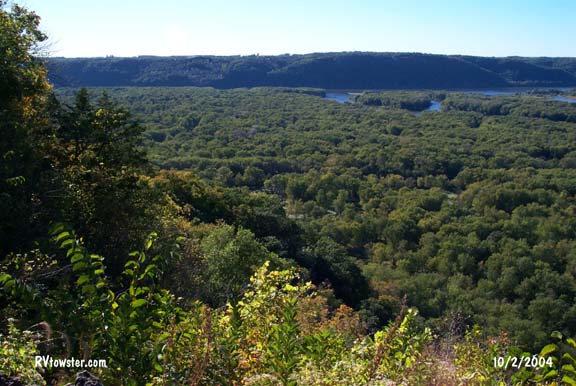
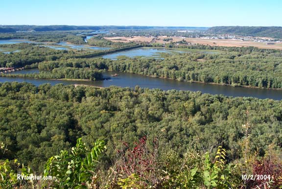
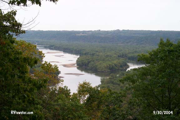
Wyalusing State Park - Bagley WI
This state park has several points of interest. It has a fantastic lookout over the Mississippi and Wisconsin rivers, Indian mounds and a history of passenger pigeons.
 Point
Lookout provides a fantastic view. Iowa is across the Mississippi in the first
two photographs below.
Point
Lookout provides a fantastic view. Iowa is across the Mississippi in the first
two photographs below.
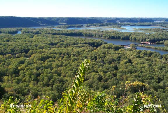

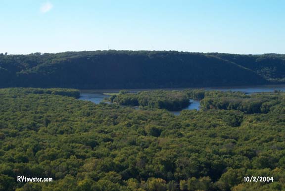 This
is where the Wisconsin River joins the Mississippi River. The Mississippi is
horizontal and the Wisconsin is flowing around the island in this photograph.
This
is where the Wisconsin River joins the Mississippi River. The Mississippi is
horizontal and the Wisconsin is flowing around the island in this photograph.
Did you see the Wall-Mart?
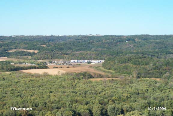
A different view from the south campground.
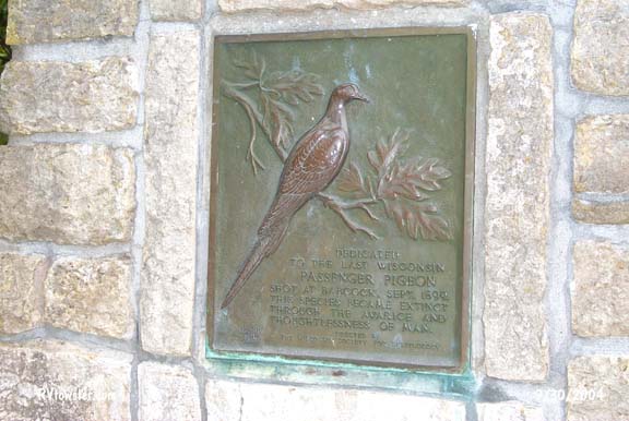 In 1899, the Passenger Pigeon became extinct in Wisconsin in Babcock, a town
near here. This monument to that fact is located in the park.
In 1899, the Passenger Pigeon became extinct in Wisconsin in Babcock, a town
near here. This monument to that fact is located in the park.

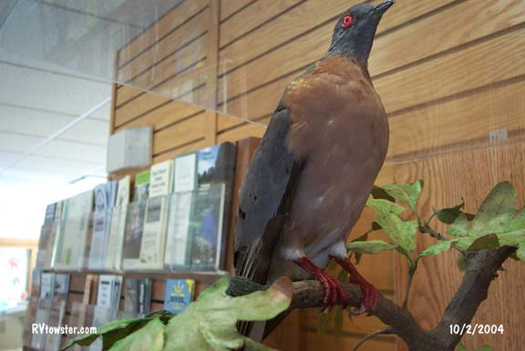
Found only in eastern North America, the Passenger Pigeons were one of the most abundant bird on earth. A single flock could stretch for 300 miles and take 14 hours to fly by. Passenger Pigeons were hunted as a food source. By 1901, there were no passenger Pigeons flying free in the wild. The last bird died in the Cincinnati Zoo on September 1, 1914.
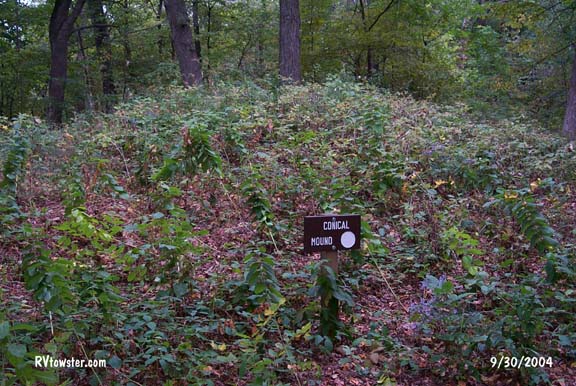
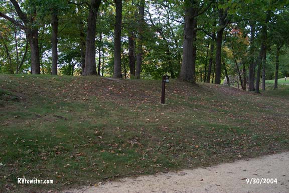
Archeologist in 1911 discovered Indian effigy mounds in the park overlooking the Mississippi River. To the novice they look like mounds of dirt. To the experts they are pre-historic American Indian burial and ceremonial mounds.
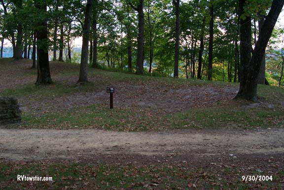
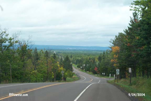
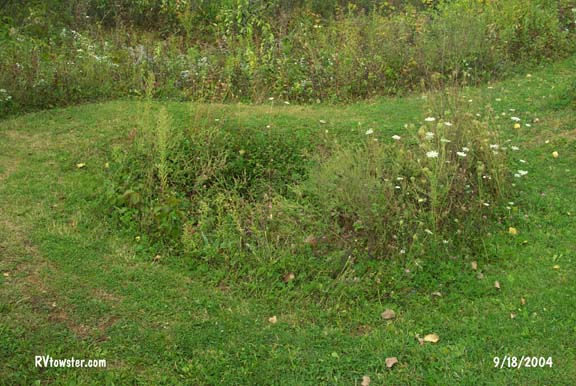
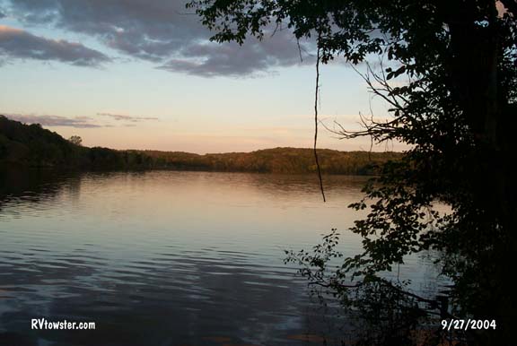
This is one of the better campsites we have had in Wisconsin. This is the view from our window and of us on the hill. And, electricity too.

 Most
fishermen spend a lot of time fishing and sometimes catching. This sign seen at
the boat landing is appropriate.
Most
fishermen spend a lot of time fishing and sometimes catching. This sign seen at
the boat landing is appropriate.