Crater Lake National Park - 2008 . . .
during our travels in the
Pacific Northwest
Updated: 01/05/09
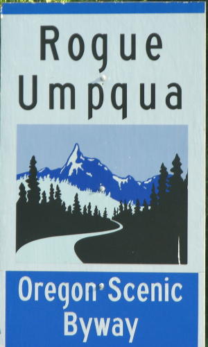
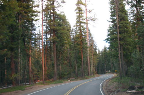
off toward Crater Lake Crater Lake National Park . . . Leaving Crater Lake . . . Rogue Gorge . . .
We were off toward Crater Lake, our next destination.
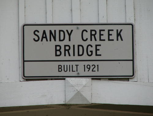
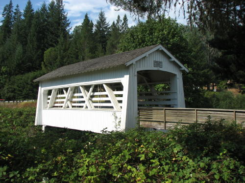
We stopped for lunch at a rest area with a covered bridge.
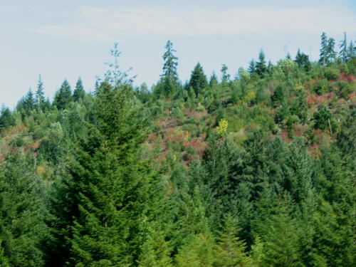
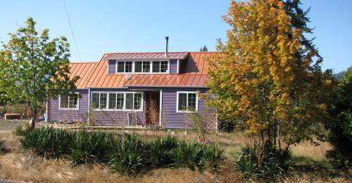
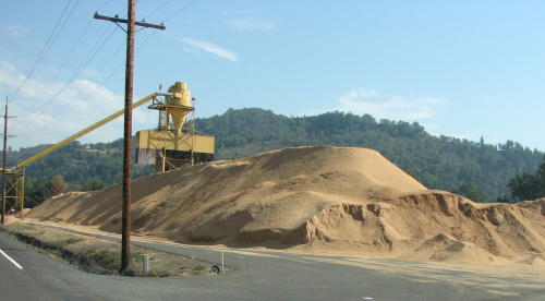
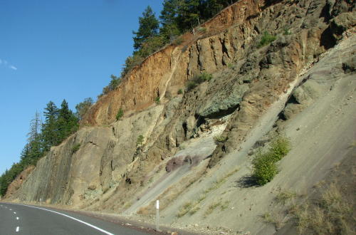
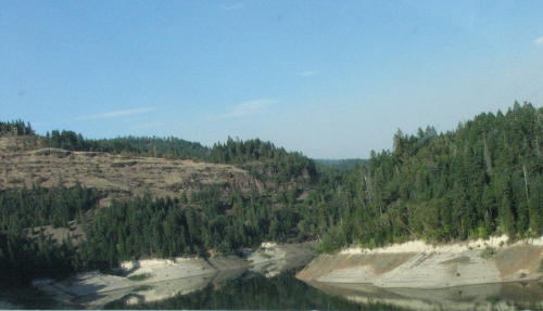
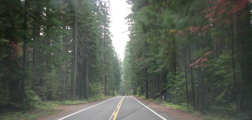
It was a colorful ride - even the houses were colorful.
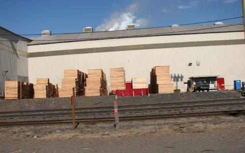
The piles of logs were being watered with a fine mist before being made into plywood. Interestingly, we watched a show recently on the Discovery Channel that said the water softens the wood. The logs are then spun so a blade can slice off thin sheets of wood. The core of the log that is left is used for 2x4s.

 Sawdust?
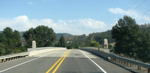
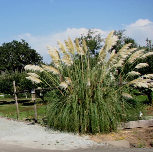
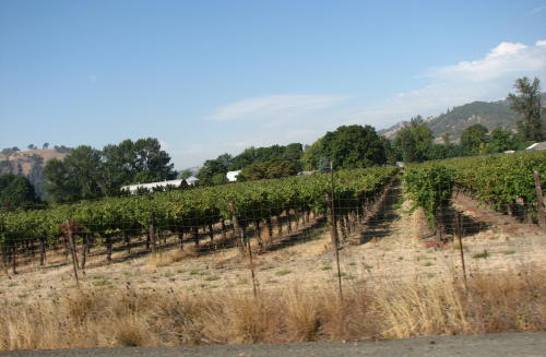
Another decorative Oregon bridge . . . a grass plant . . . grape vines

 Mary
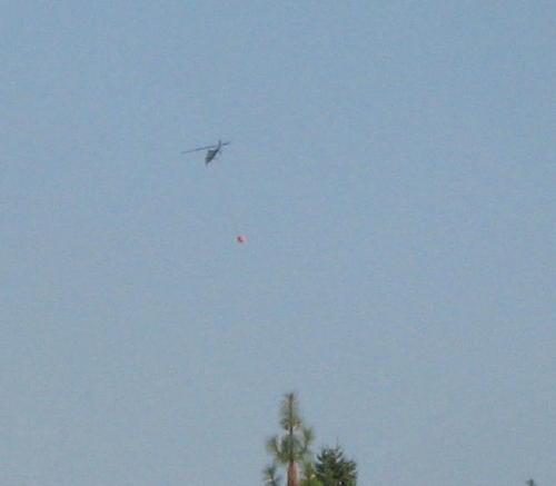
Lou spotted this helicopter hovering over a river with a cable hanging down. The
cable was attached to a bucket filling with water. The helicopter took the
bucket of water out of the river and headed for a forest fire
area.
Mary
Lou spotted this helicopter hovering over a river with a cable hanging down. The
cable was attached to a bucket filling with water. The helicopter took the
bucket of water out of the river and headed for a forest fire
area.
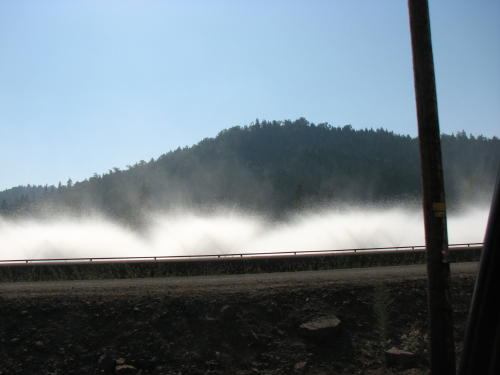
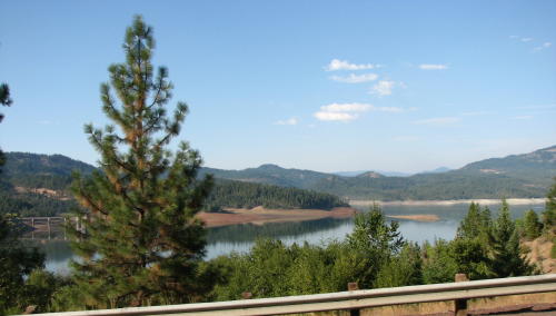
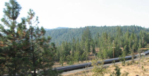
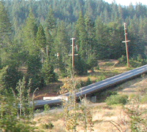
We think this pipeline was carrying water out of the mountains to a electric generating plant.
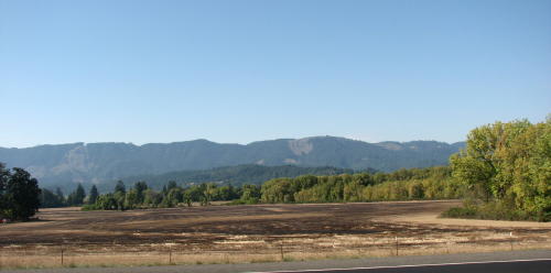
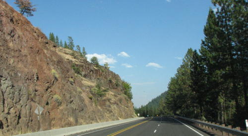
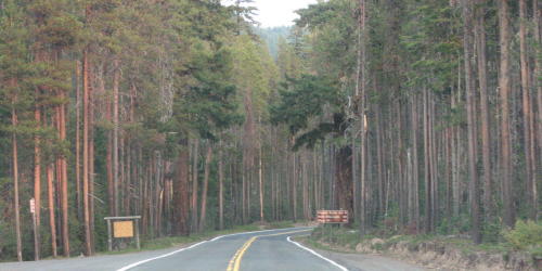
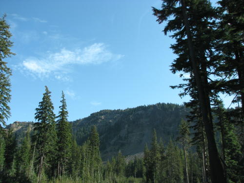
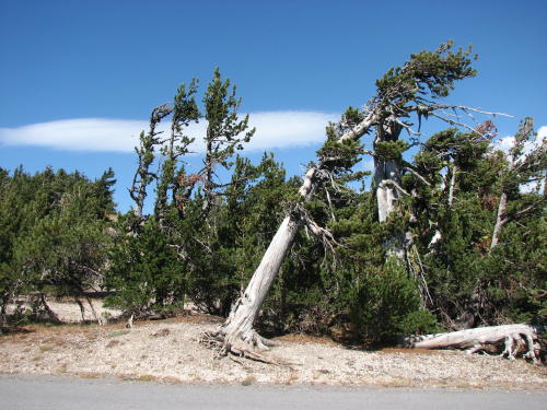
The pine lined road into Crater Lake was beautiful.

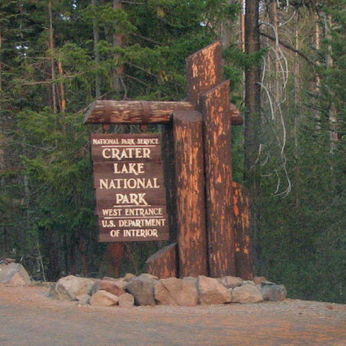

We entered
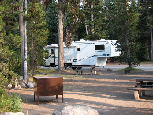
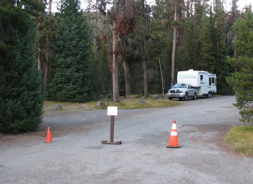 We will make a long story as short as possible. We are parked
behind the orange cone and small "B" loop closed sign because the
other end of the "B" loop was not barricaded. Oops.
We will make a long story as short as possible. We are parked
behind the orange cone and small "B" loop closed sign because the
other end of the "B" loop was not barricaded. Oops.
When we arrived at Crater Lake National Park at about 5:30pm, the fellow at the entrance booth said, "welcome - I hope you aren't planning to camp here tonight. Our campground closed at noon today." After explaining that the Web site said they were open for another week, that it was too late to drive back down the road 19 miles and not 'just going away', he said go in and see what someone else tells you. We didn't see anyone else because everything closed at 5:00pm. Driving into the campground a sign said Loop "C' and "D" to the right were closed and these cones and sign were in front of us. We noticed one RV in the campground to our left - as it turned out they were in Loop "A". We turned down the first road which turned out to be 'closed' Loop "B". We pulled into a site , talked for a couple minutes and decided to spend the night in site B15. We didn't feel too bad because two other RVs set up in Loop "B" later.
The store was open in the morning so we went in to pay. The concessionaire said they had already shutdown her computer - she could not take our money. The system had accepted reservations for periods after the 'closing date', so people were still in the campground. As we were planning to stay two nights, Fred asked if that meant we could stay two nights free. She said, "I don't care, that is up to the rangers now". We never saw a ranger in the campground. Because we spent most of the day driving around Crater Lake, we stayed the second night - free. More RVers joined us the second night.

 Each
campsite had a bear-proof "Hyd-A-Meal" locker to store food
in.
Each
campsite had a bear-proof "Hyd-A-Meal" locker to store food
in.
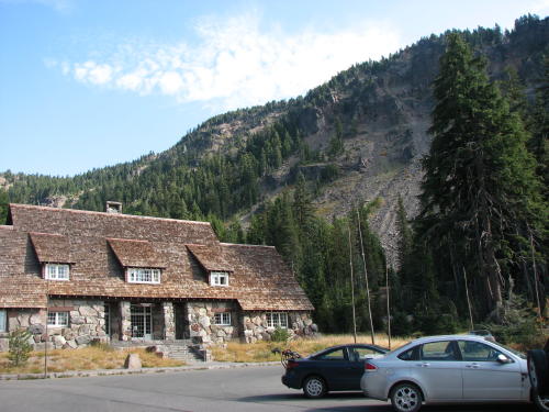
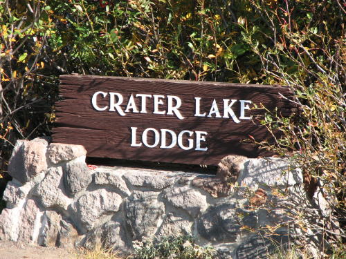
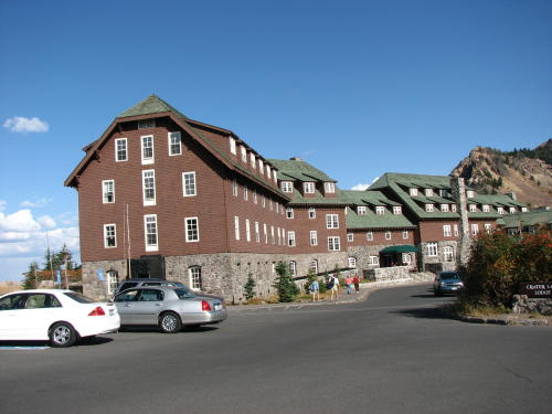
The park lodge was also closed.
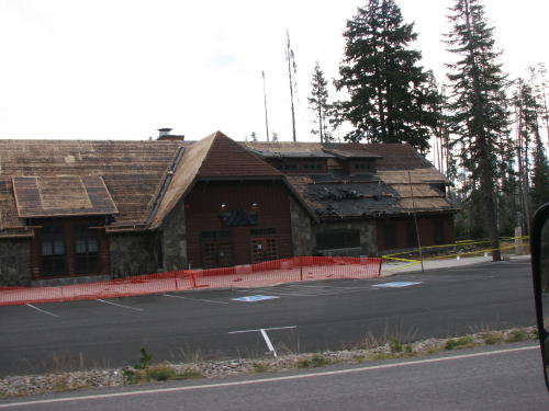
It was getting a new roof before to winter.
Crater Lake National Park . . .
 Crater
Lake
Crater
Lake
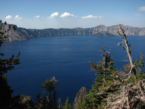
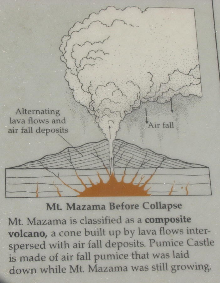
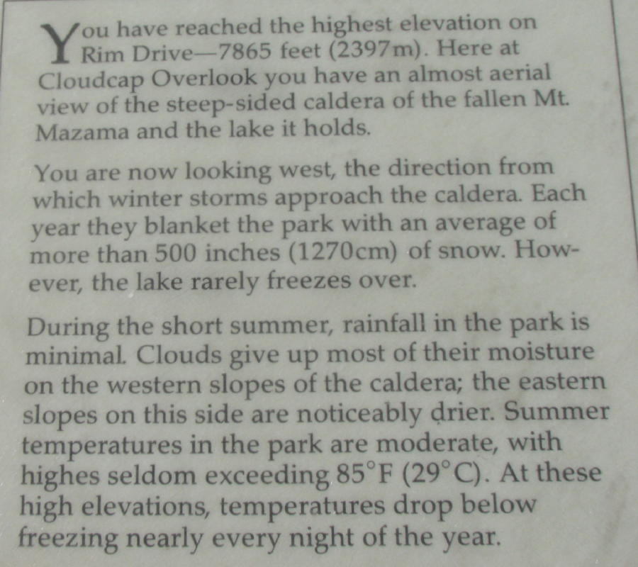
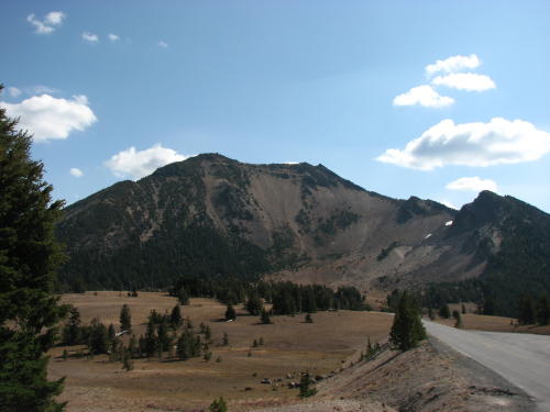
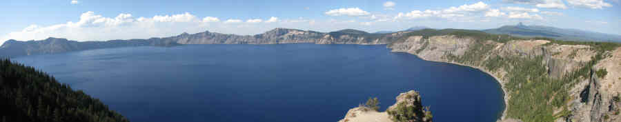
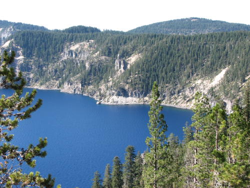
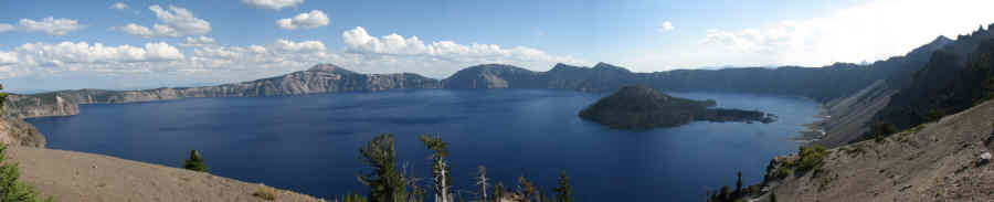
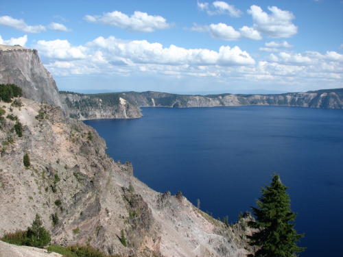
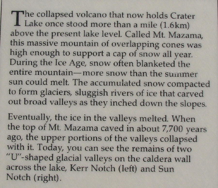
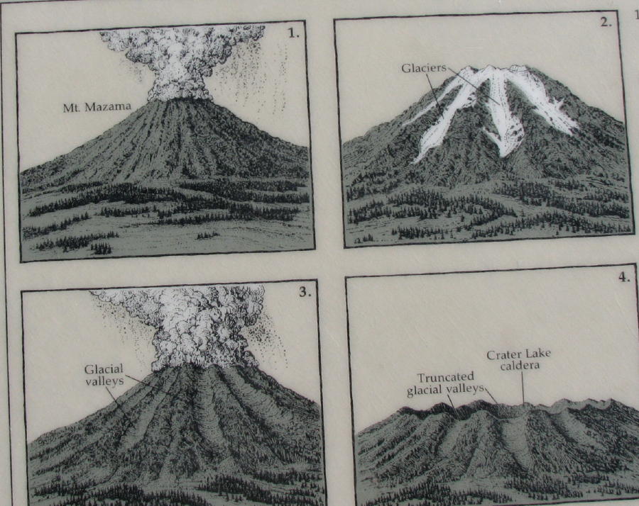
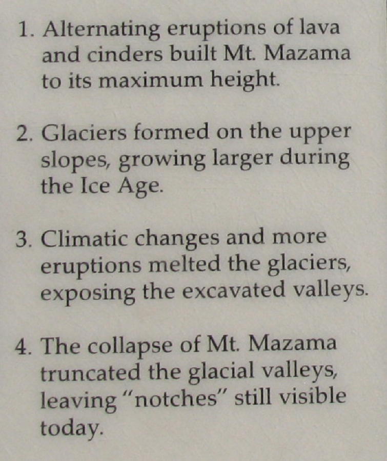
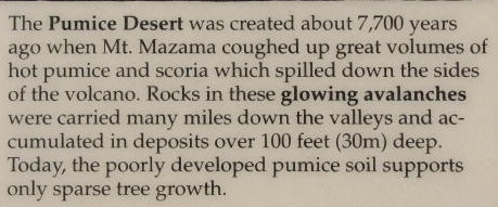
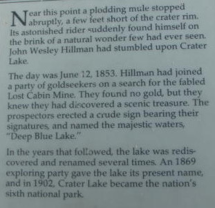
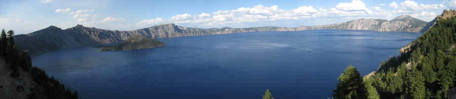
The lake rests inside a caldera formed approximately 7,700 years ago when the
12,000 foot tall Mount Mazama volcano collapsed following a major eruption. Later eruptions
formed
The
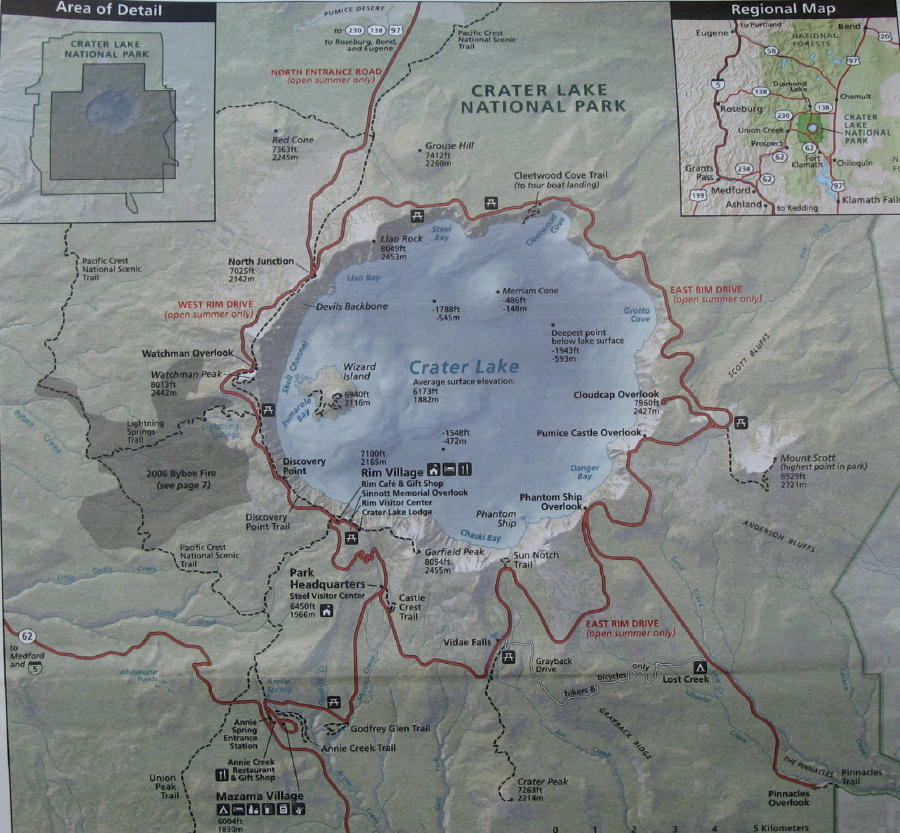 Rim Drive is a 33-mile road that encircles
We decided it was best to travel the
< Click on the map to see a larger image of the roads around Crater Lake.
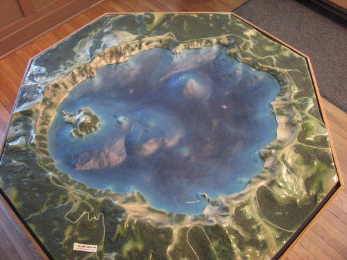
We drove to the visitors center for information first.

The visitor center displayed a nice relief map of the lake.
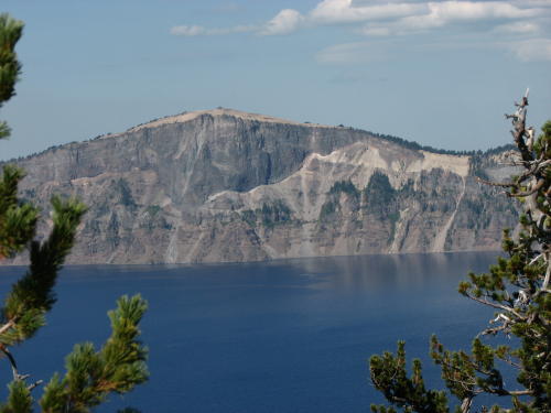
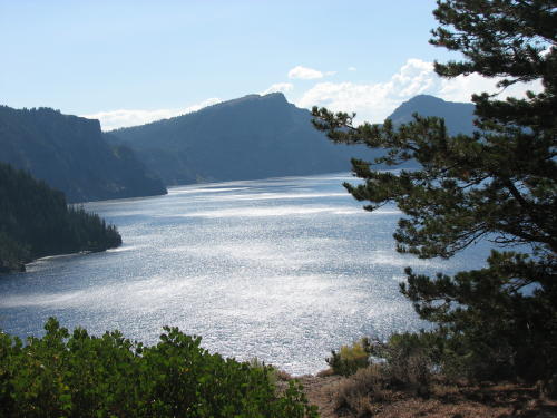
 Because
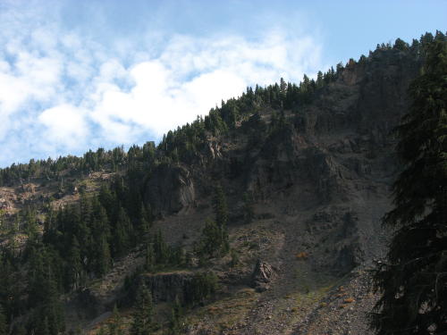
we drove the route counterclockwise, the outside wall of the crater was on our
left. We drove on the East Rim Drive for a few miles before seeing Crater Lake.
Because
we drove the route counterclockwise, the outside wall of the crater was on our
left. We drove on the East Rim Drive for a few miles before seeing Crater Lake.
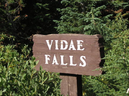
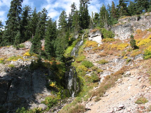
Vidae Falls were just a quick stop along the way.
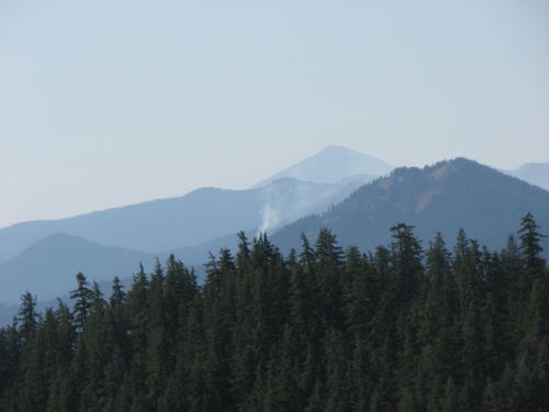
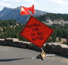
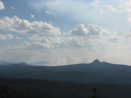
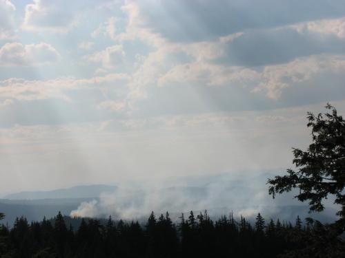
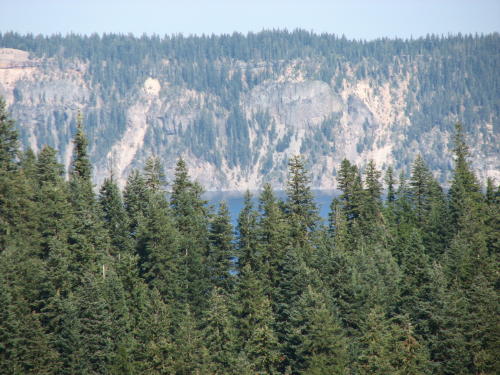
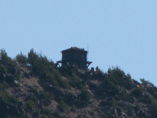
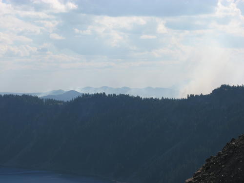
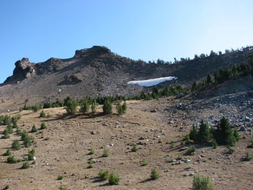
 In
addition to the crater wall to our left, we could see a couple forest fires to
our right. So they did not continue to receive numerous reports of the same
fires, a sign was
posted alongside the road where the fires could be seen.
In
addition to the crater wall to our left, we could see a couple forest fires to
our right. So they did not continue to receive numerous reports of the same
fires, a sign was
posted alongside the road where the fires could be seen.

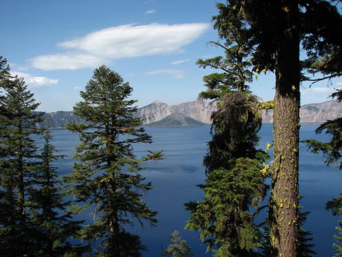
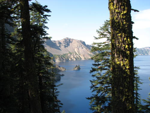
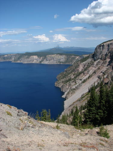
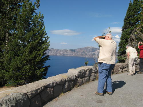
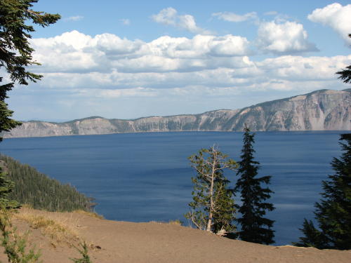
 Finally, a glimpse of Crater Lake.
Some of the pull-offs were named, some were not. We did not miss any opportunity
to view Crater Lake.
Finally, a glimpse of Crater Lake.
Some of the pull-offs were named, some were not. We did not miss any opportunity
to view Crater Lake.
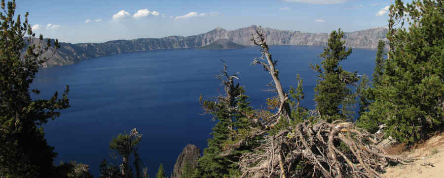
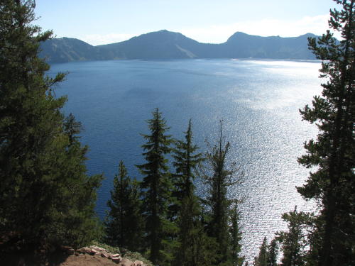
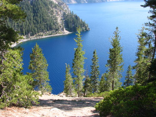
Soon, we were driving on the rim which provided spectacular views.
![]()

![]()

Cloudcap Overlook - highest elevation at 7,865 feet . . .
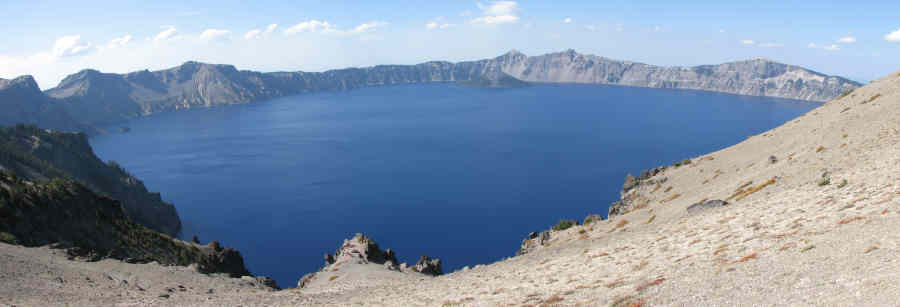
 Mount
Scott is now the highest mountain in the park at 8,926 feet.
Mount
Scott is now the highest mountain in the park at 8,926 feet.

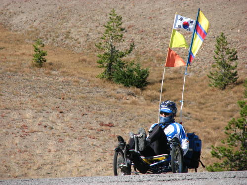 While
we were stopped for a break, these bicyclists peddled in. Fred commented on
the safety flags they had on their bikes. (We had seen a guy in a small town with
no flags on a bicycle likes these - you could hardly see him.) Their bikes had 28
speeds.
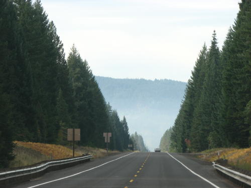
We don't know their plans but we took five hours to drive the 33 miles.
While
we were stopped for a break, these bicyclists peddled in. Fred commented on
the safety flags they had on their bikes. (We had seen a guy in a small town with
no flags on a bicycle likes these - you could hardly see him.) Their bikes had 28
speeds.
We don't know their plans but we took five hours to drive the 33 miles.

When we get home, it will be difficult to tell anyone
where our favorite lunch spot was during our travels.
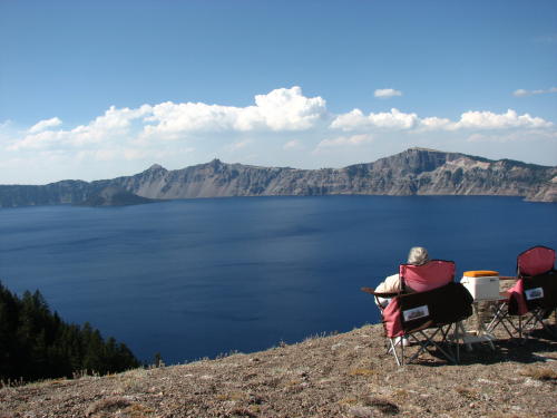
The direction and time we traveled put the sun in our face very little.

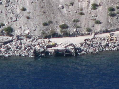
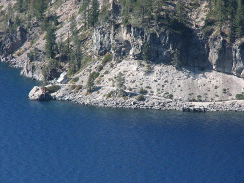
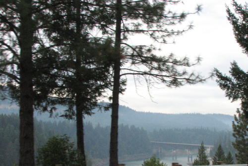
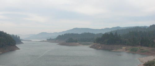
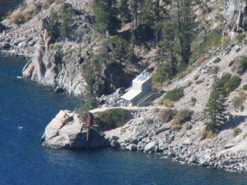 The
boat ride service was closed for the season. It is a 2-hour cruise around Crater
Lake. We think the white
building is the boathouse.
The
boat ride service was closed for the season. It is a 2-hour cruise around Crater
Lake. We think the white
building is the boathouse.
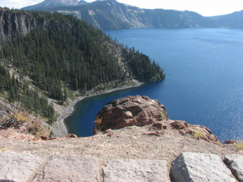
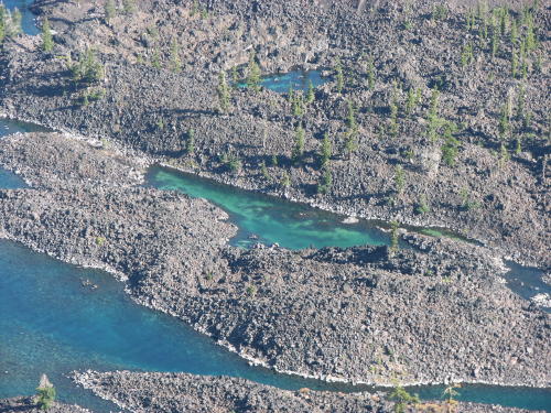
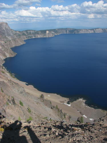
We found the docks in their winter storage location on the west side of the island.
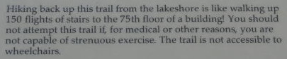
The only way to the boat dock is a walking path that drops 700
feet in 1.1 miles.
This path is the only access to the shore of the lake.
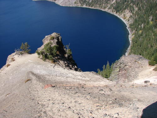
This rock near the boat parking lot will make a big splash someday.
 The edge was too shear to see the boat house.
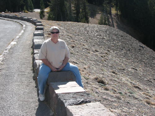
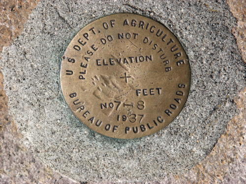
Looking at a surveyors marker, we though how difficult the surveying task was without GPS.

We are almost to Rim Village at the south entrance road.
Pumas Desert . . .
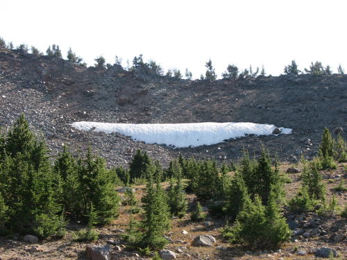
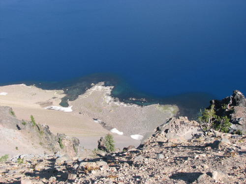
Some snow remained here and on the lake shore. Notice one of thousands of guide 'branches' for the snowplow drivers.
 If you wished, you could walk the upper trail (old road) to Rim Village.
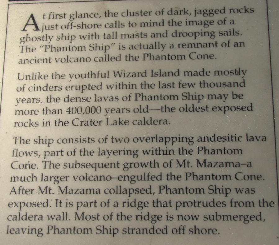
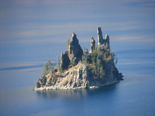
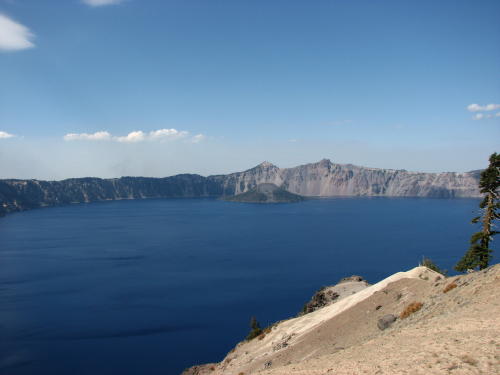
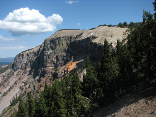
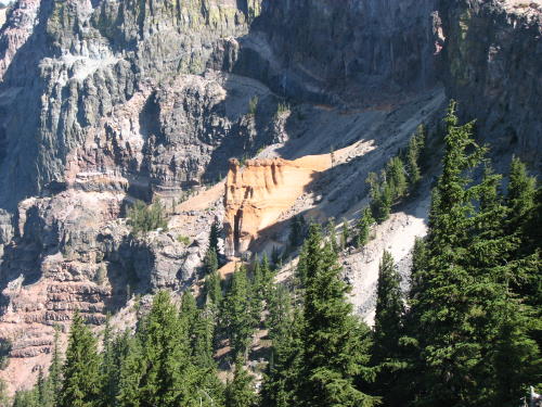
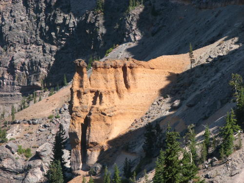
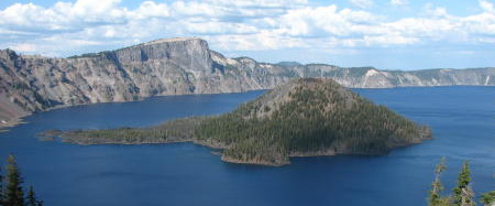
These photographs give a closer look at the island we have seen from various viewing locations all day.
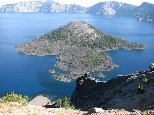

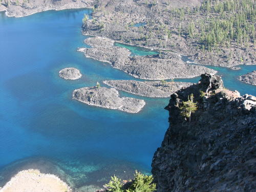
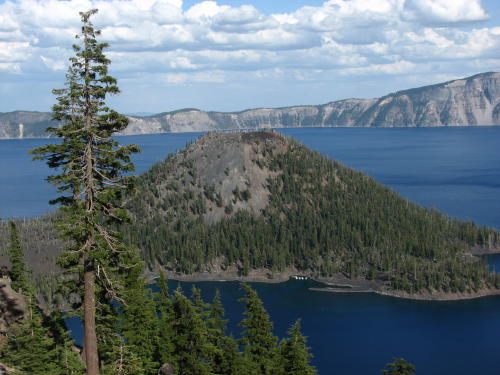
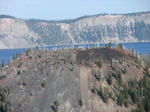
The crater of the island had an interesting look.
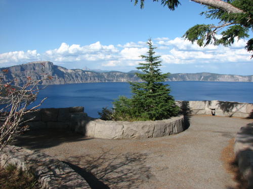 A
nice rim walk led to the left from the lodge.
A
nice rim walk led to the left from the lodge.
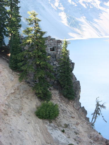
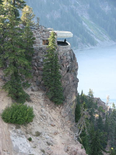
An overlook hung on the side of the caldera near the Rim Village Lodge.
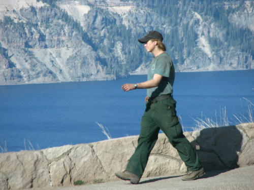
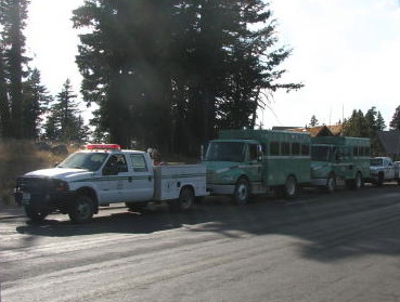
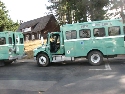
While we were there, a young lady dressed in soot covered work clothes walked up - camera in hand. She told us she graduated from college and could not find a job in her field. So she signed up as a forest fire fighter. Her group from Idaho just finished two weeks in the area.
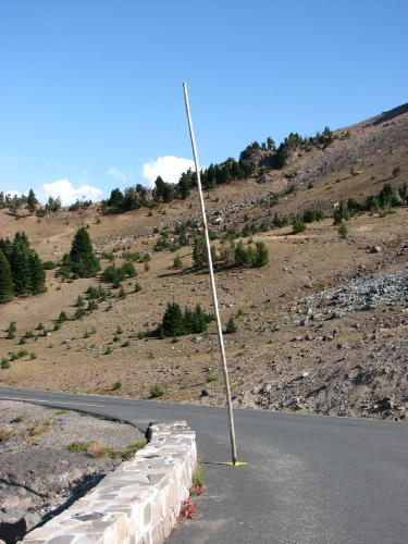
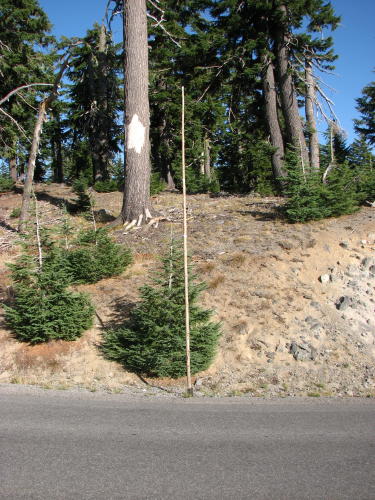 The
park service has thousands of pipes/tubes 'planted' at ground level along the
roadway throughout the park. Before the snow flies, a tall branch with two rings
of reflective silver tape near the top is placed in each one of them.
The
park service has thousands of pipes/tubes 'planted' at ground level along the
roadway throughout the park. Before the snow flies, a tall branch with two rings
of reflective silver tape near the top is placed in each one of them.
We had beautiful weather for our day at Crater Lake. The day we left was not very pleasant.
 Bridge
over the Rogue River . . .
Bridge
over the Rogue River . . .
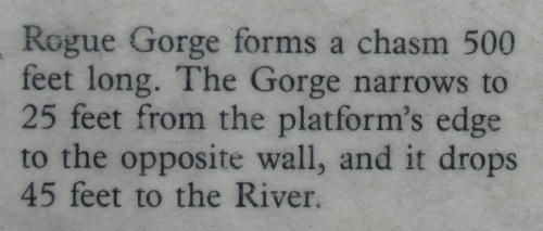
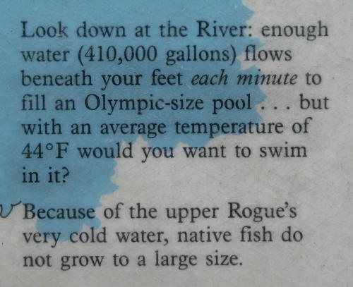
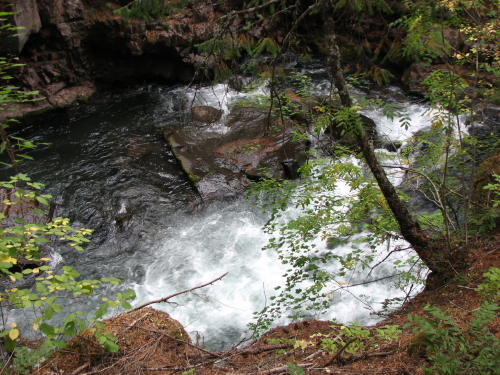
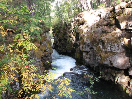
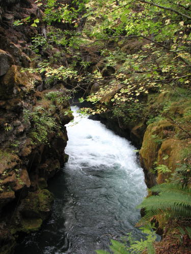
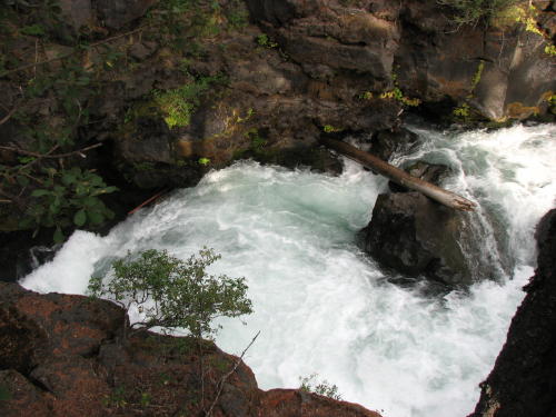
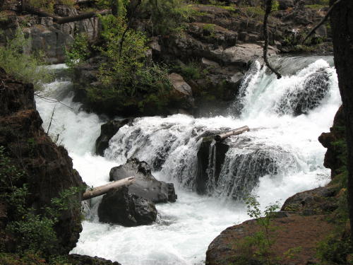
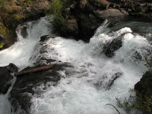
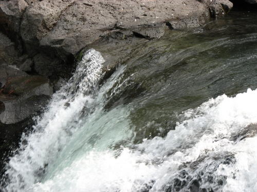
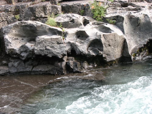
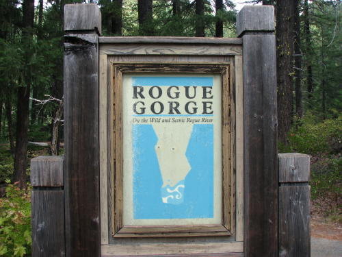 Rogue
Gorge is about 20 miles southwest of Crater Lake. We noticed it on the way to
Crater Lake a couple
days ago. It is worth a twenty minute stop.
Rogue
Gorge is about 20 miles southwest of Crater Lake. We noticed it on the way to
Crater Lake a couple
days ago. It is worth a twenty minute stop.
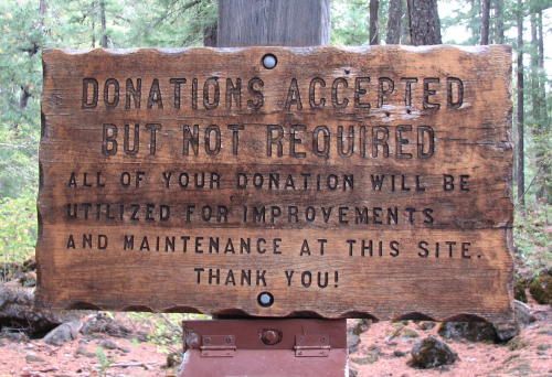 Like
at many other Federal and State attractions, an opportunity to donate was made
known.
Like
at many other Federal and State attractions, an opportunity to donate was made
known.
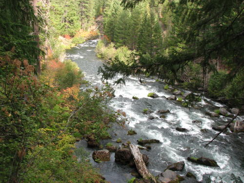
Fall colors were appearing.
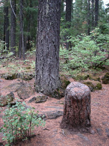
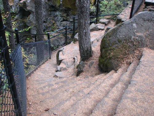
This was interesting.

The walkway was asphalt and reasonably level.
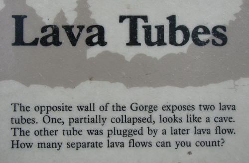
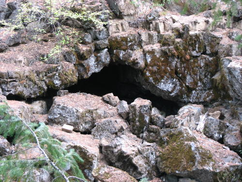
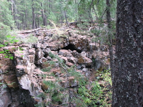
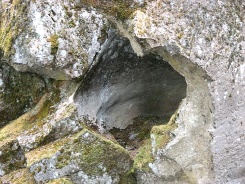
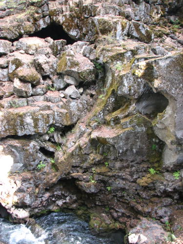

Holes in the lava rock . . .
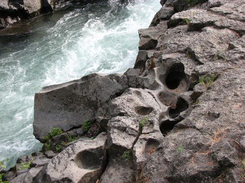
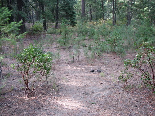
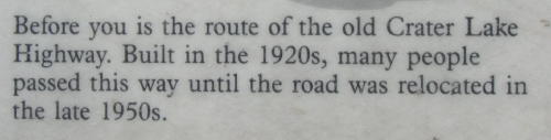
Walking a different path out, we saw this old road.


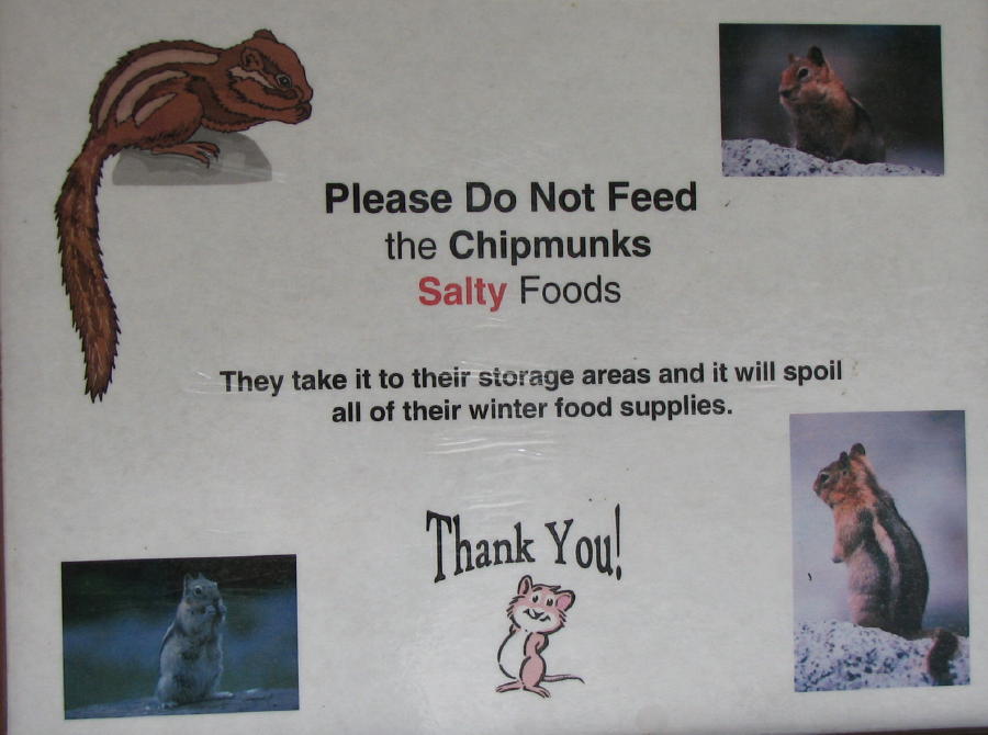
Cute sign . . .
On the road again . . .
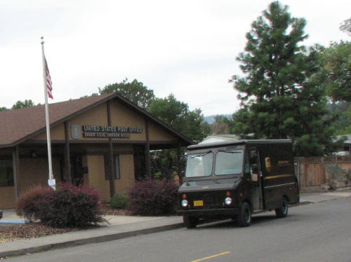
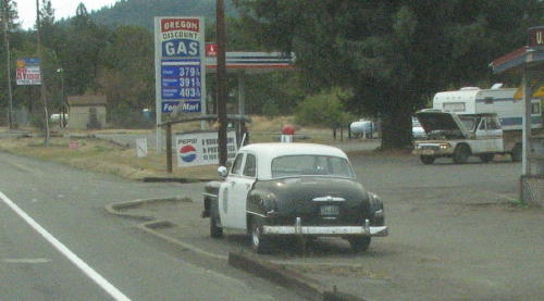
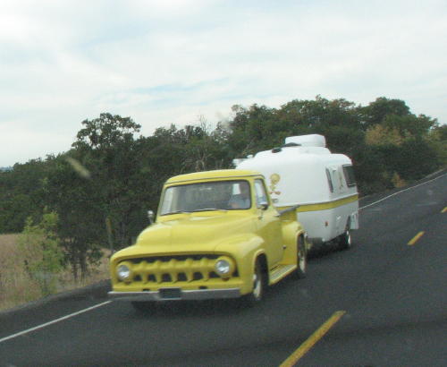
Some unusual sights - a UPS truck at a post office, an old police car decoy and a neat RV.
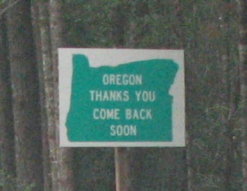 We enjoyed our time in Oregon.
GO BACK TO > > > Pacific Northwest - 2008