Texas - 2006
Updated: 11/30/08
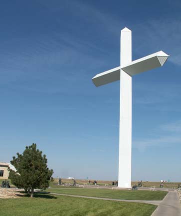
Cross of Our Lord Jesus Christ
Panhandle-Plains Historical Museum
Quadalupe Mountians National Park
Cross of Our Lord Jesus Christ This cross is located near Groom, Texas but is visible from 20 miles away when driving on I-40. Admission is free but a donation is requested. There is a gift shop where a wide variety of religious items are available.
190 feet tall
110 feet wide
weighs 2.5 million pounds
withstands 140 mph winds
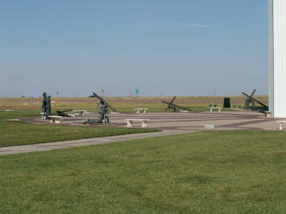
The cross is circled at its base by 14 bronze stations of the cross.

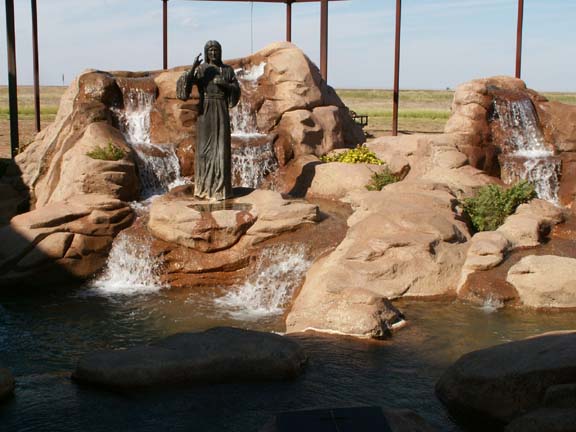
Divine Mercy Fountain
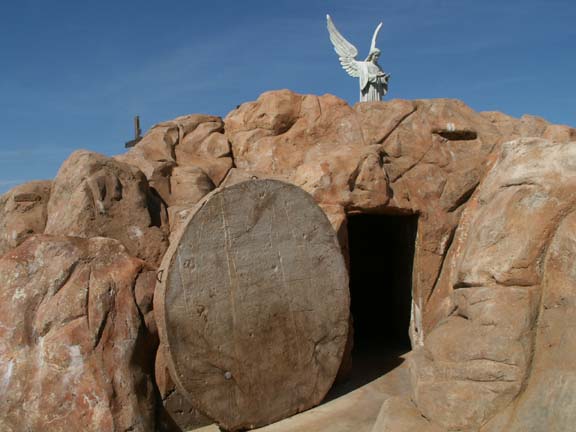
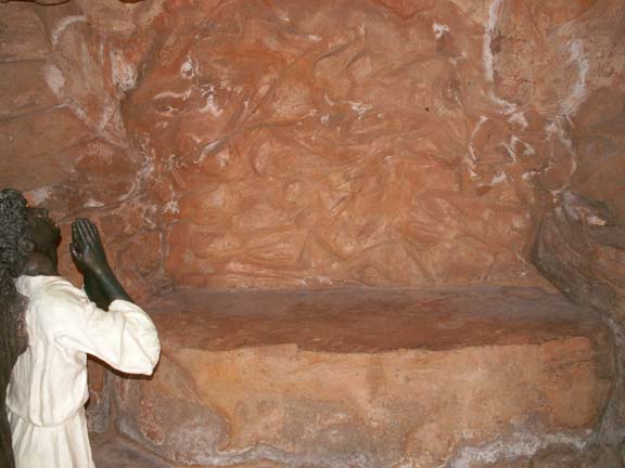
Display of the empty tomb.
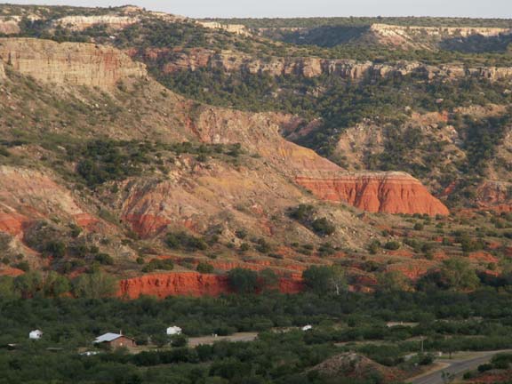
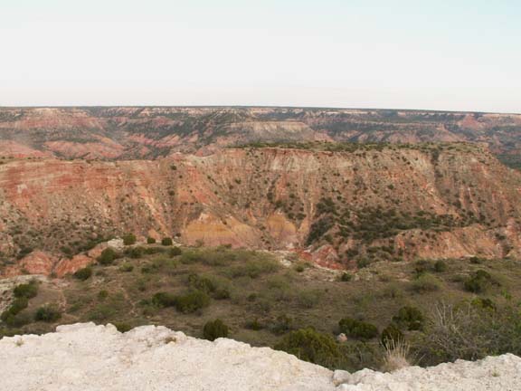
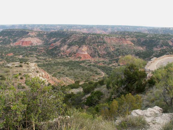
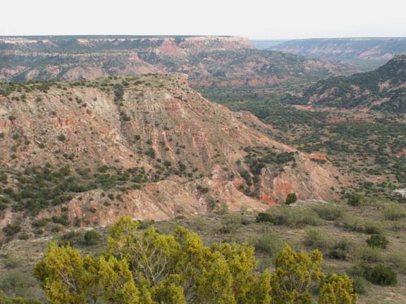
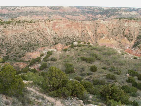
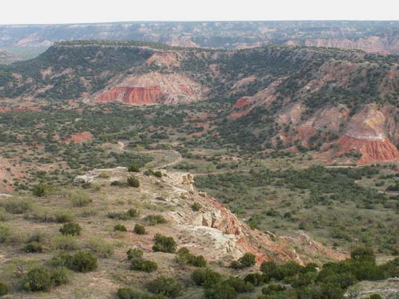
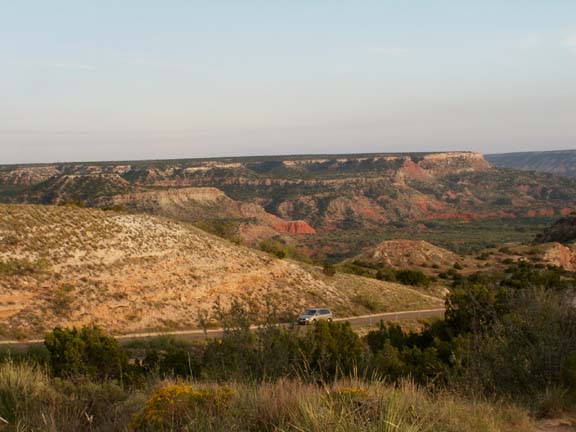
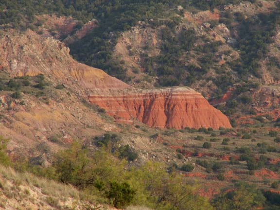
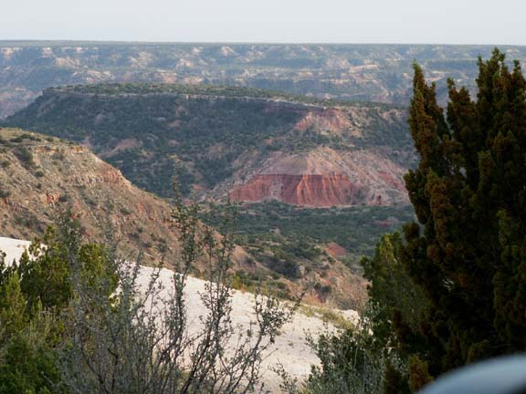
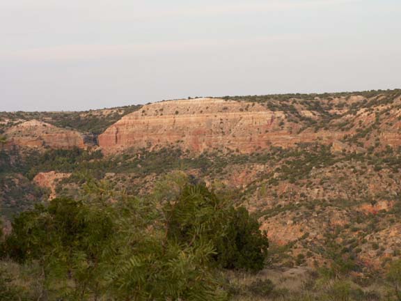
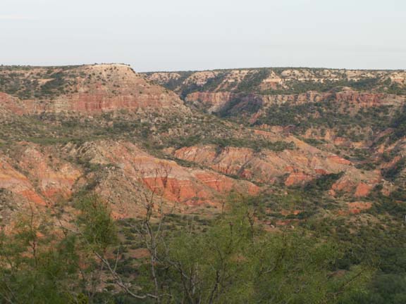
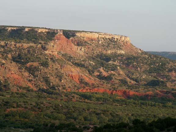
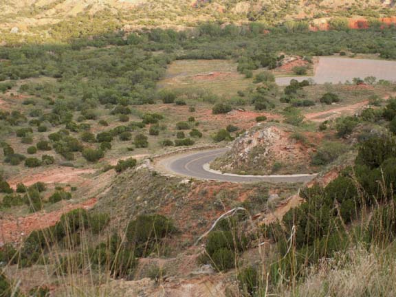
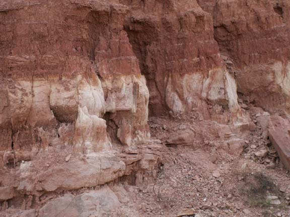
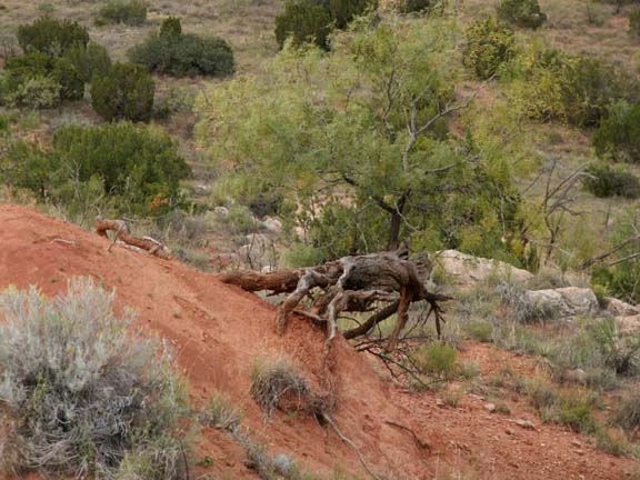
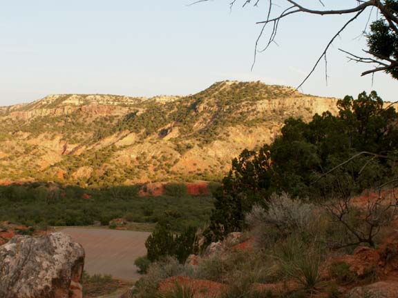
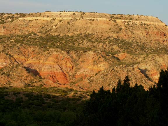
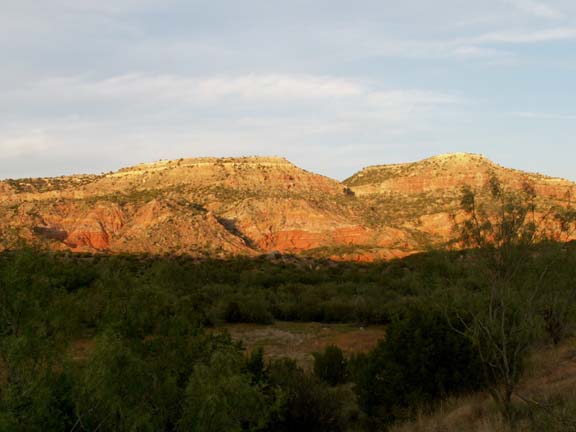
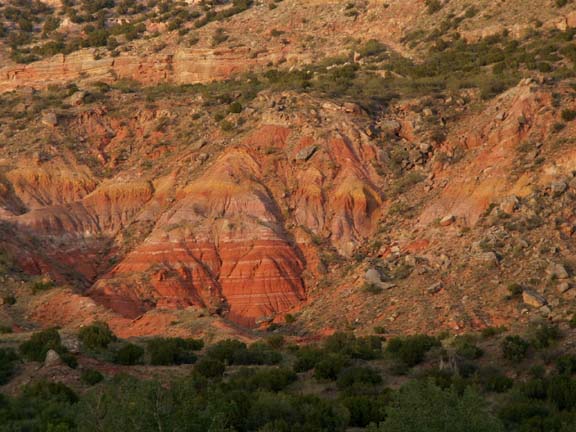
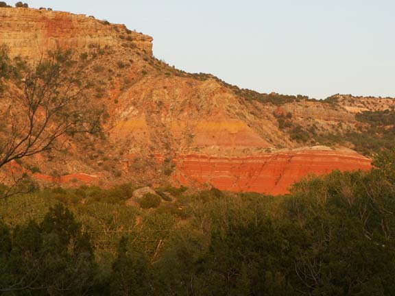
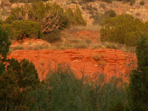
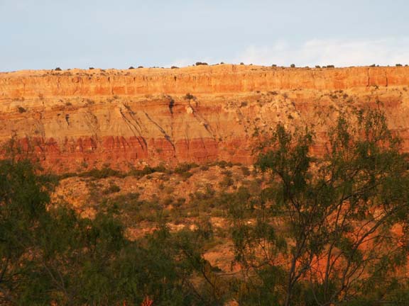
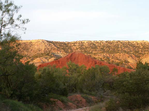
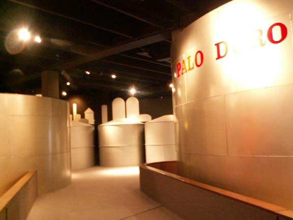
Palo Duro Canyon State Park Canyon, Texas
 We
camped in a campgrounds about ten miles from the state park, just off I-27 at
Exit 106.
We
camped in a campgrounds about ten miles from the state park, just off I-27 at
Exit 106.
We did not park in the state park due to the two mile long 10% grade inside the state park.
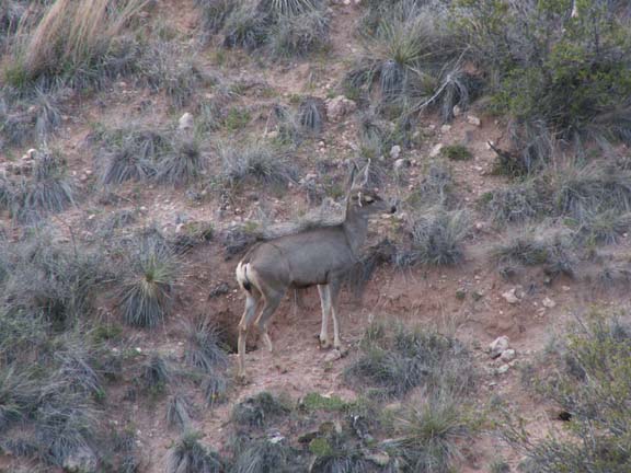
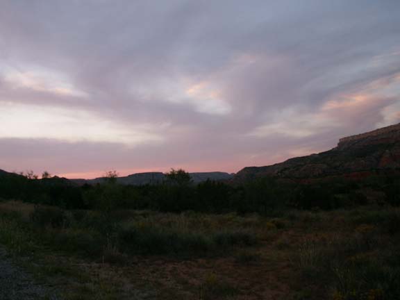
Arriving late in the day at the campground, our visit to Palo Duro Canyon was a race against the setting sun. This is not our preferred way to visit destinations but sometime necessary. If you allow at least two hours to drive Park Road that should be adequate.
In fact, these deer are difficult to see partially due to the lack of sunlight.

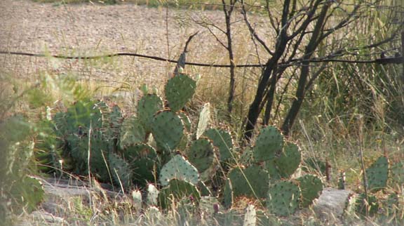
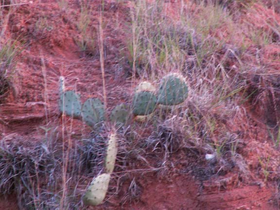
Cacti were all over the area.
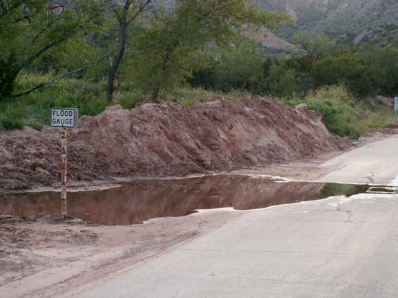 Six
river crossings on the 16 miles of Park Road cautioned you of flash
flooding.
Six
river crossings on the 16 miles of Park Road cautioned you of flash
flooding.
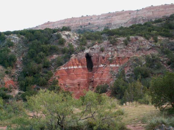
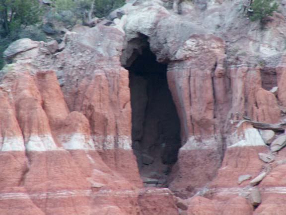
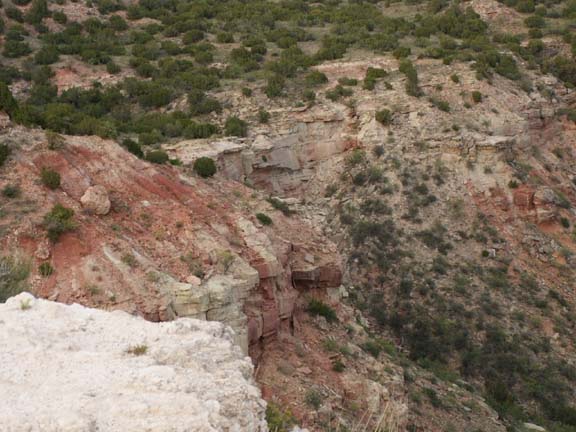
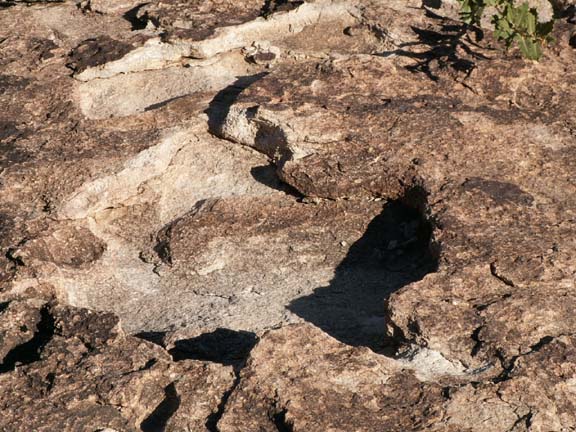
This was an interesting formation - it looked like a cave.
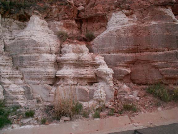 On
the way out of the state park, we stopped to use flash on a white formation near
the road.
On
the way out of the state park, we stopped to use flash on a white formation near
the road.
Soon, there was not enough light for anything except sunsets.
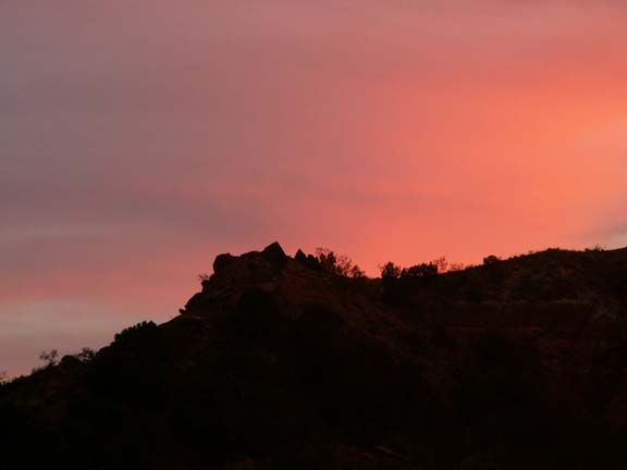
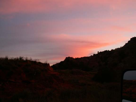
We post the following photographs in the order they were made. There is not much to say about each photograph because the beauty of the canyon speaks for itself.

The fee for a day pass to the state park was $4 for adults, $2 for seniors over 65.
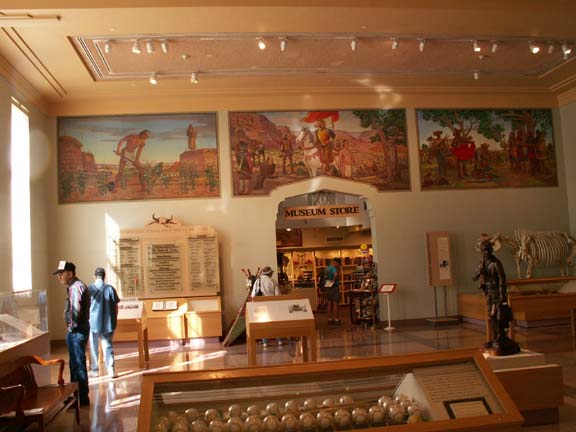
Panhandle-Plains Historical Museum Canyon, Texas
 Located
on the campus of West Texas A & M University
Located
on the campus of West Texas A & M University
(Parking is limited and not RV friendly. We parked our HHII several
blocks
away in a grocery store parking lot and walked to the museum.)
Admission is $7 Adults, $3 Seniors 65+
Hours: Mon - Sat 9 - 5; Sun 1 - 6
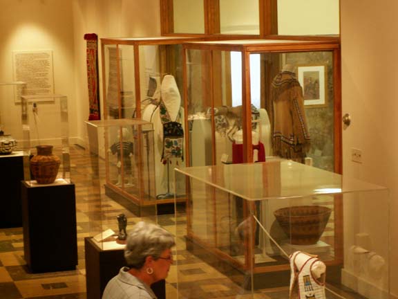
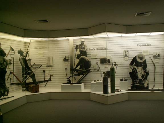
The museum presents the cultural, geological and economic history of northwest Texas. The university has created top notch exhibits. The following photographs give a sampling of their exhibits.
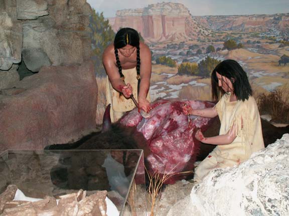
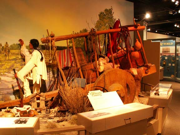
People of the Plains . . .
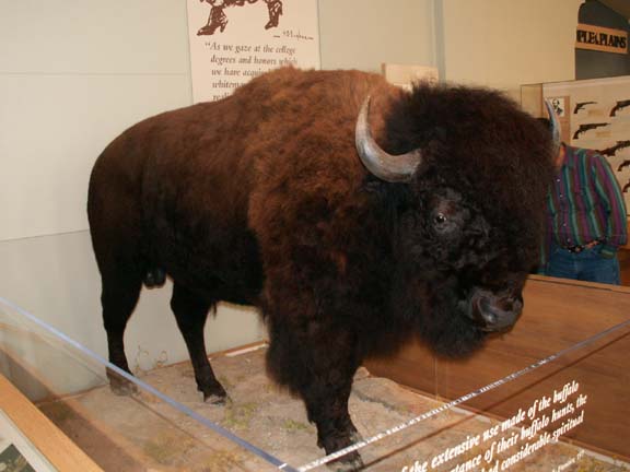 One
of the first things that we saw was an exhibit demonstrating how the Native
Americans used every piece of the buffalo. The video was very graphic but very
informative.
One
of the first things that we saw was an exhibit demonstrating how the Native
Americans used every piece of the buffalo. The video was very graphic but very
informative.
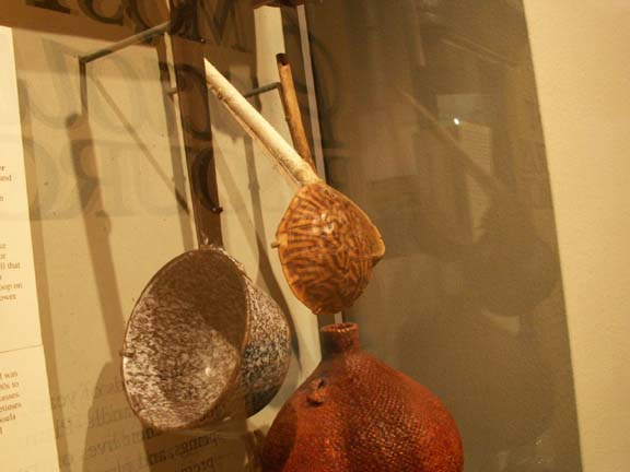
The top spoon is made from a turtle shell.
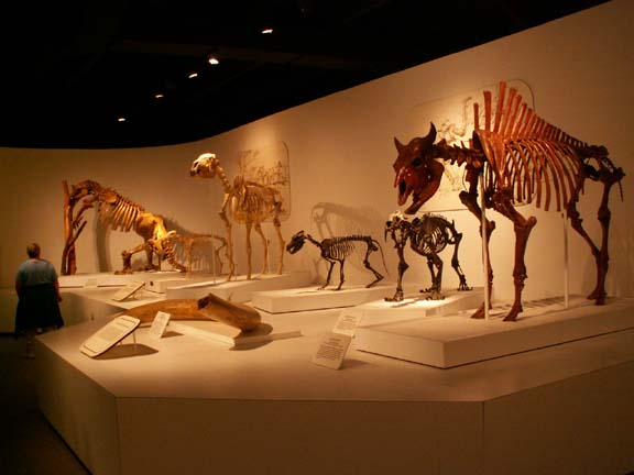
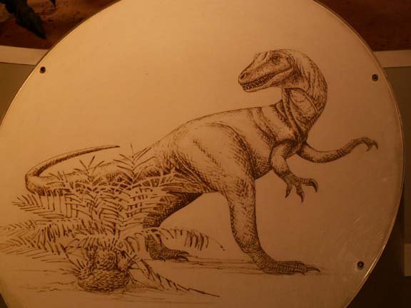
Paleontology and Geology . . .

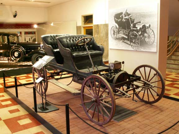
Transportation . . .
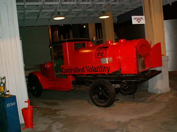
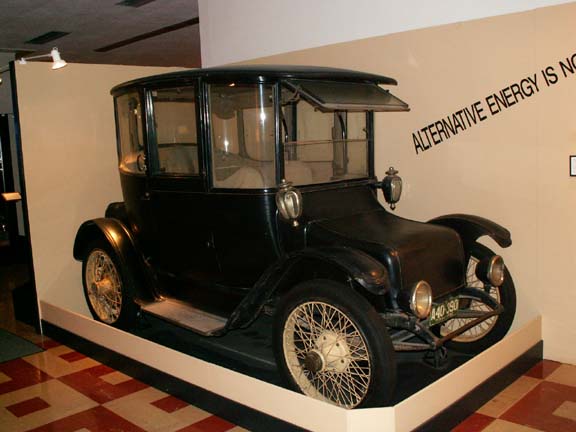 This
1916 alternative fuel car reminds us that scientists and engineers have been
working on these principles for a long time.
This
1916 alternative fuel car reminds us that scientists and engineers have been
working on these principles for a long time.

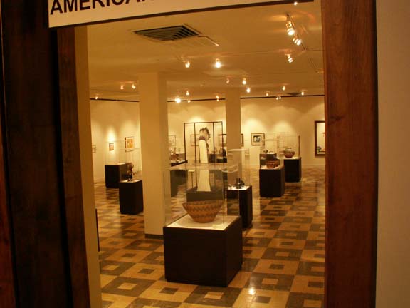
A special exhibit of Masterpieces of American Indian Art was in the museum.
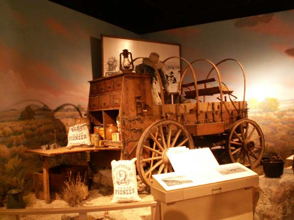
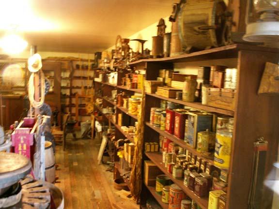
Pioneer Town . . .
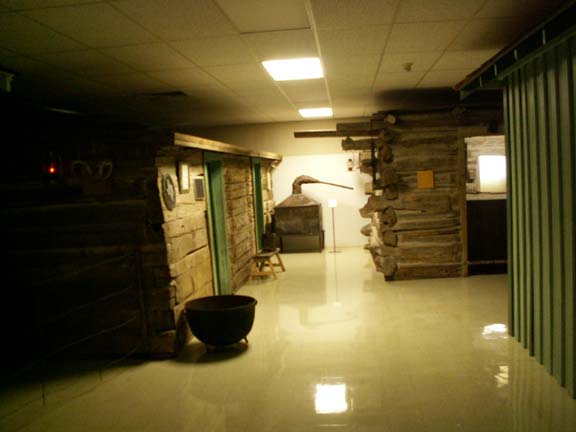
This display represents a small Texas Panhandle settlement at the
turn-of-the-century.

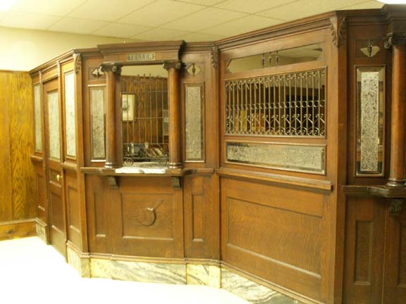
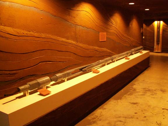
The Don D. Harrington Petroleum Wing . . .
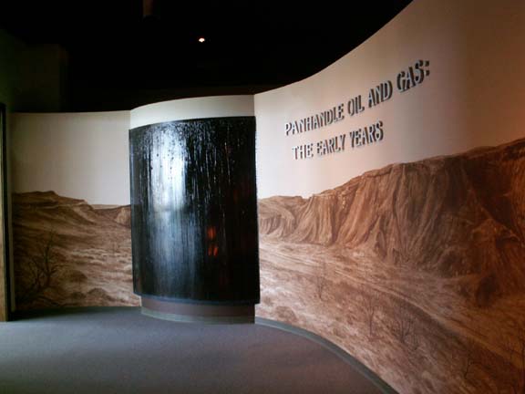 This
area tells the story of oil boom years in the Texas Panhandle during the 1920's.
This
area tells the story of oil boom years in the Texas Panhandle during the 1920's.
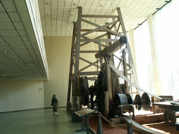
A 1920's wooden cable-tool drilling rig
Down hole tools were displayed.
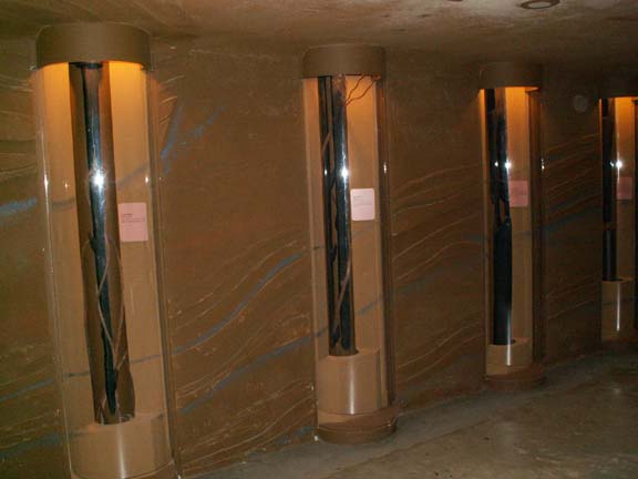
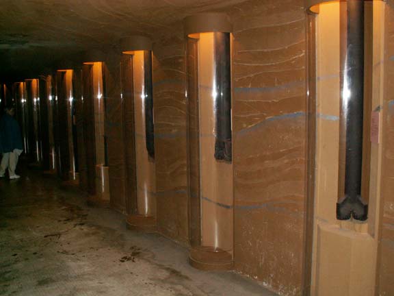
They are used to drill or to retrieve other equipment.
People in the oil industry call this a "Christmas Tree'.
It and many others control the flow of oil.
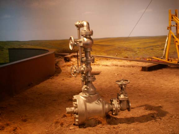
 The
'Christmas Tree' was part of a display of an oil field.
The
'Christmas Tree' was part of a display of an oil field.
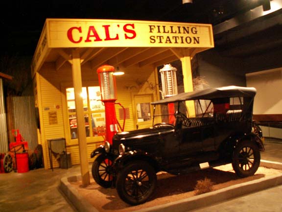 The 1930's filling station includes a hand-operated gas pump and Model-T Ford.
Because of time spent in some of the exhibits, we did not see others. We spent three hours at the museum - we could have easily spent six hours. An in-depth study could take several visits. It would depend on your level of interest .
Hueco Tanks State Historic Site
We did not know anything about this state park. We needed a place for the night and Mary Lou asked the lady at the welcome center for a suggestion. She pointed out the state park on the map located just before we got into a long uninhabited stretch of road. The sun was starting to set as we entered the campground office.
 We
have never spent as much time in a park office registering as we did at Hueco
Tanks.
They are very protective of their natural features after many vandalism
incidents. We were required to watch a video about
the park and how fragile the terrain is. It explained the importance of not touching the
pictographs and other features. Then, we had to sign a form that we
saw and understood the video message. We received a card authorizing us to camp
in the campground. We did not check-off the box for the self-guided tour of a
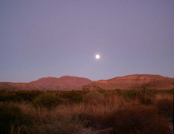
part of the features because we did not think we would stay. As we finally arrived at
our campsite, the moon was coming up.
We
have never spent as much time in a park office registering as we did at Hueco
Tanks.
They are very protective of their natural features after many vandalism
incidents. We were required to watch a video about
the park and how fragile the terrain is. It explained the importance of not touching the
pictographs and other features. Then, we had to sign a form that we
saw and understood the video message. We received a card authorizing us to camp
in the campground. We did not check-off the box for the self-guided tour of a
part of the features because we did not think we would stay. As we finally arrived at
our campsite, the moon was coming up.
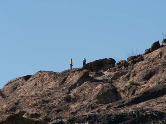
 In the morning we had decided to walk the short self-guided part
of the park before leaving. We had to go to the office to get authorization to do that. We
did not want to take the ranger guided walks. We did not complete the short walk
even though they provided chains you could use to get up the steep parts. We
traversed up to the first level and decided we could not stay longer. It was not
an easy walk 'with the chains' as we had been told.
In the morning we had decided to walk the short self-guided part
of the park before leaving. We had to go to the office to get authorization to do that. We
did not want to take the ranger guided walks. We did not complete the short walk
even though they provided chains you could use to get up the steep parts. We
traversed up to the first level and decided we could not stay longer. It was not
an easy walk 'with the chains' as we had been told.
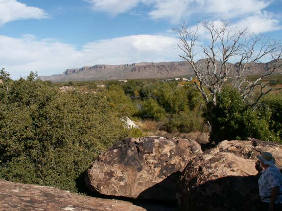
This is the view from our first level location.
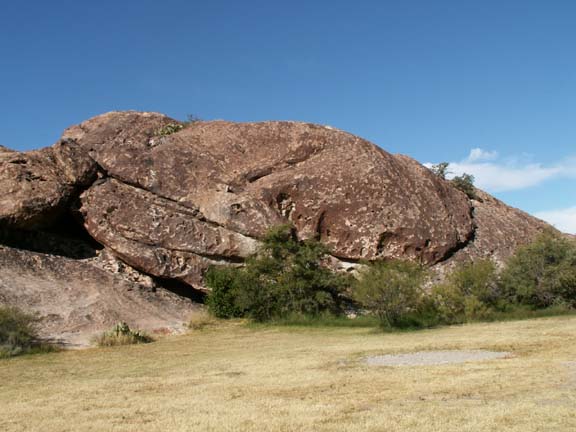
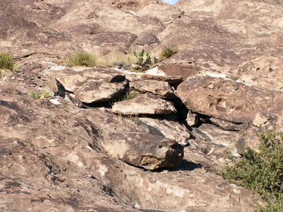
This ancient site preserves more than 2,000 pictographs. On the guided tours you can see the hunting scenes and groups of geometric designs painted on the rock through out the park. We satisfied ourselves with seeing these that we could get to easily.
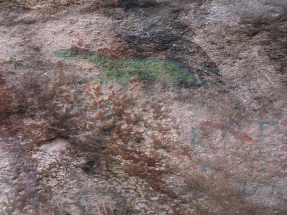

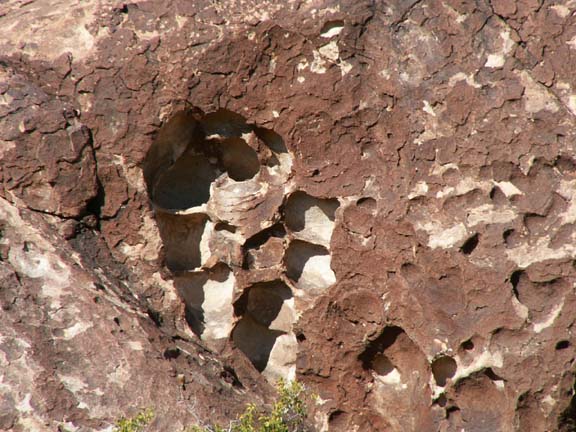
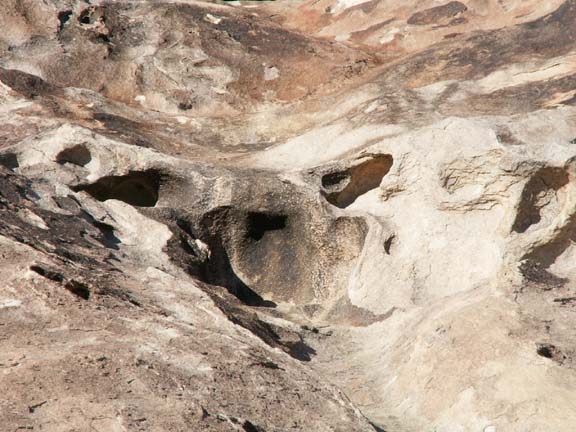
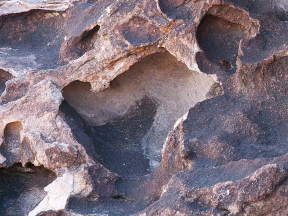
The rock at Hueco Tanks formed beneath the earth's surface 34 million years ago, as magma pushed up into an older limestone formation and then cooled. Over millennia, the weathering process eroded the overlaying limestone and created hollows (hueco) and fracture patterns in the massive granite-like formations.
These small 'tanks' would be filled to some degree with water if it had not been two months since it had rained in the area.
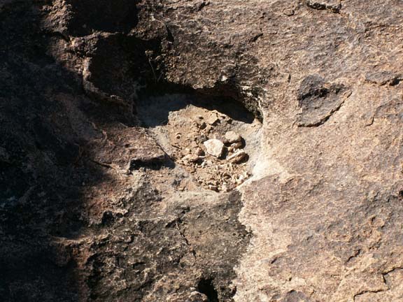

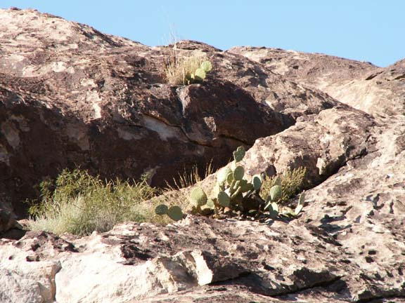
In spite of the lack of rain in the area , some vegetation survives.
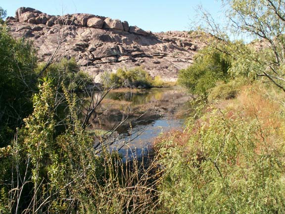
But if the tank is large, it will hold and retain a lot of water. This one was low in the rocks and offered a beautiful view. These clearly shows why this spot in the desert was a stage stop. It is interesting to smell mud and dampness in the middle of the Chihuahuan Desert.

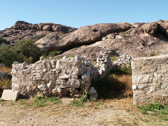
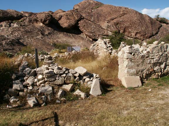
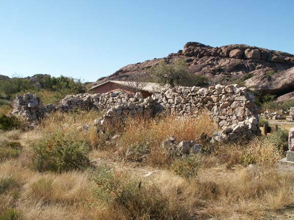 The
remains of the 1859 relay station for the Butterfield Overland Mail can be seen at the beginning of the trail near
the naturalist's building.
The
remains of the 1859 relay station for the Butterfield Overland Mail can be seen at the beginning of the trail near
the naturalist's building.
The remains of the1898 Escontrias ranch house was also located close to the stage stop.
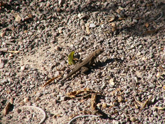 This
little guy was real brave just standing in our path. Brave to a point! When we
got closer, he was gone.
This
little guy was real brave just standing in our path. Brave to a point! When we
got closer, he was gone.
If we were not recovering from bronchitis, the entire walk would have interested us. Pictograph tours, hiking tours and bouldering tours in the guided area are available by advanced request Wednesday - Sunday. We overheard the ranger tell someone to call at least two weeks in advance for a tour of a garden area. Probably due to the high summer temperatures in the area, their busy season is November through April. Our admission was $3 per person one-day entry fee and a $14 camping fee. That included 30amp electric and water at the site and a dump station on the way out of the campground.
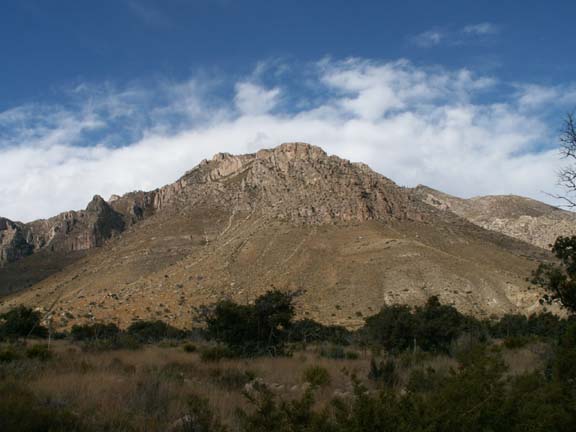
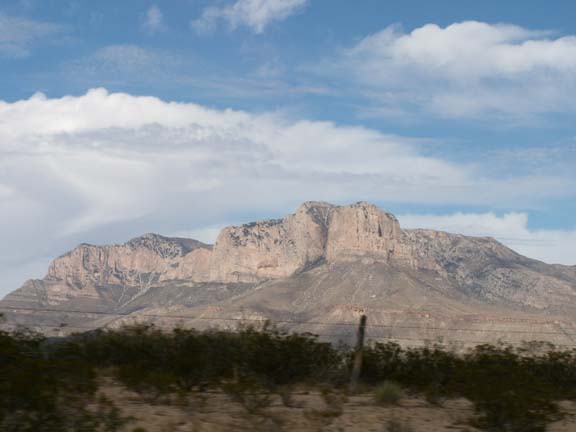
Quadalupe Mountians National Park
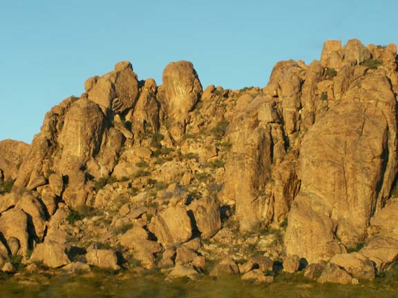
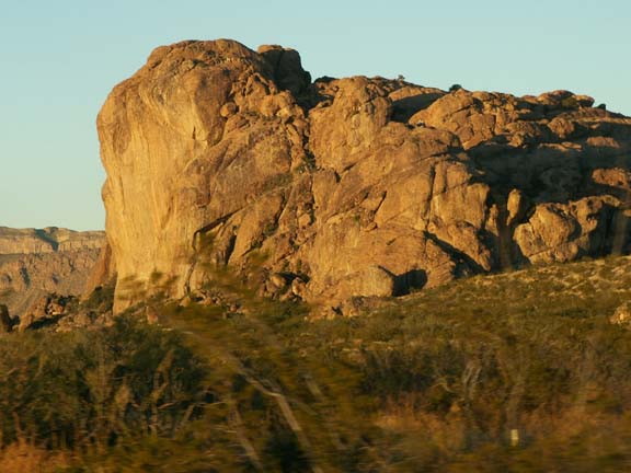
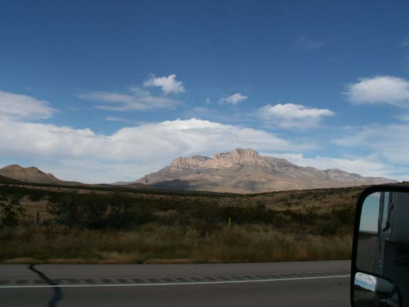
The Guadalupe Mountains are part of an ancient marine fossil reef. Millions of years ago this area was located at the equator, and was a reef made of sponges, algae and other lime secreting marine organisms. This ancient reef complex now towers over the Texas desert in the Guadalupe Mountains.
At the apex is the 2,000 foot sheer cliff, El Capitan.
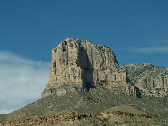
El Capitan
A part of the Guadalupe Mountains
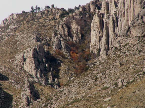
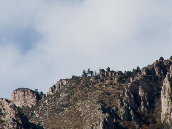 Unlike
many areas at this altitude, trees grow on the ridge - full size trees. The
'Bowl' is a high country forest of pine and Douglas fir 2,500 feet above the
surrounding desert .
Unlike
many areas at this altitude, trees grow on the ridge - full size trees. The
'Bowl' is a high country forest of pine and Douglas fir 2,500 feet above the
surrounding desert .
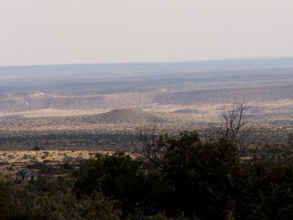
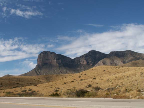
The view across
from the visitors center . . .
 Admission was
$3 per person. Unless you wanted to hike, little was
offered other than the beautiful scenery. The best viewing of El Capitan was from the roadside pull-offs west of the visitor center. As a matter of fact,
we did not know at the time this was a photograph of El Capitan in the
distance.
Admission was
$3 per person. Unless you wanted to hike, little was
offered other than the beautiful scenery. The best viewing of El Capitan was from the roadside pull-offs west of the visitor center. As a matter of fact,
we did not know at the time this was a photograph of El Capitan in the
distance.
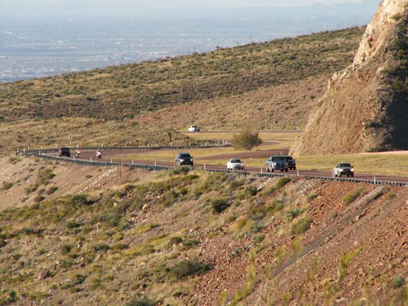
 Leaving
El Paso we experienced one of the mile high mountains surrounding the city. We
climbed it in second gear and coasted down the other side into southeast side
of the city.
Leaving
El Paso we experienced one of the mile high mountains surrounding the city. We
climbed it in second gear and coasted down the other side into southeast side
of the city.
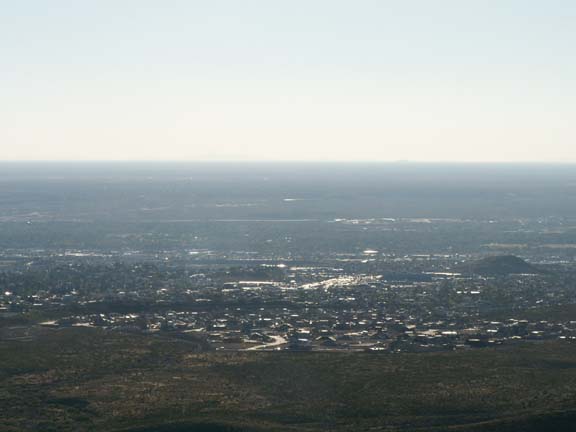
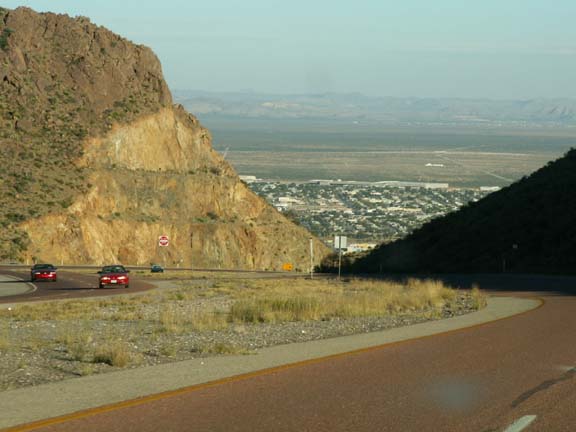
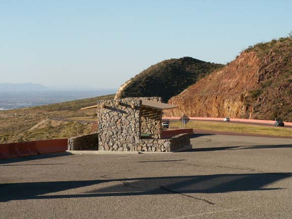 At the summit overlooking the northwest side of
the city, a large picnic area was developed. It had several covered picnic
tables.
At the summit overlooking the northwest side of
the city, a large picnic area was developed. It had several covered picnic
tables.
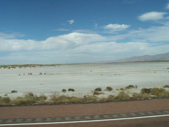
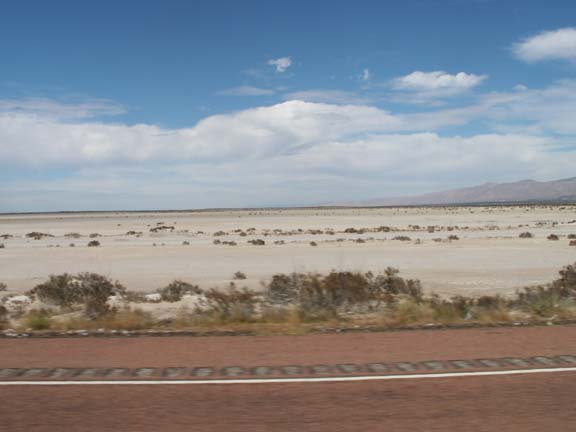
Speaking of the road west of the El Capitan, there is a salt flat that was the site of the 1870's El Paso Salt War. When an El Paso businessman attempted to take control of the salt beds from local Hispanic and Tigua communities a conflict developed. Today only wind blowing across the flats remains from that turbulent time in history.

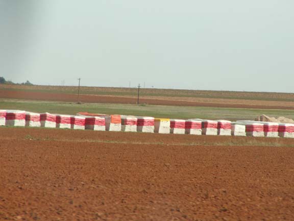
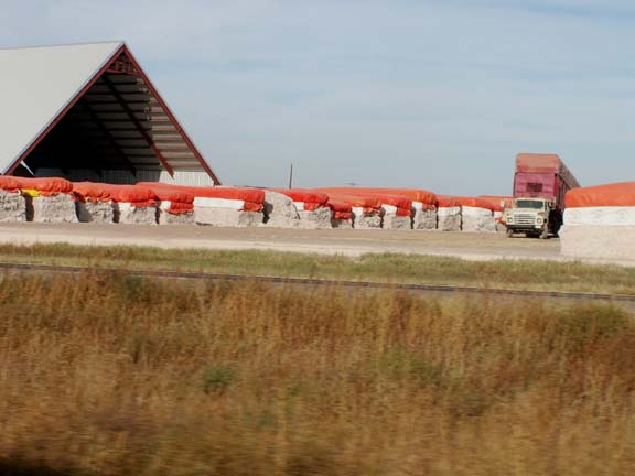
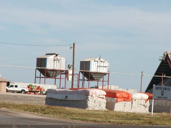
Texas is #1 in oil, #1 in cotton and #1 in peanut production in the USA. We have not identified peanut production, but we have seen oil rigs and a lots of cotton activity.
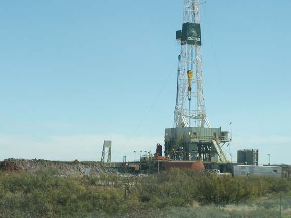
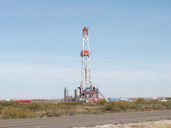
A couple of the bigger oil derricks . . .
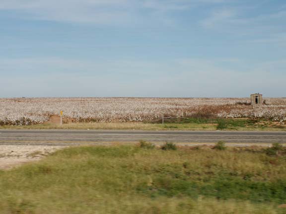
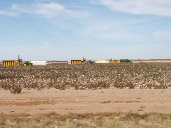
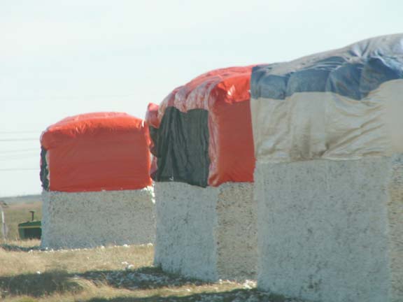
In the cotton field . . .
At the processor . . .
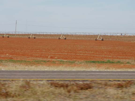
Red dirt and/or irrigation are prevalent in some areas.
Just a pretty view . . .
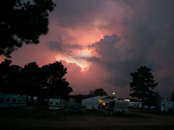
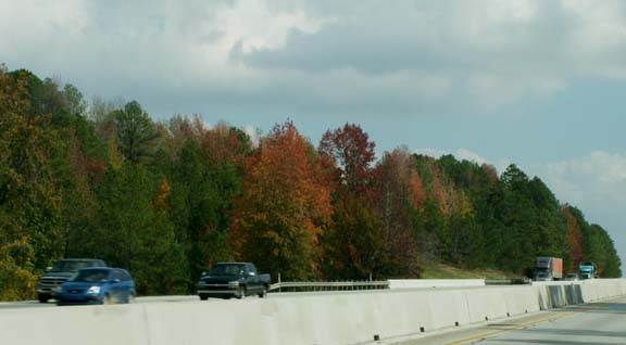
Our last day in Texas was varied. We had an exposure to changing fall colors.
In camp the last night, a storm caught up with us.
It was the first rain we had seen in over a month.