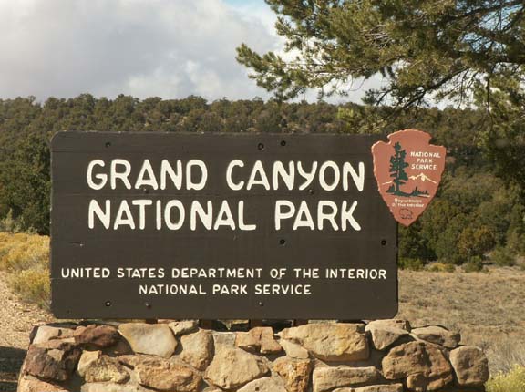
Grand Canyon National Park - 2006
Updated: 11/30/08
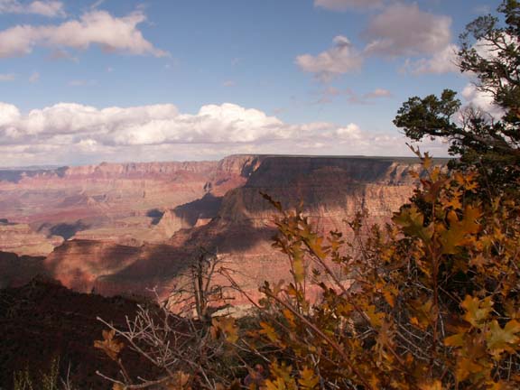
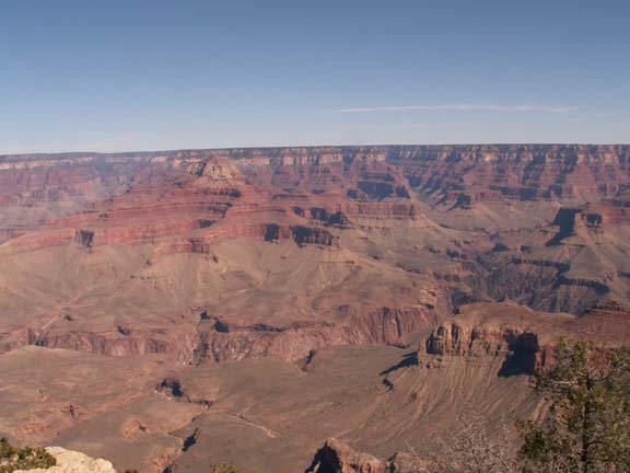
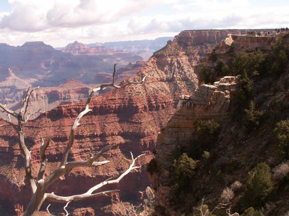
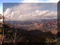
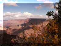
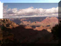
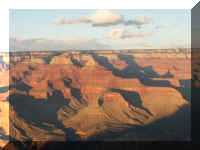
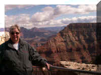
 We are showing our photographs from the various 'viewing
locations'. Because we entered the Grand
Canyon National Park at the East Entrance, our journey begins there. You
will see some features more than once but from different locations or as
close-ups for detail.
We are showing our photographs from the various 'viewing
locations'. Because we entered the Grand
Canyon National Park at the East Entrance, our journey begins there. You
will see some features more than once but from different locations or as
close-ups for detail.
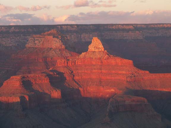
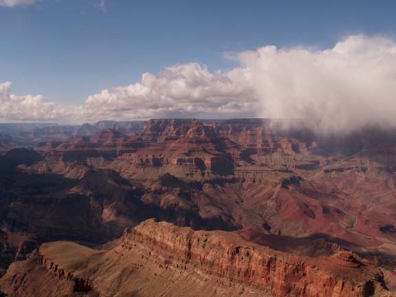
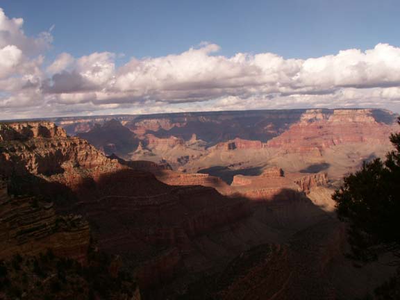
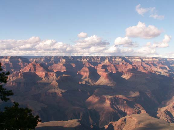
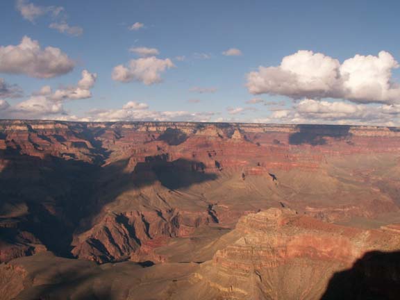
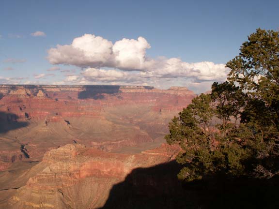
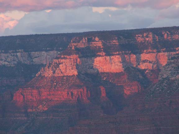
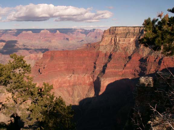
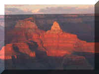
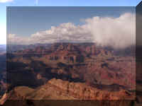
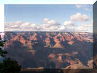
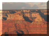
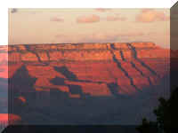
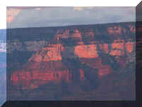
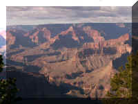
The setting sun changed the appearance.
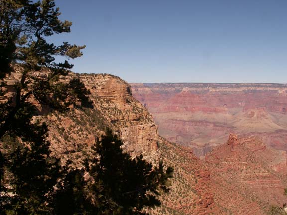
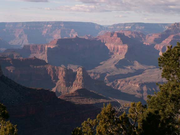
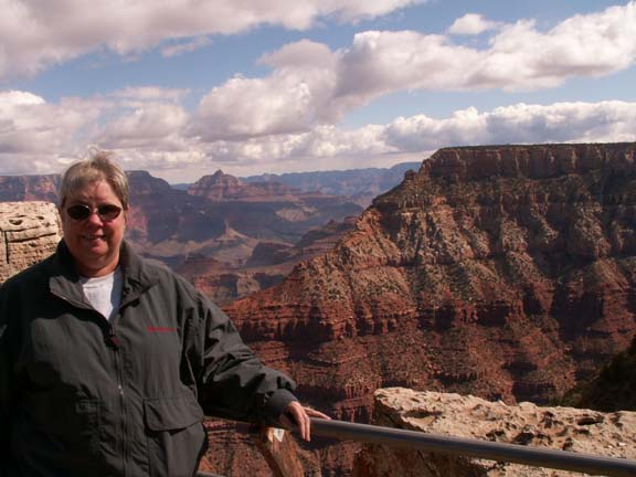
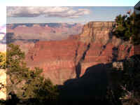
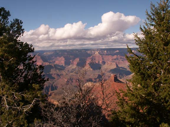
South Rim of the Grand Canyon
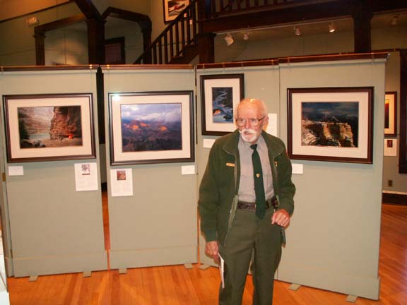
Our other experiences at the Grand Canyon
Free Shuttle Bus Service Information
We have posted photographs of Our other experiences at the Grand Canyon
at the end of the 'viewing locations' sequence. Links to these experiences
may be in the 'viewing locations'. However, it
may be easier to visit them after all of the 'viewing locations'.
Top of Page
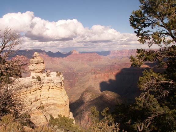
Now, ride along with us along the South Rim of the Grand
Canyon.
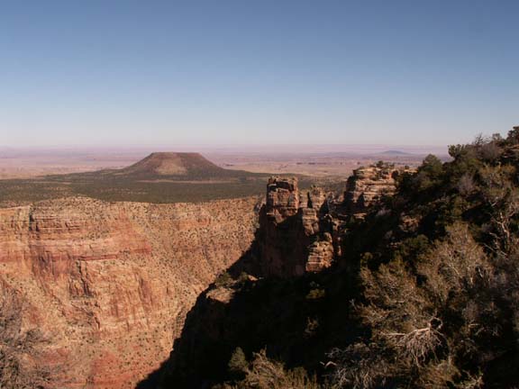
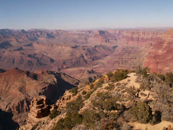
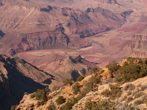
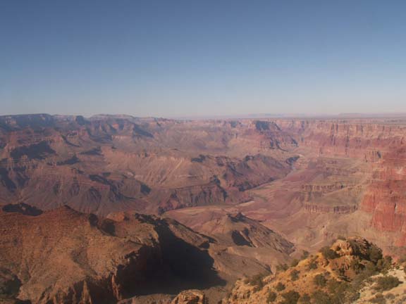
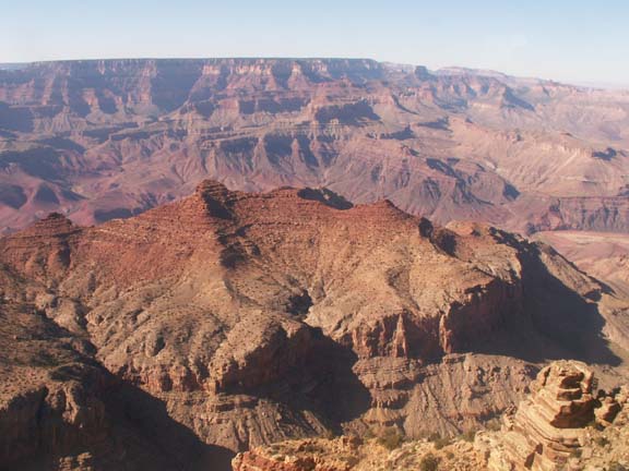
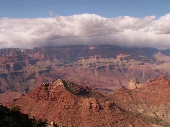
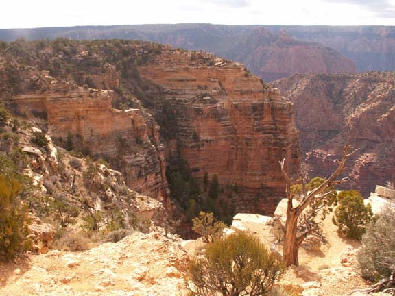
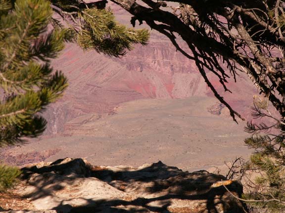
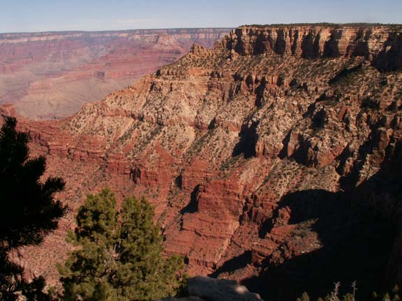
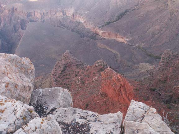
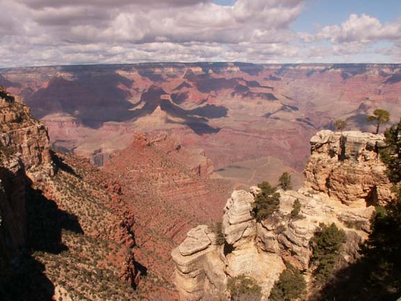
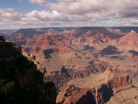
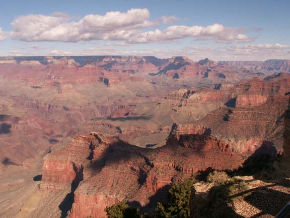
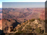
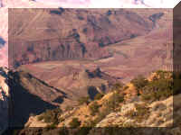
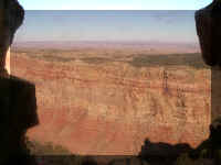
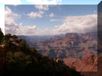
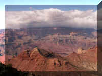
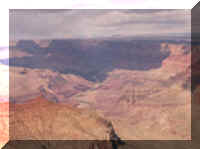
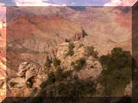
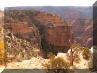
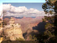
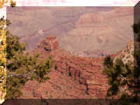
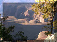
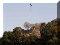
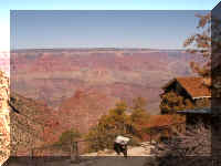
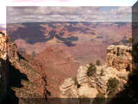
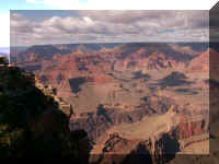
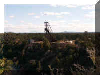
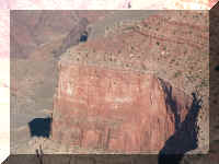
Desert View
This location has a large parking lot available for personal vehicles. You must provide your own
transportation to this location which is about 26 miles from the village. More
time is required at this location to enjoy the Watchtower.
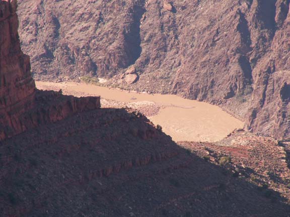
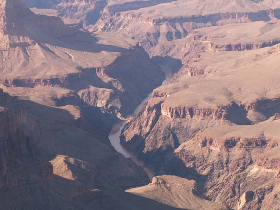
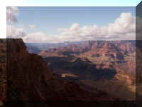
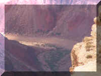
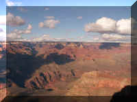
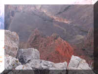
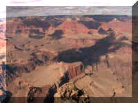
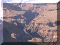
The Colorado River is visible in these photographs.
It is not the blue, rushing, white capped water seen in many published photographs.
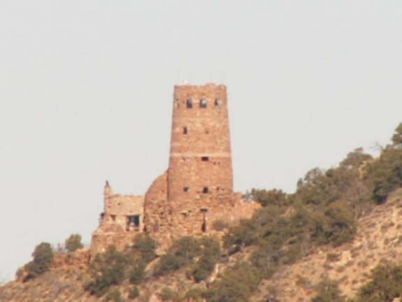
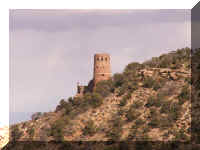
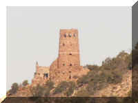
 In
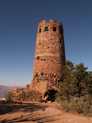
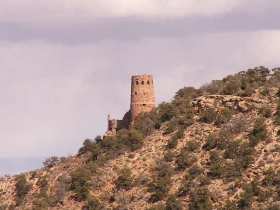
addition to the first view of the Grand Canyon, the
highlight of this location is a 70 foot replica of a Watchtower built in 1932.
In
addition to the first view of the Grand Canyon, the
highlight of this location is a 70 foot replica of a Watchtower built in 1932.
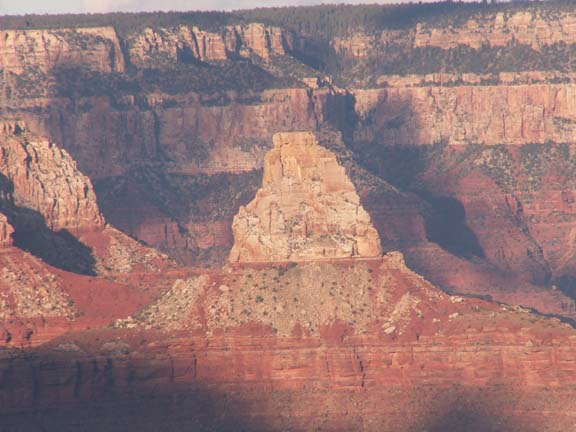
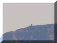
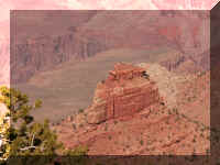
Views of the tower from other locations many miles away . . .
From Navajo Point
...
From Lipan Point
...
From Yaki Point ...
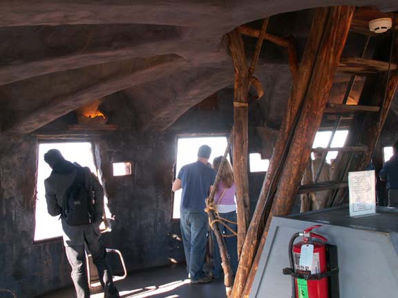
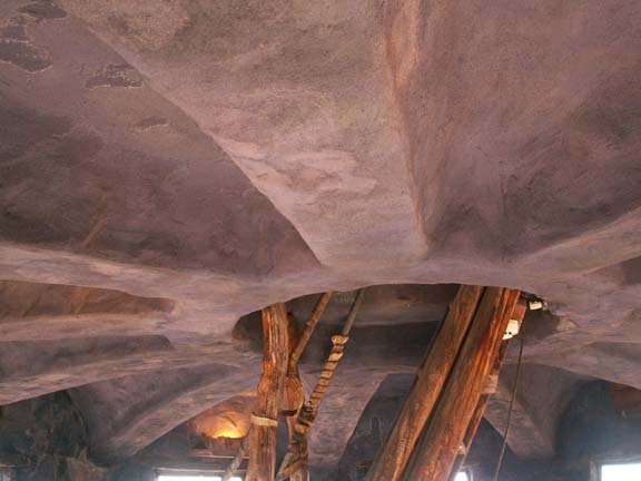
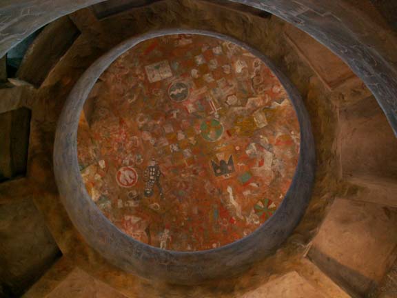
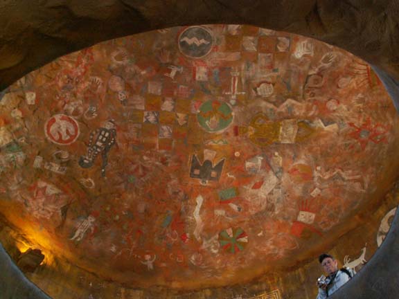
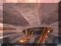
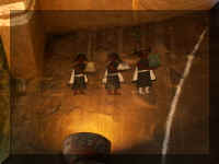
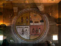
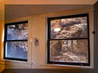
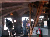 Visitors
were able to climb the stairs in the tower to view the Grand Canyon. The
interior is decorated in Native American symbols.
Visitors
were able to climb the stairs in the tower to view the Grand Canyon. The
interior is decorated in Native American symbols.
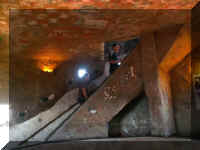
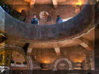
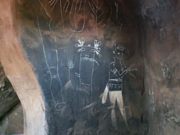
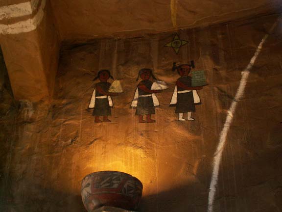
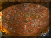
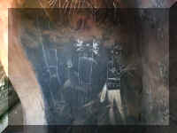
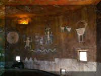
Looking up you see the open ceiling painted with Native American
symbols.
The tower walls contain symbols also.
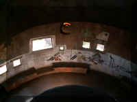
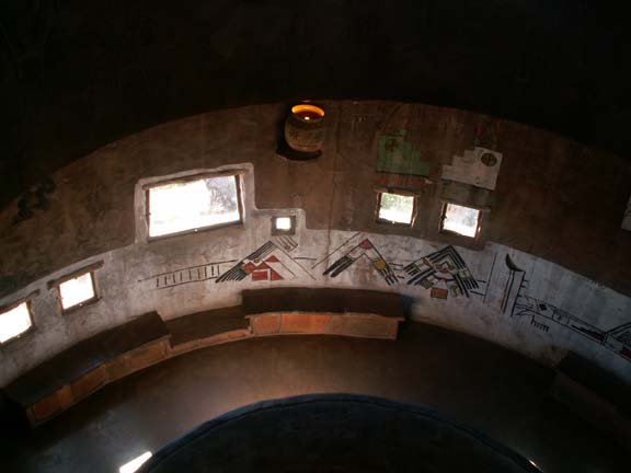
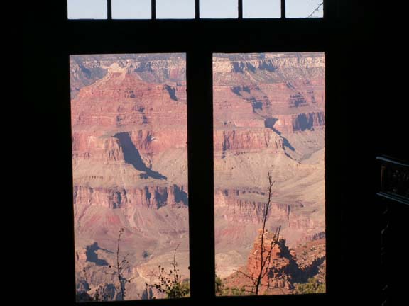
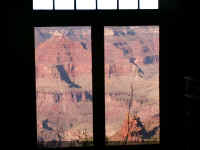
 Looking
out the jagged window openings of the tower gives you an impressive view of the
surrounding area.
Looking
out the jagged window openings of the tower gives you an impressive view of the
surrounding area.
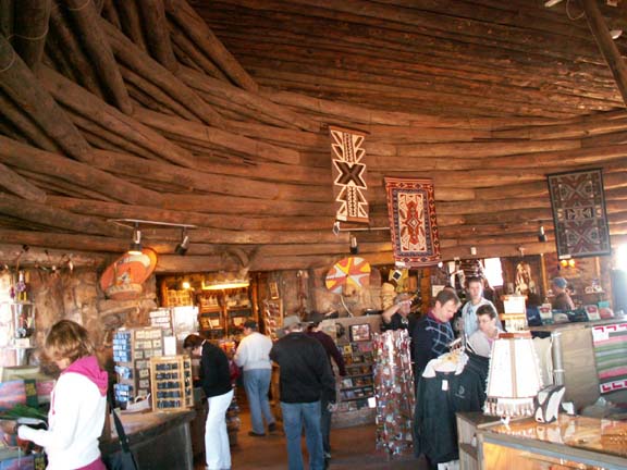
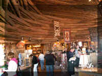
The grounds and the first floor gift shop . . .
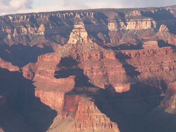
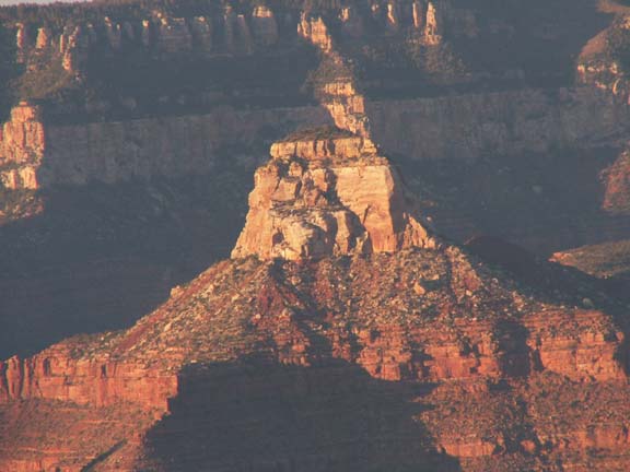
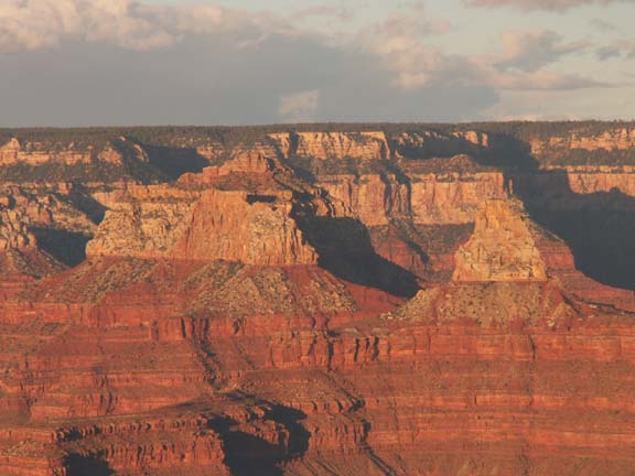
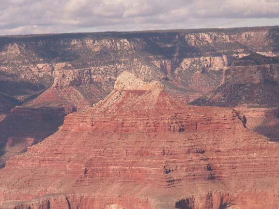
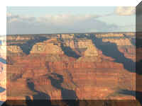
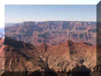
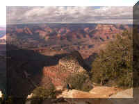
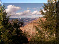
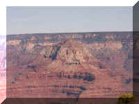
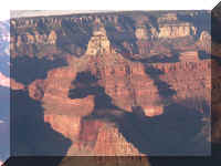
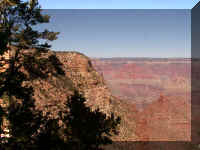
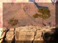
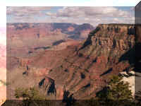
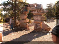
Navajo Point
Lipan Point
Grand View Point
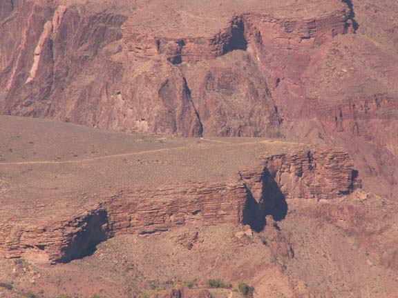
The Colorado River . . .
Unnamed 1
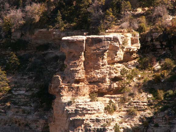
It appears the 'points' were named because
of the more panoramic views. Other 'viewing locations' were just pull-offs along
the road.
Unnamed 2
Yaki Point
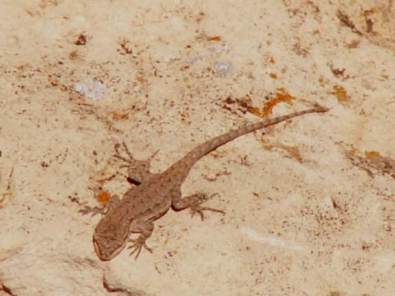
Pipe Creek Vista
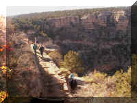
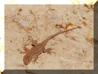 People
sit on the rock railings while waiting for a shuttle bus. At this
location, Mary Lou almost sat on this lizard. It shared the rock she was sitting
on. FYI . . . the lizard is about two inches long and camouflaged in the
color to the rock. We watched him crawl around the rocks until
the shuttle bus arrived.
People
sit on the rock railings while waiting for a shuttle bus. At this
location, Mary Lou almost sat on this lizard. It shared the rock she was sitting
on. FYI . . . the lizard is about two inches long and camouflaged in the
color to the rock. We watched him crawl around the rocks until
the shuttle bus arrived.
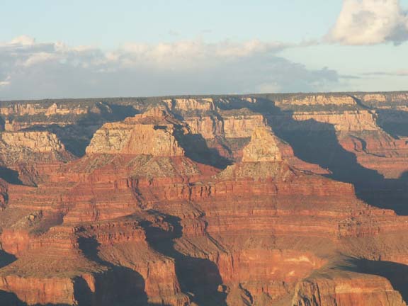
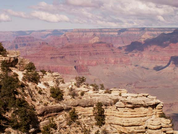
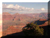
Mather Point
Yavapai Point Observation Station
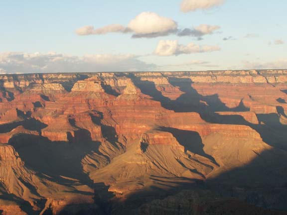
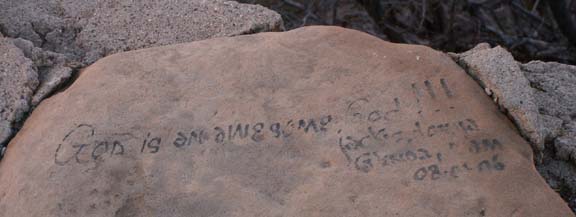
Someone left their impression of the sights they were seeing.
We stayed at the Yavapai Point Observation Station to see the the affect of
the sun setting on the Grand Canyon. The building was heated permitting, Fred to
warm up a little before going back outside to make more photographs.

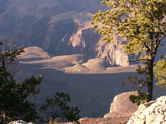
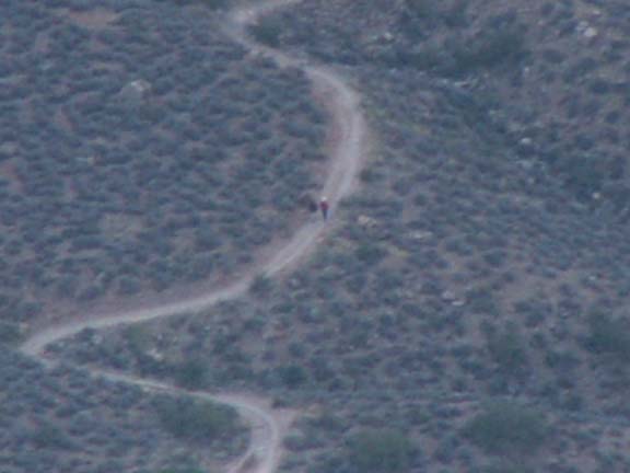
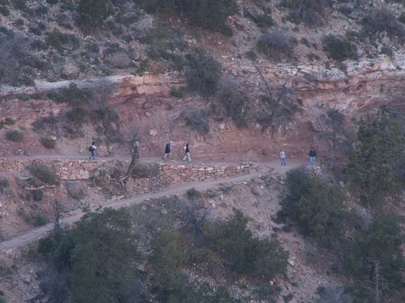
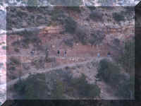
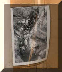
Here we see hikers near the bottom of the Bright Angel Trail. People were looking in binoculars and
talking about the people on the trail. It took Fred awhile to find them with the
camera.
near the bottom of the Bright Angel Trail. People were looking in binoculars and
talking about the people on the trail. It took Fred awhile to find them with the
camera.
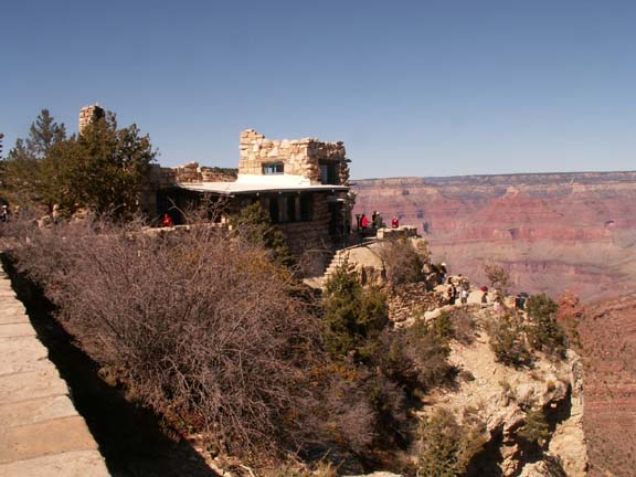
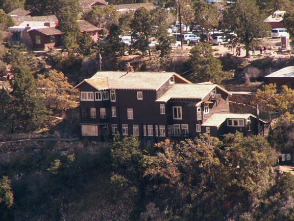
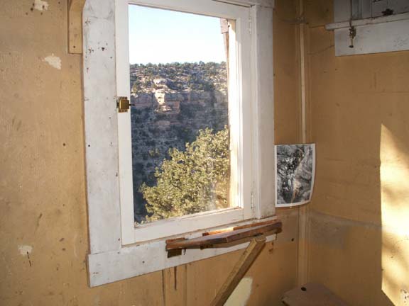
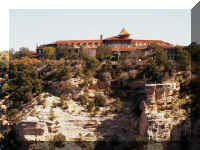
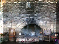
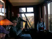
Lookout Studio
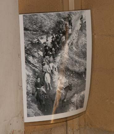
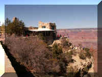 The
Outlook Studio was constructed in 1914 to compete with the already successful Kolb Photography
Studio. On the porch of the studio was a high power telescope. Here
visitors could view the features of the Grand Canyon and watch mule riders
descending into the Canyon.
The
Outlook Studio was constructed in 1914 to compete with the already successful Kolb Photography
Studio. On the porch of the studio was a high power telescope. Here
visitors could view the features of the Grand Canyon and watch mule riders
descending into the Canyon.
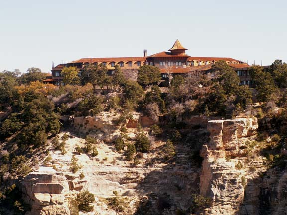
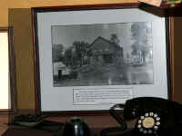
Kolb Studio
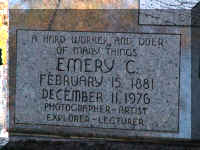
The Kolb brothers, Emery and Ellsworth, came to the Canyon in 1902. They
brought the first photographic equipment to the Grand Canyon. In 1912, the brothers filmed
their boat trip down the Colorado River. Emery presented the movie of that trip in the auditorium
of his studio daily from 1915 until his death in 1976.
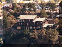 The
studio, while always on the edge of the South Rim, has been added to several
times in its history. It was the studio, office and residence for Emery from 1902 until
1976.
The
studio, while always on the edge of the South Rim, has been added to several
times in its history. It was the studio, office and residence for Emery from 1902 until
1976.
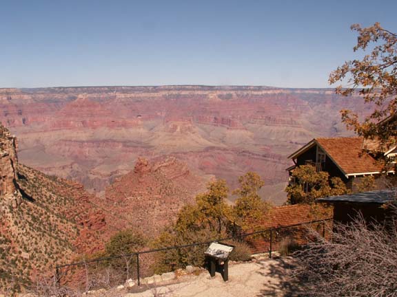
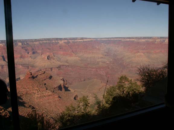
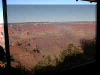
The view from the Kolb Studio is great.
We took a tour of the Kolb residence. Mary
Lou was especially interested in seeing the interior of the residence. The story
of the Kolb brothers lives and the challenges they faced was very informative.
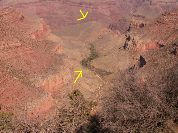
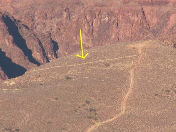
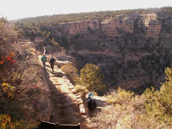
 Bright Angel
trail leads to Indian Garden camp and Plateau Point in the canyon.
Bright Angel
trail leads to Indian Garden camp and Plateau Point in the canyon.
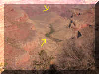 From
this location, we could see (almost) these two interesting points.
From
this location, we could see (almost) these two interesting points.
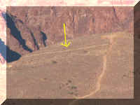
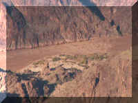
An airplane runway that the Kolb brothers built as part of a business deal.
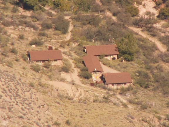
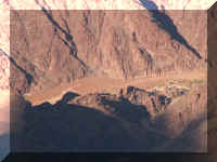
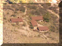 Indian
Garden camp which has bathrooms, water, emergency telephone, a ranger station
and a campground. And, maybe solar electricity.
Indian
Garden camp which has bathrooms, water, emergency telephone, a ranger station
and a campground. And, maybe solar electricity.
Thank goodness
for the zoom lens on our camera.
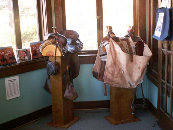
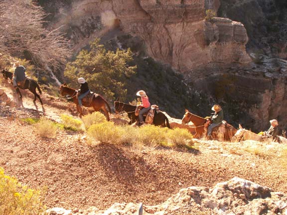
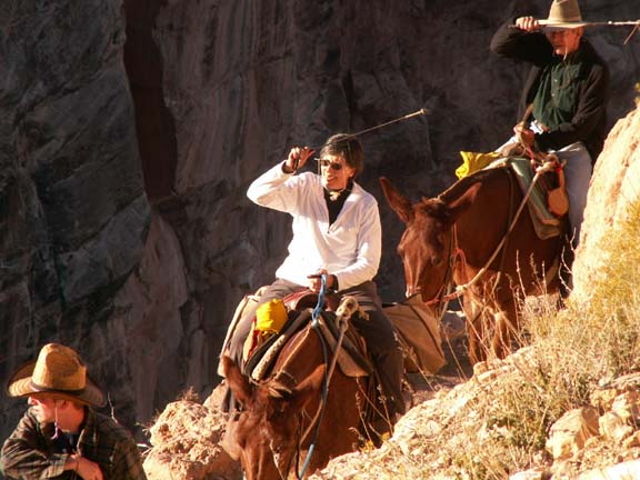
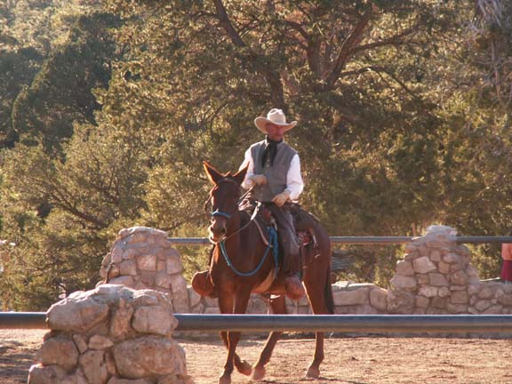
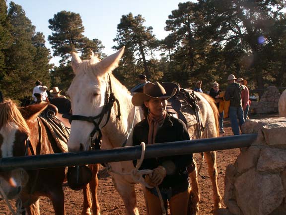
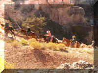
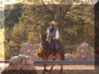
Mules as a mode of transportation have a long history in the Grand Canyon. The mule corral was near the Kolb Studio.
We were walking by as the mule train returned from a day in the canyon.

Dude saddle on left and a pack saddle
displayed in the Kolb Studio.
Village Route Transfer
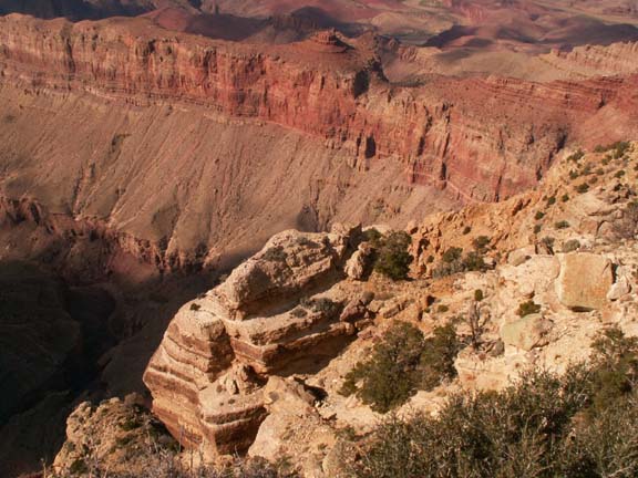
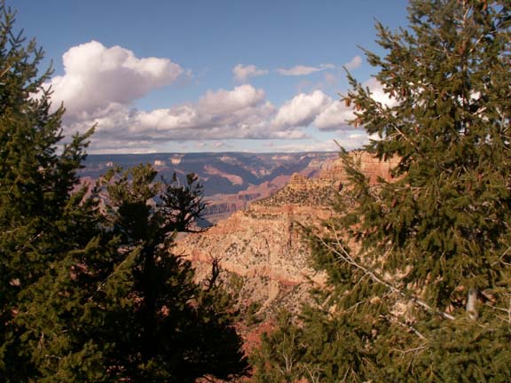
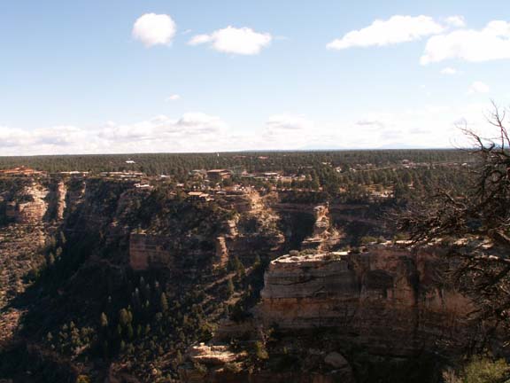
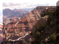
Trailview Overlook
 A
wide look back at the village.
A
wide look back at the village.
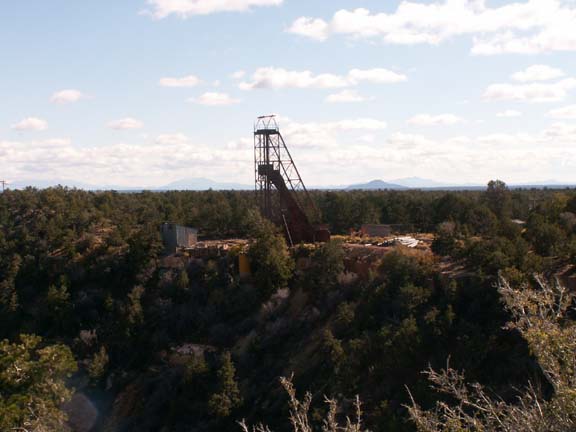
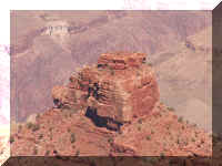
Powell Point
 One
unusual sight at Powell Point is an abandoned ore mine, The Orphan Mine.
One
unusual sight at Powell Point is an abandoned ore mine, The Orphan Mine.
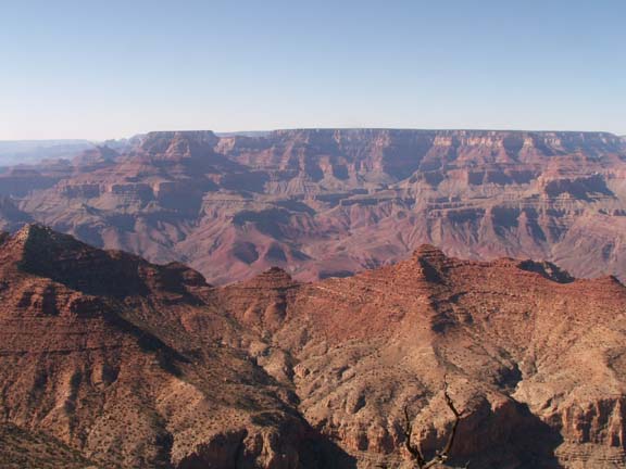
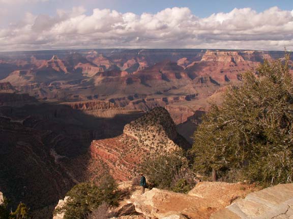
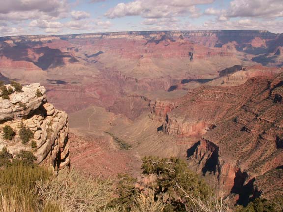
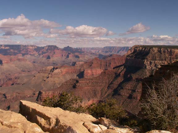
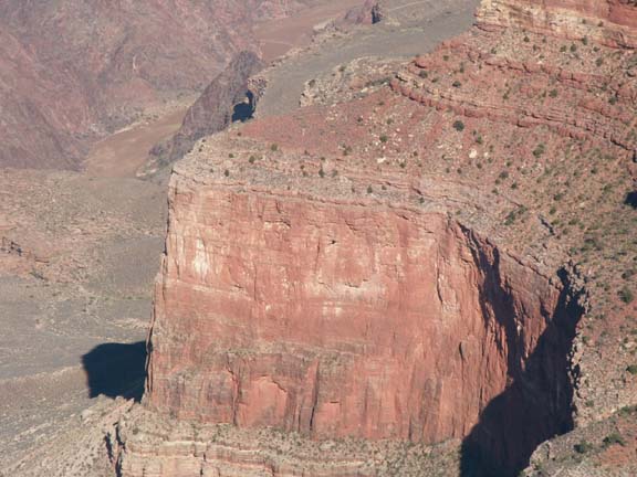
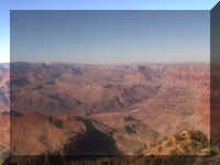
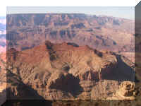
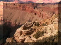
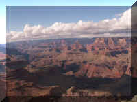
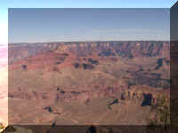
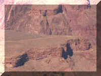
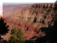
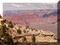
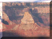
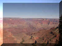
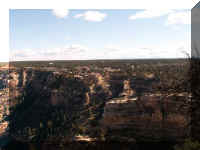
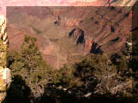
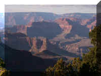
Hopi Point
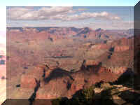
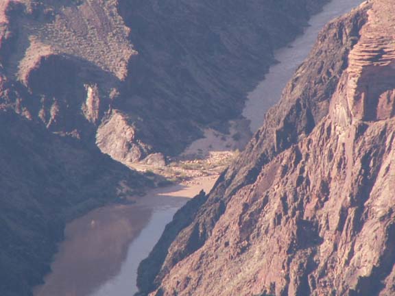
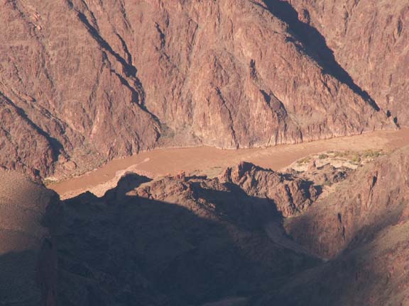
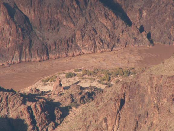
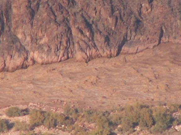
The Colorado River . . .
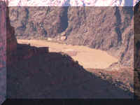
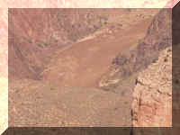
The rapids in the left photograph . . .
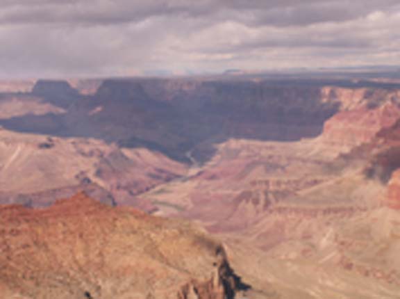
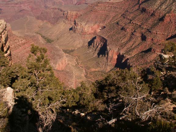
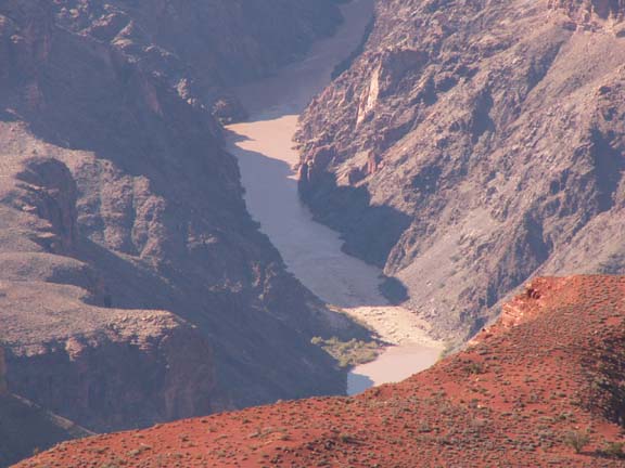
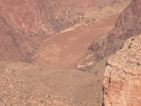
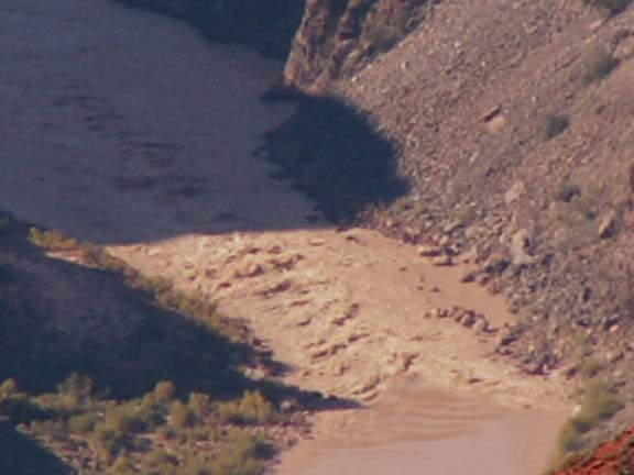
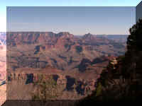
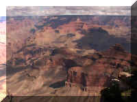
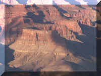
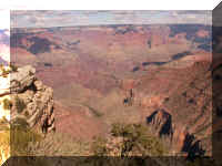
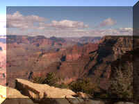
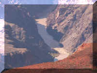
Pima Point
Looking into the canyon you see the Colorado River flowing to the
left.

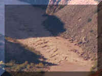
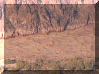
We had learned that the some spots that appeared to be dry to the naked eye, were actually
rapids. Using the zoom on the camera, we could clearly see these were large
rapids. The rapids are a mile deep in the canyon at this point but we could hear them.
You can image how loud they must have been at the river's edge.
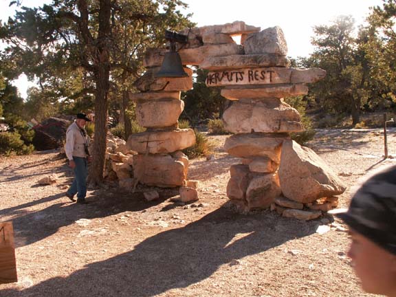
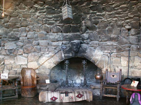
Hermits Rest
 Hermits
Rest had a gift shop, snack bar and restrooms. It is at the end of the red
shuttle bus route.
Hermits
Rest had a gift shop, snack bar and restrooms. It is at the end of the red
shuttle bus route.
It was completed in 1914.
Top of Page
Our
other experiences at the Grand Canyon . . .
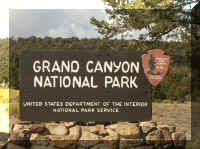
Established in 1919,
The Grand Canyon covers 1,900 square miles.
It is 280 miles long.
The Colorado River averages 300 feet wide and 100 feet deep.
(Admission is $25 per personal vehicle - good for seven days.)
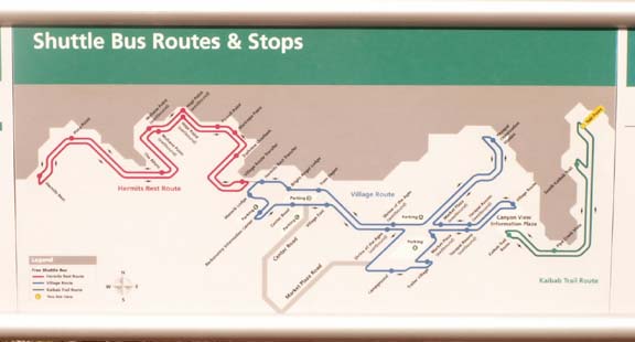
Free Shuttle
Bus Service Information
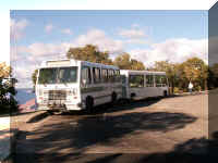 We
found the free shuttle bus service to work very well. The routes are color coded
and the Shuttle Bus Route map in The
Guide is a must to carry with you at all times. Most of the shuttle
drivers were very helpful but having the map in your hand adds comfort. The best
advice we received was to use the Eastbound Blue/Westbound
Blue transfer point at Shrine of the Ages to
avoid the long circle ride on the Blue
Route. This is mainly because of the congestions and parking problems in the
Hermit's Rest transfer area - lodges, hotels, restaurants the railway station
and other points of interest draw many people and vehicles.
We
found the free shuttle bus service to work very well. The routes are color coded
and the Shuttle Bus Route map in The
Guide is a must to carry with you at all times. Most of the shuttle
drivers were very helpful but having the map in your hand adds comfort. The best
advice we received was to use the Eastbound Blue/Westbound
Blue transfer point at Shrine of the Ages to
avoid the long circle ride on the Blue
Route. This is mainly because of the congestions and parking problems in the
Hermit's Rest transfer area - lodges, hotels, restaurants the railway station
and other points of interest draw many people and vehicles.
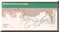 The
first few 'viewing locations' are not on a shuttle bus route due to their
distance from the village and ample parking availability. We showed them in black
- the others 'viewing locations' are in the shuttle bus route color (green, blue
or red). Most of the 'viewing locations' on
the green
route and all of the 'viewing locations' on the red
route are accessible only by shuttle bus. We suggest you ride the entire green
route and red route and use the blue
route east/west transfer point as a convenience.
The
first few 'viewing locations' are not on a shuttle bus route due to their
distance from the village and ample parking availability. We showed them in black
- the others 'viewing locations' are in the shuttle bus route color (green, blue
or red). Most of the 'viewing locations' on
the green
route and all of the 'viewing locations' on the red
route are accessible only by shuttle bus. We suggest you ride the entire green
route and red route and use the blue
route east/west transfer point as a convenience.
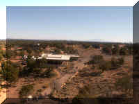
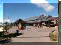
Visitor Center
The area around the Visitor Center is a very congested -
vehicles and people. The parking lot across the street from the Visitor Center
is generally full. Because we traveled in the off-season, we found a parking
spot in the lot twice and along the side the road once. We drove to the Visitor Center
to pick up the green route shuttle bus to
avoid taking the long blue route.
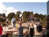
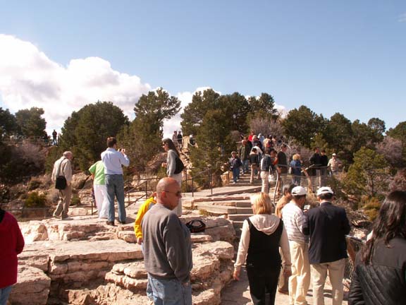
Walking to the
overlook
People on an
overlook
Posing for photographs
 The
Visitor Center building and the shuttle bus transfer is across the street from
the parking lot and could be a challenging walk for some - not rough walking, just
quite a distance.
The
Visitor Center building and the shuttle bus transfer is across the street from
the parking lot and could be a challenging walk for some - not rough walking, just
quite a distance.
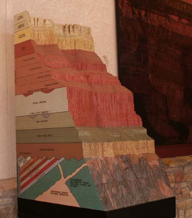
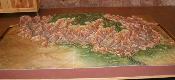
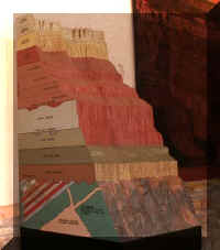
In addition to information, there were two displays about the
canyon.

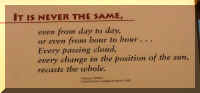
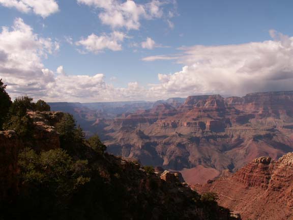
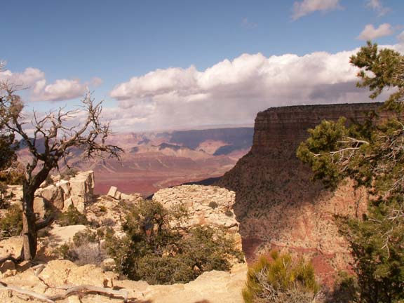
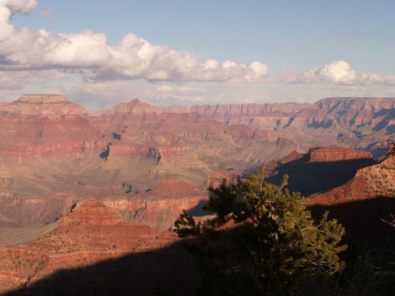
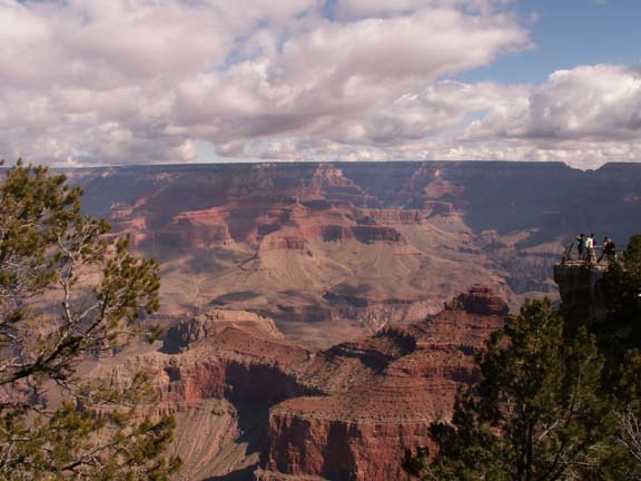
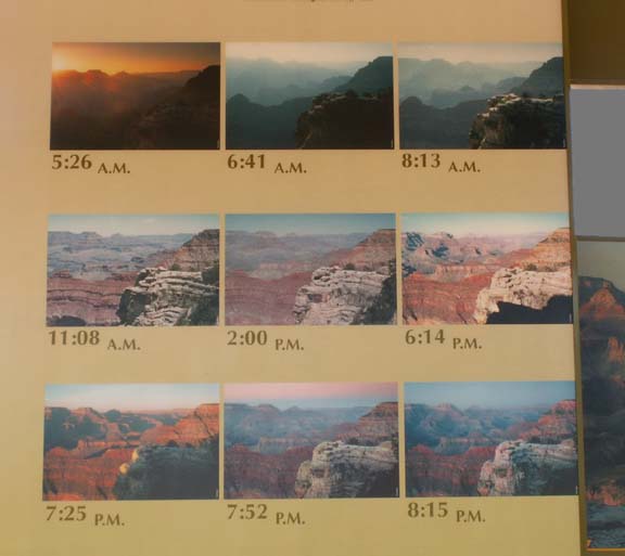
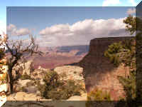
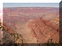
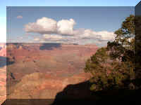
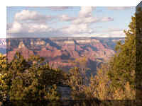
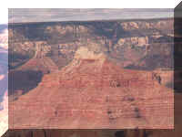
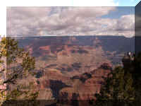
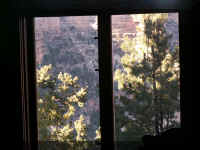
 The
view you see is always changing. Shadows create a new look with each visit to
the same location.
The
view you see is always changing. Shadows create a new look with each visit to
the same location.
This shows the dramatic affect the time of day has.
Top of Page
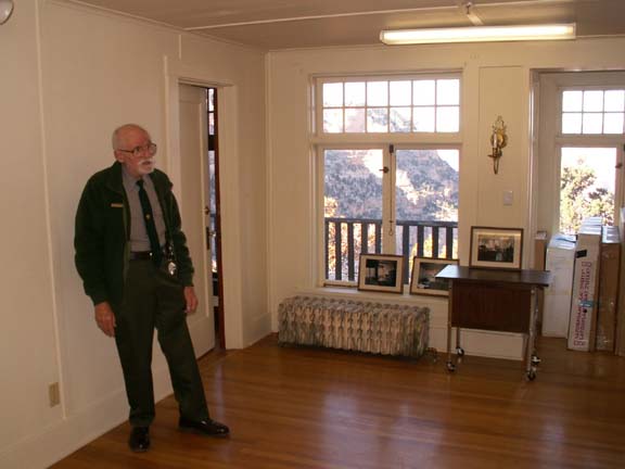
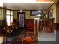
We enjoyed a tour of the Kolb
residence. There were only seven people
in our group so we were taken to a couple rooms not usually shown on the planned twelve
people tour.
Ranger Jon was a very interesting guide. He knew his material. The tour
started in the auditorium where many great photographs were display.
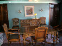
 The
first room visited was the study.
The
first room visited was the study.
The tent in the photograph on the desk was the
first Kolb Studio.
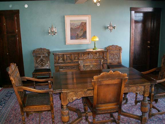
The dining room set is the only original pieces in the house.
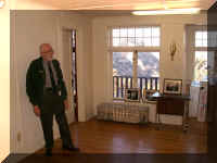
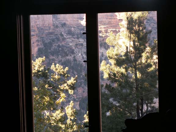
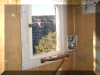
 His
office had the biggest window and a fantastic view.
His
office had the biggest window and a fantastic view.
 The
other windows in the house looked out over beautiful views or faced the rock on
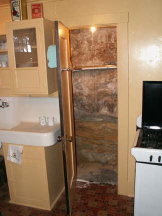
which the house was perched. The back wall of the pantry is a rock wall.
The
other windows in the house looked out over beautiful views or faced the rock on
which the house was perched. The back wall of the pantry is a rock wall.
This is the window from which he made most of his money. He discovered that
there was money to be made photographing people on mules and selling them the
photographs. He rested his camera on the shelf in front of the window.
 The
dark room is scheduled for renovation as well as a couple other room when finds
are available. The two guys on the tour with us thought they could still smell
the chemicals used in photography. Ranger Jon confirmed others have made the same
claim.
The
dark room is scheduled for renovation as well as a couple other room when finds
are available. The two guys on the tour with us thought they could still smell
the chemicals used in photography. Ranger Jon confirmed others have made the same
claim.
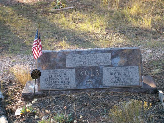
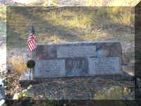 While
walking through the cemetery in the Grand Canyon, we found the burial location
for the Kolbs.
While
walking through the cemetery in the Grand Canyon, we found the burial location
for the Kolbs.
Top of Page
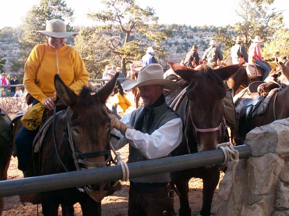
The
mule corral was near the Kolb Studio.
As we were making our way back to the shuttle bus after lunch,
the mules were returning from a day in the canyon.
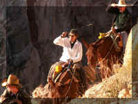
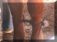
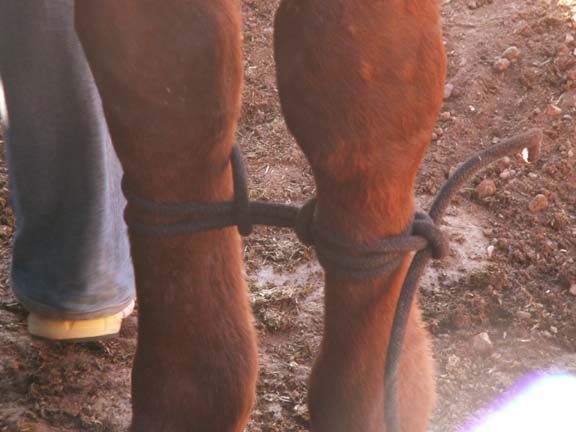
The lead mule is accustomed to being hobbled
instead of tied to the rail like the other mules.
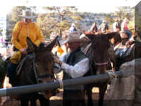

Lead mule and the trail
boss This woman
said, "I did it!" A gal from Michigan
Top of Page
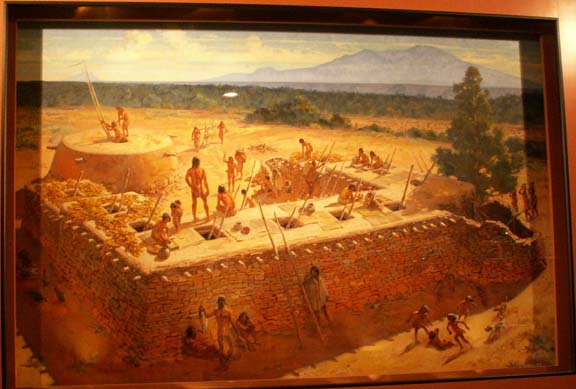
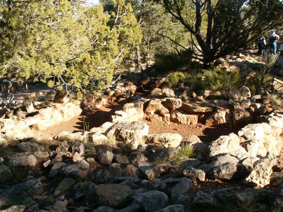
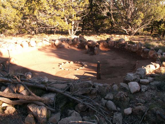
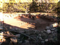
Tusayan Ruin and Museum
The Tusayan Ruin is a U-shaped, prehistoric pueblo
inhabited from 1185 until 1225 by two generations of Anasaiza. It contains about 15 rooms
and it is estimated that 30 people lived here.
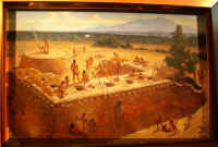
The larger rooms are where the people lived. The smaller rooms
were used for storage.
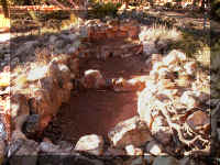
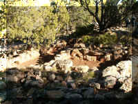
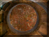
This is a Kiva or gathering place where ceremonial activities
took place.
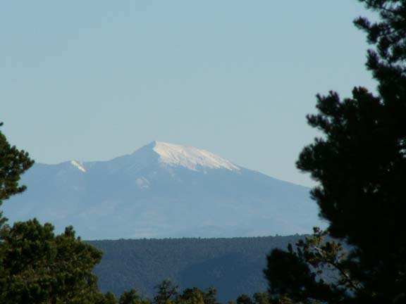
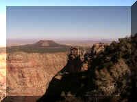
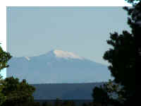 From
the grounds of the Tusayan grounds, we had a clear view of Mount Humphrey. Part
of the San Francisco Peaks, it was considered sacred by several tribes.
From
the grounds of the Tusayan grounds, we had a clear view of Mount Humphrey. Part
of the San Francisco Peaks, it was considered sacred by several tribes.
Top of Page
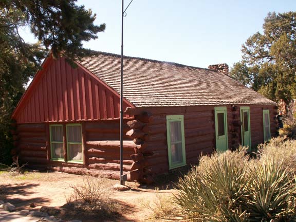
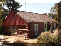
Buckey O'Neill Cabin
It is the oldest continuously standing structure on the Rim in
the Grand Canyon. Now used as a visitor cabin through the Bright Angel Lodge.
Top of Page
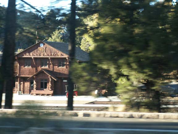
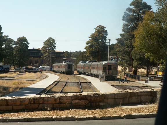
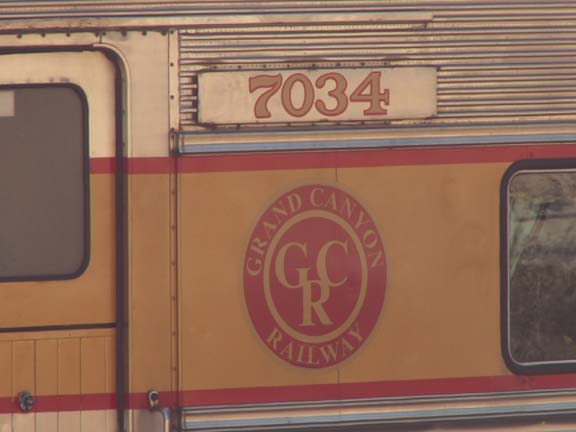
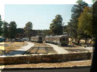
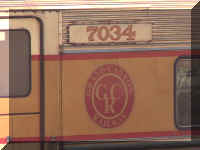
Grand Canyon Railroad
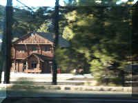 The
Grand Canyon Railroad runs daily from Williams, AZ to the Grand Canyon Depot.
After leaving the Grand Canyon, we camped in Williams, AZ. Our photographs from
Williams, AZ show the departure activities at the depot - a wild west shootout.
The
Grand Canyon Railroad runs daily from Williams, AZ to the Grand Canyon Depot.
After leaving the Grand Canyon, we camped in Williams, AZ. Our photographs from
Williams, AZ show the departure activities at the depot - a wild west shootout.
Top of Page

 We are showing our photographs from the various 'viewing
locations'. Because we entered the Grand
Canyon National Park at the East Entrance, our journey begins there. You
will see some features more than once but from different locations or as
close-ups for detail.
We are showing our photographs from the various 'viewing
locations'. Because we entered the Grand
Canyon National Park at the East Entrance, our journey begins there. You
will see some features more than once but from different locations or as
close-ups for detail.