Arizona - 2006 (Westbound)
Updated: 11/30/08
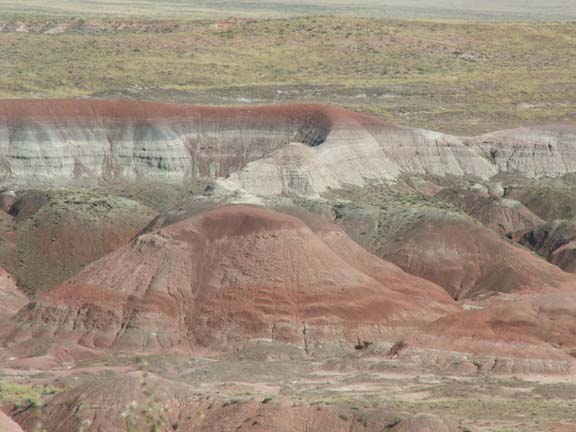
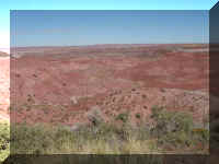
Petrified Forest National Park in the Painted Desert
Sedona - Oak Creek Canyon
Sedona and Red Rock Loop Road
Montezuma Castle National Monument
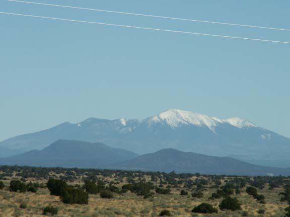
Williams, AZ Area
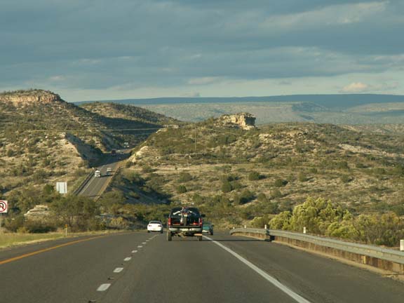
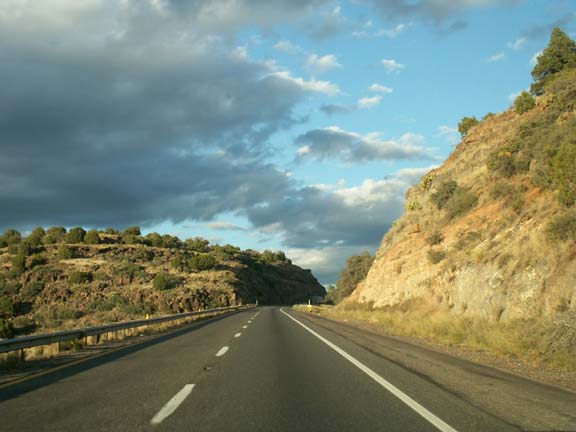
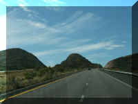
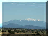
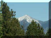
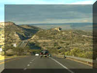
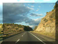
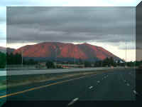
On the road . . .
Petrified
Forest National Park in the Painted Desert
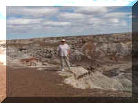
This was the first attraction we visited in Arizona. It was a beautiful
beginning. We have seen the name presented in a couple ways - the Painted Desert
has to be included in this way. You drive through the Painted Desert for
quite a while coming in from the North before getting to the Petrified Forest.
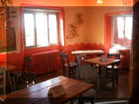
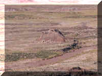
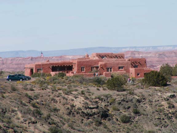
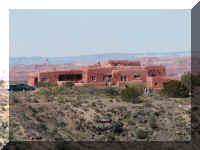 One
of the first things you see is the Painted Desert Inn - a National Historic
Landmark. Because at the time the inn was built petrified wood was plentiful,
the building was built using petrified wood and other native stone. The Inn was
registered with the land office in 1924. Known as the Stone Tree House, it
operated as a tourist attraction. During the 1930's it was redesigned and
redecorated by the Civil Conservation Corp.
One
of the first things you see is the Painted Desert Inn - a National Historic
Landmark. Because at the time the inn was built petrified wood was plentiful,
the building was built using petrified wood and other native stone. The Inn was
registered with the land office in 1924. Known as the Stone Tree House, it
operated as a tourist attraction. During the 1930's it was redesigned and
redecorated by the Civil Conservation Corp.
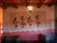
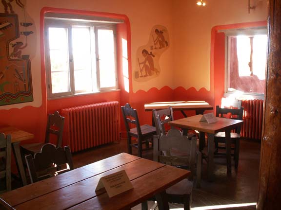
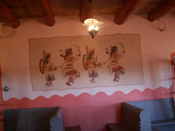
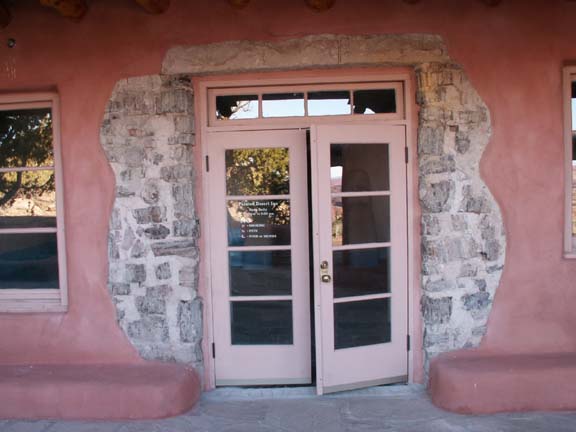
The Inn was repaired and reopened in 1976 as the Petrified Forest National
Park Bicentennial Travel Center. It is open year-round and serves as a museum and
information center.
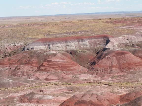
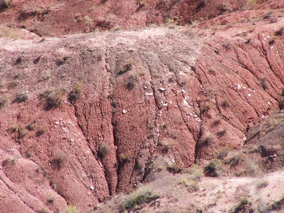
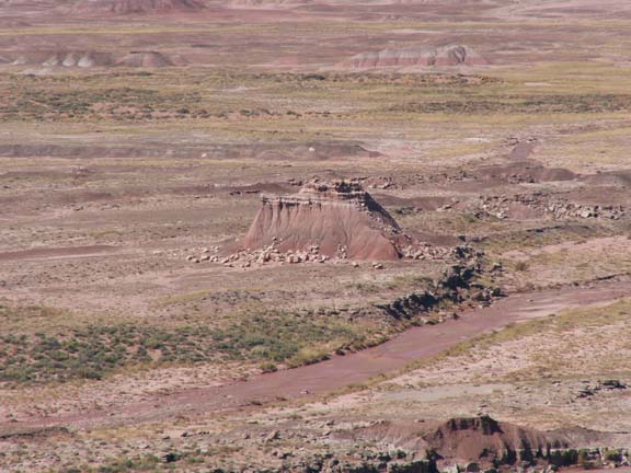
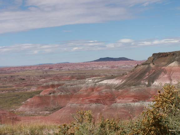
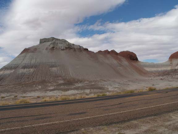
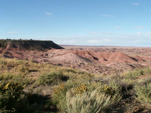
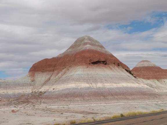
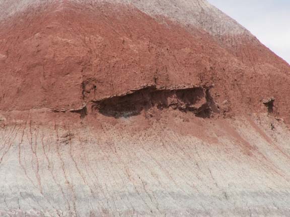
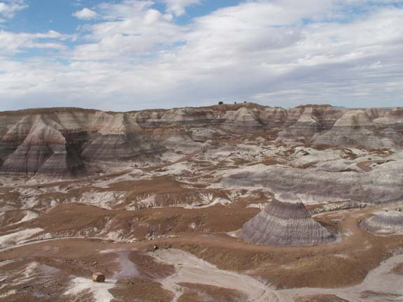
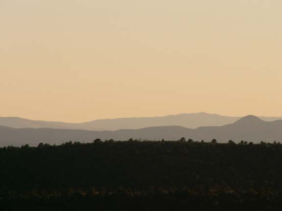
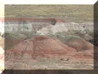
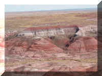
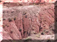
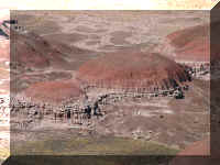
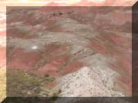
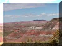
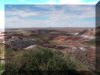
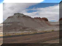
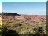
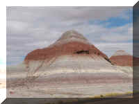
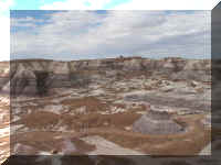
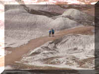
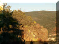
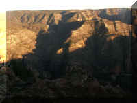
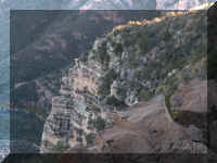
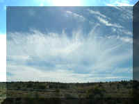
The following are samples of the Painted Desert views.
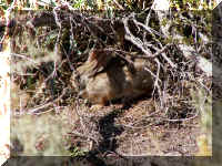 Someplace
in the Painted Desert, this rabbit ran across our path and hid - he thought.
Fred walked around to make this photograph and the rabbit never moved. He was
'invisible'
Someplace
in the Painted Desert, this rabbit ran across our path and hid - he thought.
Fred walked around to make this photograph and the rabbit never moved. He was
'invisible'
Doesn't this look like eyebrows. Maybe the 'mountain' is watching the
travelers as they drive by.
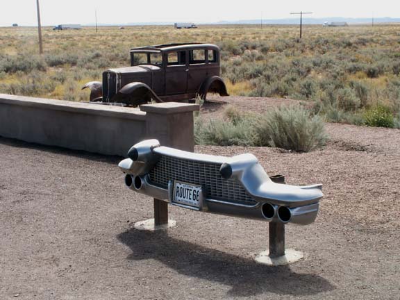
 On
an open stretch of road, we came across a commemorative spot where it crossed
Old Route 66.
On
an open stretch of road, we came across a commemorative spot where it crossed
Old Route 66.
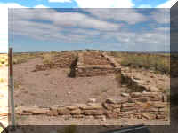 Halfway
through the Painted Desert and the Petrified forest is the Puerco
Pueblo. A 100-room pueblo build about 1250AD that may have housed nearly 1,200
people.
Halfway
through the Painted Desert and the Petrified forest is the Puerco
Pueblo. A 100-room pueblo build about 1250AD that may have housed nearly 1,200
people.
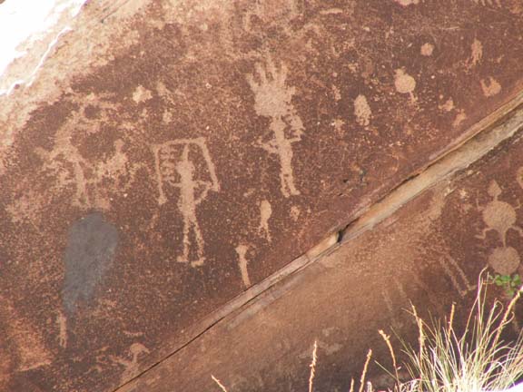
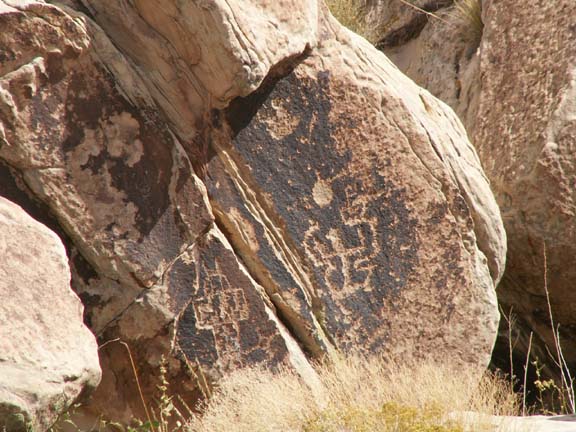
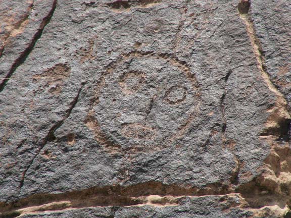
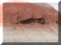
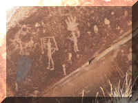
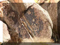
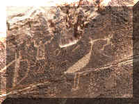
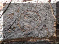
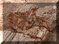
While the foundations were interesting, a more interesting feature of this
pueblo was the petroglyphs.
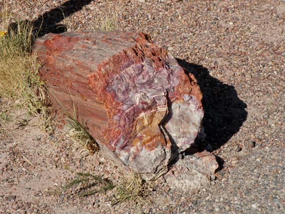
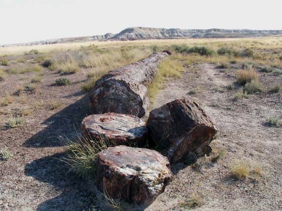
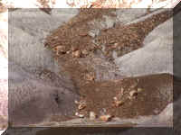
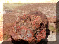
The petrified wood is protected now. Signs are visible, it is
mentioned on the welcome center video and you are reminded at the gate. They impress upon you what
will happen to you if you are caught with one splinter of petrified wood. It
wasn't going to be fun.
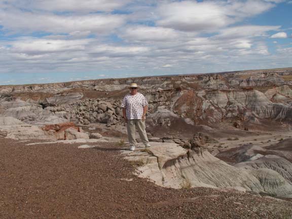
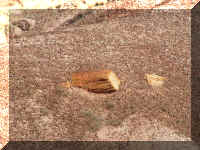
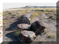
Mary Lou is standing in front of this petrified log. This is where we started
seeing petrified wood.
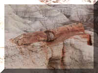
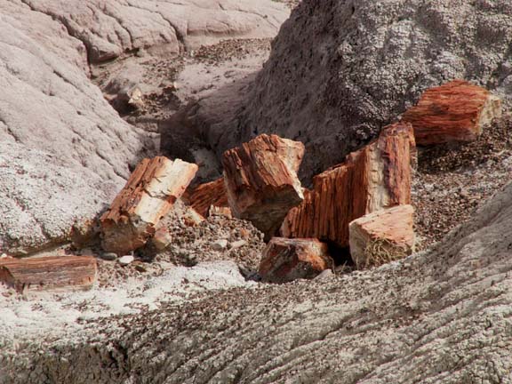
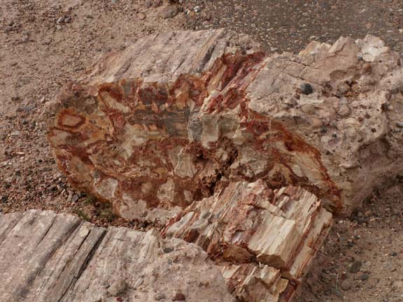
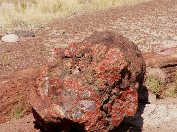
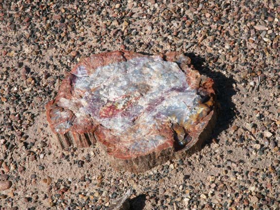
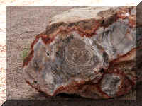
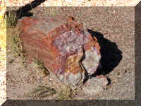
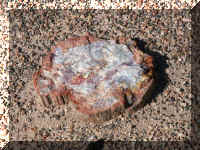
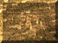
First lets say, it really isn't a forest. There are no trees
reaching to the sky. The brilliantly colored trees are laying all over the
ground, many are in fragments. Some not fully
expose . . . yet.
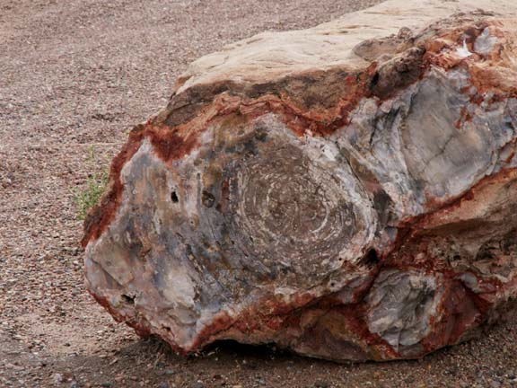
225 million years ago the trees were buried under volcanic ash
sediments rich in silica. Silica replaced the wood until the logs were literally
turned into stone. Iron oxide and other minerals stained the silica to produce
rainbow colors.
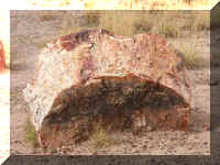
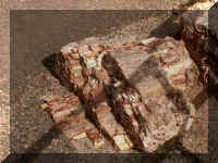
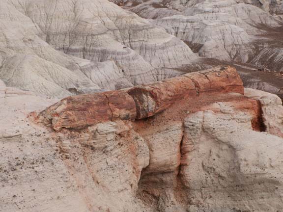
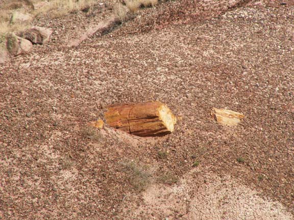
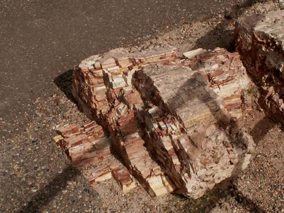
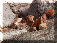
 This
log looked almost intact. Most petrified wood was in large pieces but not long
logs. When Fred looked up from
the viewfinder, a Park Ranger was parked on the shoulder of the road making sure
he took nothing but photographs. When Fred walked back to the truck, the ranger
drove off.
This
log looked almost intact. Most petrified wood was in large pieces but not long
logs. When Fred looked up from
the viewfinder, a Park Ranger was parked on the shoulder of the road making sure
he took nothing but photographs. When Fred walked back to the truck, the ranger
drove off.
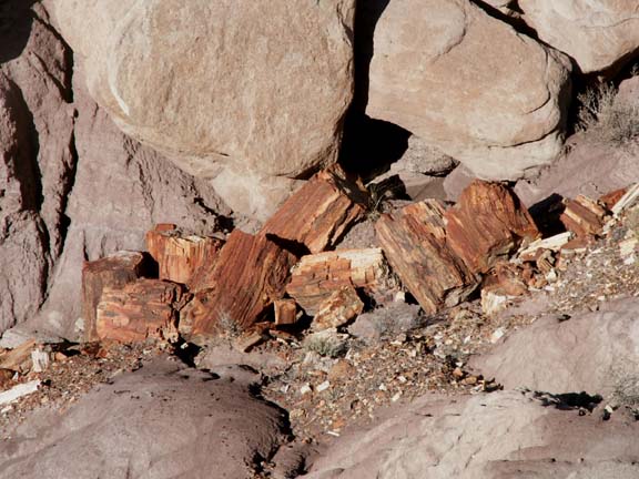
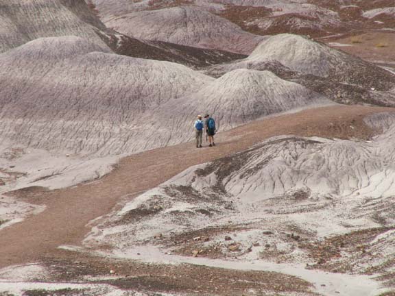
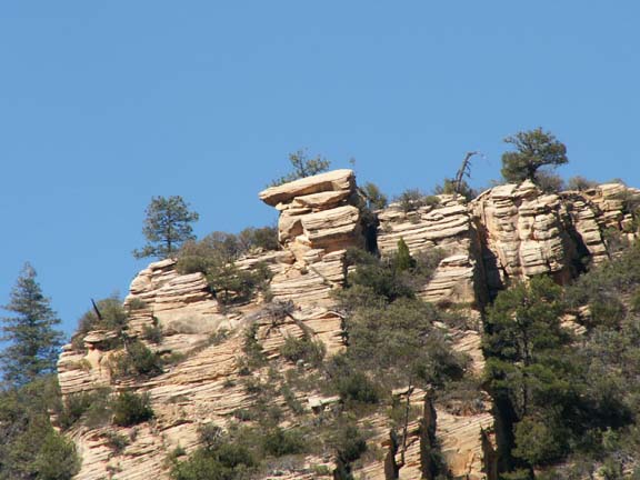
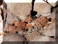
 The
Blue Mesa Trail provides an opportunity to hike along a trail with many opportunities
to pick up petrified wood. A couple returning from their hike remarked how
they had to resist temptation. They thought about the random searches of
persons and vehicle and thought it wiser not to succumb to temptation - maybe, it
was the image of the father in the video being handcuffed in front of his
family.
The
Blue Mesa Trail provides an opportunity to hike along a trail with many opportunities
to pick up petrified wood. A couple returning from their hike remarked how
they had to resist temptation. They thought about the random searches of
persons and vehicle and thought it wiser not to succumb to temptation - maybe, it
was the image of the father in the video being handcuffed in front of his
family.
We spent about four hours in the Petrified Forest National Monument and
Painted Desert. If you are of the proper age, be sure and purchase a Golden Age
Passport. With card, admissions are generally free, usage fees are generally half
price in national monuments and national parks.
Top of Page
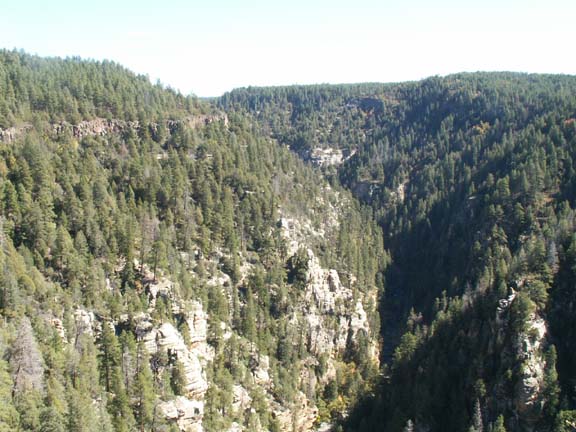
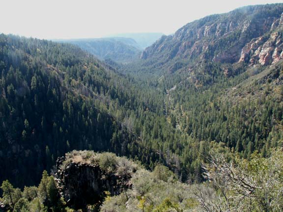
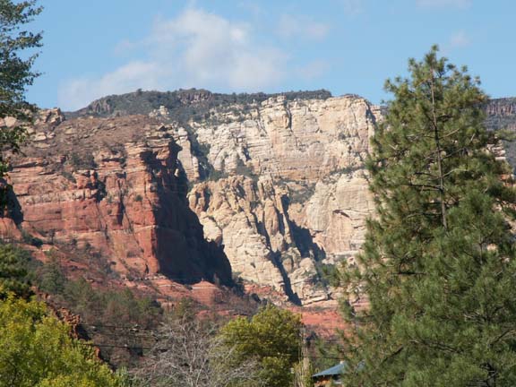
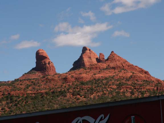
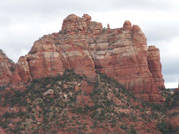
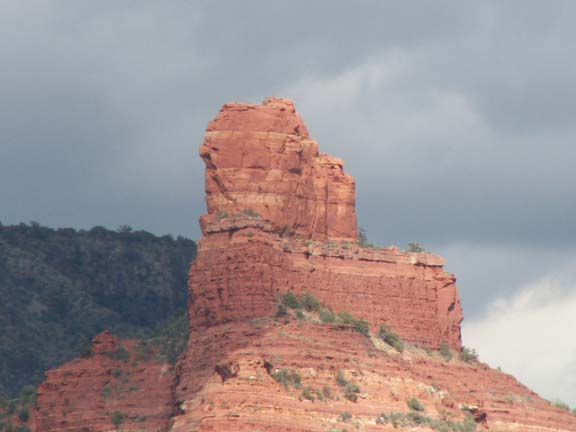
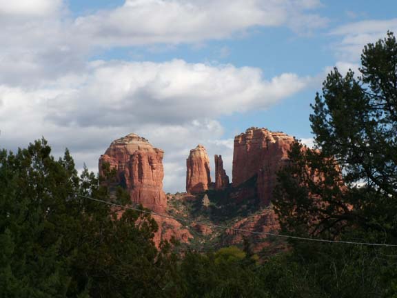
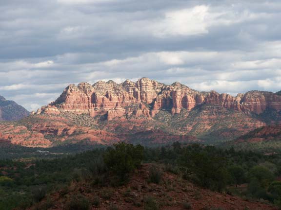
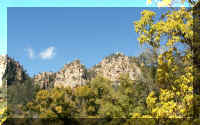
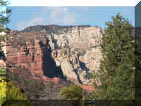
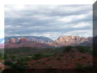
Sedona - Oak Creek Canyon
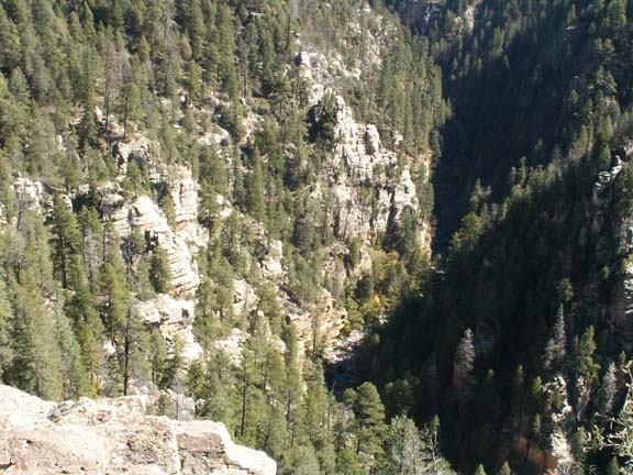
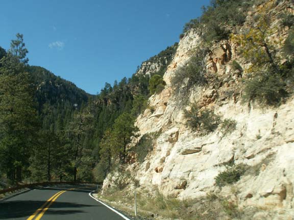
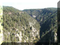
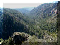
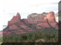
South of Flagstaff, headed for Sedona on Highway 89A is Oak Creek Canyon.
These photographs are made from the area of the visitors information center.
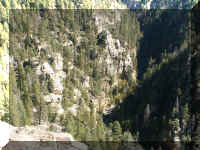
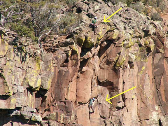
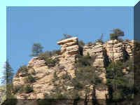
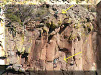 We
will help you find the climbers on this cliff.
We
will help you find the climbers on this cliff.
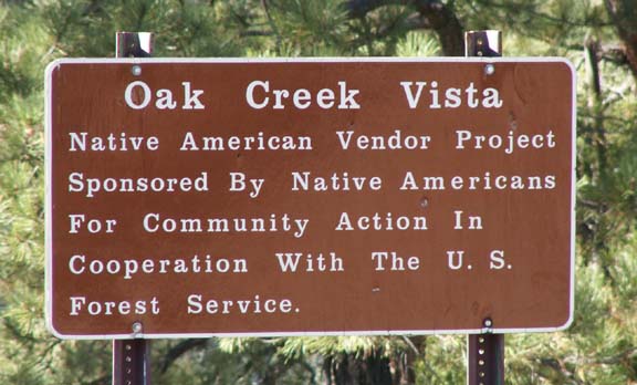
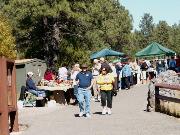
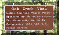
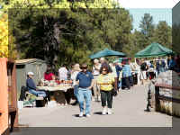
The Native American are permitted to sell crafts.
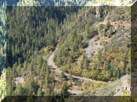
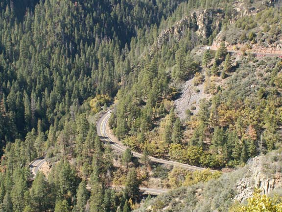
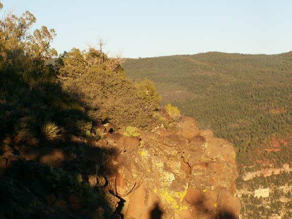
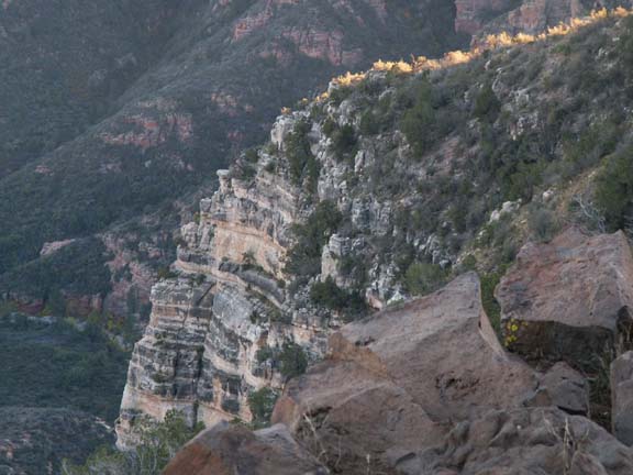
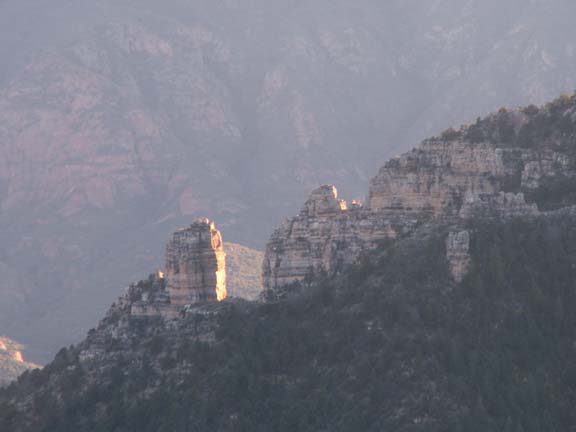
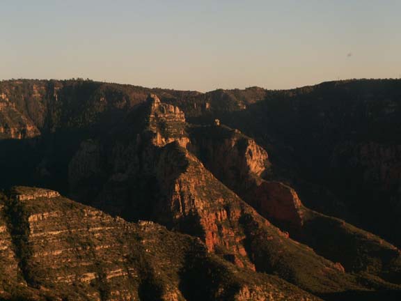
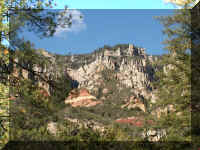
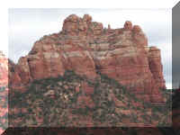
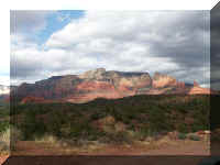
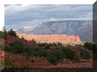
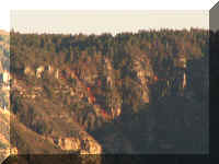
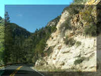 Oak Creek Canyon which offers many views of the canyon
and rock formations - a nice ride. From one overlook in the visitor information
center, you could see five levels of road. In the photograph, you see the three
at the right. The two farther down at the left do not show.
Oak Creek Canyon which offers many views of the canyon
and rock formations - a nice ride. From one overlook in the visitor information
center, you could see five levels of road. In the photograph, you see the three
at the right. The two farther down at the left do not show.
There is no admission fee for driving through the Oak Creek Canyon. You can
stop to take photographs, that was okay also. But, if you parked to hike or use
the recreational area, you had to pay a fee.
Top of Page
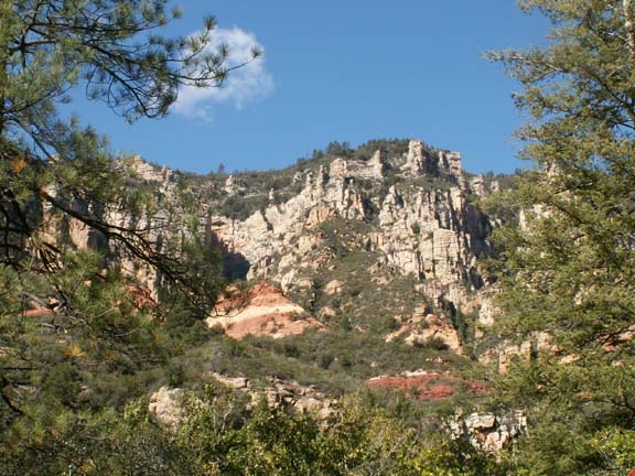
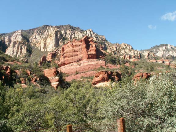
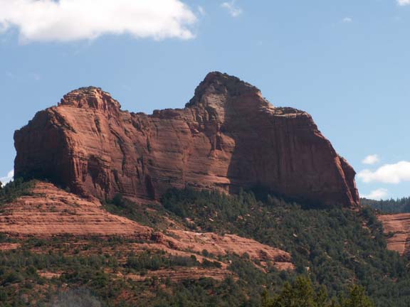
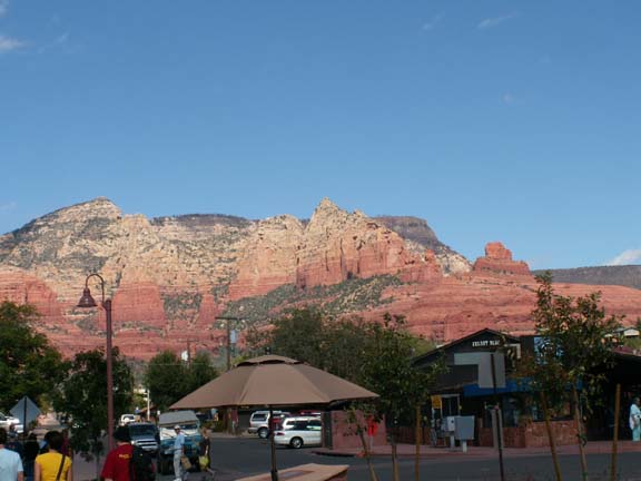
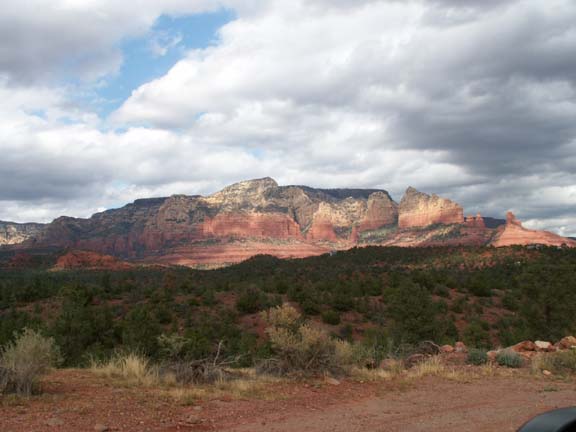
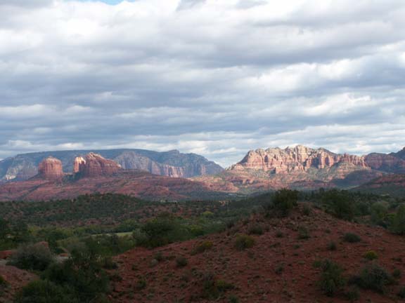
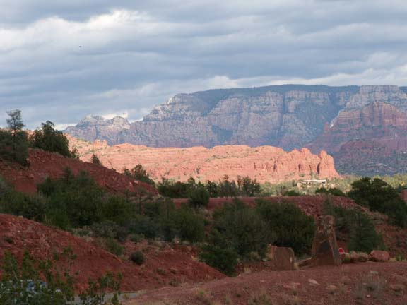
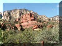
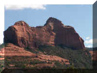
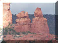
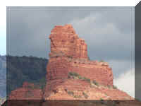
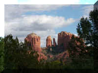
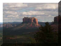
Sedona and Red Rock Loop Road
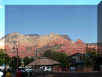 Sedona
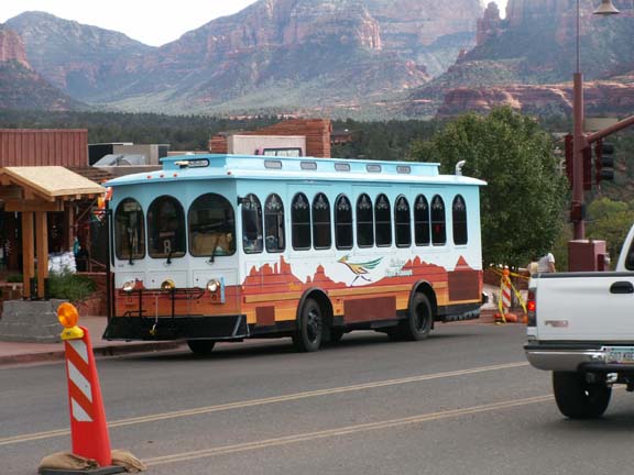
is located in a beautiful setting. You will note the orange cone. One thing you
have to deal with when you travel in the off season is construction. The cities
that are tourist destinations have to take advantage of the remaining good
construction weather and fewer people.
Sedona
is located in a beautiful setting. You will note the orange cone. One thing you
have to deal with when you travel in the off season is construction. The cities
that are tourist destinations have to take advantage of the remaining good
construction weather and fewer people.
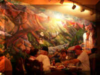 In
Sedona, we had lunch in
the Cowboy Club. They had great hamburgers, buffalo burgers and other items on
their menu. It was a noisy place but very attractive with good service.
In
Sedona, we had lunch in
the Cowboy Club. They had great hamburgers, buffalo burgers and other items on
their menu. It was a noisy place but very attractive with good service.
 Mary
Lou had seen the ice cream store next door to the restaurant. However, we were
too full to participate.
Mary
Lou had seen the ice cream store next door to the restaurant. However, we were
too full to participate.
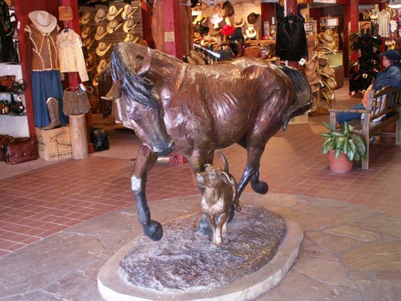
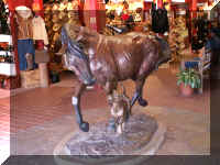
These horses greeted you as you entered one group of shops.
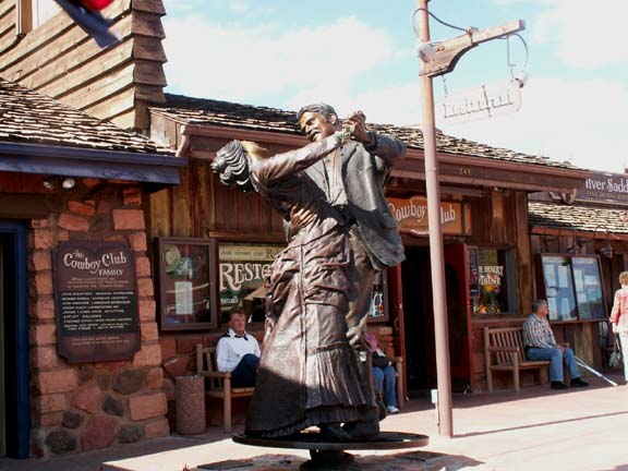
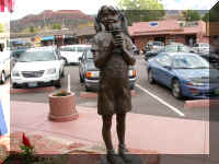
Several movies were make in Sedona. This sculpture and several plaques documented the
movies and the stars.
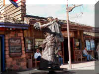
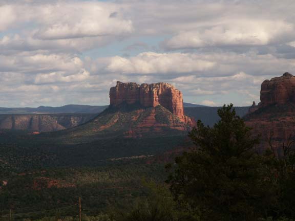
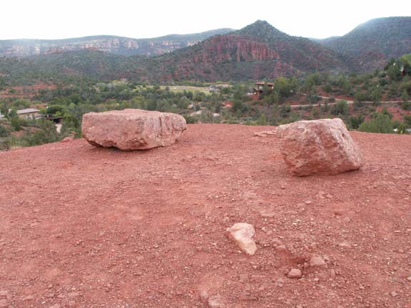
After a little window shopping we continued our ride South. A real
estate office parking lot was a nice location to make a couple
photographs.
A short distance down the road, Fred spotted a sign that said, Red Rock Loop
Road. When he saw the second sign, we turned left to check it out. It was primarily an asphalt road - this is a guess, about one of the five miles
was dirt.
 Just
below this location was a community of homes with fantastic views. We assume the
residents along the dirt section of the road are trying to limit the number of
tourist drive-bys.
Just
below this location was a community of homes with fantastic views. We assume the
residents along the dirt section of the road are trying to limit the number of
tourist drive-bys.
There was no fee for this beautiful ride as it is just a local road.
Top of Page
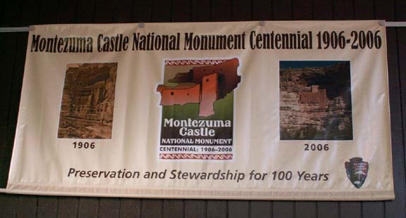
Montezuma Castle National
Monument
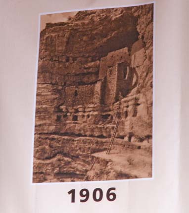
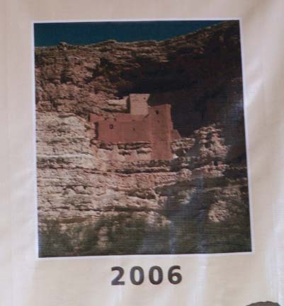
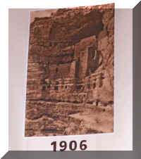
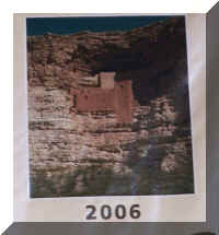
Montezuma Castle is celebrating their centennial this year. The photographs
below show the castle in 1906 and 2006. The odd name came from a mistaken belief
that the cliff-dwelling was a castle Aztec refugees had built for their emperor.
We now know that Montezuma never strayed this far north from his home in
Mexico, but the name has stuck.
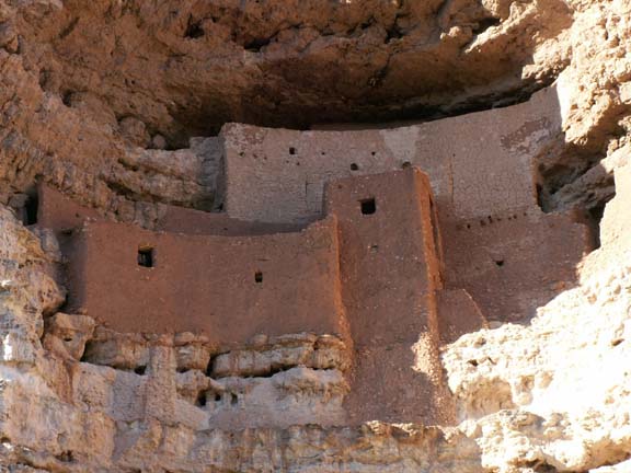
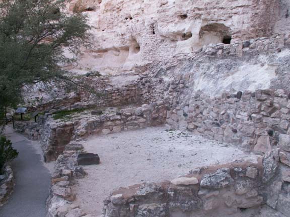
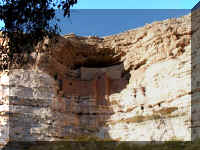
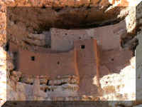
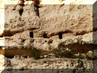
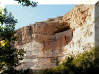 Approaching
Montezuma Castle on the pathway gives you a striking view. Sinagua farmers built
this five-story 20 room dwelling early in the 12th century. It stands on a cliff
recess about 100 feet above the valley.
Approaching
Montezuma Castle on the pathway gives you a striking view. Sinagua farmers built
this five-story 20 room dwelling early in the 12th century. It stands on a cliff
recess about 100 feet above the valley.
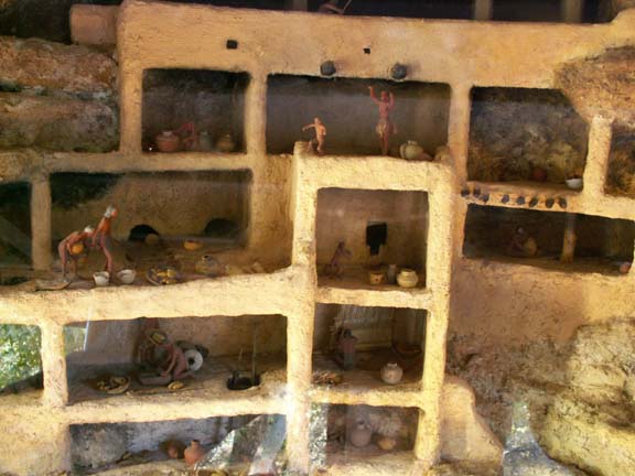
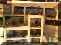 A
scale
model provided a look at what the inside dwelling looked like.
A
scale
model provided a look at what the inside dwelling looked like.
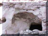
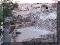 A
short distance west is the remains of a once six-story apartment with about 45
rooms; it is badly deteriorated. This dwelling was build against the base of the
cliff.
A
short distance west is the remains of a once six-story apartment with about 45
rooms; it is badly deteriorated. This dwelling was build against the base of the
cliff.
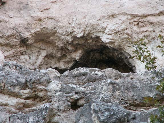
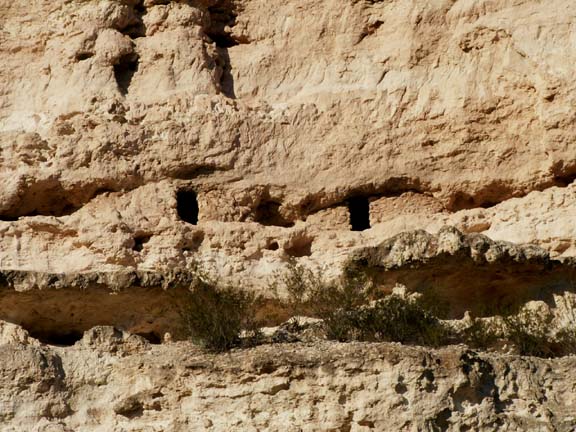
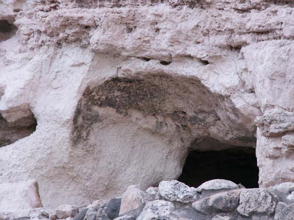
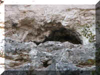
Caves in the mountain were also inhabited or used as storage
locations.
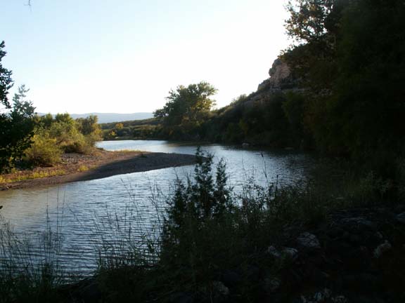
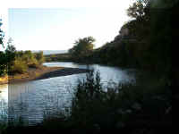 Most
settlements are dependent on a water source. Beaver
Creek near the dwellings provided the vital water supply for people, stock and
agriculture.
Most
settlements are dependent on a water source. Beaver
Creek near the dwellings provided the vital water supply for people, stock and
agriculture.
Top of Page
Williams, AZ Area
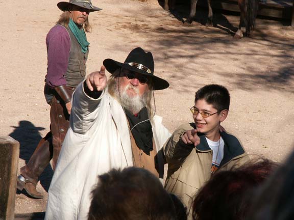
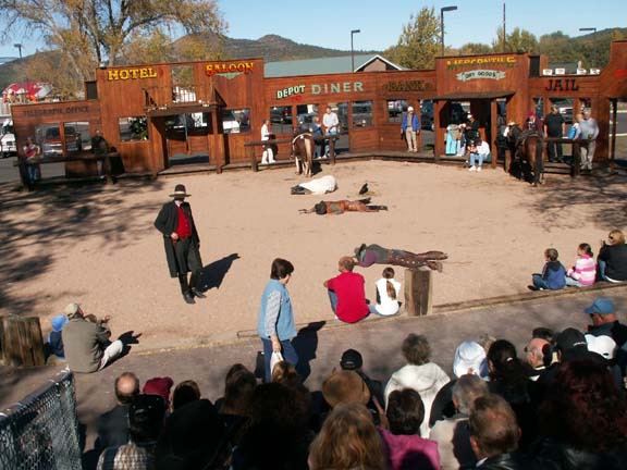
Shootout at the train depot
We spent two nights in a campground in Williams, AZ. That gave us time for some
chores and still had time to checkout the area a little. We had read that there
was going to be a 'shootout' before the train left the depot for the Grand
Canyon. We set our alarm so we didn't miss this local event.
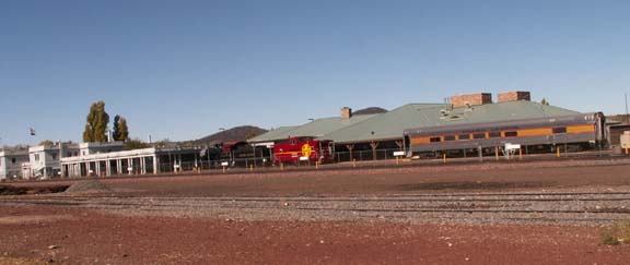
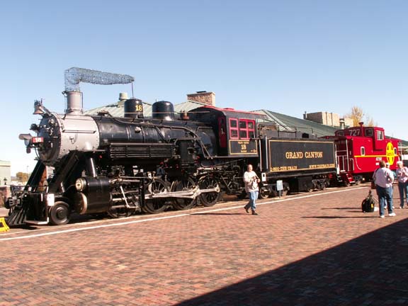
The Grand Canyon
Railroad has daily round trips to the Grand Canyon from Williams. The Williams
Depot is buzzing with activity each morning.
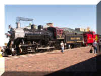 After
reporting in, the passengers could have their photograph made in front of this
train.
After
reporting in, the passengers could have their photograph made in front of this
train.
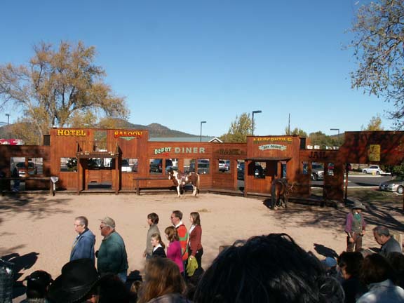
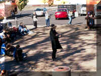
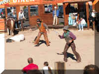
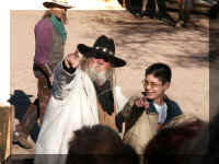 We
found the set for the shootout at the far end of the railroad station platform. The
We
found the set for the shootout at the far end of the railroad station platform. The  cowboys
warmed up the crowd before the Sheriff showed up.
cowboys
warmed up the crowd before the Sheriff showed up.
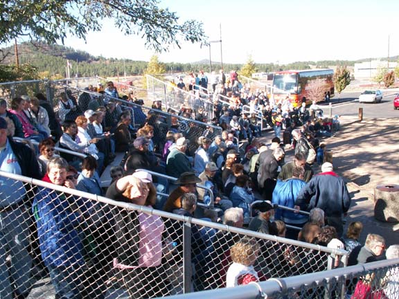
Bleachers were set up so the spectators could easily see the
town street where the shootout would occur. Mary Lou thinks it was a
gimmick - get the people there early to insure they are ready for the train to
leave. It worked!
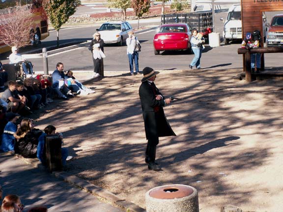
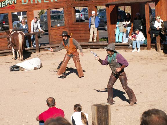
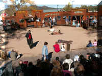
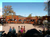 The
drama once again, showed that good wins over evil. The Sheriff shot the horse
thieves.
The
drama once again, showed that good wins over evil. The Sheriff shot the horse
thieves.
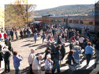 The
railcars were moved to the track behind the bleachers. As soon as the drama was over,
everyone headed for the train.
The
railcars were moved to the track behind the bleachers. As soon as the drama was over,
everyone headed for the train.
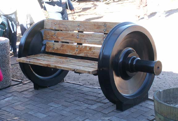
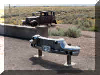
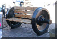 Several
of these benches made from train wheels were placed on the platform.
Several
of these benches made from train wheels were placed on the platform.
The shootout was a fun event. the admission was free, it was
only a mile from our campground and we had nothing pressing to do at 9:30 in the
morning. During the peak tourist season, the town also has a western gun fight on
Main Street (Historic Route 66) every evening.
Top of Page
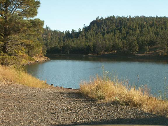
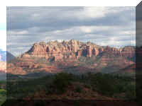
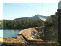
Sycamore Canyon
The people at the NPS Visitor Information Center said there was not
much to do in the fall of the year. We asked about any scenic rides. She asked
what type of vehicle we were driving. She got a map showing several places we
could visit. We choose to visit Sycamore Canyon. It was a 18 mile ride on mostly
maintained dirt roads. The map said a passenger car could travel the roads if
they were dry.
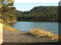
Just outside town, we found this lake. Most of the water used
for recreation in the area is of a manmade variety.
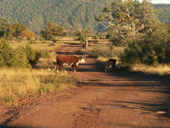
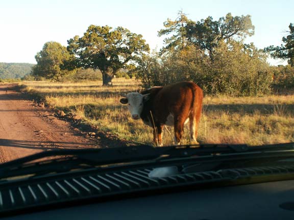
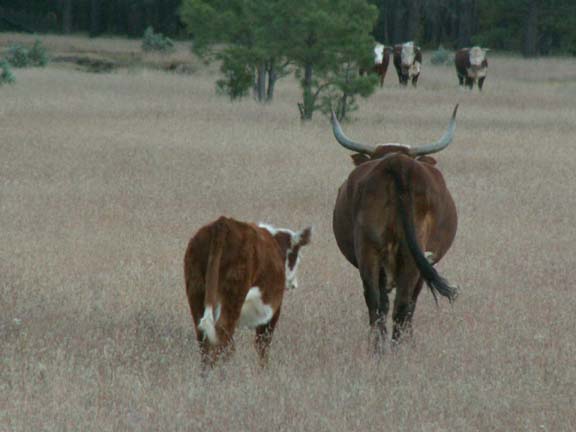
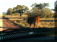
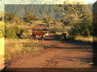 The
road deteriorated as we proceeded. Eventually, we found cattle in the road. A
few of the cattle decided to keep their eye on us.
The
road deteriorated as we proceeded. Eventually, we found cattle in the road. A
few of the cattle decided to keep their eye on us.
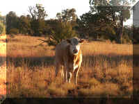
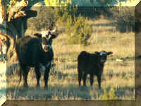
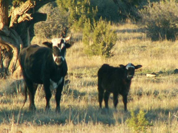
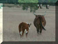
A couple just walked away.
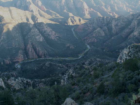
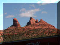
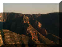
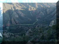 We
finally arrived at Sycamore Point, overlooking Sycamore Canyon. It was slow
going for a while. The red rock is said to be in the same mountain range as
those in Sedona. Sycamore Canyon is the second largest canyon in Arizona.
We
finally arrived at Sycamore Point, overlooking Sycamore Canyon. It was slow
going for a while. The red rock is said to be in the same mountain range as
those in Sedona. Sycamore Canyon is the second largest canyon in Arizona.
It is a very pretty canyon with the appearance of a small amount
red rock. The NPS person said to take chicken and potato salad - it would
have been a nice place for a picnic. We stayed only fifteen minutes due to
approaching darkness.
Our ride on the 36 mile round trip was not too bad. Fortunately,
the road was dry. The signage was very good the entire route. We enjoyed our
ride but would make sure that your approximately three hour ride ends in
daylight.
Top of Page
On the road . . .
Top of Page

 One
of the first things you see is the Painted Desert Inn - a National Historic
Landmark. Because at the time the inn was built petrified wood was plentiful,
the building was built using petrified wood and other native stone. The Inn was
registered with the land office in 1924. Known as the Stone Tree House, it
operated as a tourist attraction. During the 1930's it was redesigned and
redecorated by the Civil Conservation Corp.
One
of the first things you see is the Painted Desert Inn - a National Historic
Landmark. Because at the time the inn was built petrified wood was plentiful,
the building was built using petrified wood and other native stone. The Inn was
registered with the land office in 1924. Known as the Stone Tree House, it
operated as a tourist attraction. During the 1930's it was redesigned and
redecorated by the Civil Conservation Corp.