Dawson Creek to Watson Lake - Alaska 2005
Updated: 11/30/08
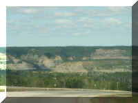
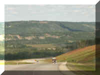
Approaching Dawson Creek the terrain changed. It became more mountainous and beautiful - an indication of things to come.
DAWSON CREEK, BRITISH COLUMBIA
We camped near Mile '0' of the Alaska Highway. The Milepost is in the middle of town.
This metal sculpture of a surveyor was in the middle of a traffic circle in town. Hopefully, we won't have to use many of these traffic circles towing the fifth wheel during our trip. This one, we shared with a Greyhound bus.
The city owned park where our campground was located also included the Walter Wright Pioneer Village. For a donation, you could walk the street and buildings.
It was like many old town museums we have visited. But you always see something unusual and different.
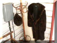
This bear coat caught our eye.
This type of telephone switchboard Fred was familiar with from when he first started working and modernizing his company's telephone system. And, a phonograph similar to one he had asked his grandmother for - after she put it out to the trash along with his grandfather's floor model radio.
Most of the building were open and included period artifacts.
While we were sitting in our fifth wheel on Saturday, people were putting a piece of paper on each picnic table, held down by a few stones from the parking pad. It was an invitation to to attend the Foursquare Family Church service in St. Paul's Anglican Church in the Pioneer Village. About 50 people attended - some regulars and several camping people for our campground next door. The church membership is several families who meet in homes but are doing a service four times this summer in Pioneer Village.
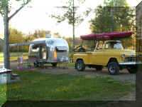 This
neat rig was in our campground.
Any combination of RVs and equipment can be seen on the route - pop-ups, truck campers, travel trailers, fifth wheels, motorhomes, van conversions - new, old - large, small. And many have 'stuff' lashed on for use in Alaska.
We went into town for lunch Sunday and found two examples of local vehicles. If ours gets this dirty, a way will be found to wash it.
And ... a bus pulling a trailer. We saw one on the road earlier but Fred was not fast enough with the camera.
Leaving Dawson Creek, we begin our journey on the Alaska Highway.
Walking distance from our campground in Fort Nelson, B.C. was the Fort Nelson Heritage Museum. It was the brainchild of a local welder. He collected everything - big and small. He advertises displays of wildlife, construction equipment, a trapper's log cabin, cars, trucks, a working blacksmith shop, a 1950s machine shop and much more. A small admission is charged - $2.00 per person for seniors. It is worth a visit as you travel in the area.
His collection of stuff inside the museum was not as impressive to us as his collection outside and in the car barn. He had cars, trucks, machinery and equipment everywhere.
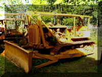 This
bulldozer and other equipment was actually used to build the Alaska
Highway.
He had an electric generator used for the town of Fort Nelson until the 1970s - it was huge.
We are always interested in vehicles - especially rare Dodge vehicles.
The museum included a tribute to those who built the Alaska Highway.
The book said that the drive from Fort Nelson would be one of the most beautiful on the Alaska Highway. Much of the time we were in the Canadian Rockies.
It was spectacular.
We were warned that the road would narrow and not be as good as we had been experiencing. It did. And, it wasn't. But, the scenery was still beautiful. Then, we hit a little construction. At the construction area is where vehicles may get bunched up a little - the flag person may hold you for oncoming traffic to pass. Otherwise, everyone is spread out along the highway.
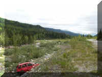
It looks like nobody wanted
this little red car.
Construction and general road conditions were not the only problem. Near Stone Mountain the native wild life decided to cohabitate with us.
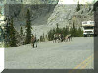
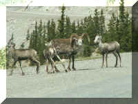
We have no idea what these Stone Mountain Sheep were eating.
This was our view during lunch. It started to rain a little as we ended lunch. It rained so hard we decided to pull over and wait it out instead of missing something.
It is a good thing we did. We would have missed these two waterfalls.
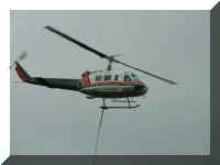 Hauling
supplies in is a real trip from any major city. We are guessing they do not
drive a crane to lift equipment into place. They bring in a helicopter. As we
rounded a curve, there it was.
The snow has not melted in the protected crevasses of the mountains - photo opportunities. These are part of the reason we traveled only 160 miles from Fort Nelson to Muncho Lake. We made too many stops along the way.
As it passed Munch Lake, the Alaska Highway is on a ledge between the lake and the mountain. Wire is hung on the mountain to make sure rocks fall straight down and maybe not on the road.
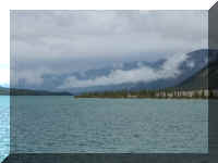
Muncho Lake
(Mary Lou asks, where is the green color?)
These views are from the dock in our campground on Muncho Lake.
The next morning on our way to Watson Lake we saw Muncho Lake
for the last time.
A short distance down the road we started seeing wildlife. Some people leave early in the morning in hopes of seeing wildlife before traffic drives them into the woods. Our bear was meandering along the side of the road and ignored us. We saw evidence of the buffalo before we saw them. The wild ponies were a pleasant sight.
Goat mountain was one of many beautiful mountains seen today.
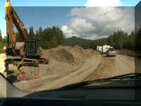 The
day was not without a little inconvenience - nine miles at 20 mph through
construction. It was rough going. A tank truck was watering the dirt to
reduce dust for the workers. We used four wheel drive a couple times for mud and
sand.
We had lunch next to the Cranberry Rapids of the Liard River. Further, down the road it was a more peaceful river.
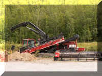 The
crews laying fiber optic cable did not interfere with traffic. The were
trenching at the tree line from Whitehorse to Laird Springs. It is a five year
project.
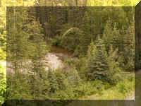 The
final sections of the Alaska Highway were connected at this creek, which was
named Contact
Creek - The regiment from the south met the regiment from the north at this pint
in September 1942. A plaque which described the event was so small it would not photograph
well.
Approaching Watson Lake we saw our first glimpse of the Yukon.
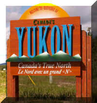
Then it was official . . . we were in Yukon Territory.
Watson Lake is primarily known for it's Sign Post Forest. These photographs give an idea of the city block size area and the density of the 54,000+ signs. They estimate 2,000 are added each year.
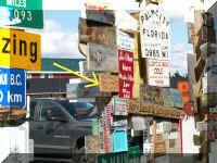
If you go to the Sign Post Forest, look up our sign.
Leaving the visitor's center, turn right
on the path parallel to the parking lot.
our sign is 75 paces and on the left.
Go back to Alaska Photo Album .