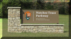
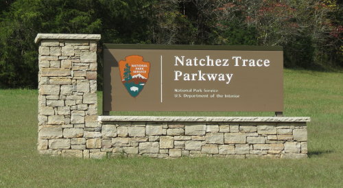
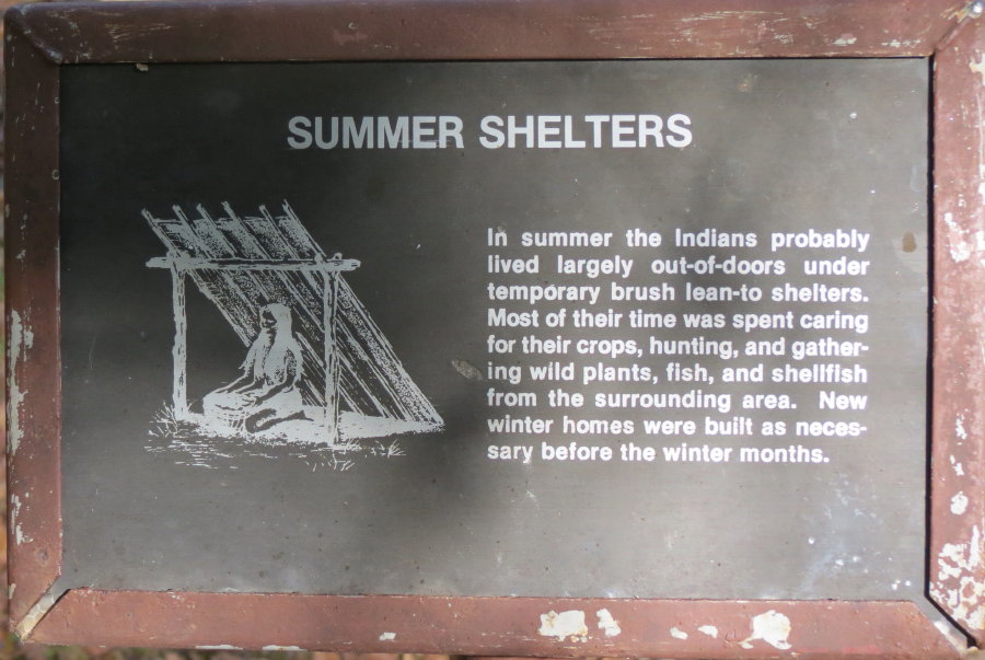
Natchez Trace Parkway - 2015
Our route began in Nashville, TN
and ended in
Natchez, MS
Updated:
07/29/16
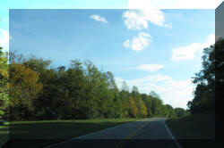
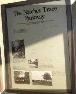
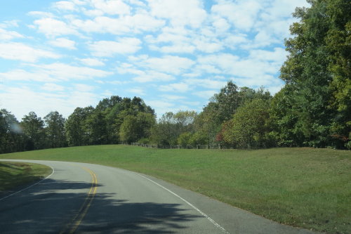
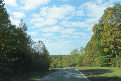
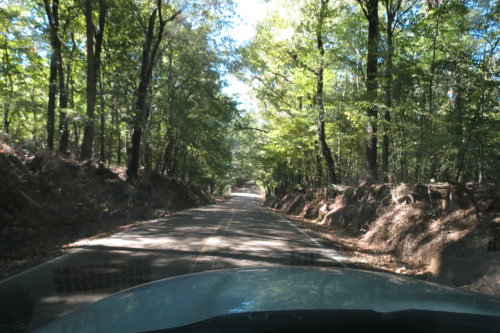
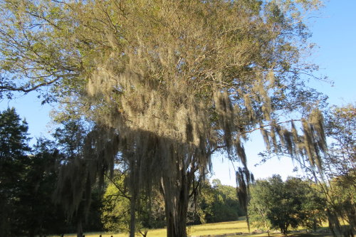
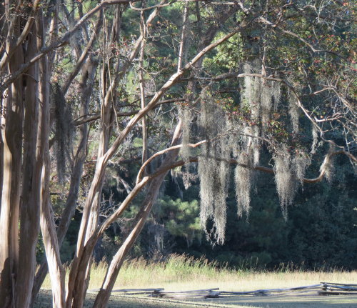
 The
Parkway is beautiful. Commercial vehicles are not permitted. Gas stations
(maybe, diesel) are in nearby towns. The Parkway includes many points of
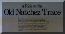
interest. Informational panels
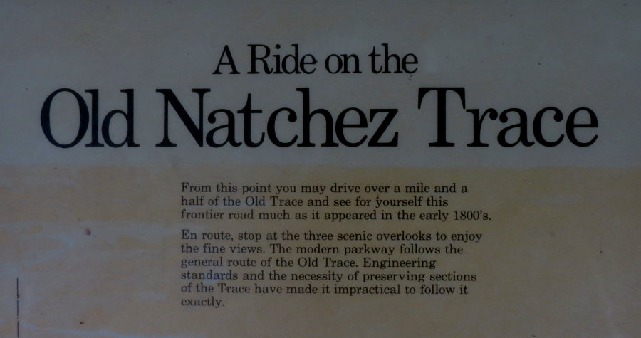
discussing 10,000 years of North American history are plentiful. We have linked
the thumbnail photographs for the informational panels to image files large enough for you to read the
words. To enlarge the
thumbnail with a beveled edge for a photograph or an informational panel, just
left click on it.
The
Parkway is beautiful. Commercial vehicles are not permitted. Gas stations
(maybe, diesel) are in nearby towns. The Parkway includes many points of
interest. Informational panels
discussing 10,000 years of North American history are plentiful. We have linked
the thumbnail photographs for the informational panels to image files large enough for you to read the
words. To enlarge the
thumbnail with a beveled edge for a photograph or an informational panel, just
left click on it.
THREE WAYS TO VIEW THIS PAGE: (Because this
is a large page, we give you options.)
>>> You can enjoy our
ten day trip reading our comments
and looking at or enlarging our photographs.
>>> If you are a history buff, you will find the
exhibit
panels full of very interesting information.
>>> Or, you can just
follow these links to view
Our favorite points of
interest:
FALL HOLLOW
OLD TRACE DRIVE
MERIWETHER LEWIS STATE PARK
BEAR
CREEK MOUND CONFEDERATE
GRAVES
FRENCH CAMP
CYPRESS SWAMP
SUNKEN TRACE
MOUNT LOCUST
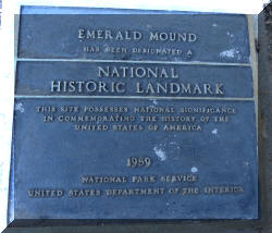
EMERALD MOUND
NATCHEZ, MISSISSIPPI
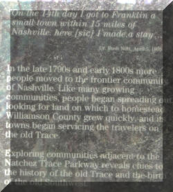
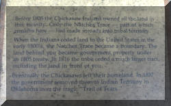
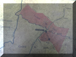
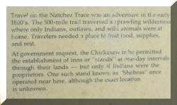
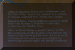
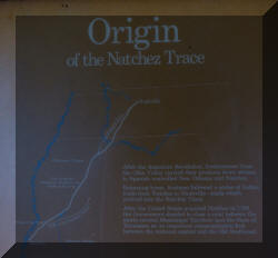
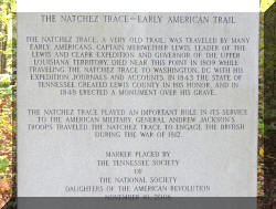
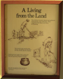
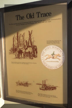
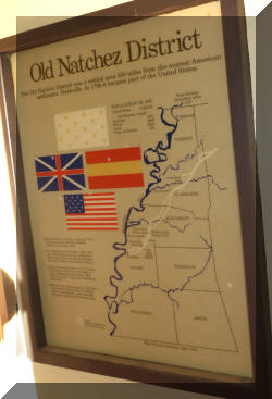
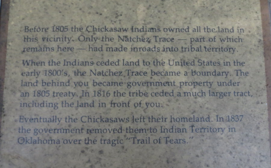
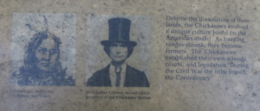
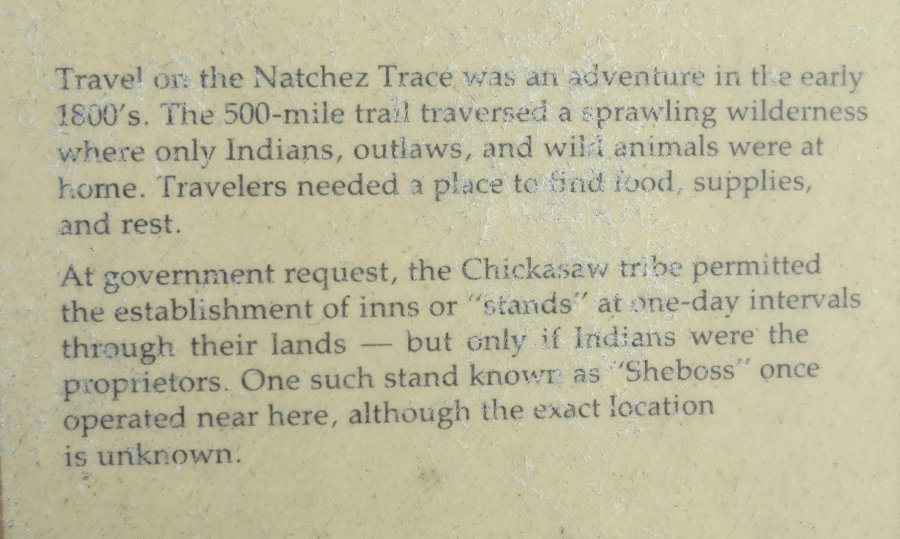
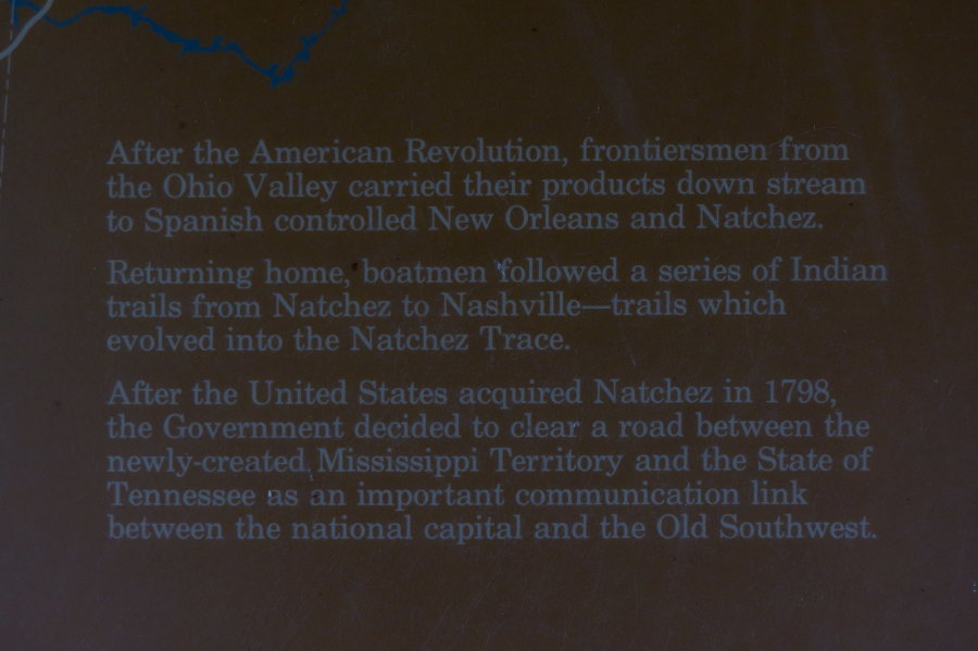
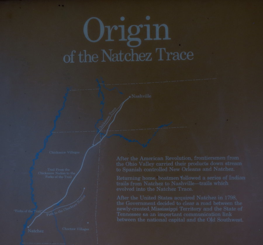
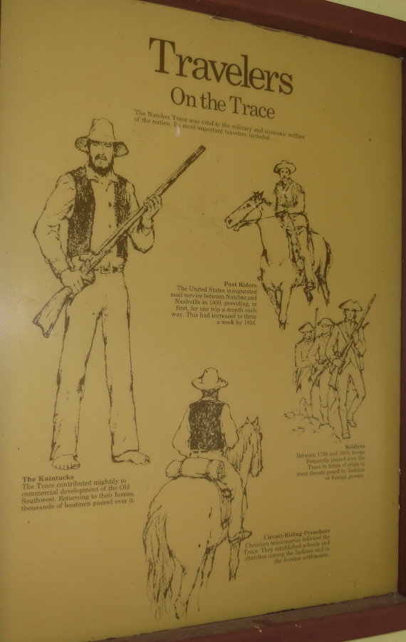
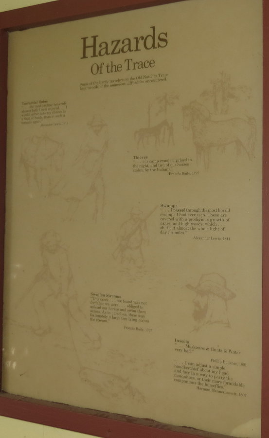
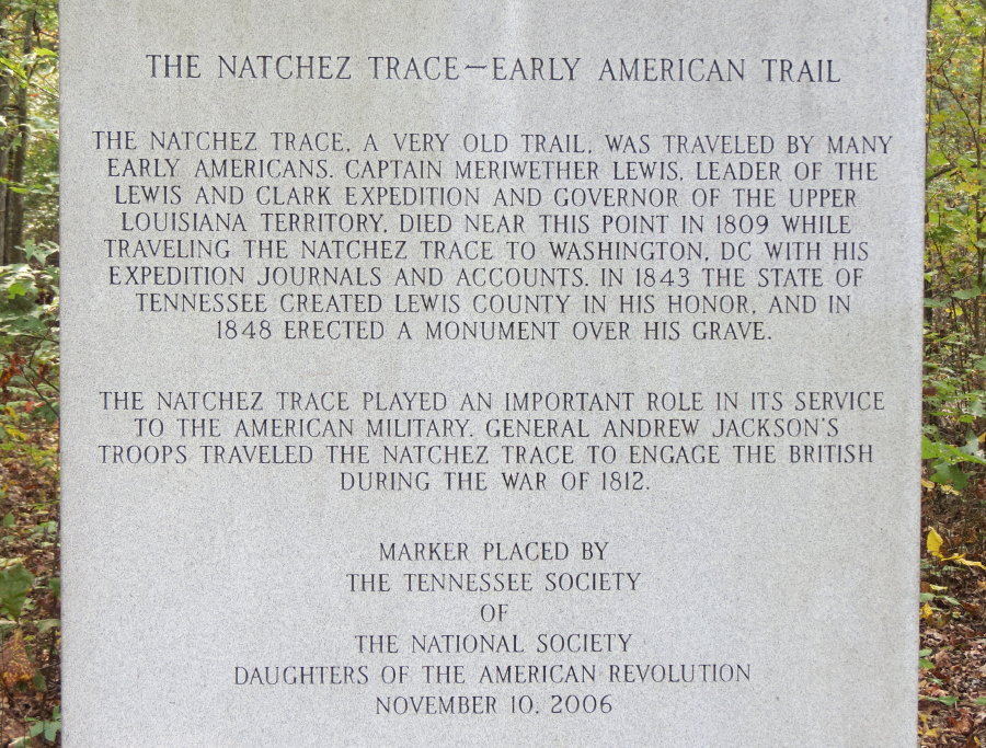
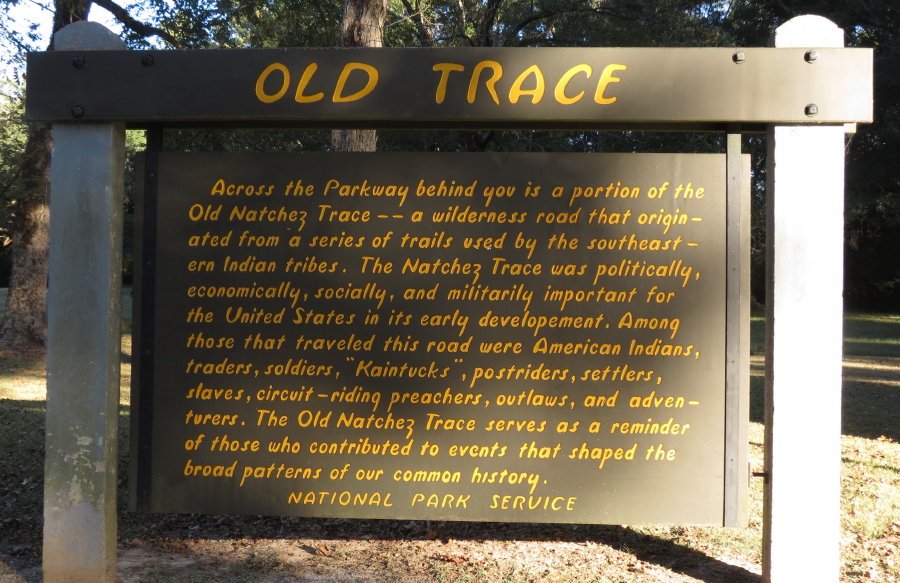
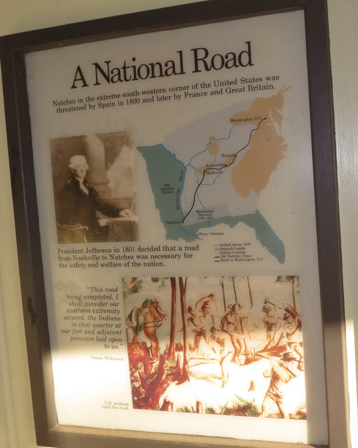
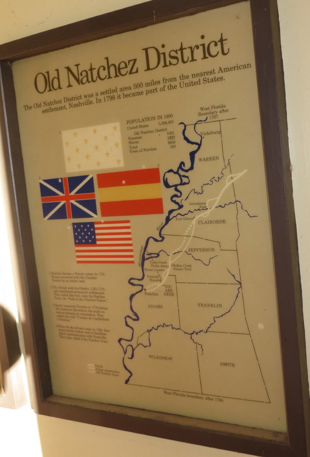
The Natchez Trace began as ancient animal trails. The passage and its parts
were called the Chickasaw Trail, Path to the Choctaw Nations, Boatman's Trail, Natchez Road, Nashville Road, Mail Road.
It acquired the name "Natchez Trace" sometime after its heavy use dwindled in
the 1820's. The most famous period for this trail was from 1790 to 1820.
When
the port of Natchez opened more widely to the Mississippi River Trade, the
influx of boatman who needed a way home did much to publicize the route. In the early 1800's through the mid-1820's, "Kaintucks"
from the Ohio River Valley floated cash crops, livestock, and other materials
down the Mississippi River on wooden flatboats. At Natchez or New Orleans, they
sold their goods, sold their boats for lumber, and walked or rode horseback home via the
Old Trace. As the road was improved, stands (inns) provided lodging, food and
drink to the Trace travelers. When steamboats were developed in the 1820s that
travel northward on the Mississippi River could be accomplished by boat.
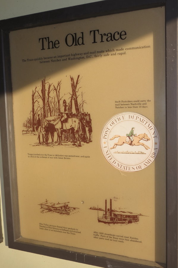
In 1800, the U.S. Government
established the postal route between Nashville and Natchez. The postal riders
continued their travels along the old road, by 1816 there were three mail
deliveries a week. The government began to rely more on the steamboats to carry
mail in the 1820's.

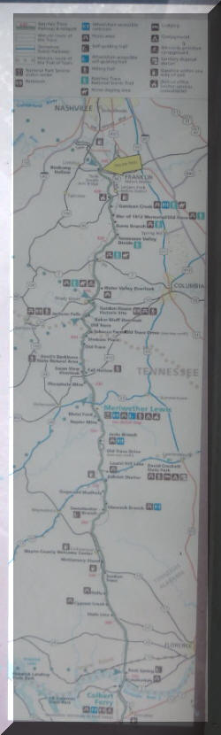
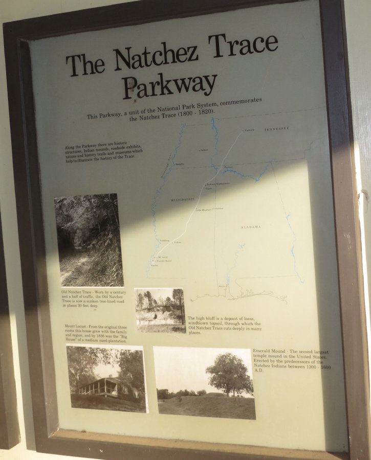
The Parkway was established as a unit of the National Park System in 1938 and
officially completed in 2005, the Parkway commemorates the most significant
highway of the Old Southwest.
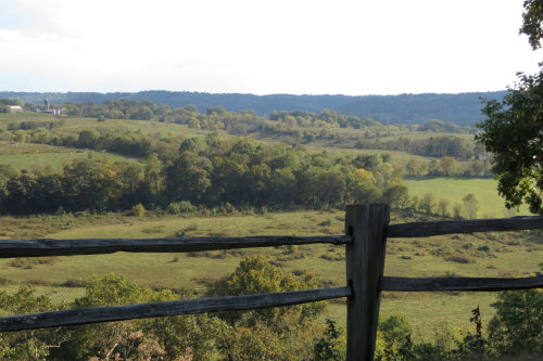
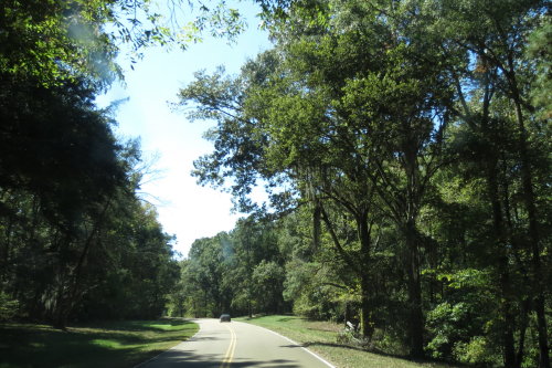
The Parkway passes through three states - Tennessee, Alabama and Mississippi.
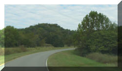
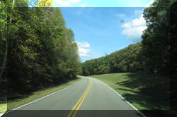
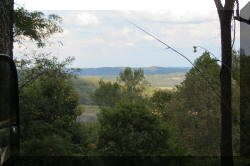
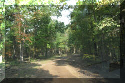
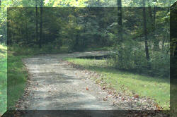
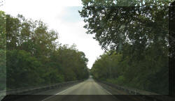
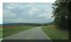
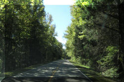
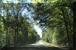
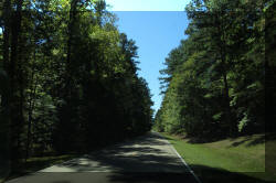
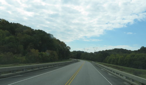
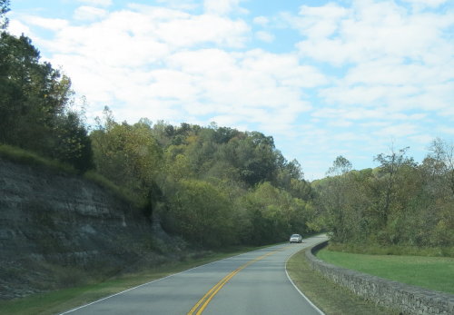
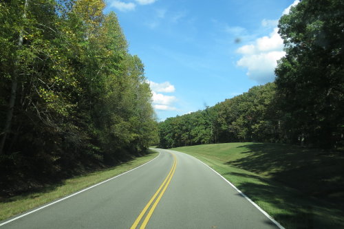
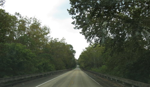
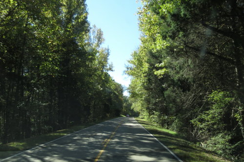
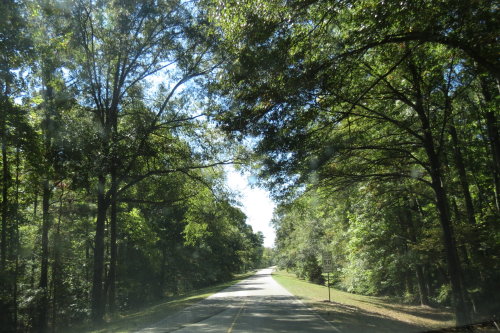
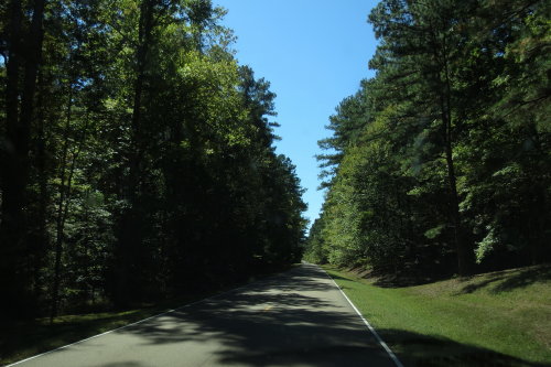
 The
Parkway is a beautiful 444 mile scenic ride. The National Park
Service (NPS) owns a swathe of land approximately 800 feet wide along the entire
length of the parkway. Not knowing this limited park ownership, we initially found it interesting that the land near the parkway
was being farmed.
The
Parkway is a beautiful 444 mile scenic ride. The National Park
Service (NPS) owns a swathe of land approximately 800 feet wide along the entire
length of the parkway. Not knowing this limited park ownership, we initially found it interesting that the land near the parkway
was being farmed.
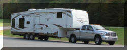
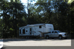
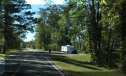
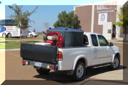
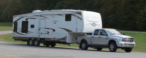
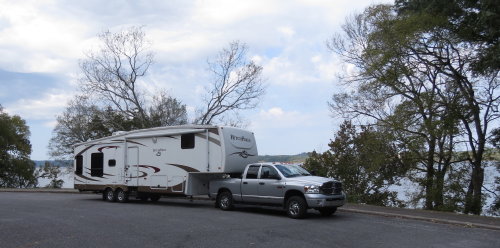
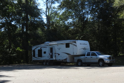
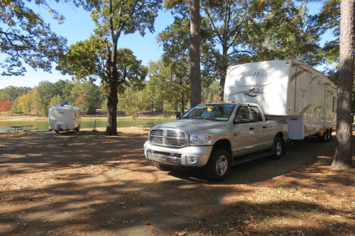
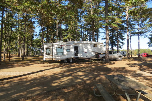
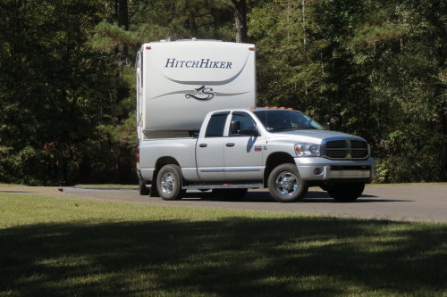
The following photographs are organized as we viewed the "Points of Interest"
- not necessarily the order they appeared on the map. We often parked our
Hitchhiker for the night(s) and used the truck to explore the nearby area.
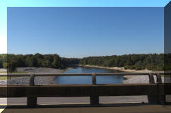
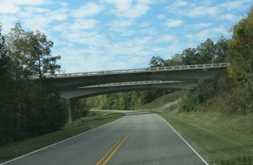
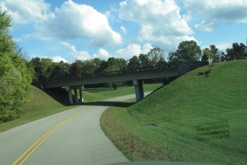
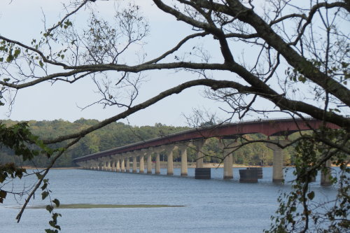
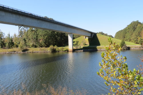
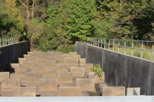
DOUBLE ARCH BRIDGE . . .
This is the nation's first arch bridge constructed with segments of concrete,
it spans 1,648 feet. The bridge's arches are designed to support the deck
without evenly spaced spandrel columns, resulting in an unencumbered appearance.
The bridge won the Presidential Award for Design Excellence from the National
Endowment for the Arts in 1995.
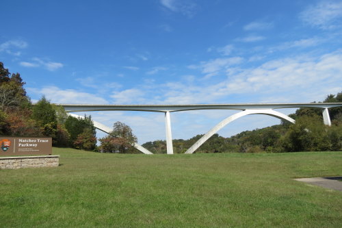
The Double Arch Bridge was worth getting off
the parkway to see it better.
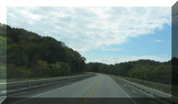
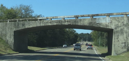
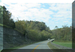
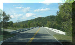
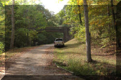
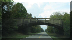
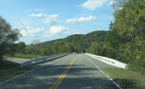
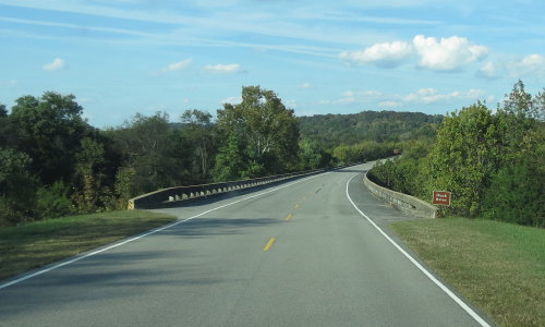
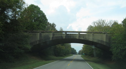
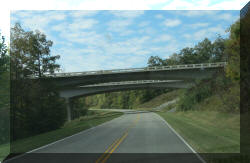 Most
of the bridges over the parkway were not very long and made of concrete.
Most
of the bridges over the parkway were not very long and made of concrete.
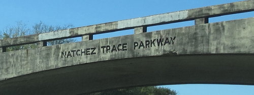
Many were emblazoned with "Natchez Trace Parkway".
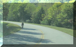
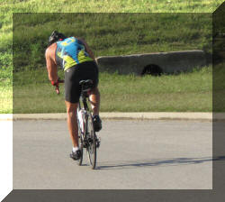
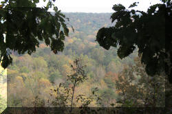
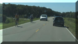
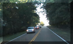
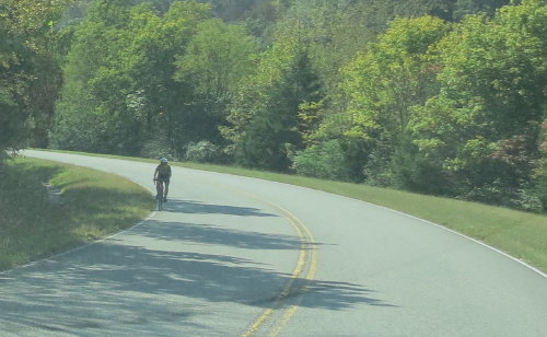
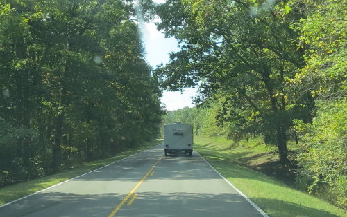
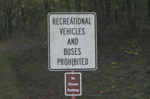
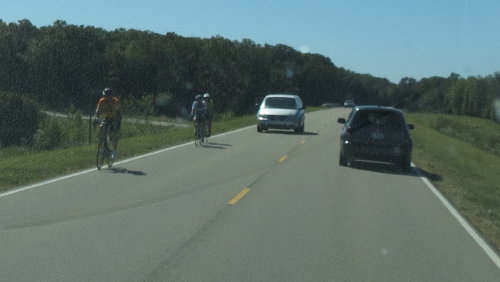
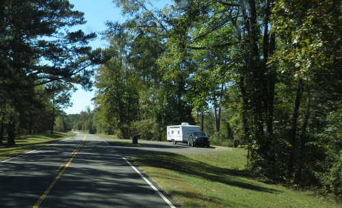
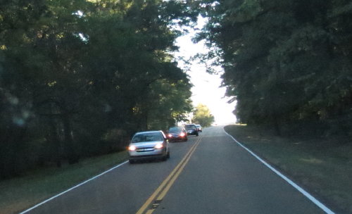
We saw very few bicycles and a few cars on the parkway.
Traveling in the
Fall (September) was a good time.
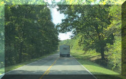
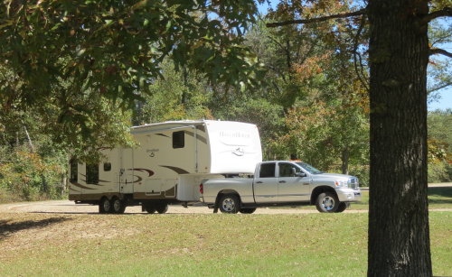
We could count the number of RVs
we saw on the parkway on one hand.
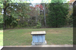
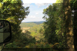
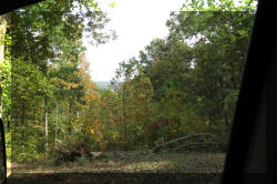
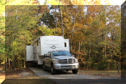
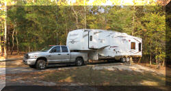
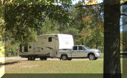
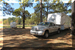
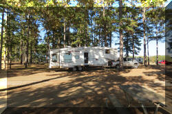
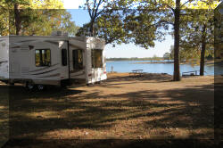
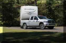
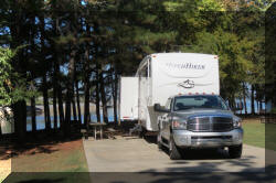
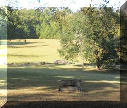
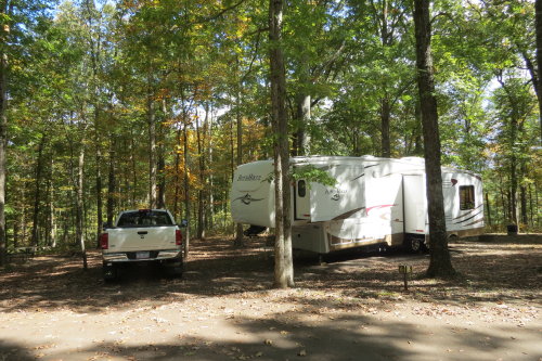
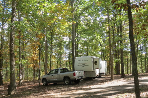
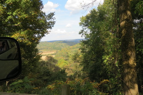
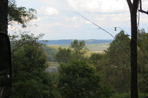
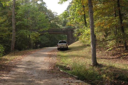
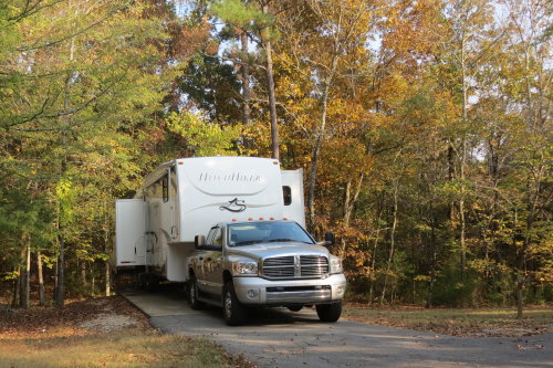
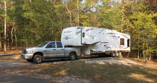
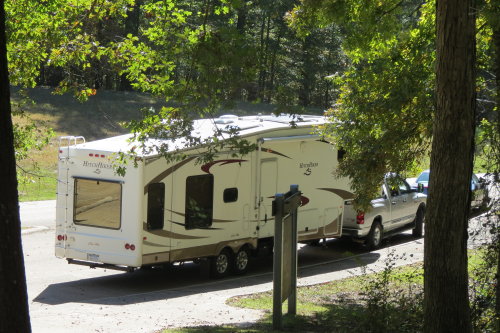
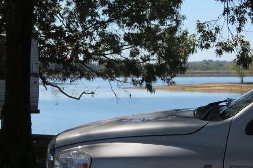
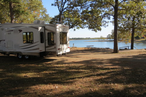
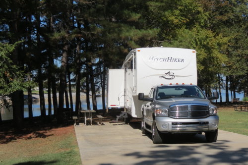
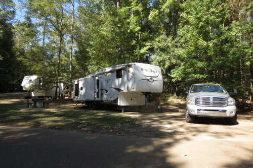
MERIWETHER LEWIS STATE PARK . . . OUR CAMPSITE
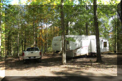
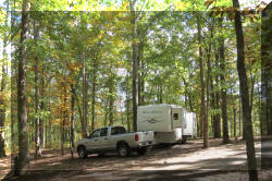 Our
first campsite on the parkway was used as a base camp for four days. Because the
trees provided a lot of shade, the solar panels were mostly 'protected' from the sun.
It was a challenge to manage our 12-volt power. (We made a decision when packing
for the trip NOT to load the generator . . . OOPS. Maybe we should have the generator
on the 'must have' section of the TAKE WITH list.)
Our
first campsite on the parkway was used as a base camp for four days. Because the
trees provided a lot of shade, the solar panels were mostly 'protected' from the sun.
It was a challenge to manage our 12-volt power. (We made a decision when packing
for the trip NOT to load the generator . . . OOPS. Maybe we should have the generator
on the 'must have' section of the TAKE WITH list.)
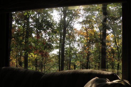
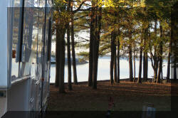
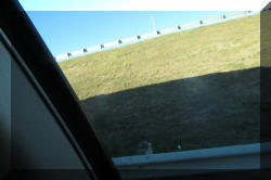
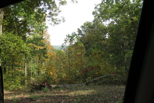
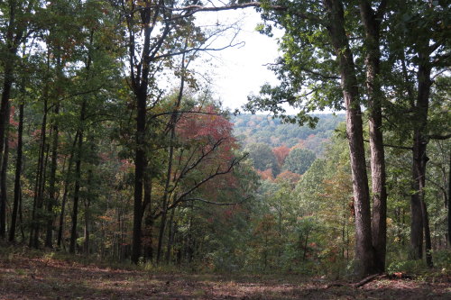
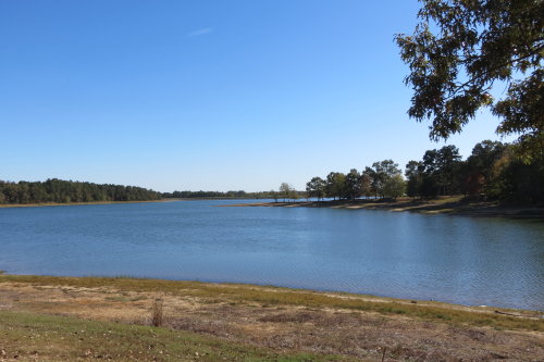
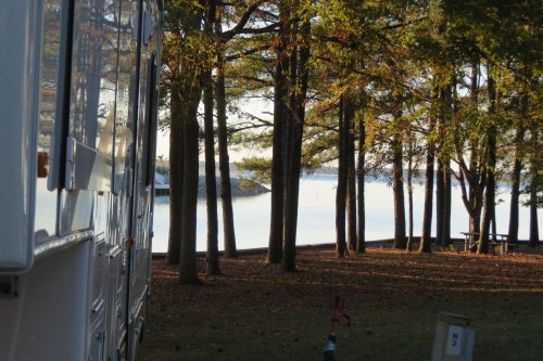
The view out our rear window was beautiful.
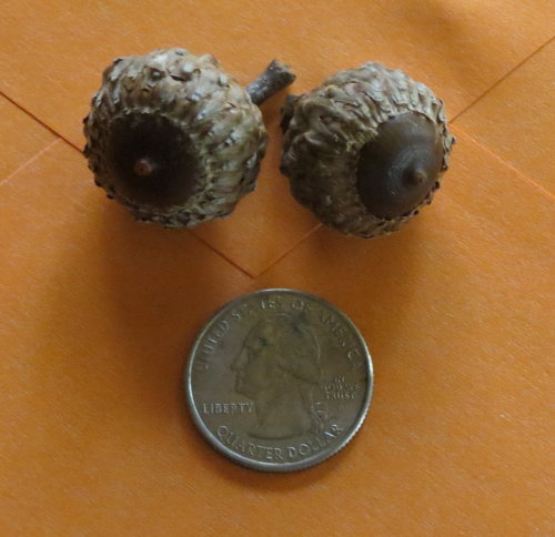
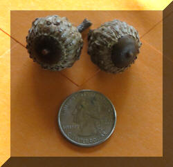 These
large acorns sounded like bombs hitting the fifth wheel roof.
These
large acorns sounded like bombs hitting the fifth wheel roof.
 Watching
our two batteries' condition meter, after four days of partial sun, battery
condition
was low. The afternoon of the last day in camp, we decided to run our slides in and use what little sunlight we had
remaining for a little recharge. So, we entered conservation mode for our last
night in the (this) woods
Watching
our two batteries' condition meter, after four days of partial sun, battery
condition
was low. The afternoon of the last day in camp, we decided to run our slides in and use what little sunlight we had
remaining for a little recharge. So, we entered conservation mode for our last
night in the (this) woods
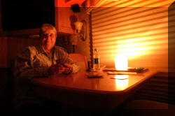
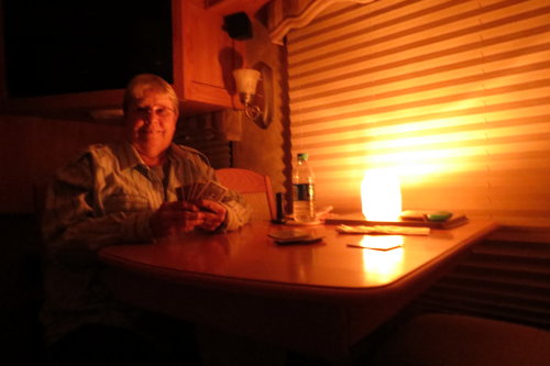
Since we bought our truck camper in 1969, we have used a candle in a large
glass jar when dry camping - most of the time as a nightlight. It is amazing how
much light a single candle produces. The last night, we played cards by candlelight ... how romantic.
We left our campsite to visit the attractions in the area.
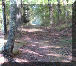
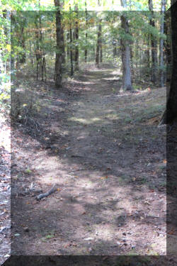
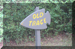
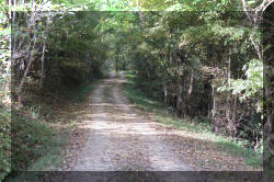
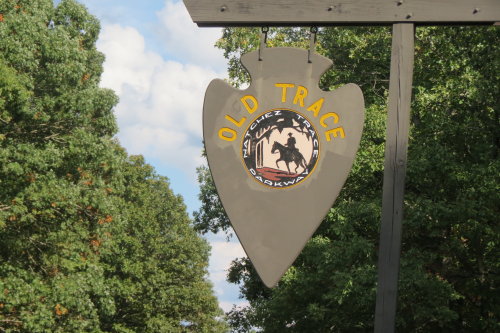
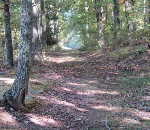
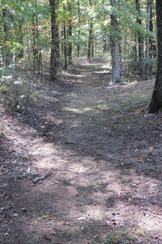
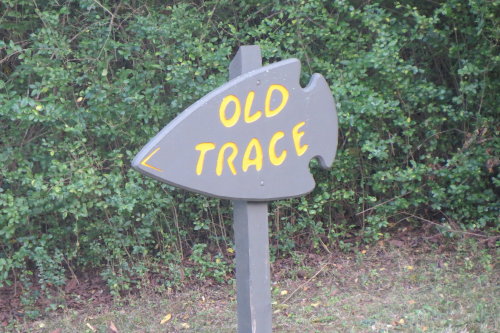
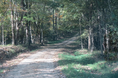
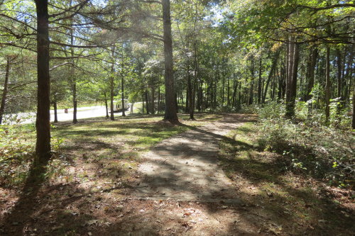
OLD TRACE . . . These 'Old Trace' signs usually only indicated
a view of the old trace.
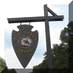
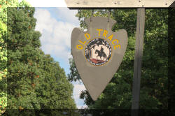 Points
of interest along the parkway were all marked with a sign shaped like an arrow head. A pull-off
and parking area was provided that varied in size depending on the expected
number of visitors. Many of the
pull-offs were small and would have been unavailable to us when towing our 35' fifth
wheel.
Points
of interest along the parkway were all marked with a sign shaped like an arrow head. A pull-off
and parking area was provided that varied in size depending on the expected
number of visitors. Many of the
pull-offs were small and would have been unavailable to us when towing our 35' fifth
wheel.
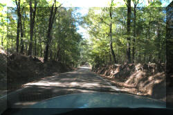
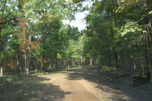
The road was narrow with no shoulder. Fortunately, the
drop-off was small and RV traffic was light.
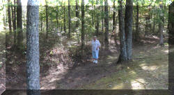
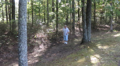
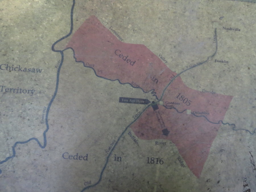
This was our first opportunity to walk on the "Old Trace". Use of this
section of the "Natchez Road", as it was known in 1802 - 1803, required permission
from
the Chickasaw Nation.
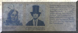
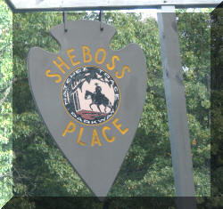
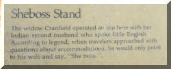
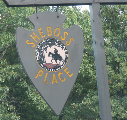
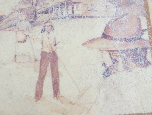
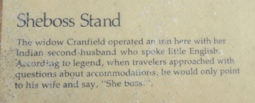
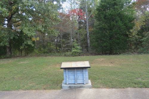
SHEBOSS PLACE . . .
Legend is a full-blooded Chickasaw man, who spoke very little English, married
a white women. Together, they operated this rest stop. When travelers arrived
and began to converse and ask questions, the Chickasaw man would point to his
wife and say "Sheboss".
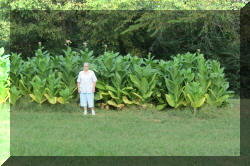
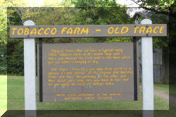
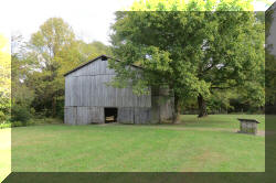
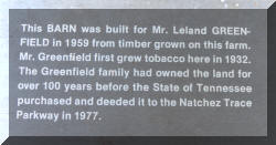
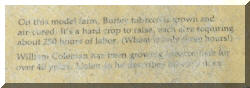
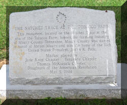
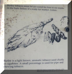
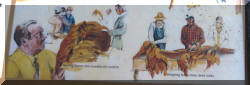
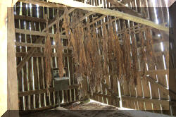
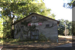
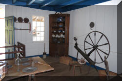
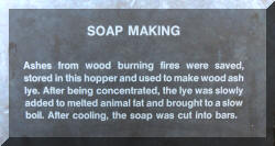
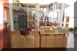
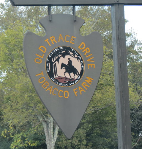
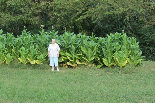
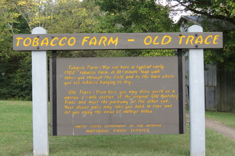
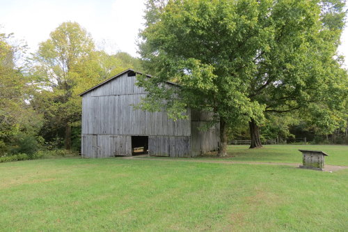
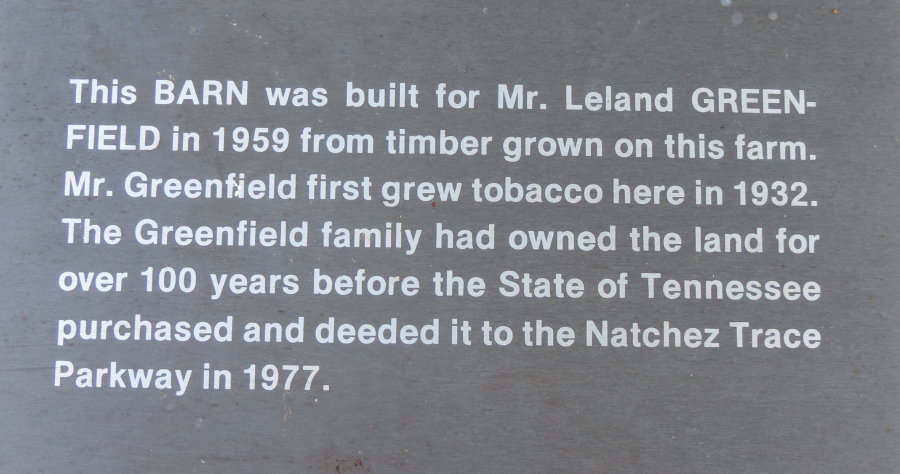
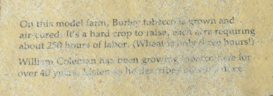
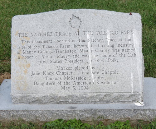
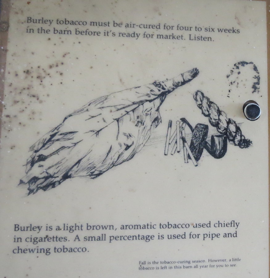
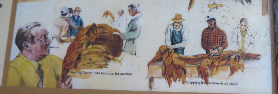
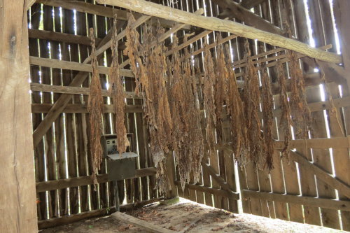
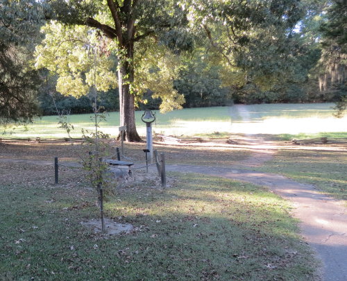
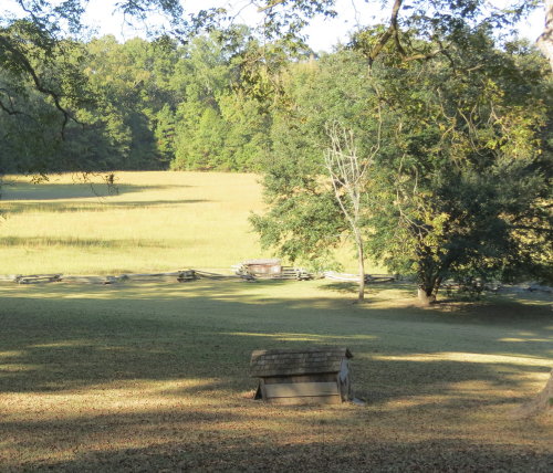
TOBACCO FARM . . .
At this location, an old tobacco barn still has some leaves suspended from
the rafters. Other exhibits explain tobacco growing. Mary Lou stood by a small
planting of tobacco plants. It was interesting to look in the barn.
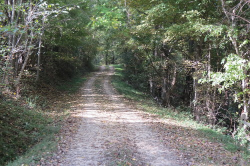
 This
section of road following the Old Trace originated behind the Tobacco Farm and rejoined the
parkway about two miles north. At first fairly rough and rutted, the road
finally becomes a version of old pavement as it slopes gently down the ridge to
join the parkway.
This
section of road following the Old Trace originated behind the Tobacco Farm and rejoined the
parkway about two miles north. At first fairly rough and rutted, the road
finally becomes a version of old pavement as it slopes gently down the ridge to
join the parkway.
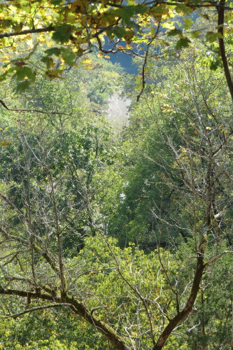
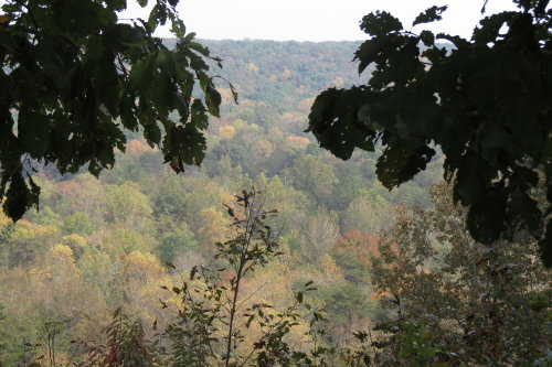
The current parkway could be seen through the trees.
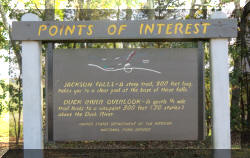
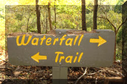
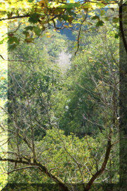
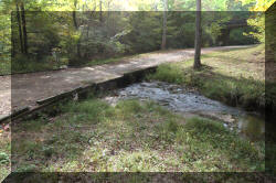
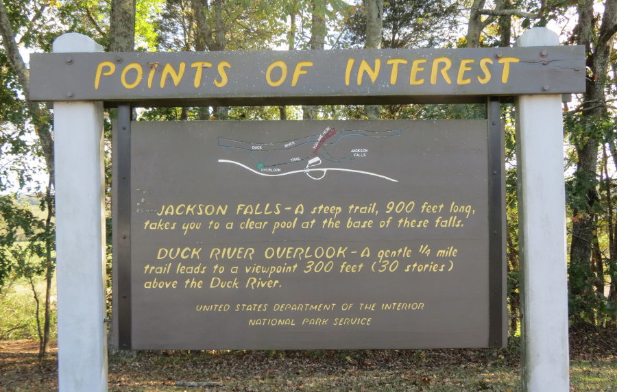
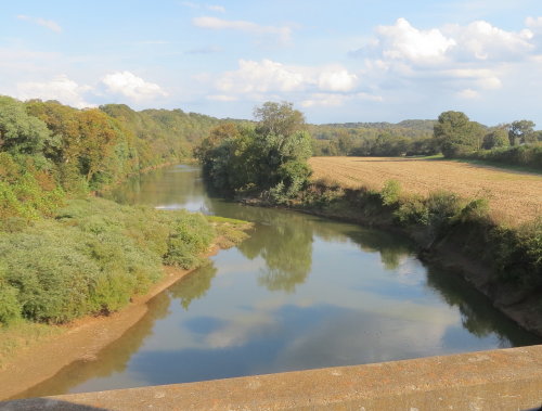
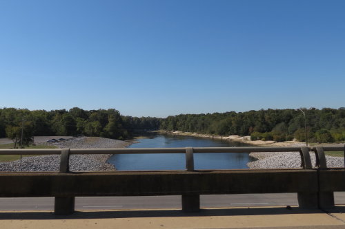
JACKSON FALLS and DUCK RIVER . . .
Because to fully see this waterfall required a 900 foot decent, we chose to
skip it. We understand the hike to Jackson Falls is paved, includes bridges and steps down to the falls. The water from the falls feeds the
Duck River.
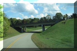
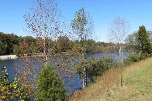
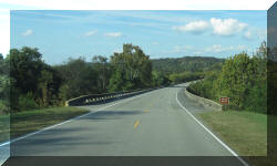 There
were many bridges like this over small but deep valleys, creeks and etc.
There
were many bridges like this over small but deep valleys, creeks and etc.
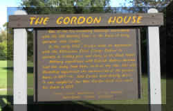
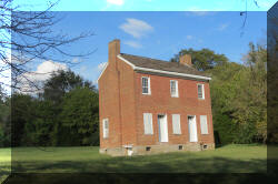
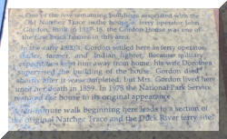
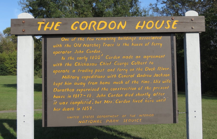
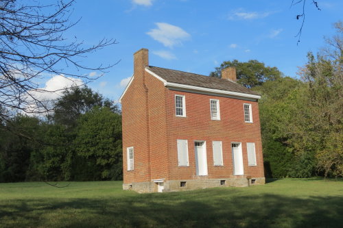
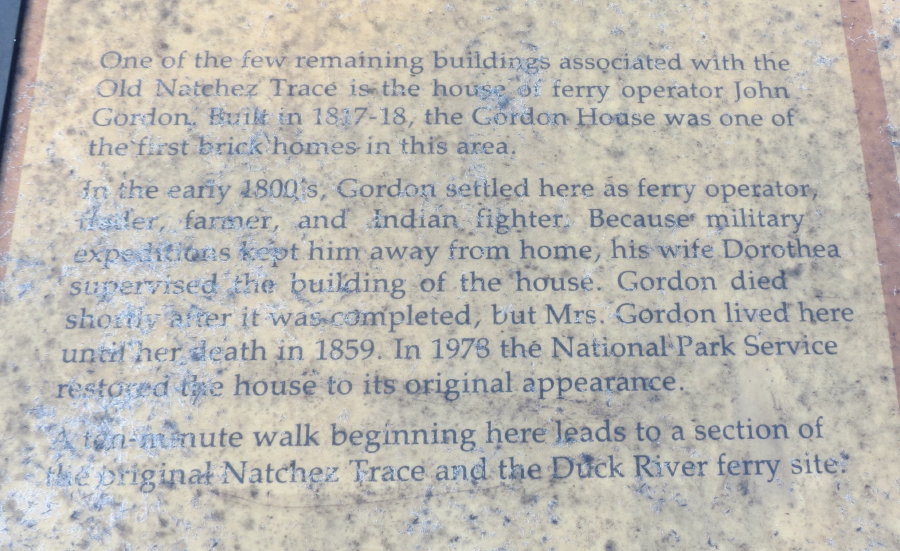
THE GORDON HOUSE . . .
This brick home, built in the early 1800's, is one of the two surviving
structures from the Old Trace. This home and plantation once
encompassed more than 1,500 acres. The couple ran the ferry across the Duck
River. Although the house is closed now, the NPS acquired the
house in 1977, they have plans to make it an interpretive station.
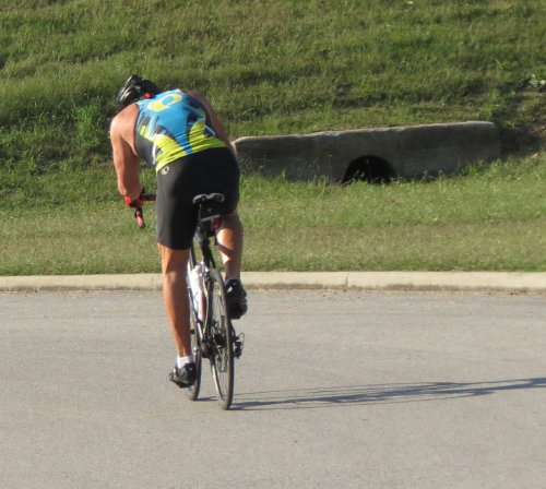
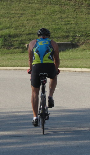
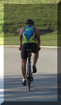 As
we pulled into the parking lot for The Gordon House, this guy was getting
equipped for a bicycle ride on the parkway. He was a gentleman in his 60s ... but
... in terrific condition. During our ten minutes conversation, he told us his
ride that day would be about 23 miles. And, off he went.
As
we pulled into the parking lot for The Gordon House, this guy was getting
equipped for a bicycle ride on the parkway. He was a gentleman in his 60s ... but
... in terrific condition. During our ten minutes conversation, he told us his
ride that day would be about 23 miles. And, off he went.
Beyond the house, a narrow path will take you to a level spot by the water
that was the waiting grounds for the ferry. The ferry operated until a bridge
was built in 1896.
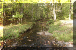
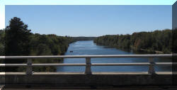
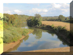 The
Duck River . . .
The
Duck River . . .
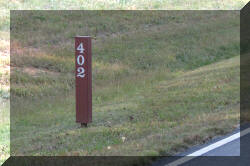
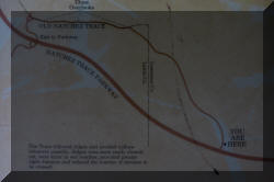
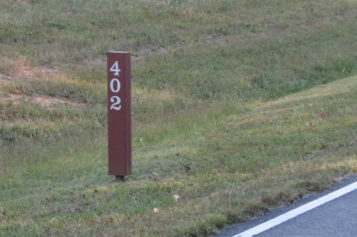
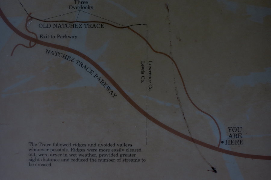
Mile marker posts helped you follow
the Natchez Trace Parkway guide map.
The numbering started from the
southern end of the Trace.
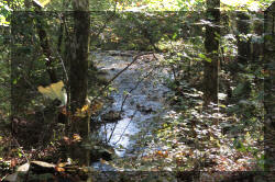
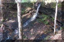
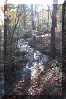
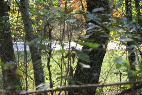
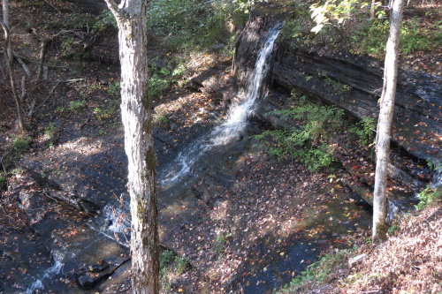
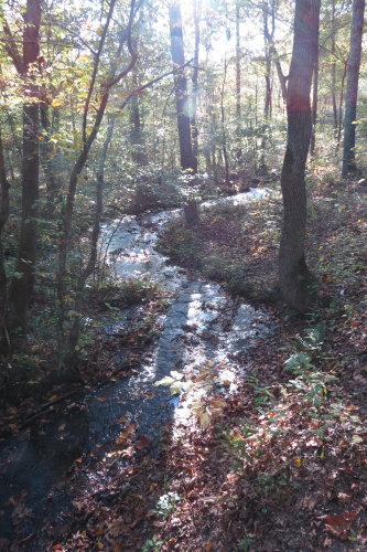
FALL HOLLOW . . .
It takes less then five minutes to follow the short, paved trail to a viewing
platform. The waterfall has a twenty foot drop. You can continue along the less
developed path to view more waterfalls.
Top of Page Our
list of favorites
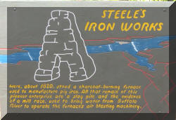
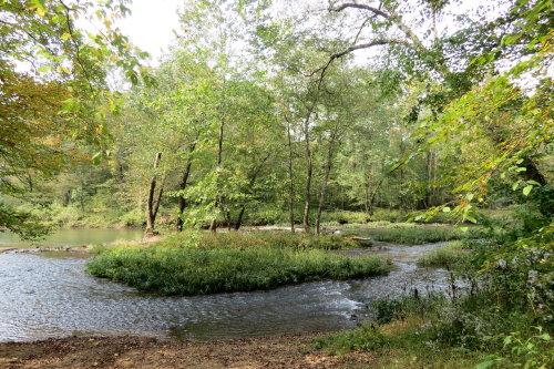
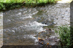
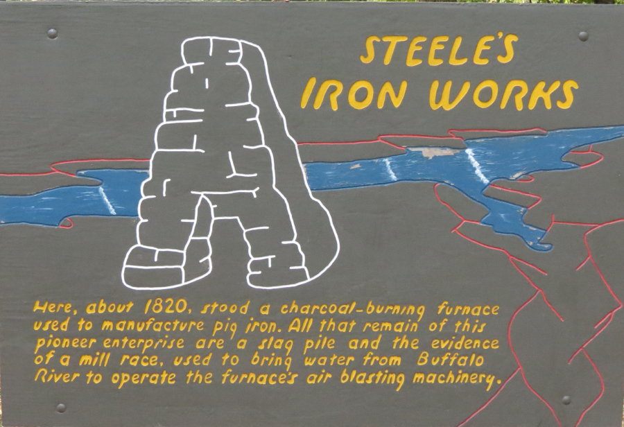
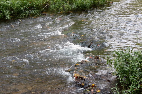
STEELES IRON WORKS . . .
A short trail along the river takes you to an old millrace, a river channel,
whose current fed Steele's Iron works. It produced primitive pig iron in the early
1800's.
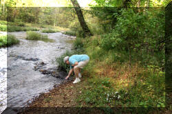
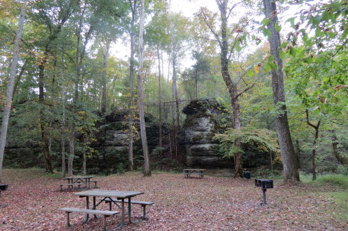
In front of the parking area is a lovely park setting. There are picnic
tables, an old-fashioned swimming hole, and an open grassy field. Perfect
place for a picnic, rest or swim. Mary Lou checked out the water, it was clear and
cool.
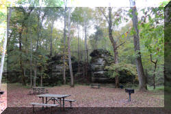
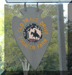
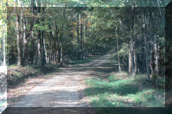
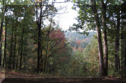
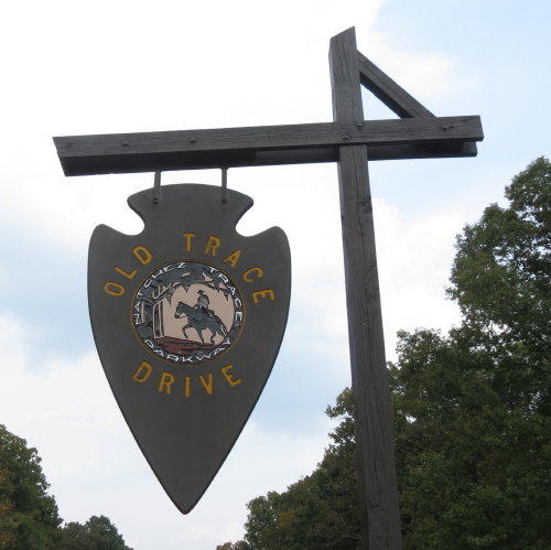
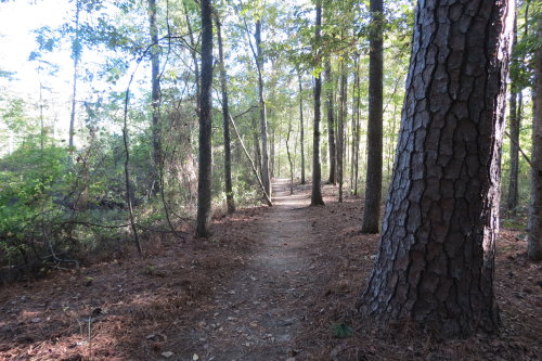
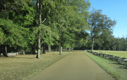
OLD TRACE DRIVE . . .
The original Trace was always a work in progress. The three sections of the
original road here, show how the route was relocated to avoid mud holes.
The drive was beautiful.
This 2.5 mile road follows the original Trace route and was one-way traffic
heading north.
 Sometimes
you have to park and walk back for
Sometimes
you have to park and walk back for
the photographs you
want to make.
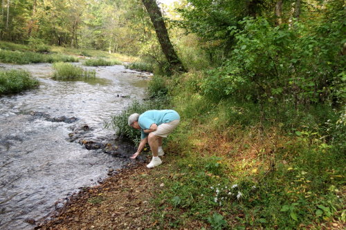
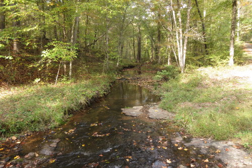
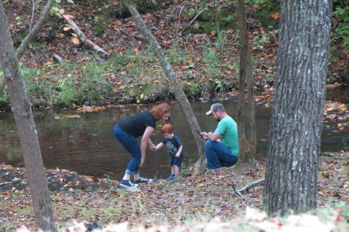
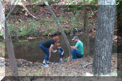 A flowing creek attracted families.
Top of Page
Our list of favorites
BACK TO THE PARKWAY . . .
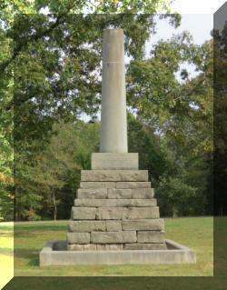
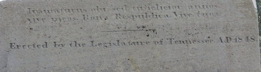
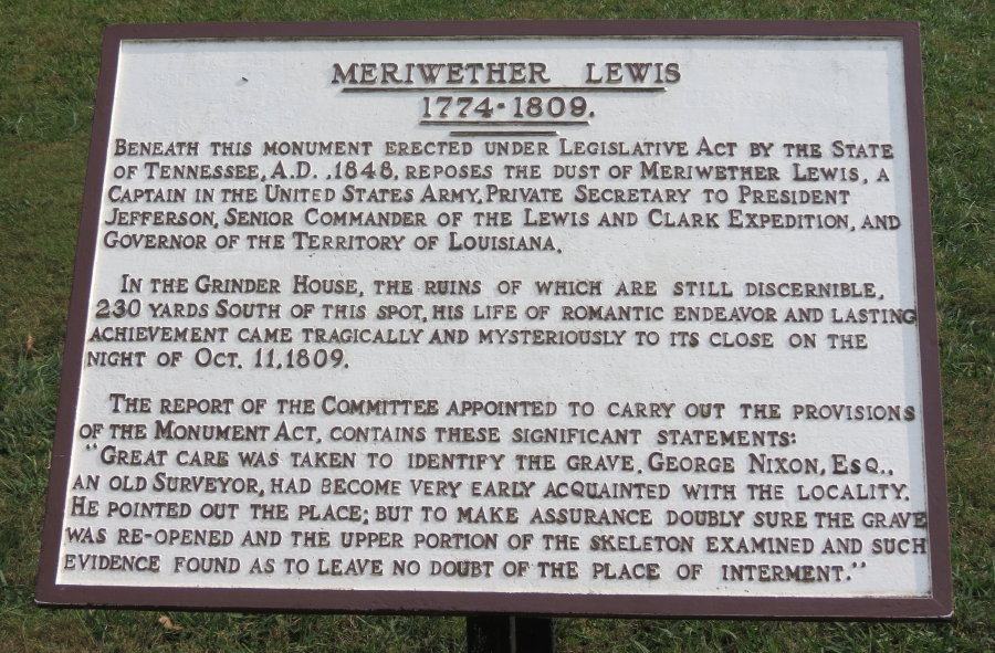
MERIWETHER LEWIS STATE PARK . . .
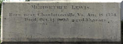
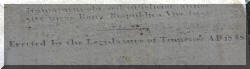
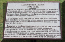
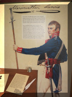
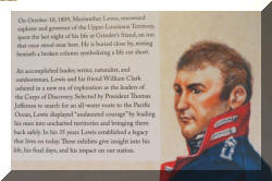
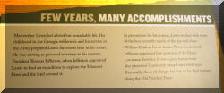
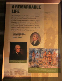
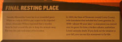
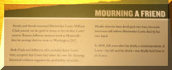
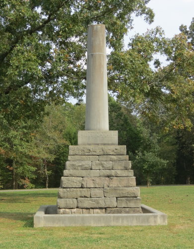
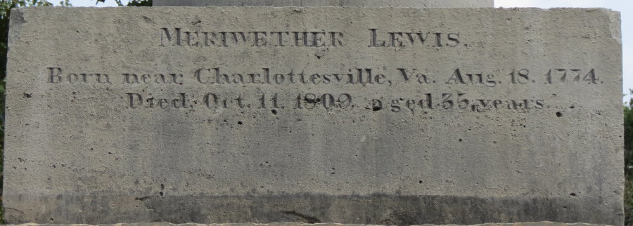
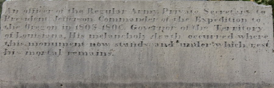
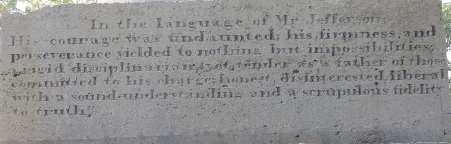
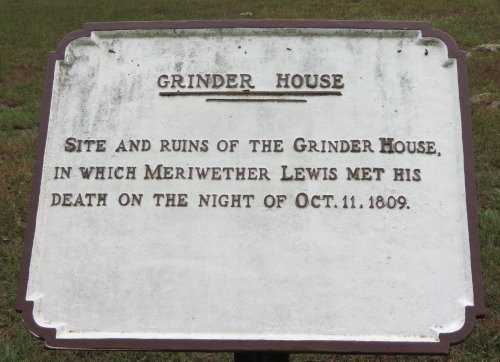
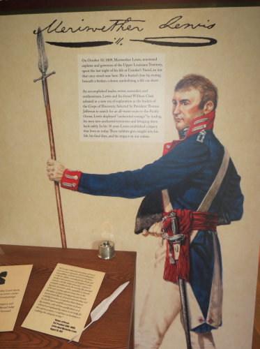
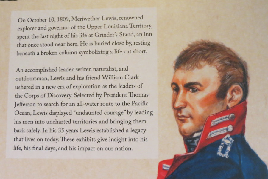
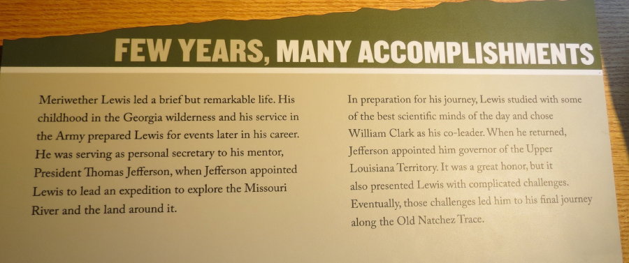
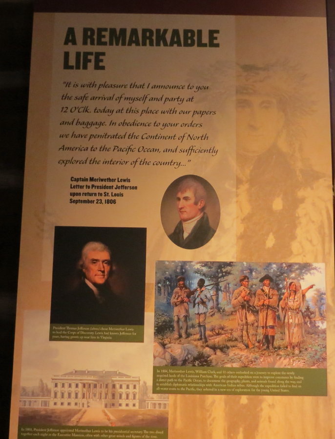
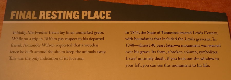
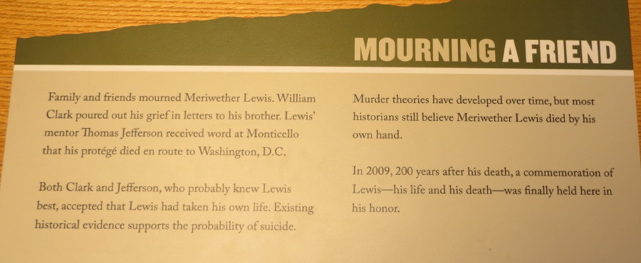
The primary attraction here is the grave of Meriwether Lewis, whose death
remains a mystery. He was either shot to death or committed suicide on the night
of October 19, 1809 at Grinder's Stand. It was the first inn north of the Chickasaw
nation, operated by whites. In 1848, the State of Tennessee erected this monument
over his gravesite - a broken shaft symbolizing his untimely death.
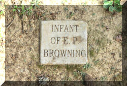
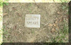
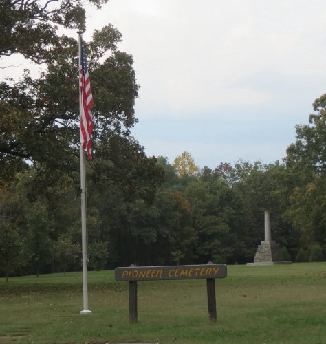
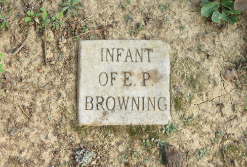
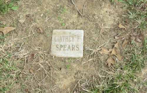
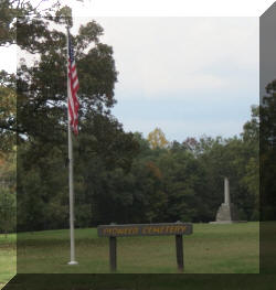 The
Pioneer Cemetery was an interesting place. It included the monument and remains
of Meriwether and many small (8" X 8") headstones.
The
Pioneer Cemetery was an interesting place. It included the monument and remains
of Meriwether and many small (8" X 8") headstones.
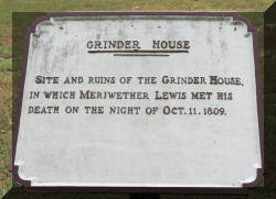
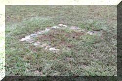
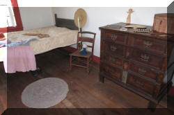
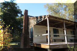
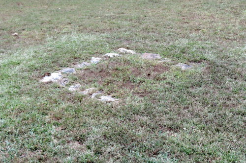
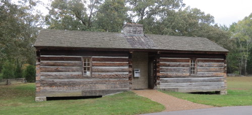
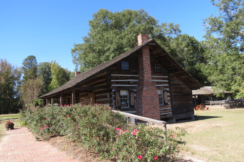
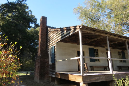
Grinder house foundation . . .
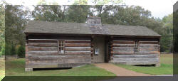 A
log cabin suggesting the "Inn" housed historical information about the life of Meriwether Lewis. We
had an interesting conversation with the rangers on duty. They discussed the use
of the parkway, visitor volume and traffic patterns near cities.
A
log cabin suggesting the "Inn" housed historical information about the life of Meriwether Lewis. We
had an interesting conversation with the rangers on duty. They discussed the use
of the parkway, visitor volume and traffic patterns near cities.
Top of Page
Our list of favorites
NOTE: Collinwood, TN is a great exit for fuel and lunch - very close to the
Trace and the price was good.
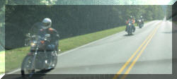
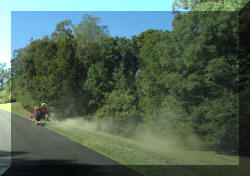
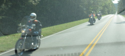
Motorcycles
on the parkway . . .
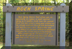
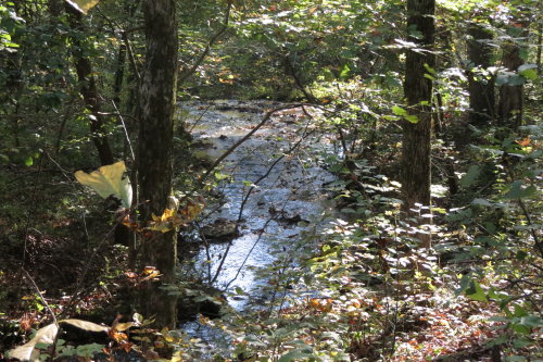
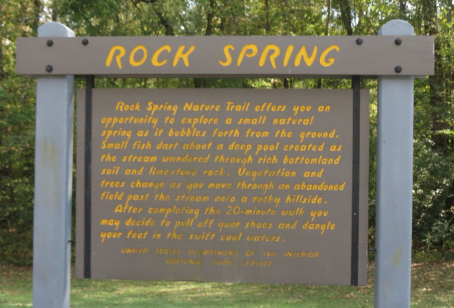
ROCK SPRING . . .
A self-guided trail along Colbert Creek - we didn't walk it.
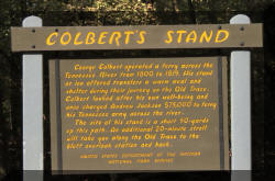
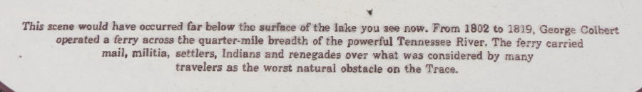
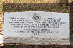
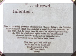
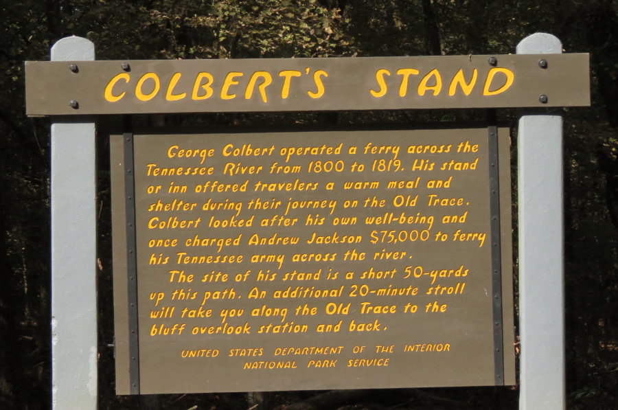
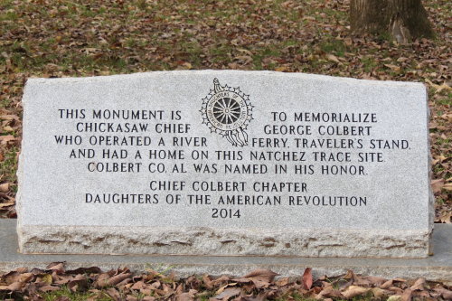
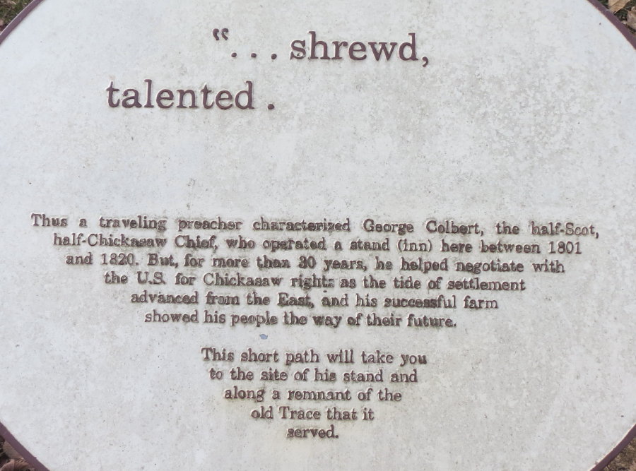
COLBERT'S STAND . . .
Chickasaw George Colbert operated a stand and ferry across the Tennessee
River in the early 1800's. The ferry station is submerged, the ranger station is
closed, but here are amenities of restrooms, picnic area, fishing, boat launches
and a bike-only campground.
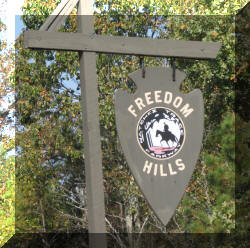
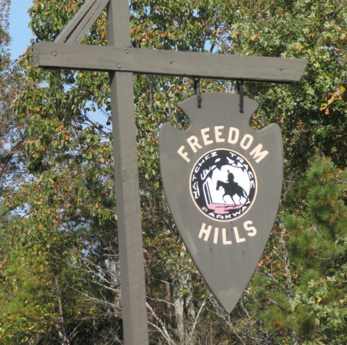
FREEDOM HILLS . . . Alabama's highest point.
A paved trail that takes ten minutes to walk at a moderate pace heads up to
Alabama's highest point on the Parkway, 800 feet above sea level. We chose not
to walk it.
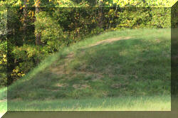
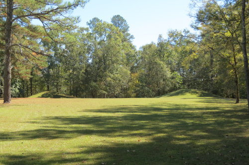
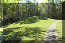
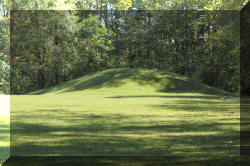
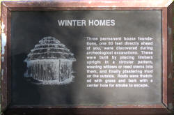
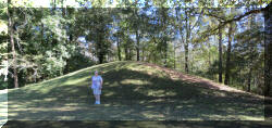
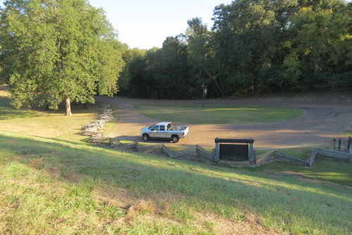
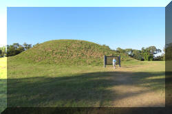
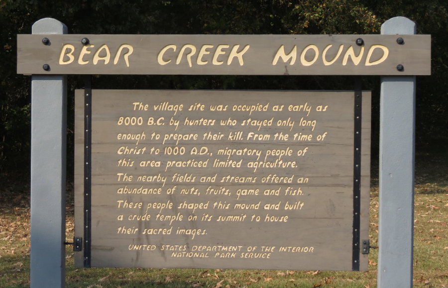
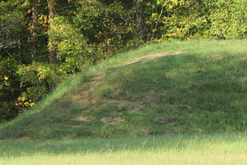
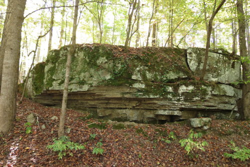
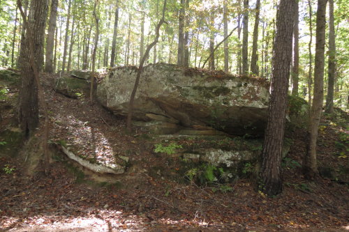
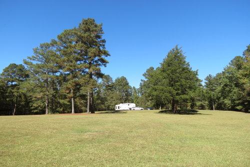
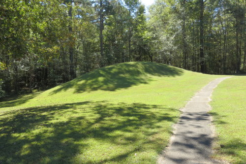
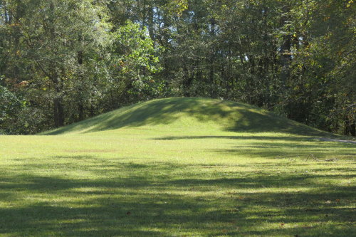
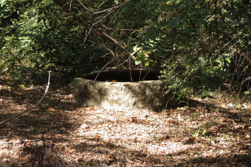
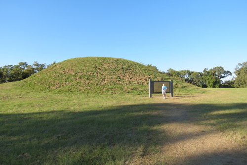
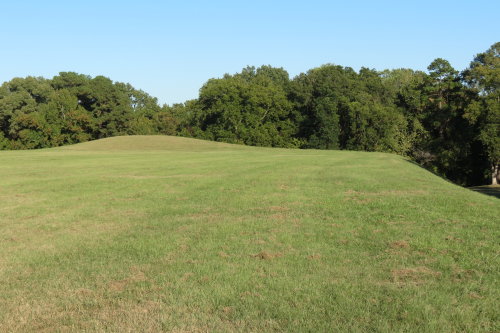
BEAR CREEK MOUND . . .
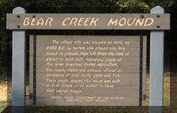
The Bear Creek Mound is the oldest prehistoric site on the Trace. Migratory
hunters used it as a temporary station, as early as BCE (Before Common Era) 7000, or roughly 9,000
years ago. The earthwork was built in several stages for ceremonies or leader
residents. When acquired by the National Park Service, the mound had been
greatly reduced in height. Following excavation in 1965, the mound was restored
to its original estimated dimensions of about 8 feet high by 85 feet across the
base.
Top of Page
Our list of favorites
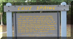
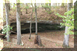
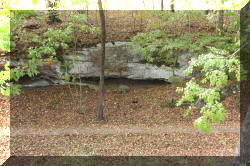
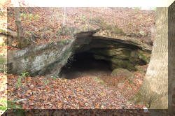
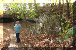
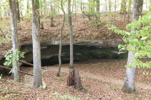
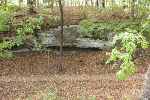
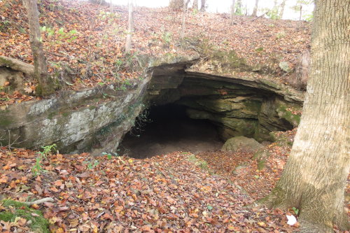
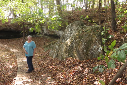
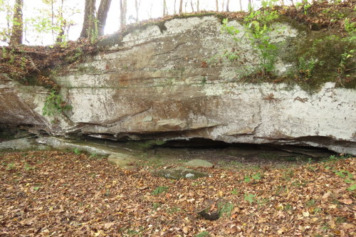
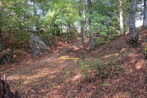
CAVE SPRING . . .
Hunters who used the Bear Creek Mound site probably used this water source. A
collapsed underground limestone cave formed this cave. There was no water during
the time we visited. The NPS warns against drinking the water or entering the
cave for safety reasons.
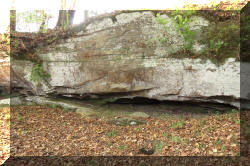
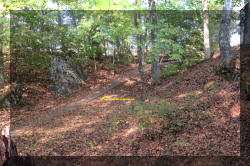
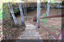
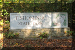
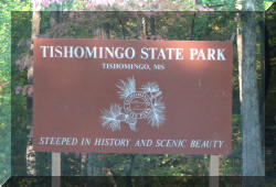
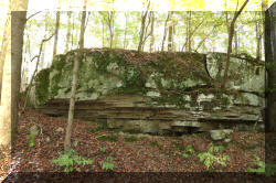
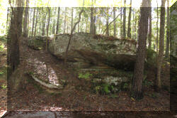
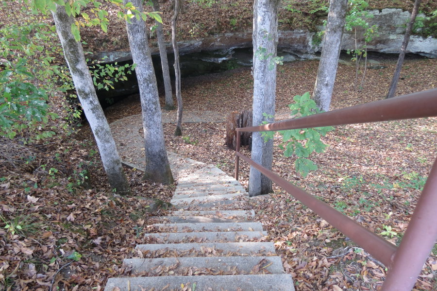
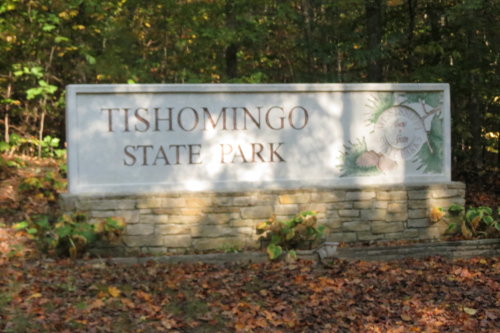
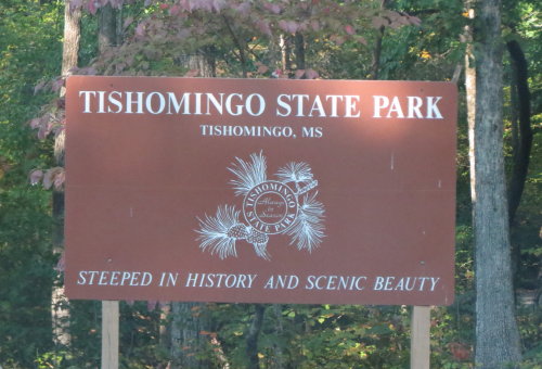
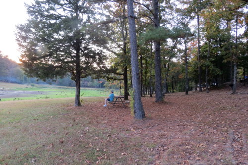
TISHOMINGO STATE PARK . . .
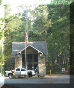
Along the road into the state park . . .
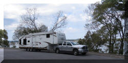
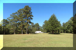
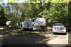
 The
site was easy to back into. The rear stabilizing jacks did not reach the ground
as the rear of the HitchHiker was at least three feet off the
ground,
The
site was easy to back into. The rear stabilizing jacks did not reach the ground
as the rear of the HitchHiker was at least three feet off the
ground,

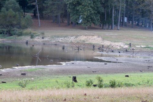
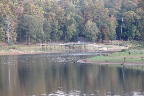
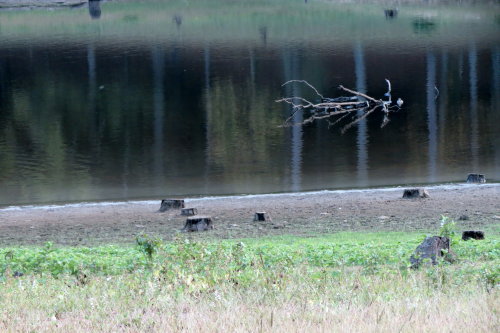
Mary Lou sat on the bench watching
the lake level go lower.
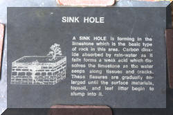
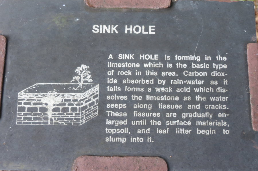
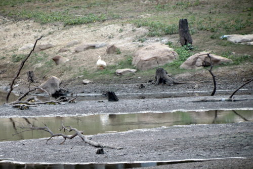
Well, not really watch the level go down ... but ... the water was draining
out of the lake. Haynes Lake, a 45 acre lake, did have a 'hole' in it permitting
water to drain out. The state tried to fill the hole twice. Being unsuccessful
twice, they decided to let the water drain out of the limestone bottom.
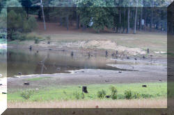
Not the
best photo 'stitch' job . . . but, you get an idea of what the lake looked like.
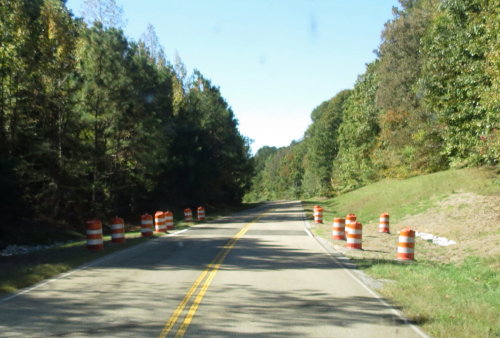
 Orange
barrels were seen even on the parkway.
Orange
barrels were seen even on the parkway.
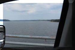
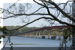
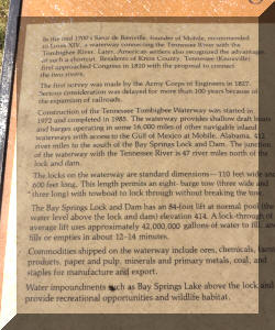
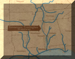
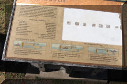
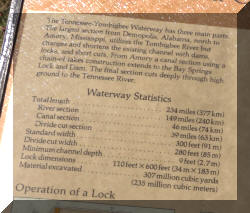
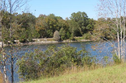
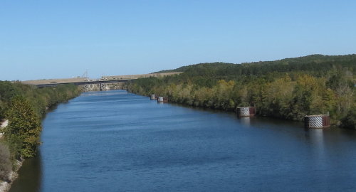
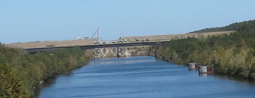
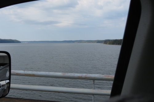
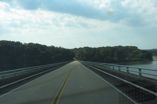
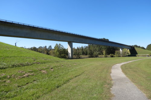
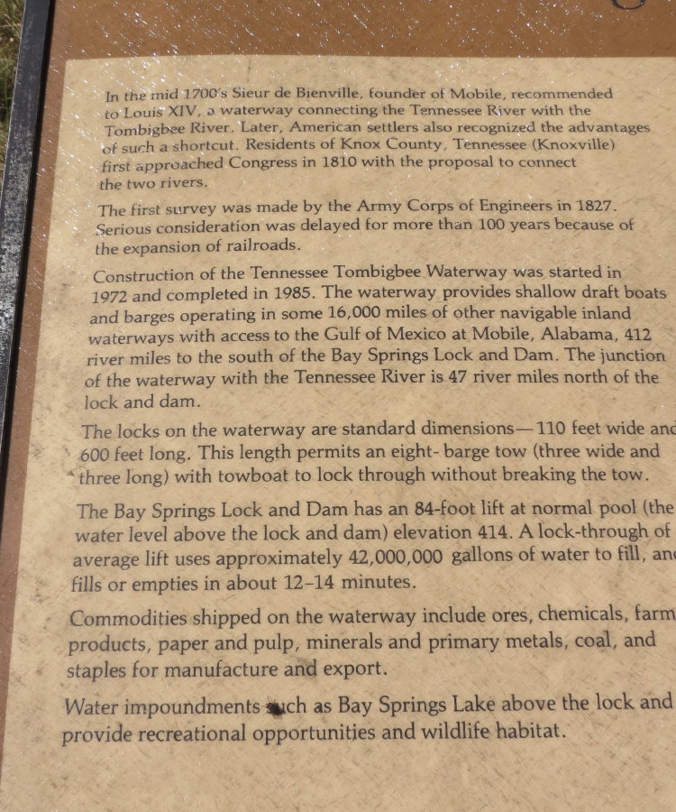
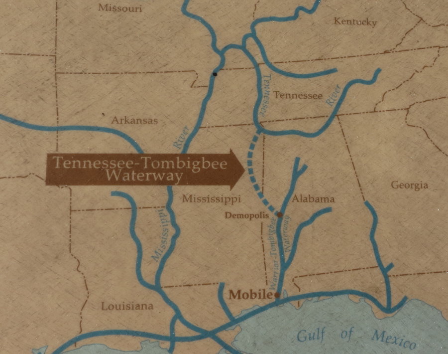
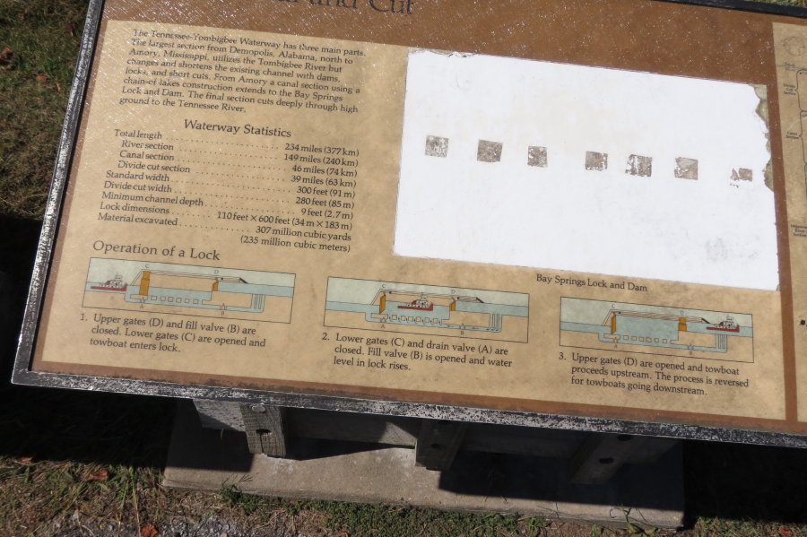
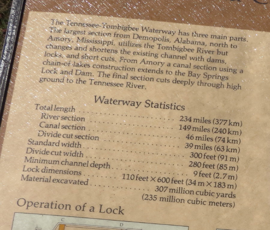
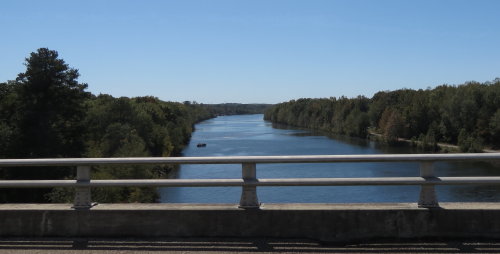
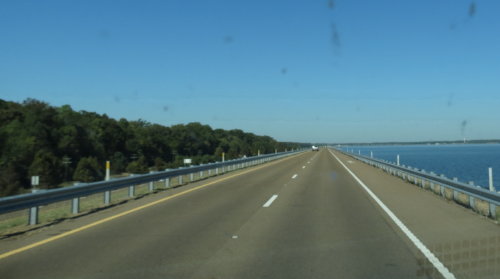
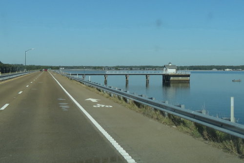
TENNESSEE-TOMBIGBEE WATERWAY . . .
This waterway is a 234 mile long, 300 foot wide by 9 feet deep
transportation artery. It provides 459 miles of navigable water between the Gulf of
Mexico and Tennessee River. The most popular commodities shipped by barge are
forest products, petroleum by-products, crushed rock and grains.
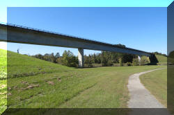
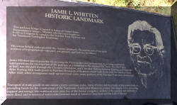
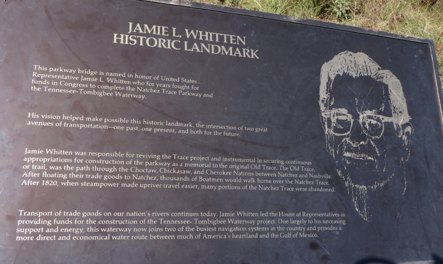
Jamie L. Witten Bridge . . . the center panel was in a park across the road.
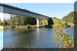
This was a pleasant stop. We didn't see any waterway traffic, unfortunately.

 Fire
ants were abundant on the trail from the parking lot to the waterway.
Fire
ants were abundant on the trail from the parking lot to the waterway.
From the bridge, we could see one of the locks.
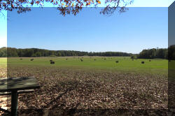
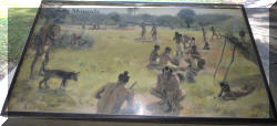
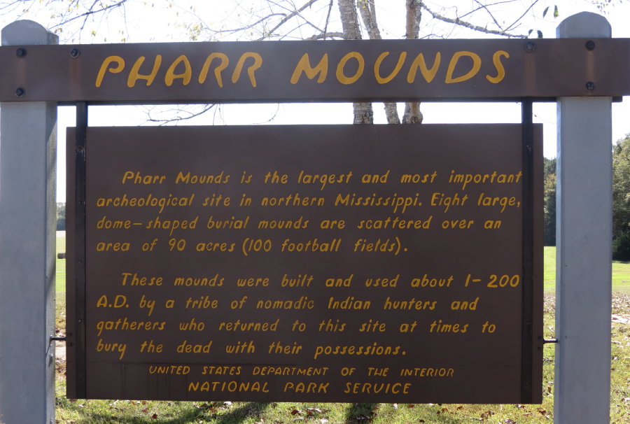
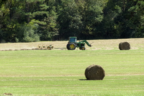
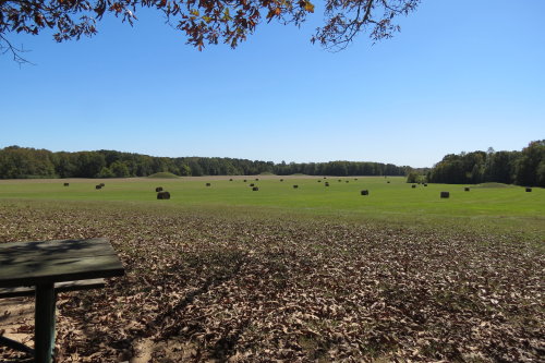
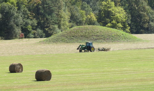
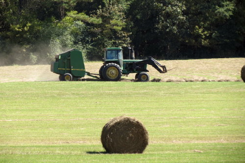
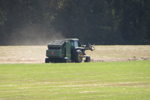
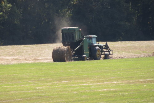
PHARR MOUNDS . . . It was at this location that the cooperation of the Federal government and
the local farmers was clearly demonstrated.
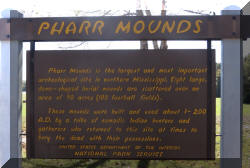
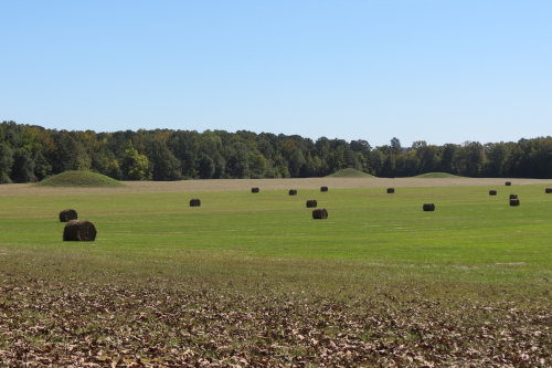
The eight mounds visible from across a field were build between CE (Common
Era) 1 and 200.
These mounds range in
height from 2 feet to 18 feet. The mounds are distributed over an area of about 90 acres.
The NPS allows the fields to be harvested for hay.
The NPS excavated four of the mounds in 1966. The mounds hold various
internal features, including fire pits and low, clay platforms. Cremated and
unburned human remains were found in and near these feature, as were various
ceremonial artifacts.
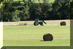
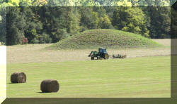


It was here that us 'city folk' were entertained by the baling
process.
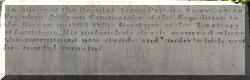
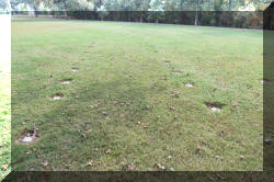
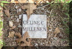
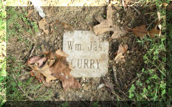
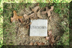
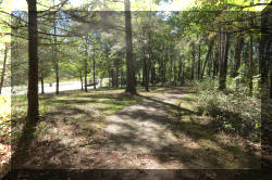
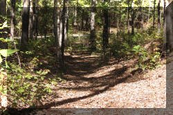
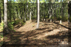
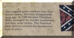
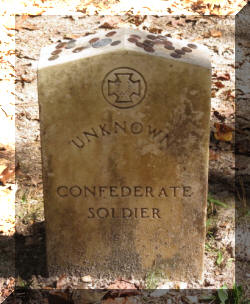
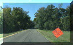
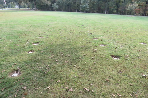
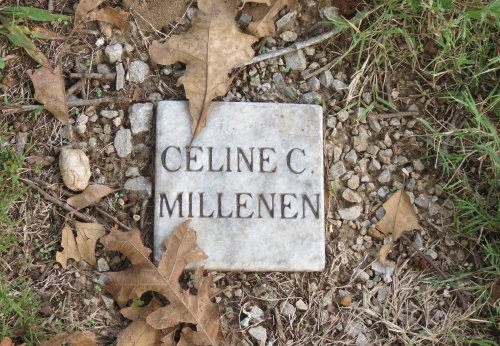
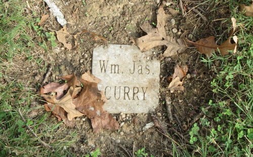
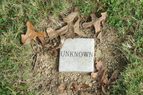
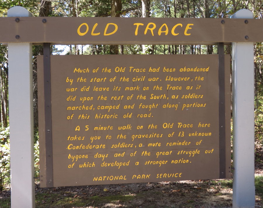
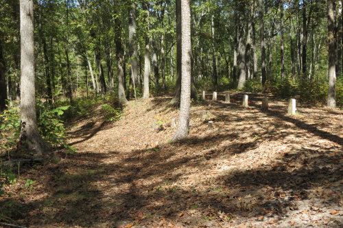
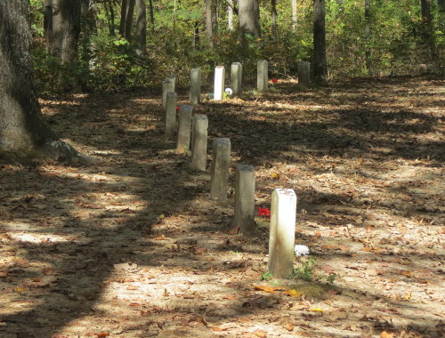
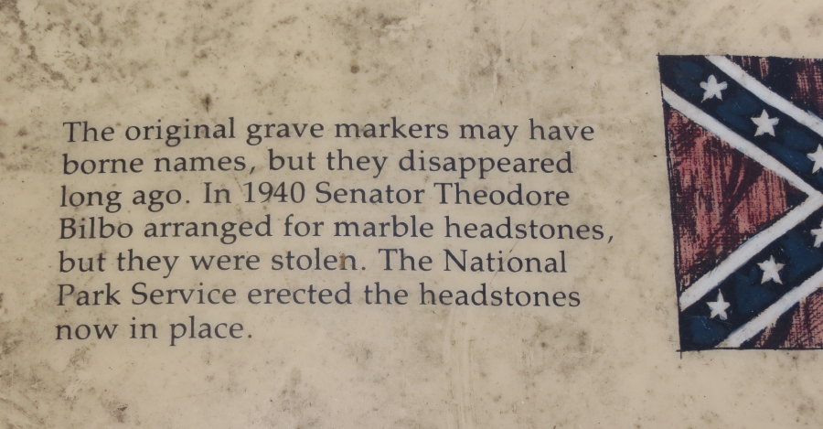
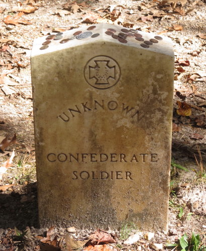
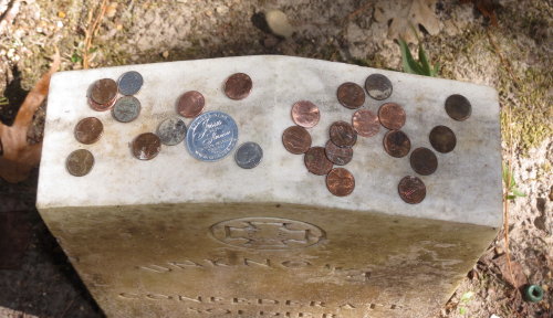
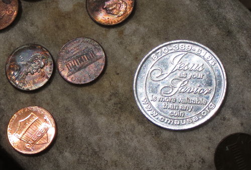
OLD TRACE . . . CONFEDERATE GRAVES
A five-minute walk on this section of the Old Trace takes you to the graves
of 13 unknown Confederate soldiers, whose faintly etched tombstones line a ridge
beside the once busy route. It
is unclear how the men died, but their graves speak to a chapter of Trace's
history.
I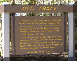
.
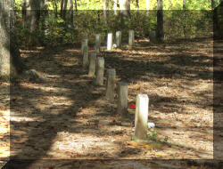
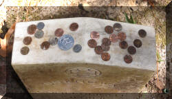

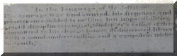
Here is a brief summary of the tradition of leaving coins on a soldier's headstone
and the meanings of different denominations of coins. "A friend, or
an acquaintance that visits may only leave a penny. A nickel would be left by
someone that may have been through boot camp, or trained with them. Someone that served in another platoon in the same company may leave a dime. A
quarter would be left by someone that served in the same outfit, or was with the
soldier when they died."
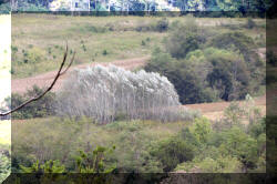
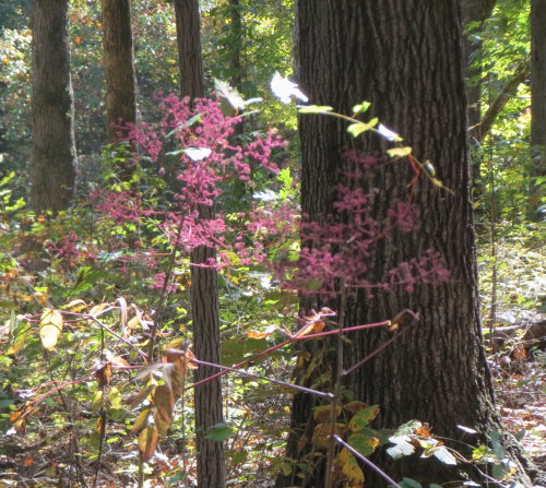
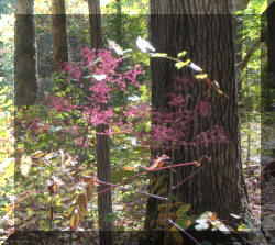 These
pink flowers were plentiful along this section of the Trace. When we showed the
photograph to the employees in a near-by visitor's center, they could not
identify them. They said they would send a ranger out to look at them.
These
pink flowers were plentiful along this section of the Trace. When we showed the
photograph to the employees in a near-by visitor's center, they could not
identify them. They said they would send a ranger out to look at them.
Top of Page
Our list of favorites
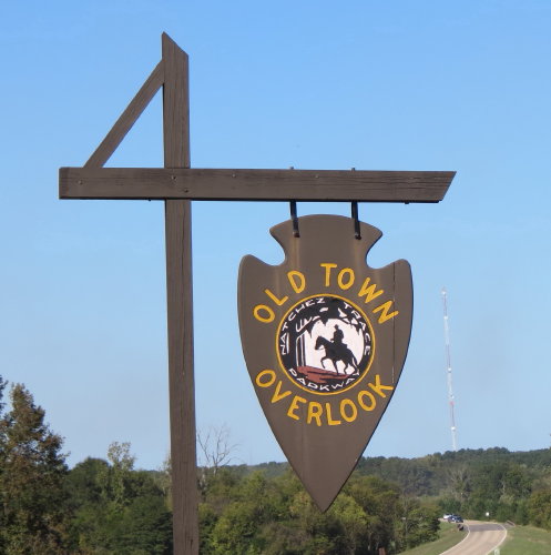
OLD TOWN OVERLOOK . . .
The "Old Town" refers to a Chickasaw village that was here near the "Old Town
Creek". From this parking lot you can hike two miles to the Chickasaw Village or
the near-by Parkway Visitor Center.
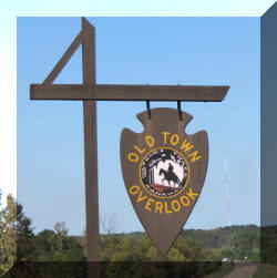
We pulled in here hoping to find a spot for lunch. We did.
Even with the
green water, it was an attractive place.
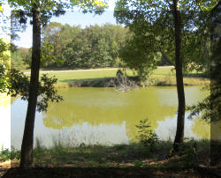
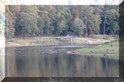
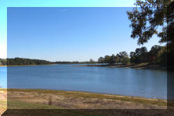
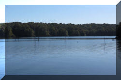
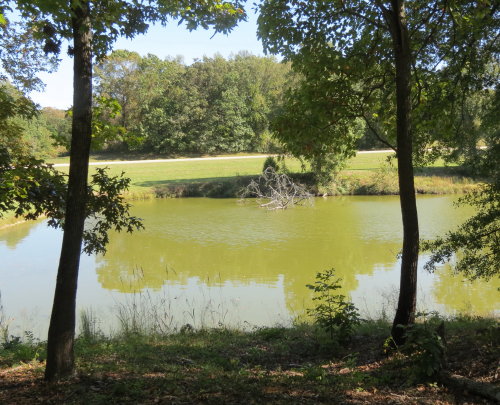
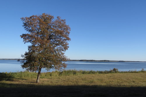
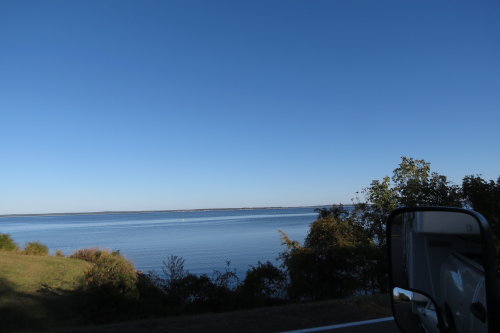
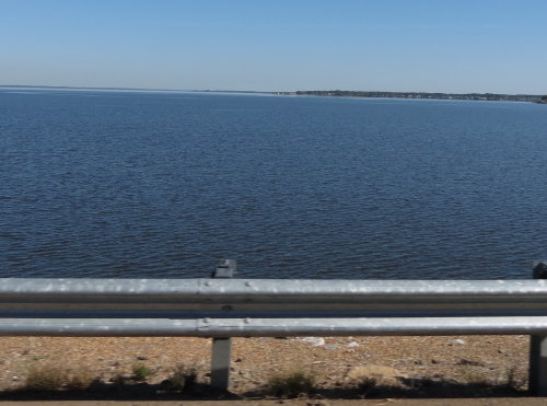
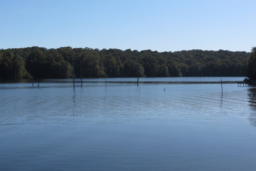
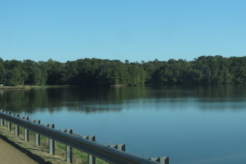
TRACE STATE PARK . . .
This state park is located nine miles from Tupelo, Mississippi. The park
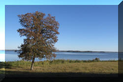
offers a lot of amenities for campers and day visitors. We enjoyed the views of Natchez Lake.

Wow. A traffic jam on the Parkway.
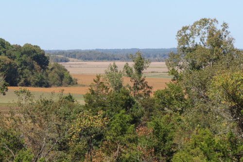
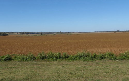
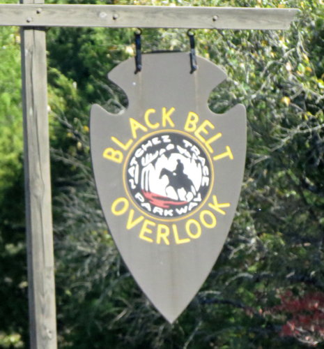
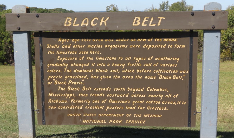
BLACK BELT OVERLOOK . . .
"Black Belt" refers to a stretch of earth that reaches eastward across nearly
all of Alabama, a region know for its rich, black soil excellent for growing
crops, especially cotton.
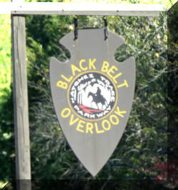
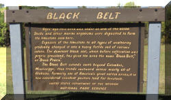
Once at the bottom of the sea, limestone deposits over millions of years
transformed into very fertile soil. At one time, this was a grassland prairie,
now it is pasture land for livestock.
Another RV . . .
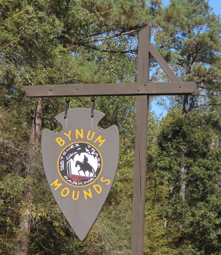
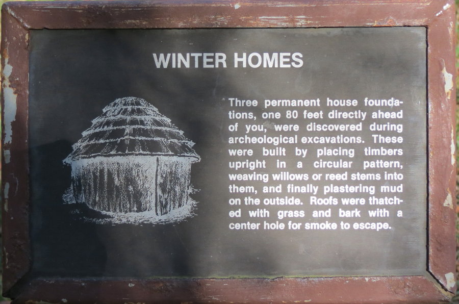
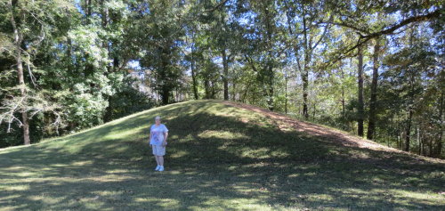
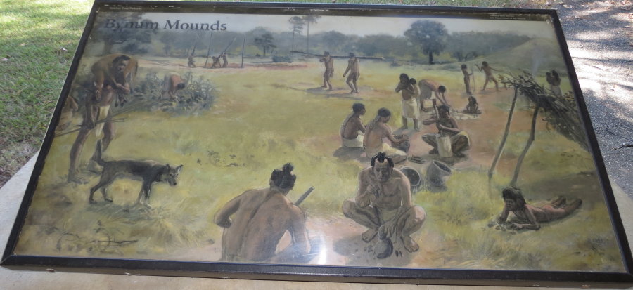
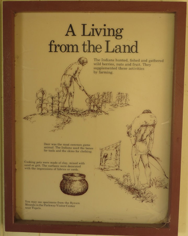
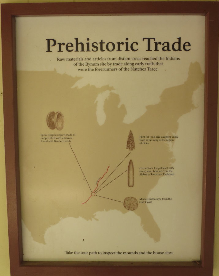
BYNUM MOUNDS . . .
There are six burial mounds and an associated area build between
BCE 100 and CE 100.
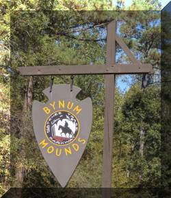
The mounds range in heights from 5 to 14 feet. The NPS excavated five of them
in the later 1940's. Exhibits at the mounds describe the lifestyles of the
people.
More of the 'black belt' fields.
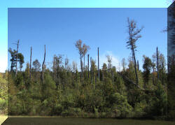
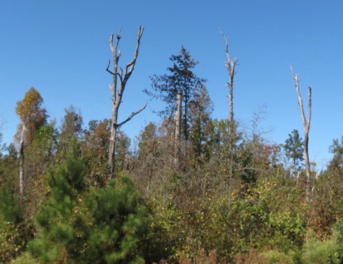
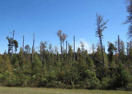
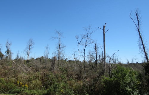
2011 TORNADO DAMAGE . .
Tornadoes and violent storms struck the Natchez Trace Parkway on April 27,
2011 destroying trees for over 20 miles along the Trace - starting at milepost 200.
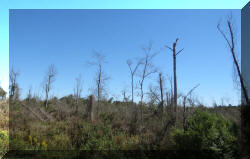
This looks much better . . .
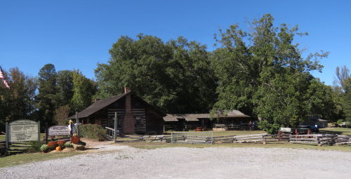
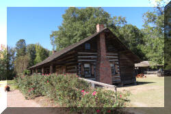
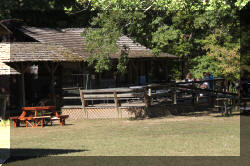
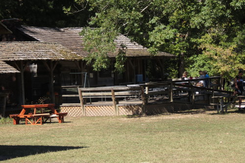
HISTORIC DISTRICT . . . FRENCH CAMP
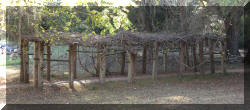
French Camp Academy, a school catering to the needs of young people who came from broken homes, traces
its origins to the school founded here in 1822. It is still operating today but
we were hesitant to take the HitchHiker into the small town. It supports about 200
borders and 85 students from the surrounding area. We were told to be sure to
stop here for lunch.
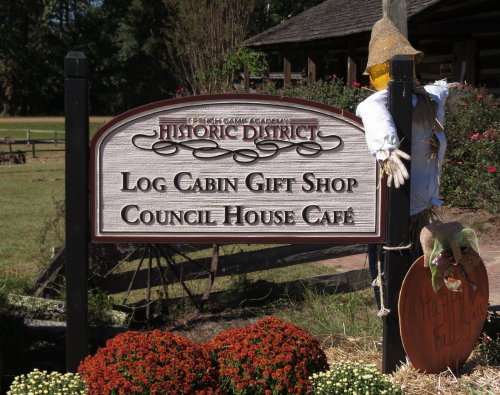
Gift Shop
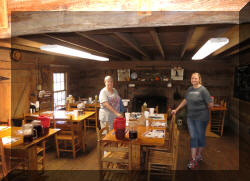
Cafe
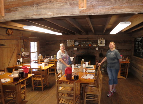
The food was excellent, a bit pricey, but very good. Mary Lou had sweet
potato soup, home made bread and broccoli salad. The thick soup was very rich, tasted
like the sweet potato casserole you have at Thanksgiving complete with pecans. Fred enjoyed
a sliced beef sandwich on the homemade bread. Our server was a student at the
school.
Top of Page
Our list of favorites
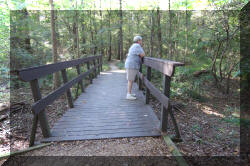
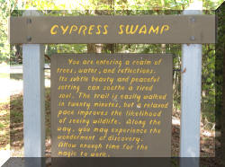
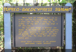
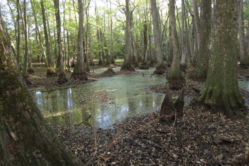
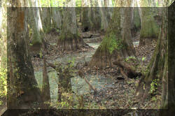
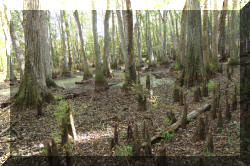
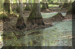
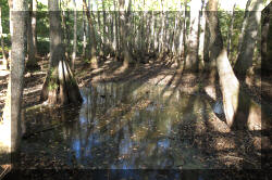
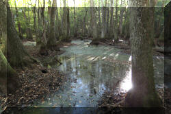
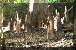
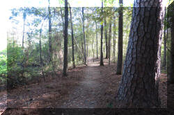
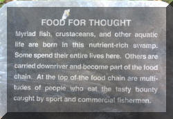
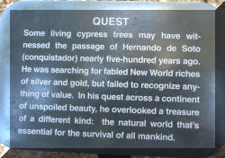
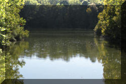
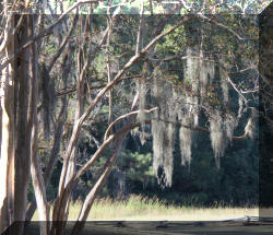
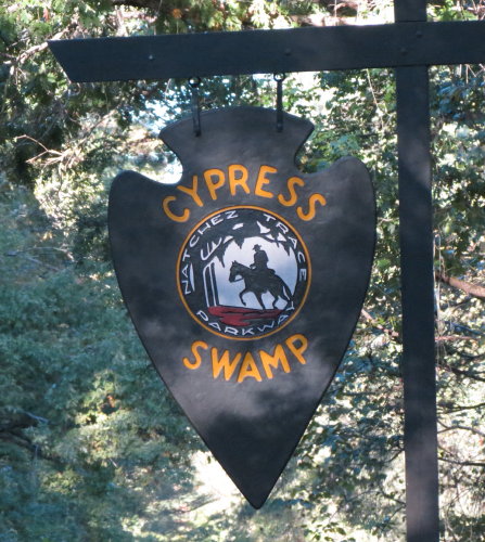
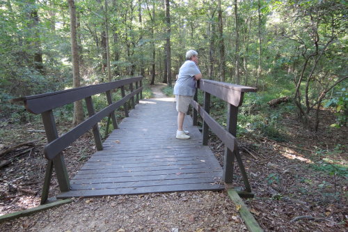
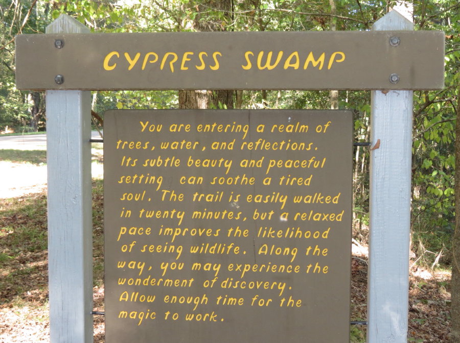
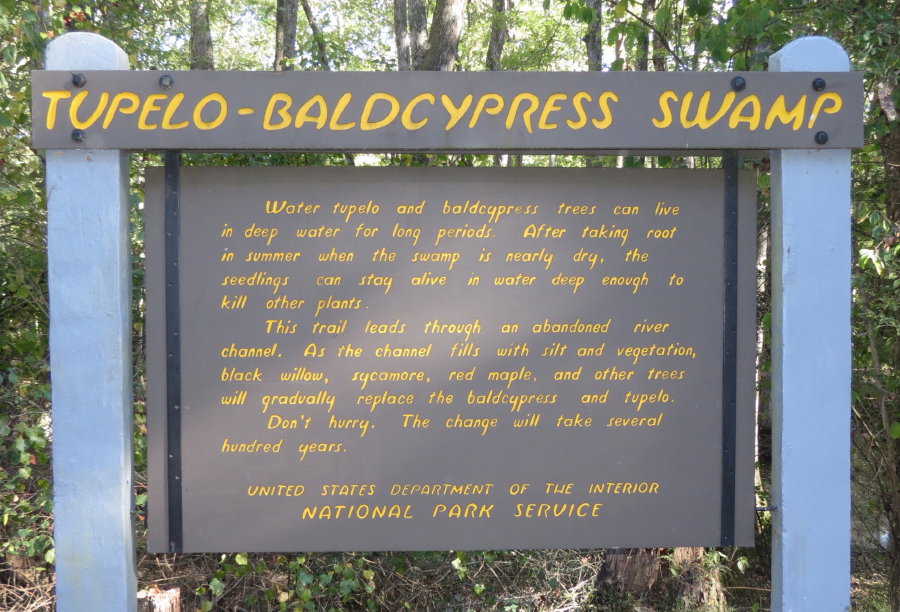
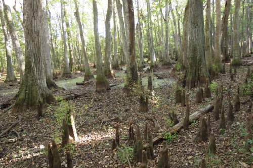
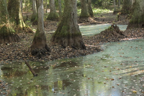
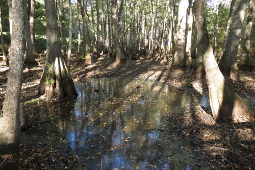
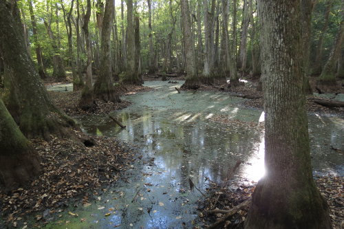
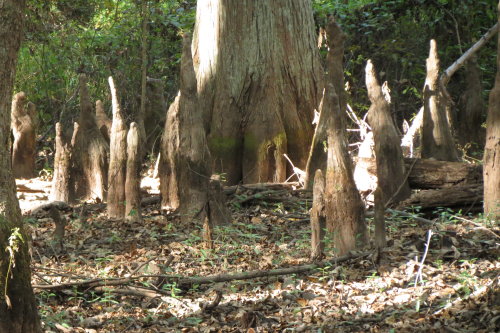
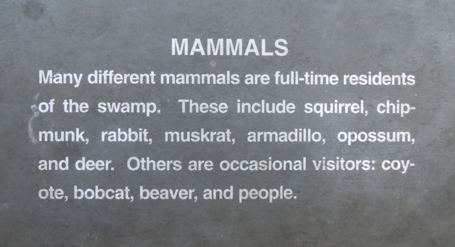
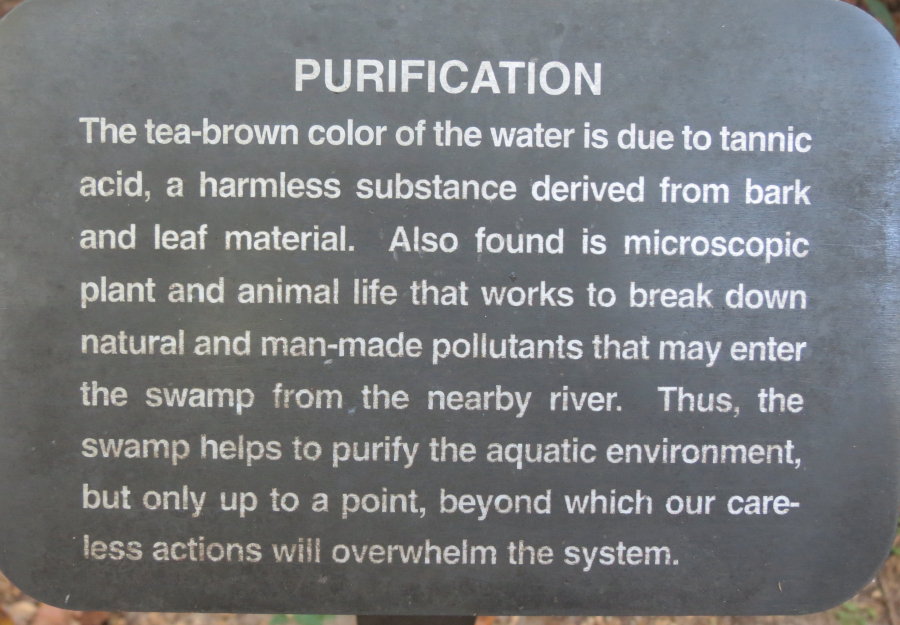
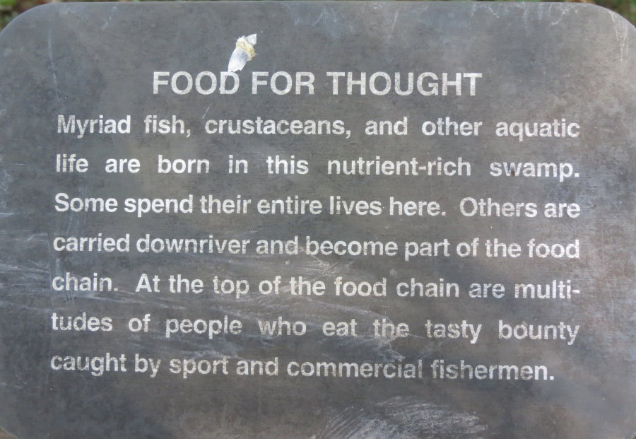
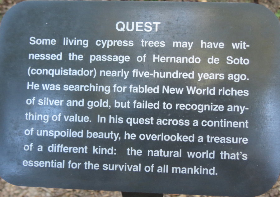
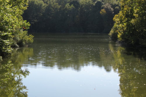
CYPRESS SWAMP . . .
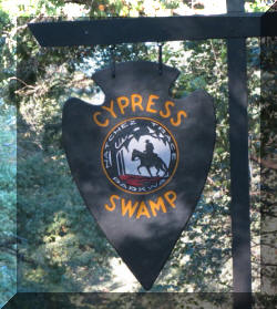 Crossing the wooden bridge, we entered this swamp with it's water tupelo and
bald cypress trees. A flat, walking pathway lead through the area. This was
one of our favorite stops along the Parkway. We really enjoyed the walk
through the "swamp".
Crossing the wooden bridge, we entered this swamp with it's water tupelo and
bald cypress trees. A flat, walking pathway lead through the area. This was
one of our favorite stops along the Parkway. We really enjoyed the walk
through the "swamp".
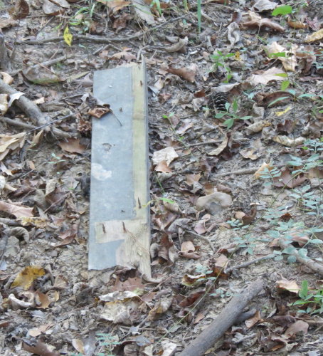
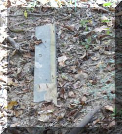 We included a board
(one of several) with nails sticking out of it to show
the lack of dedication of some of our Federal employees or contractors. There were
several leftover scraps of construction wood left behind by workers in this
otherwise beautiful and unusual area.
We included a board
(one of several) with nails sticking out of it to show
the lack of dedication of some of our Federal employees or contractors. There were
several leftover scraps of construction wood left behind by workers in this
otherwise beautiful and unusual area.
Information panels along the walkway provided interesting
information.
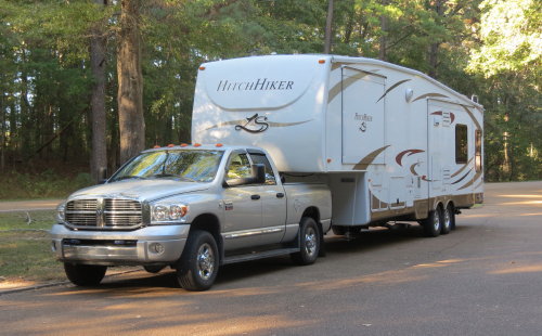
Our home away from home - or mobile cottage, as Mary Lou calls it.
Top of Page
Our list of favorites
 More
traffic . . .
More
traffic . . .
TIMBER LAKE CAMPGROUND . . . Jackson, Mississippi
Getting there . . . around Ross R Barnett Reservoir.
NOTE: Returning to the Trace, we purchased fuel in town. Fuel was $0.20 less
per gallon lower at the station next to the Trace entrance but we missed
noticing that on the way to the
campground. (Okay, we didn't use Gas Buddy.)
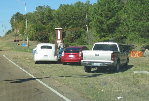 The
customized car on the left needed some mechanical help.
The
customized car on the left needed some mechanical help.
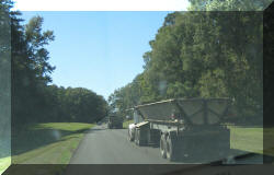
Back on the Trace . . .
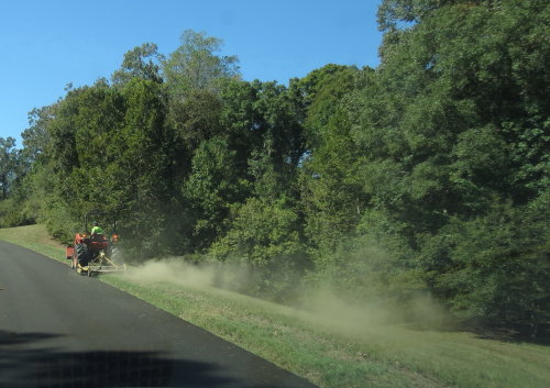
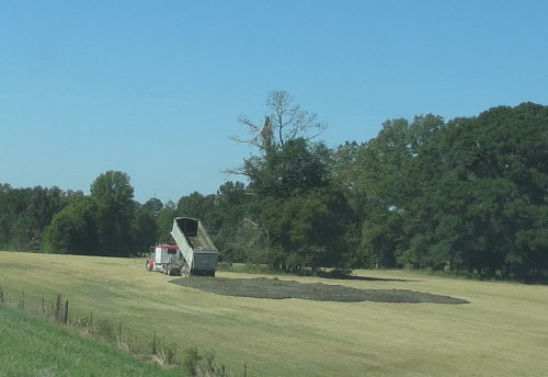 The
aroma from several truckloads of natural fertilizer was in the air.
The
aroma from several truckloads of natural fertilizer was in the air.
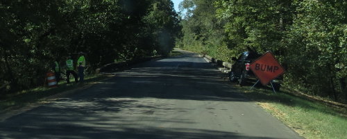
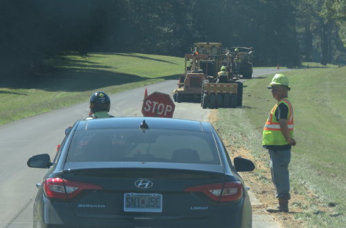
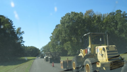
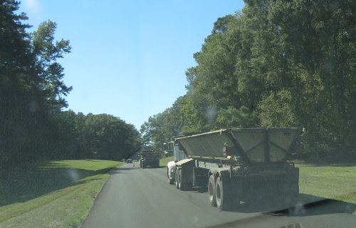
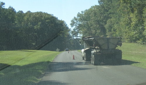
We decided that this must be the area along the Trace that was the designated
work zone for the week.
 Oops.
Oops.
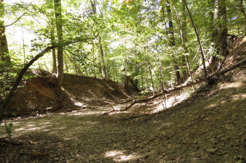
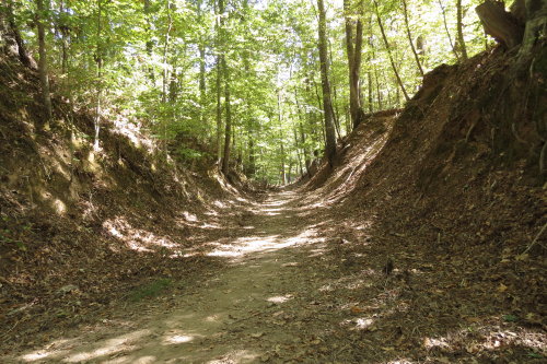
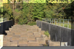
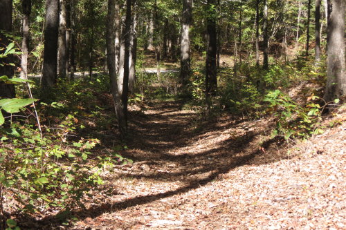
SUNKEN TRACE . . .
This section of the Trace is featured on the front of the NPS guide map.
Animals first wore down this path, then people. The trail is very short. As you
walk it, you are looking at the effects of time, hooves and feet.
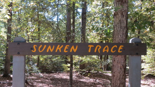
The
most photographed section of the Trace.
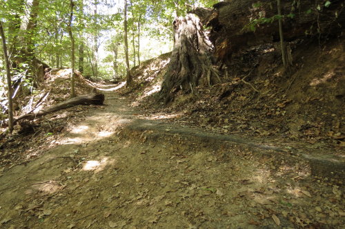 Rustic path down to the sunken trace ...
Left
Right
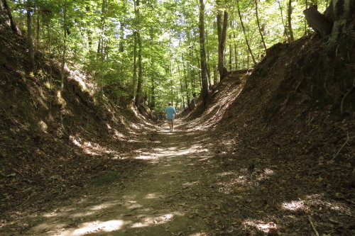 Mary
Lou strolls in the sunken trace.
Mary
Lou strolls in the sunken trace.
Top of Page
Our list of favorites
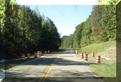
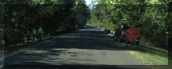
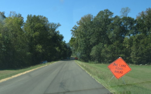
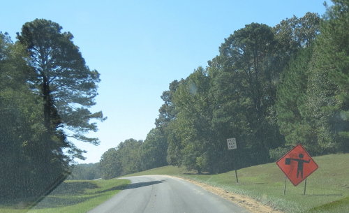
We knew we could not avoid it forever . . . serious road construction, that is.

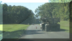
Mowing 444 miles of grass - a mile at a time.
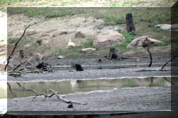
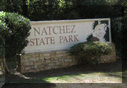
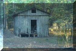
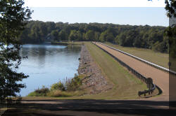
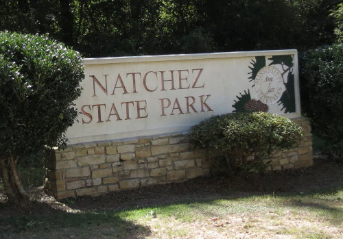
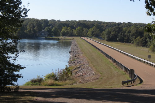
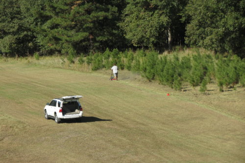
NATCHEZ STATE PARK . . . Located ten miles north the historic City of Natchez.
We drove straight to Natchez State Park because it was close to the City of
Natchez. We thought it might be busy. It was. We had our choice of TWO sites for
ONE night only. We used it as our base camp for the rest of the day. Our side
trips included Mount Locust, Loess Bluff, Emerald Mound, the Old Trace Exhibit
Shelter and the Elizabeth Female Academy Site discussed below.
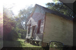
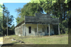
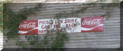
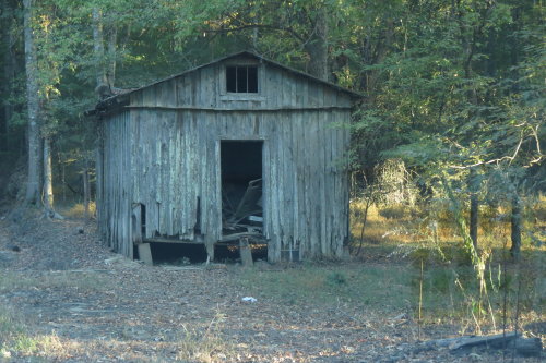
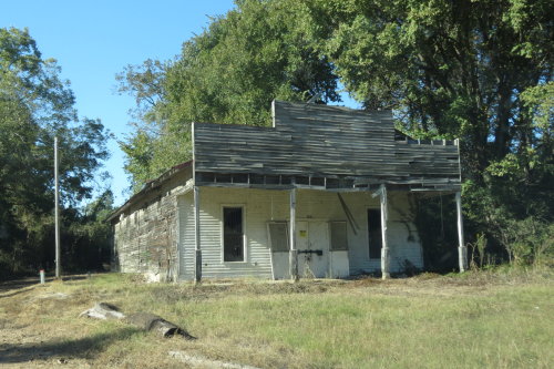
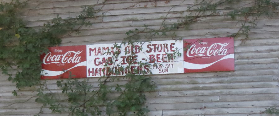
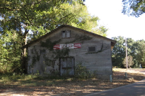
The ride to the state park went past what was probably, at one
time,
a busy grocery store and proprietor's homestead.
The road had slopped edges and
tall dirt 'walls'.
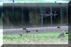
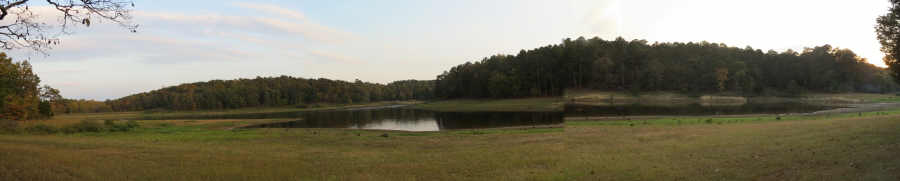
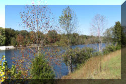
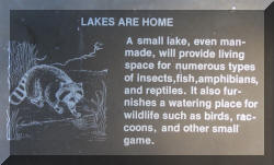
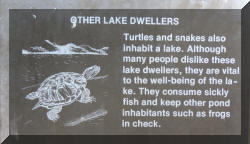
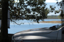
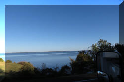
Inside the state park, Natchez Lake is stocked for fishing.
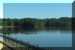
Lake
Lagoon
Spillway water breakers . . .
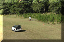 When
we drove across the dam, we saw a guy mowing this HUGE plot of grass with a
20" gasoline push mower.
When
we drove across the dam, we saw a guy mowing this HUGE plot of grass with a
20" gasoline push mower.
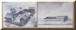
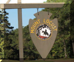
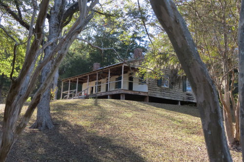
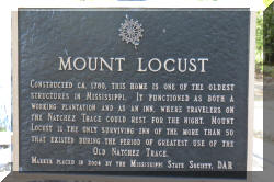
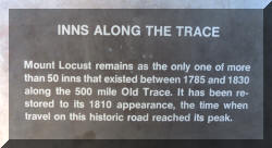
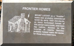
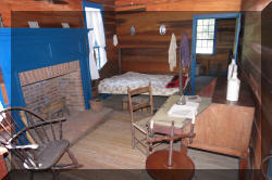
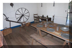
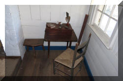
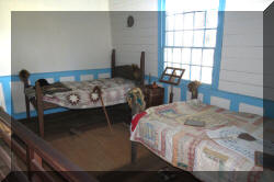
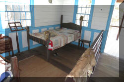
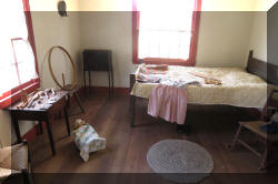
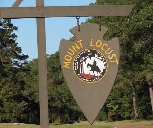
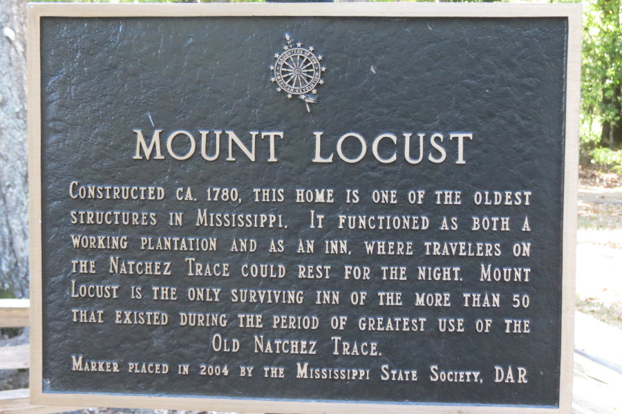
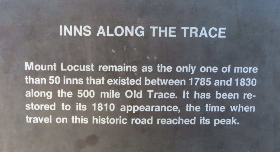
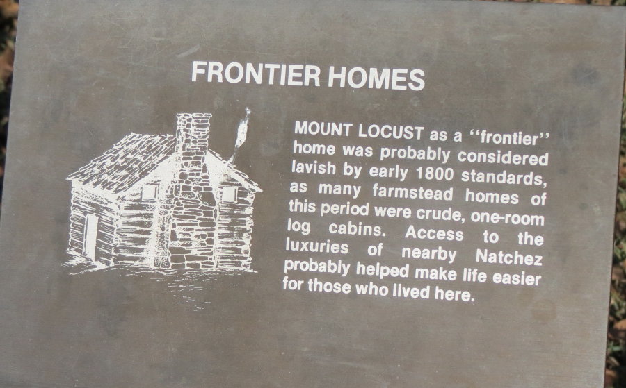
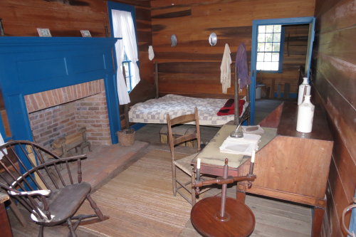
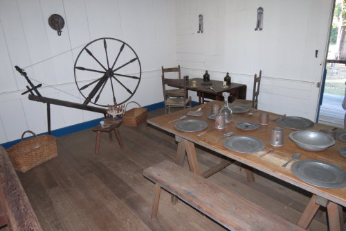
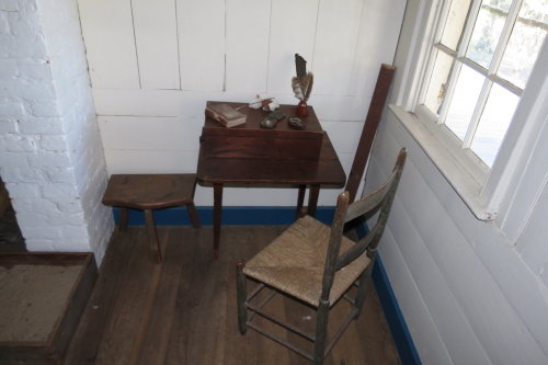
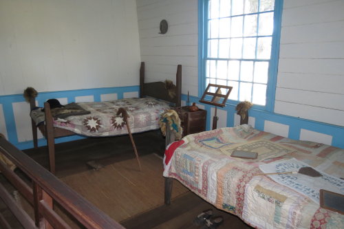
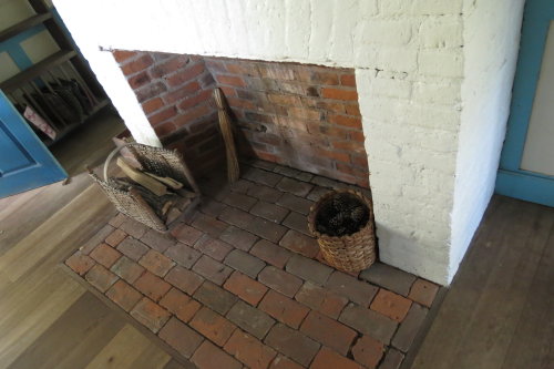
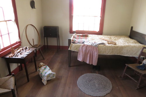
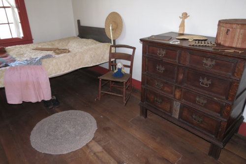
MOUNT LOCUST . . .
Of the fifty or so primitive hostelries established before 1820 along the
Trace, only Mount Locust remains. It is one of the oldest building in
Mississippi, dating to 1780. In 1956, it was restored as a frontier
home of the 1820's, which was the peak era of the Trace's foot and horse travel.
(Note: It closes at 4:00pm - we just made it with 30 minutes to spare.)
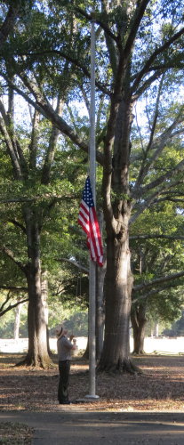 As
we were leaving the grounds, they were closing for the day. We happened to see the
Ranger walk up to the flag pole, salute the flag and lower the American flag. Impressive.
As
we were leaving the grounds, they were closing for the day. We happened to see the
Ranger walk up to the flag pole, salute the flag and lower the American flag. Impressive.
Top of Page
Our list of favorites
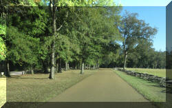
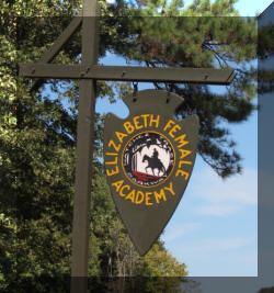
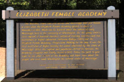
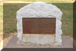
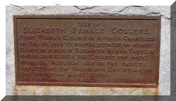
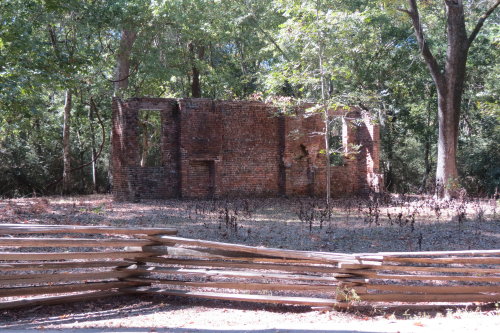
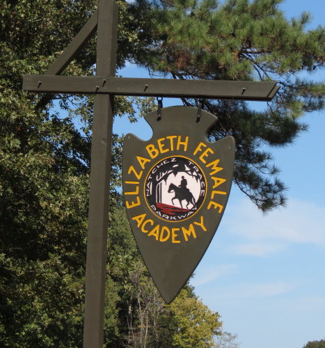
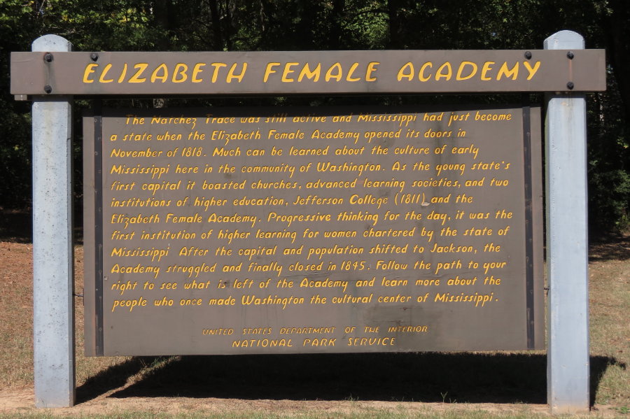
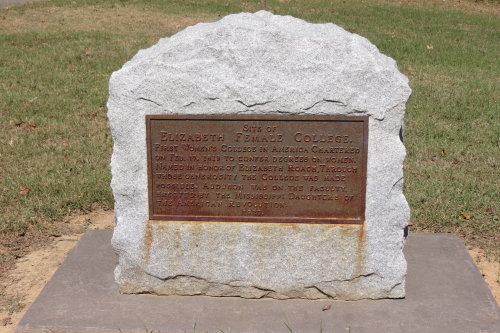
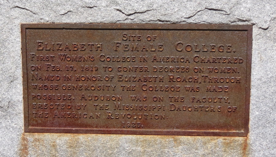
ELIZABETH FEMALE ACADEMY . . .
On this site was the first institution of higher learning for women chartered
by the State of Mississippi. It operated from 1818 to 1845. Noted naturalist John
James Audubon taught at the Academy from 1822 to 1823 while he recorded the birds
of the Lower Mississippi region.
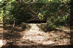
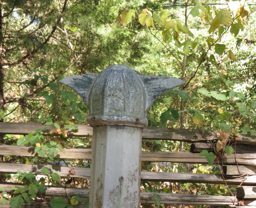
Well
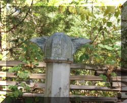
Post Cap
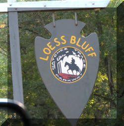
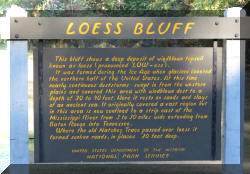
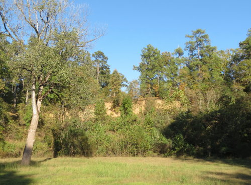
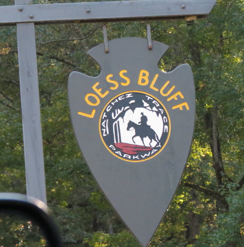
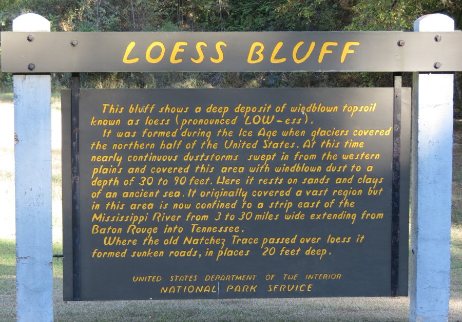
LOESS BLUFF . . . (Loess, pronounced like the woman's name, Lois)
Deposits of silt were blown
here from the north during the Ice Age. An interesting fact for people who have
a background in the geologic processes.
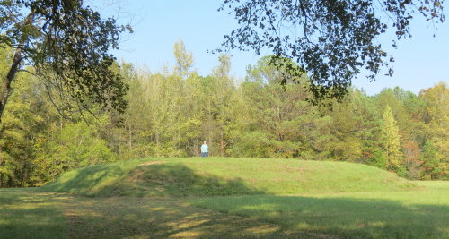
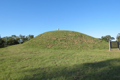
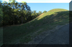
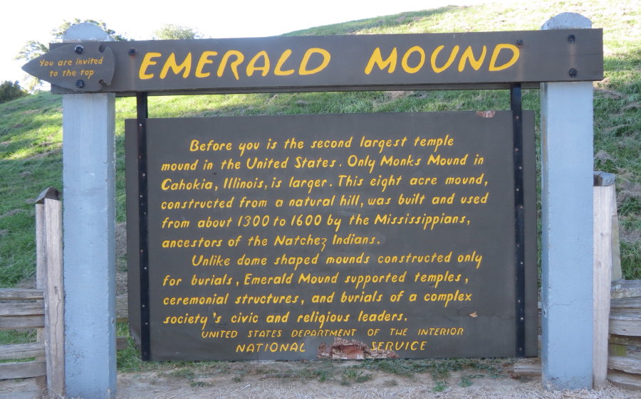
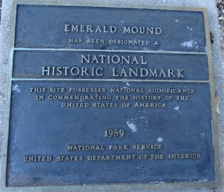
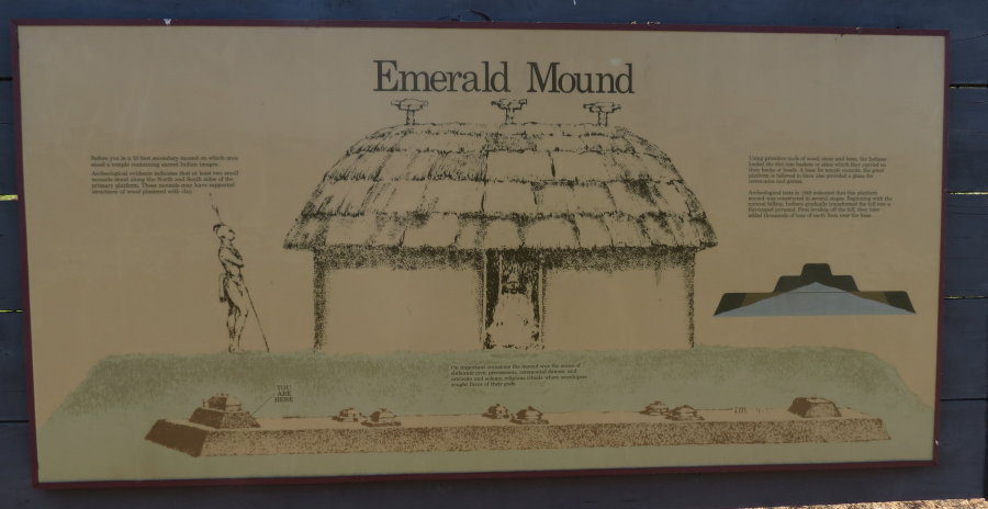
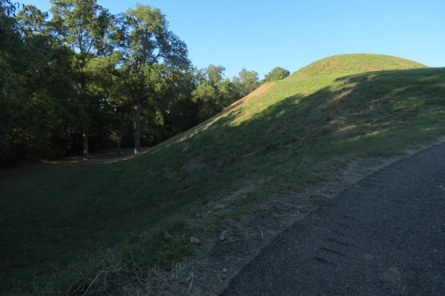
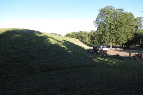
EMERALD MOUND . . .
The nation's second-largest Mississippian structure, Emerald Mound covers
nearly eight acres. The mound measures 770 feet by 435 feet at its base (roughly
2.5 by 1.5 football fields), and is approximately 35 feet high. This ceremonial
mound was build about CE 1250 to 1600. The mound was built by depositing earth
along the sides of a natural hill.
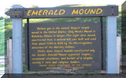
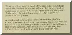
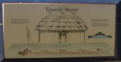
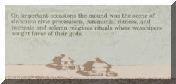
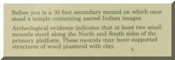
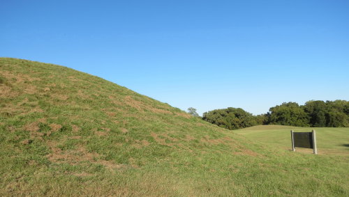

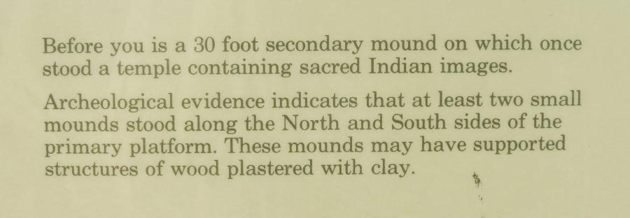
Taking the trail to the top you find two more mounds at either end.
The larger one measures 190 by 160 feet at the base and 30 feet in height.
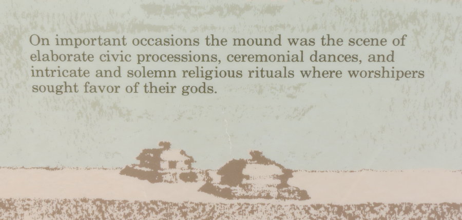
Emerald Mound was the location of elaborate civic processions, ceremonial
dances and intricate and solemn religious rituals.
Top of Page
Our list of favorites
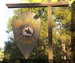
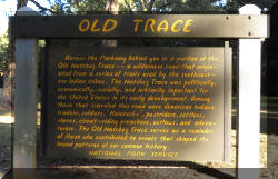
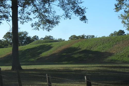
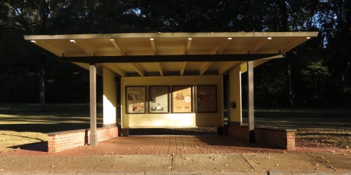
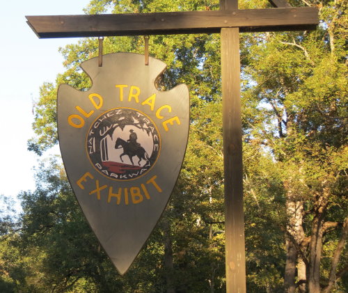
OLD TRACE EXHIBIT . . . The beginning of the Natchez Trace Parkway according
to the sign posts - but - the end of our journey.
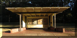
Exhibit area at the south end of the Natchez Trace Parkway. Because we
traveled from the north to south it talked about what we had already seen. This
exhibit would have been somewhat beneficial to those traveling north if they did
not prepare in advance. Mary Lou researched a lot about the Natchez Trace Parkway and its history in
preparation for our trip. Her main resources were the
Natchez Trace Parkway map obtained from the National Park Service and the book "Guide
to the Natchez Trace Parkway" (Author: F. Lynn Bachleda) purchased through
Amazon.
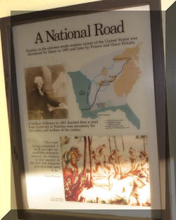
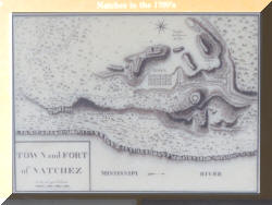
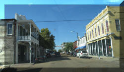
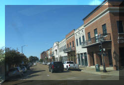
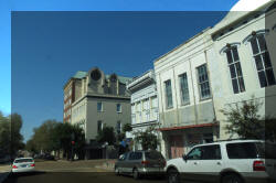
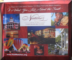
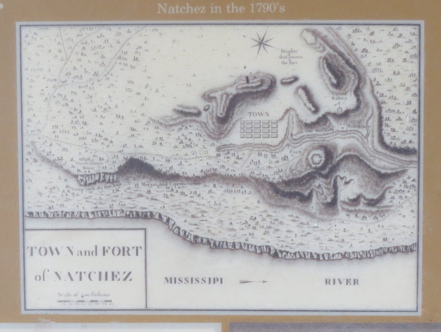
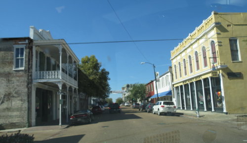
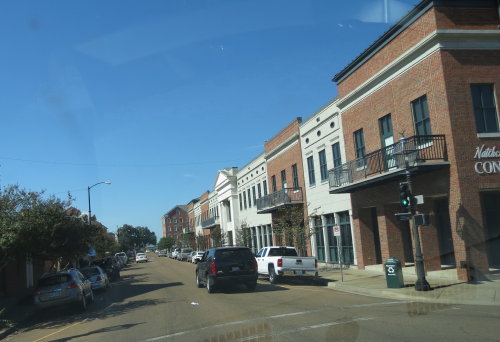
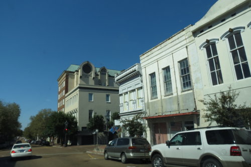
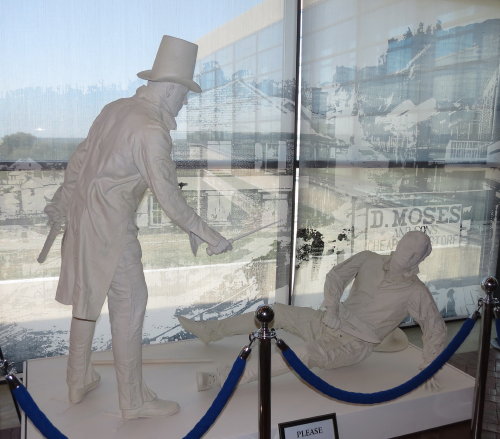
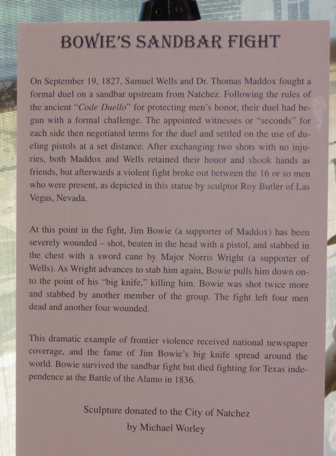
NATCHEZ, MISSISSIPPI . . .
Guide books and travel pamphlets
highlight locations on the Trace Parkway from south to north. As you will
remember, we traveled from north to the south - as the postal riders did. We don't
feel it makes much difference which direction your travel.
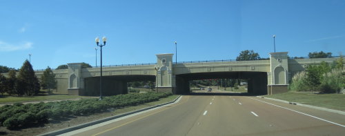 Signage
was not very effective when we exited the Natchez Trace Parkway. So, we guessed
and headed under the viaduct. That was a good guess.
Signage
was not very effective when we exited the Natchez Trace Parkway. So, we guessed
and headed under the viaduct. That was a good guess.
Natchez was a welcoming older southern town.
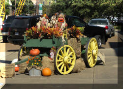
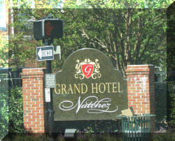
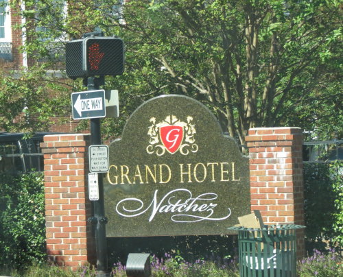
Fall decorations were displayed ...... We have a Grand Hotel in Michigan.
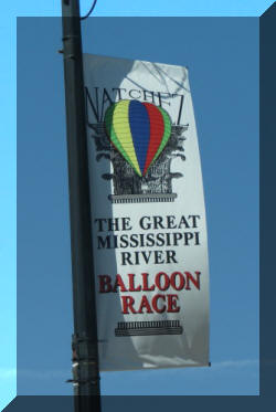
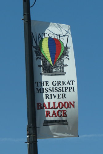
We did not know there was a hot air balloon competition in town until we
arrived. We had not planned to spend time looking around the town and it was a
good thing. Very busy. There are things to see and do, we just chose to move on
with the trip.
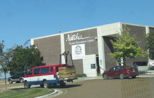
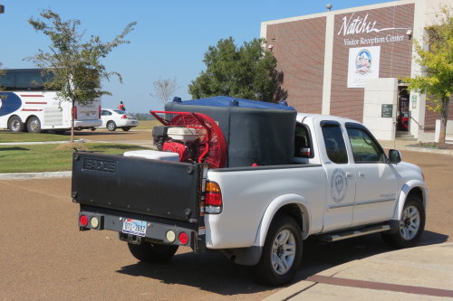
We found a parking spot so we could gather some information from the Visitors
Center. Interestingly, the city provides overnight parking (including some electric
outlets free
of charge) in the parking lot. On this weekend, you would have to contend with
the crowds and maybe be trapped in the parking lot until Monday. We choose
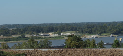
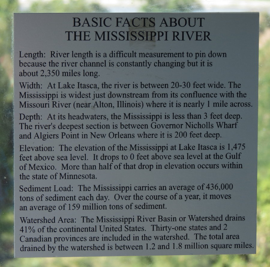
to cross the Mississippi River into Louisiana.
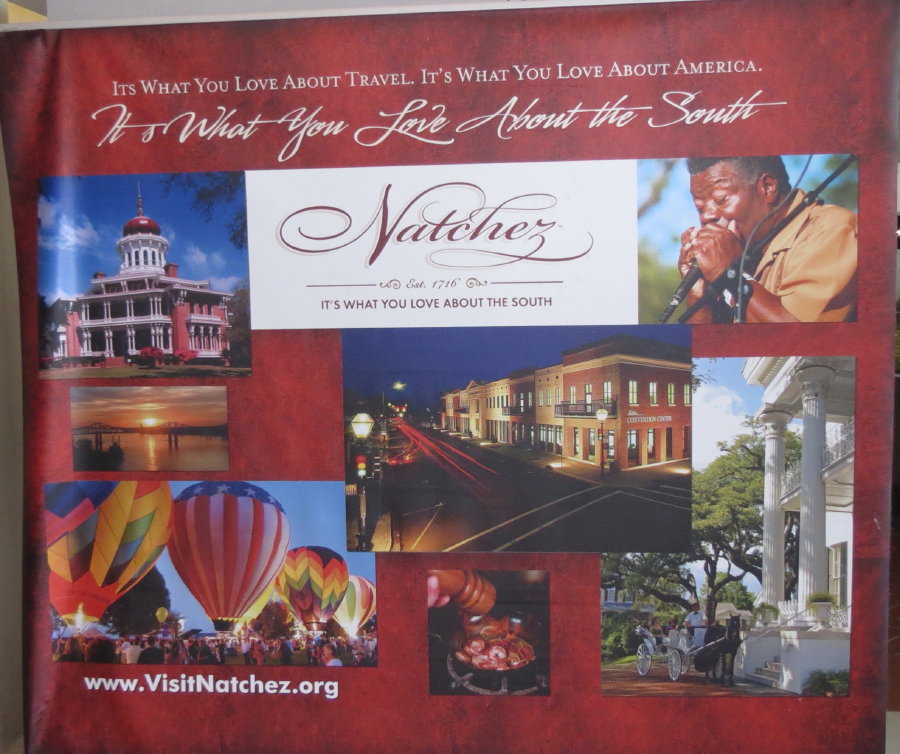
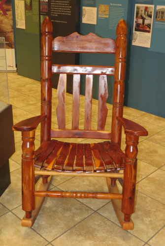
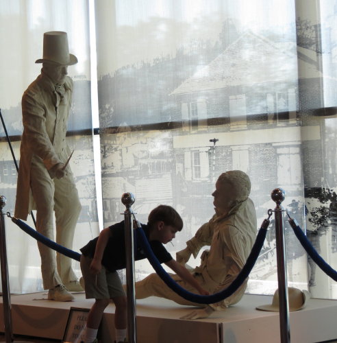
The visitors center provided a large tourist counter and various displays and
exhibits.
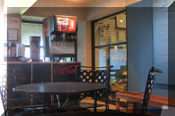
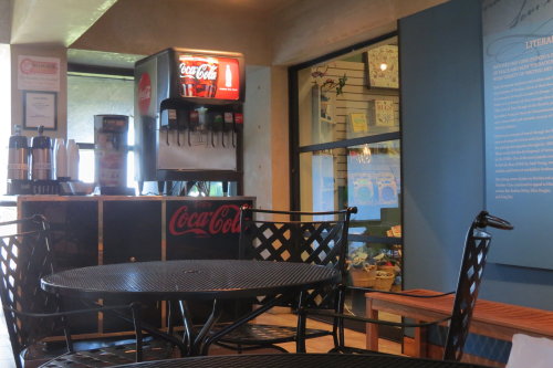
And, free Coke products . . .

Do you see something inconsistent with these two photographs?
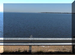
Looking across the Mississippi River into Louisiana from the visitors center.
Top of Page
Our list of favorites
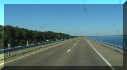
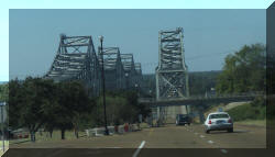
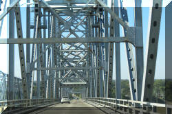
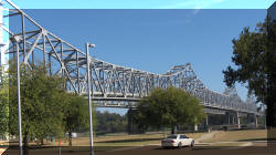
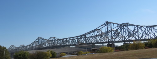
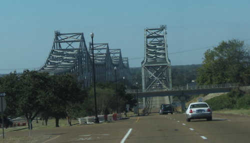
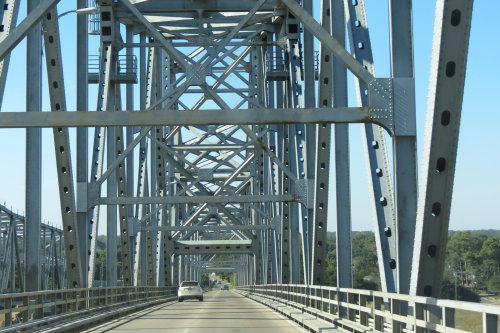
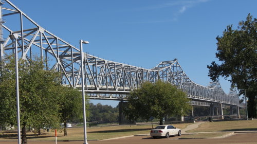
BRIDGE OVER THE MISSISSIPPI RIVER . . .
The next leg of our trip was in Louisiana. We headed more or less diagonally
across the state to the shoreline of the Gulf of Mexico.
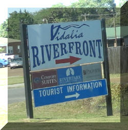
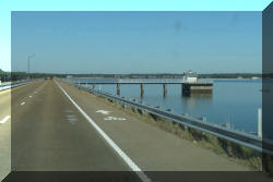
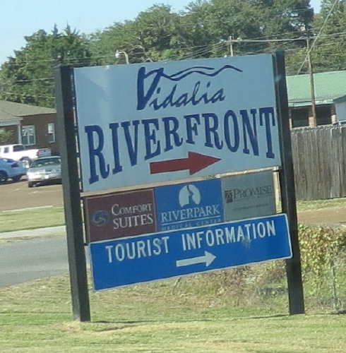
Vidalia, LA had a very active picnic,
walking and bicycle park
along the
waterfront.
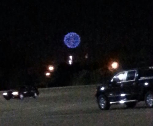
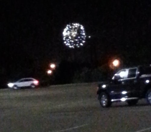
We left Vidalia and headed west to avoid the congestion caused by the balloon
race activities. We found a Wal*Mart about seven miles away. Mary Lou went in
the store for chicken wings and permission to spend the night in their parking
lot.
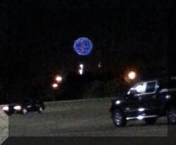
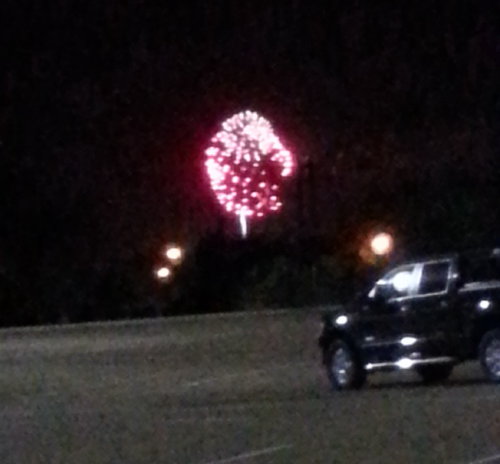
Just after dark, we watched the fireworks over the distant Mississippi River
with another RV overnighter.
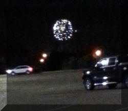
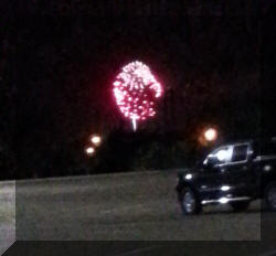
These photographs were made using Fred's Smartphone and
his elbows on the truck's hood as a tripod.
This page is long . . . by the time we reached the end of the Natchez Trace
Parkway, it seemed long as well. The various state parks provided good overnight
stays. The points of interest that provided more than just a sign were enjoyed.
The points of interest that consisted only of a sign at the edge of the parking
area discussing what was at this location hundreds of years ago were
disappointing.
Top of Page
Our list of favorites
 The
Parkway is beautiful. Commercial vehicles are not permitted. Gas stations
(maybe, diesel) are in nearby towns. The Parkway includes many points of
interest. Informational panels
discussing 10,000 years of North American history are plentiful. We have linked
the thumbnail photographs for the informational panels to image files large enough for you to read the
words. To enlarge the
thumbnail with a beveled edge for a photograph or an informational panel, just
left click on it.
The
Parkway is beautiful. Commercial vehicles are not permitted. Gas stations
(maybe, diesel) are in nearby towns. The Parkway includes many points of
interest. Informational panels
discussing 10,000 years of North American history are plentiful. We have linked
the thumbnail photographs for the informational panels to image files large enough for you to read the
words. To enlarge the
thumbnail with a beveled edge for a photograph or an informational panel, just
left click on it.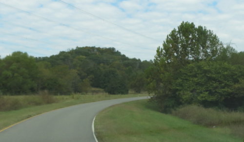


